| Name: | Orange County |
|---|---|
| FIPS code: | 36-071 |
| State: | New York |
| Founded: | 1683 |
| Named for: | William III of Orange |
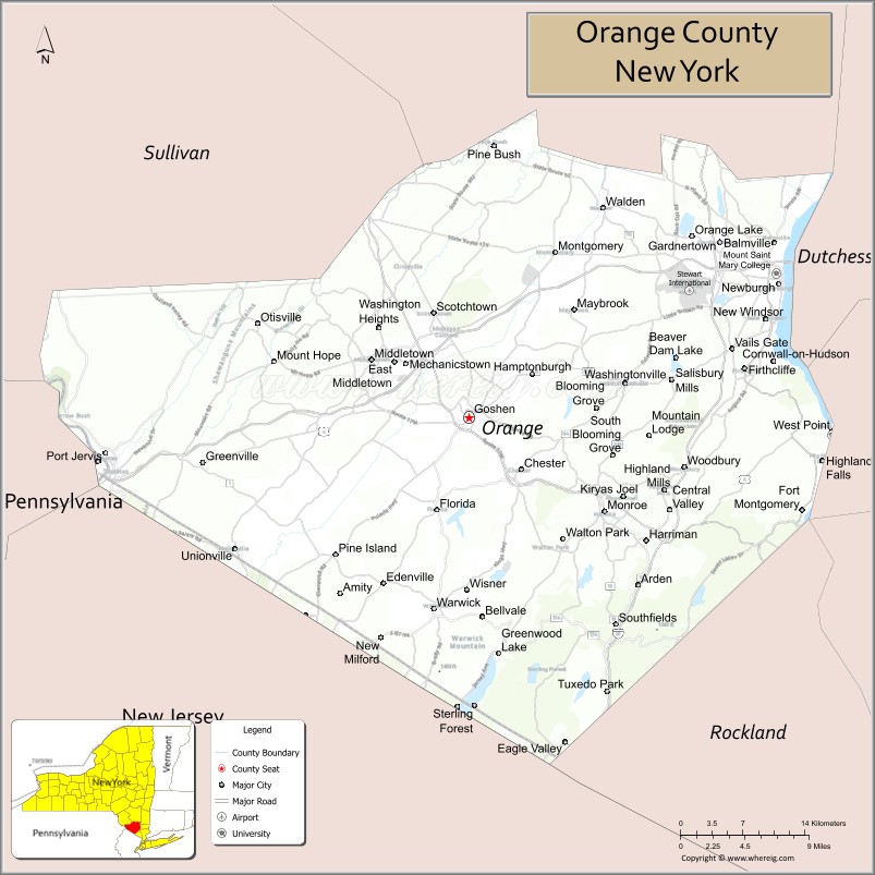
| Seat: | Goshen |
| Largest town: | Palm Tree |
| Total Area: | 839 sq mi (2,170 km²) |
| Land Area: | 812 sq mi (2,100 km²) |
| Total Population: | 401,310 |
| Time zone: | UTC−5 (Eastern) |
| Summer Time Zone (DST): | UTC−4 (EDT) |
| Website: | www.orangecountygov.com |
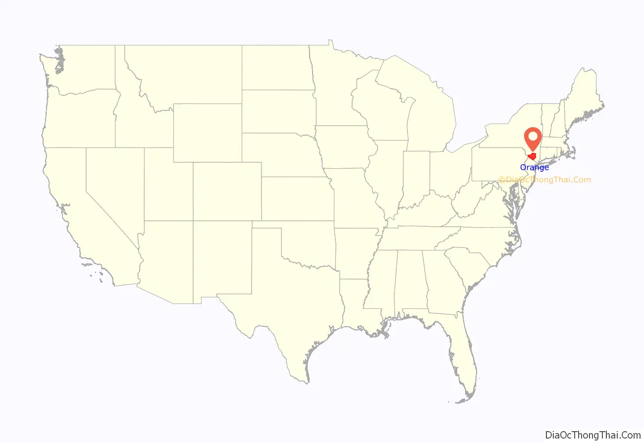
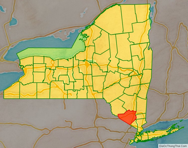
Orange County location map. Where is Orange County?
History
Orange County was officially established on November 1, 1683, when the Province of New York was divided into twelve counties. Each of these was named to honor a member of the British royal family, and Orange County took its name from the Prince of Orange, who subsequently became King William III of England. As originally defined, Orange County included only the southern part of its present-day territory, plus all of present-day Rockland County further south. The northern part of the present-day county, beyond Moodna Creek, was then a part of neighbouring Ulster County.
At that date, the only European inhabitants of the area were a handful of Dutch colonists in present-day Rockland County, and the area of modern Orange County was entirely occupied by the native Munsee people. Due to its relatively small population, the original Orange County was not fully independent and was administered by New York County.
The first European settlers in the area of the present-day county arrived in 1685. They were a party of around twenty-five families from Scotland, led by David Toshach, the Laird of Monzievaird, and his brother-in-law Major Patrick McGregor, a former officer of the French Army. They settled in the Hudson Highlands at the place where the Moodna Creek enters the Hudson River, now known as New Windsor. In 1709, a group of German Palatine refugees settled at Newburgh. They were Protestants from a part of Germany along the Rhine that had suffered during the religious wars. Queen Anne’s government arranged for passage from England of nearly 3,000 Palatines in ten ships. Many were settled along the Hudson River in work camps on property belonging to Robert Livingston. In 1712, a 16-year-old indentured servant named Sarah Wells from Manhattan led a small party of three Munsee men and three hired carpenters into the undeveloped interior of the county and created the first settlement in the Town of Goshen on the Otter Kill. She was falsely promised by her master Christopher Denne 100 acres bounty for taking on the dangerous mission to make a land claim for him. He never gave her the land. But, she did fall in love and married Irish immigrant William Bull there in 1718 and they had 12 children and built the Bull Stone House. In 1716, the first known Black woman resident was recorded in Orange County. Her name was Mercy and she was enslaved by Christopher Denne at his settlement on the Otter Kill. Additional immigrants came from Ireland; they were of Scots and English descent who had been settled as planters there.
During the American Revolutionary War the county was divided into Loyalists, Patriots, and those who remained neutral. The local government supported the Revolution, or “The Cause.” Some residents posed as Loyalists but were part of a secret spy network set up by Gen. George Washington. Capt. William Bull III of the Town of Wallkill (which was then a part of Ulster County) served in the Continental Army with Gen. Washington in Spencer’s Additional Continental Regiment. His cousin was revealed after the war to be part of Washington’s spy ring. His brother Moses Bull raised 20 men from the Town of Wallkill to service with his brother. Capt. Bull was promoted twice for valor on the battlefield, once in the Battle of Monmouth where he was part of Lord Stirling’s men who famously saved the day after Gen. Lee’s retreat. Capt. Bull wintered at Valley Forge with several men from Orange County. Capt. Bull retired from the Army in 1781 and returned to the Town of Wallkill where he built Brick Castle. Hundreds of men from Orange County served in the local militia and many of them fought in the Battle of Fort Montgomery and Fort Clinton. However, many residents remained loyal to King George III, include members of Capt. Bull’s family. Many in the county were divided within families. Capt. Bull’s uncle Thomas Bull was jailed for years in Goshen and then Fishkill for being a Loyalist. Resident Claudius Smith was a Loyalist marauder whose team robbed and terrorized citizens; he was hanged in Goshen in 1779 for allegedly robbing and killing Major Nathaniel Strong; two of his sons were also executed for similar crimes. Capt. Bull’s cousin Peter Bull of Hamptonburgh served in the Orange County regiment and was charged with guarding the roads at night from Smith. The Mathews family of Blooming Grove were active Loyalists; Fletcher Mathews was a sympathizer and sometime associate of Smith, and his brother David Mathews was Mayor of New York City during its British occupation for the entirety of the war.
In 1798, after the American Revolutionary War, the boundaries of Orange County changed. Its southern corner was used to create the new Rockland County, and in exchange, an area to the north of the Moodna Creek was added, which had previously been in Ulster County. This caused a reorganization of the local administration, as the original county seat had been fixed at Orangetown in 1703, but this was now in Rockland County. Duties were subsequently shared between Goshen, which had been the center of government for the northern part of Orange County, and Newburgh, which played a similar role in the area transferred from Ulster County. The county court was established in 1801. It was not until 1970 that Goshen was named as the sole county seat.
Due to a boundary dispute between New York and New Jersey, the boundaries of many of the southern towns of the county were not definitively established until the 19th century.
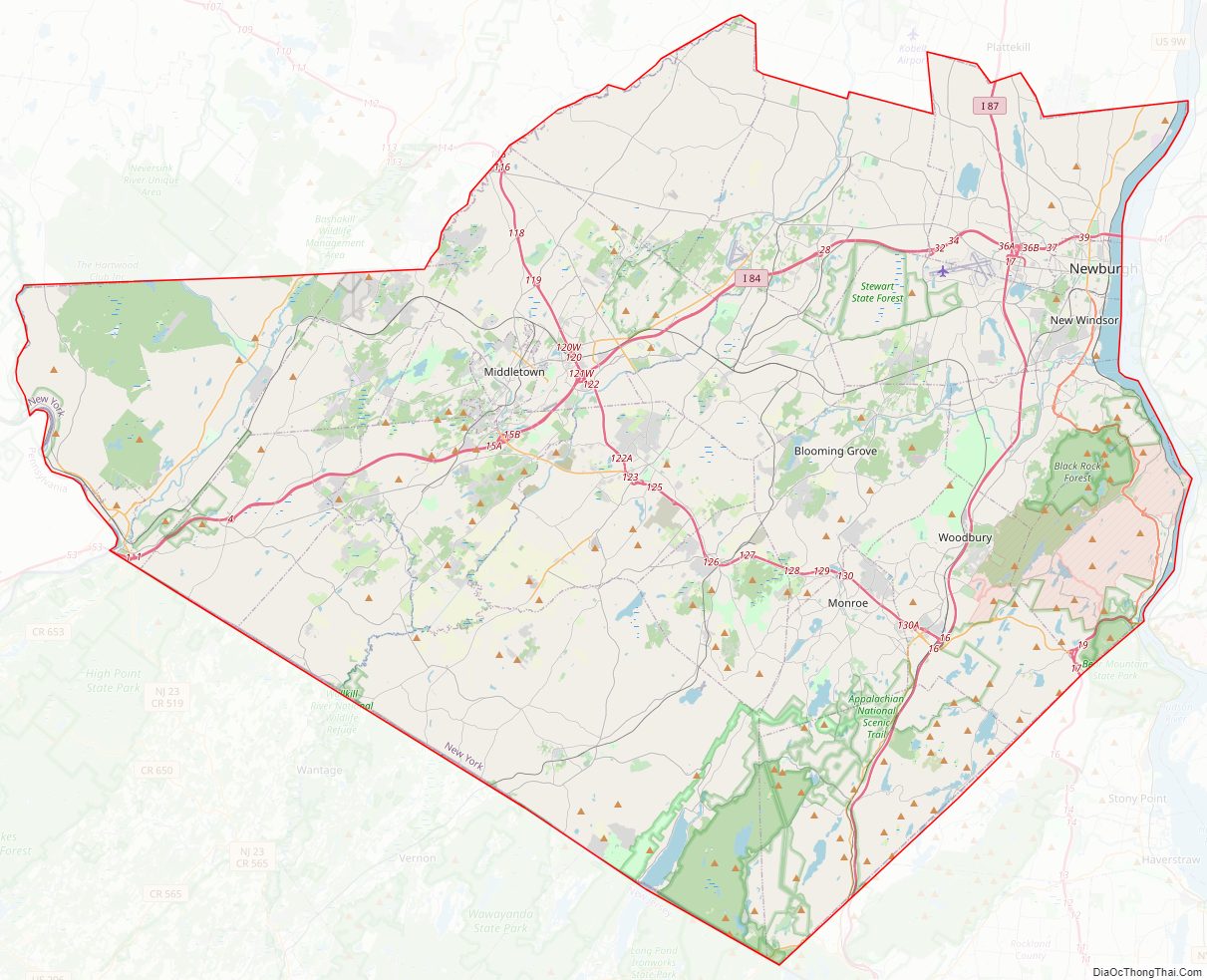
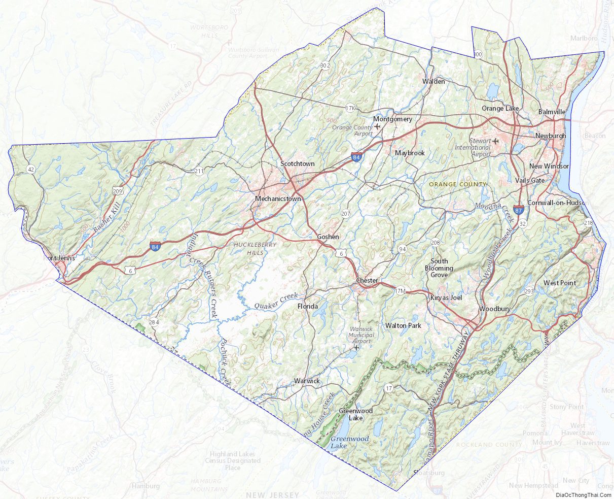
Orange County Road Map
Geography
According to the U.S. Census Bureau, the county has a total area of 839 square miles (2,170 km), of which 812 square miles (2,100 km) is land and 27 square miles (70 km) (3.2%) is water.
Orange County is in southeastern New York State, directly north of the New Jersey-New York border, west of the Hudson River, east of the Delaware River and northwest of New York City. It borders the New York counties of Dutchess, Putnam, Rockland, Sullivan, Ulster, and Westchester, as well as Passaic and Sussex counties in New Jersey and Pike County in Pennsylvania.
Orange County is the only county which borders both the Hudson and Delaware Rivers, and is also the only county in the state to border both New Jersey (south) and Pennsylvania (west).
Orange County is where the Great Valley of the Appalachians finally opens up and ends. The western corner is set off by the Shawangunk Ridge. The area along the Rockland County border (within Harriman and Bear Mountain state parks) and south of Newburgh is part of the Hudson Highlands. The land in between is the valley of the Wallkill River. In the southern portion of the county the Wallkill valley expands into a wide glacial lake bed known as the Black Dirt Region for its fertility.
The highest point is Schunemunk Mountain, at 1,664 feet (507 m) above sea level. The lowest is sea level along the Hudson.
National protected areas
- Upper Delaware Scenic and Recreational River (part)
- Wallkill River National Wildlife Refuge (part)
Adjacent counties
- Dutchess County – northeast
- Passaic County, New Jersey – southeast
- Pike County, Pennsylvania – southwest
- Putnam County – east
- Rockland County – southeast
- Sullivan County – northwest
- Sussex County, New Jersey – south
- Ulster County – north
Orange County Topographic Map
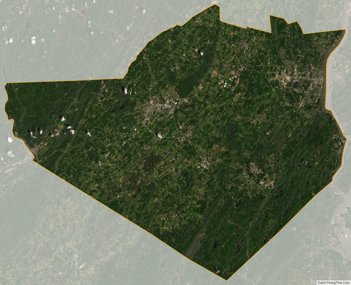
Orange County Satellite Map
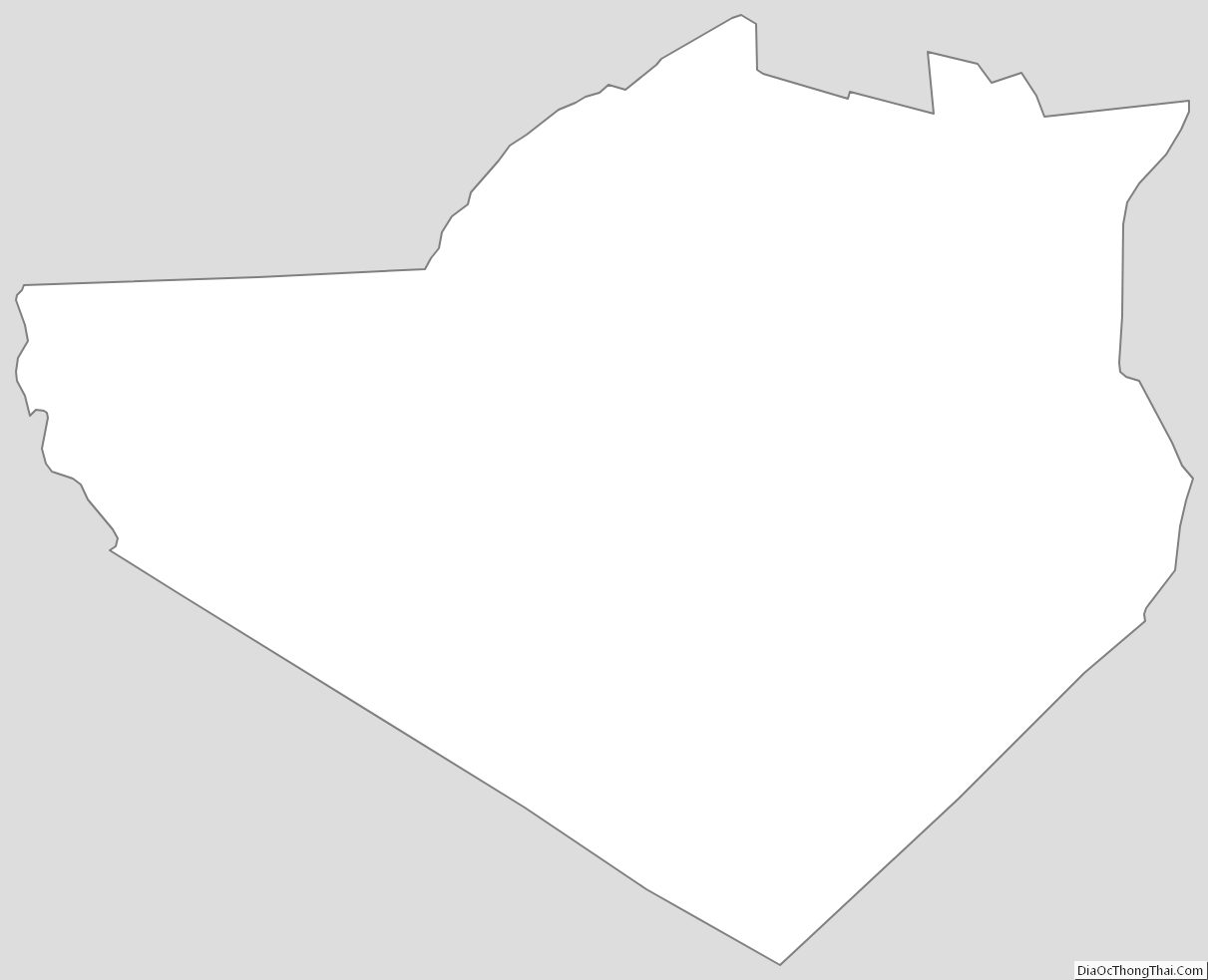
Orange County Outline Map