Cold Spring is a village in the town of Philipstown in Putnam County, New York, United States. The population was 1,986 at the 2020 census. It borders the smaller village of Nelsonville and the hamlets of Garrison and North Highlands. The central area of the village is on the National Register of Historic Places as the Cold Spring Historic District due to its many well-preserved 19th-century buildings, constructed to accommodate workers at the nearby West Point Foundry (itself a Registered Historic Place today). The town is the birthplace of General Gouverneur K. Warren, who was an important figure in the Union Army during the Civil War. The village, located in the Hudson Highlands, sits at the deepest point of the Hudson River, directly across from West Point. Cold Spring serves as a weekend getaway for many residents of New York City.
Commuter service to New York City is available via the Cold Spring train station, served by Metro-North Railroad. The train journey is approximately one hour, ten minutes to Grand Central Terminal.
| Name: | Cold Spring village |
|---|---|
| LSAD Code: | 47 |
| LSAD Description: | village (suffix) |
| State: | New York |
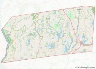
| County: | Putnam County |
| Incorporated: | 1846 |
| Elevation: | 108 ft (33 m) |
| Total Area: | 0.60 sq mi (1.55 km²) |
| Land Area: | 0.59 sq mi (1.54 km²) |
| Water Area: | 0.01 sq mi (0.01 km²) 0.91% |
| Total Population: | 1,986 |
| Population Density: | 3,343.43/sq mi (1,291.51/km²) |
| Area code: | 845 |
| FIPS code: | 3616936 |
| Website: | coldspringny.gov |
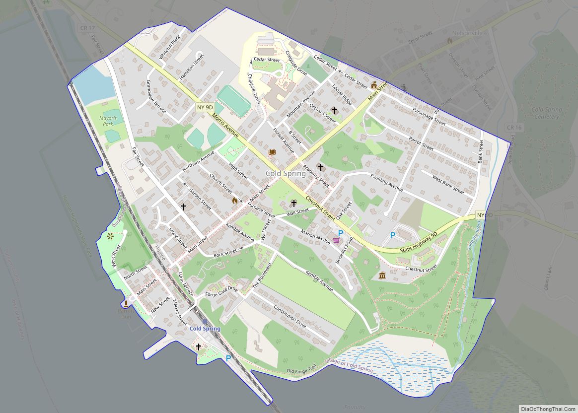
Online Interactive Map
Click on ![]() to view map in "full screen" mode.
to view map in "full screen" mode.
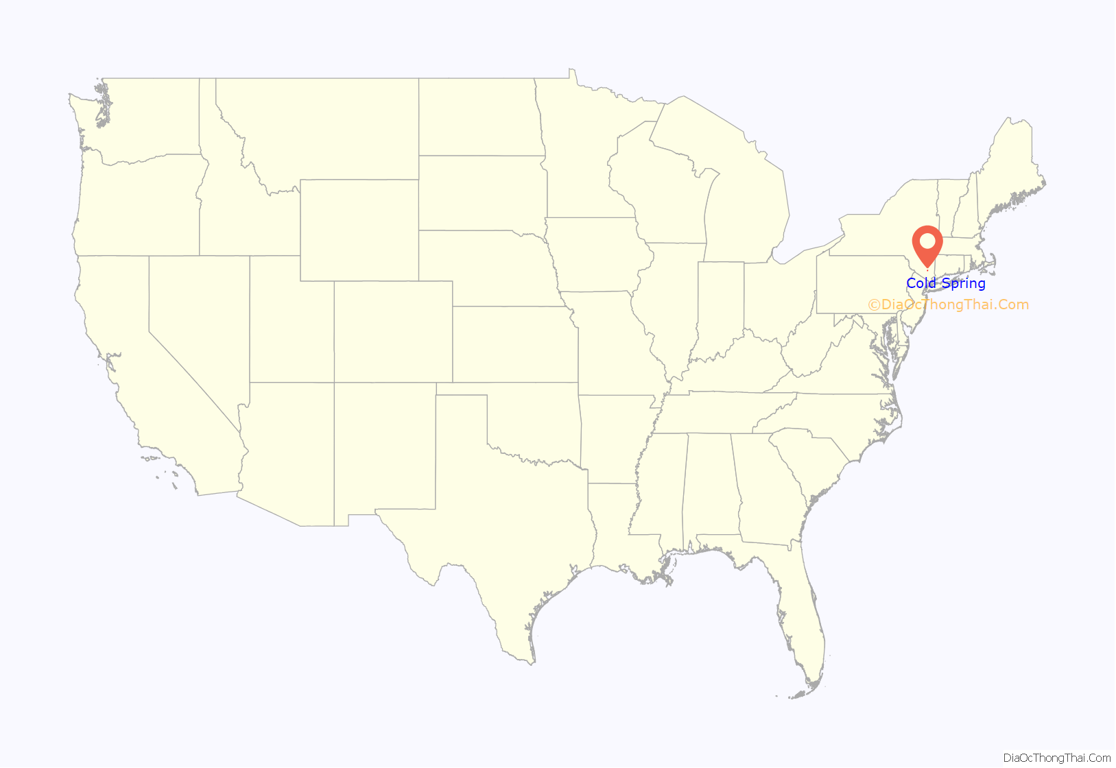
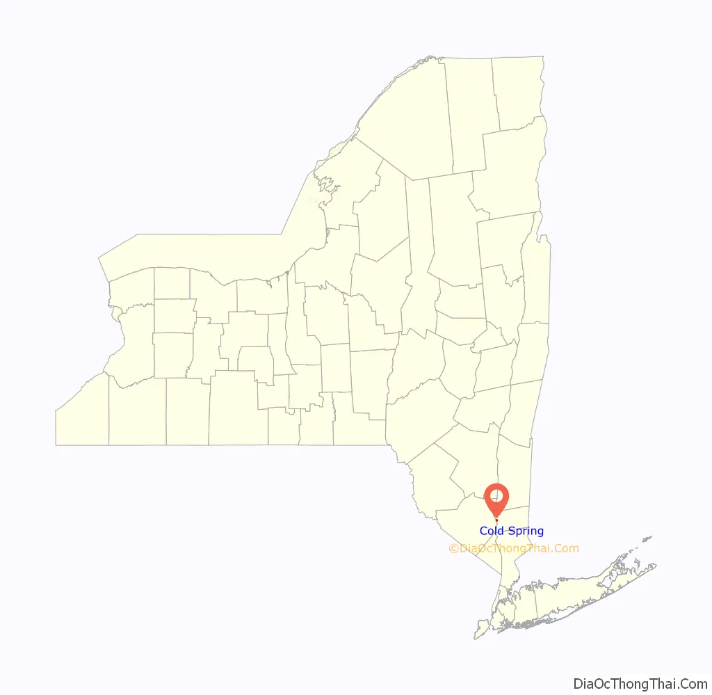
Cold Spring location map. Where is Cold Spring village?
History
Early industry
The site of present-day Cold Spring was part of the lands belonging to Merrick Williams. The first settler of Cold Spring was Merrick Williams in 1730. In 1772, a highway master was chosen for the road from Cold Spring to the Post Road from New York to Albany. A small trading hamlet grew alongside the river by the early 1800s. A couple of sloops made regular weekly trips from Cold Spring to New York, carrying wood and some country produce, which came over this model road from the east. Those trips by sloop usually took a week.
In 1818, Gouverneur Kemble established the West Point Foundry opposite West Point to produce artillery pieces for the United States Government. The nearby mountains contained veins of ore, and were covered with timber for fuel. A brook provided hydropower, and the Hudson a ready shipping outlet. In 1843, the Foundry built the USS Spencer, the first iron ship built in the U.S. With the influx of workers at the Foundry, local housing, businesses and churches increased, and Cold Spring was incorporated as a village in 1846. The first President of the Village was Joshua Haight. The Foundry became famous for its production of Parrott rifles and other munitions during the Civil War, when the foundry grew to a sprawling 100-acre complex employing 1,400. It also manufactured cast iron steam engines for locomotives, gears, and produced much of the pipework for New York’s water system. The rise of steel making and the declining demand for cast iron after the Civil War caused the Foundry to cease operations in 1911.
Many artifacts from the Foundry’s history can be viewed at the Putnam History Museum on Chestnut Street. Built in 1830, the building was originally a one-room schoolhouse for the Foundry’s teenage apprentices and the children of employees.
On January 22, 1896, local businessmen of Cold Spring formed a fire brigade known as the Cold Spring Hose Company, No.1. A horse-drawn hook and ladder was donated in 1899. The Municipal Building, designed by Louis Mekeel, was constructed in 1926 to house the company’s first firetruck, an American LaFrance. The company, renamed Cold Spring Fire Company No.1 in 1900, serves the Villages of Cold Spring, Nelsonville and a district in the Town of Philipstown.
Mr. Willis Buckner, a former slave from the South, was a driver and groom for Susan and Anna Bartlett Warner at their farm on Constitution Island. Mr. Buckner taught Sunday School at the Methodist Church. In the early decades of the 20th century, blacks who stayed in this part of New York state migrated away from rural towns to nearby cities with waterfront manufacturing such as Peekskill, Beacon, Newburgh and Ossining. During the 1920s, the Ku Klux Klan had a presence in Cold Spring as well as Fishkill and Nelsonville.
Pete Seeger formed the Clearwater organization, an environmental group dedicated to advances in sewer treatment, industrial waste disposal, and addressing the discharge of major pollutants into the Hudson. In 1970, the sloop Clearwater docked for a songfest at Cold Spring. As Seeger appeared on stage to thank the audience for coming, fifteen drunks stood up waving little American flags, yelling “Throw the Commies out.” That night someone cut the sloop’s moorings and there were threats to torch the boat. All of this created tension within the Clearwater organization.
Country estates
Towards the latter part of the nineteenth century artists, writers and prominent families were drawn to Cold Spring by the beauty of the Hudson Highlands. Mansions were built along Morris Avenue, including “Undercliff”, the home of publisher George Pope Morris, and “Craigside”, the home of Julia and General Daniel Butterfield.
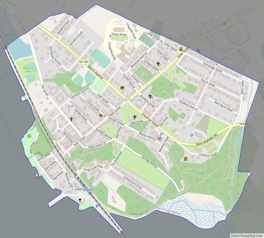
Cold Spring Road Map
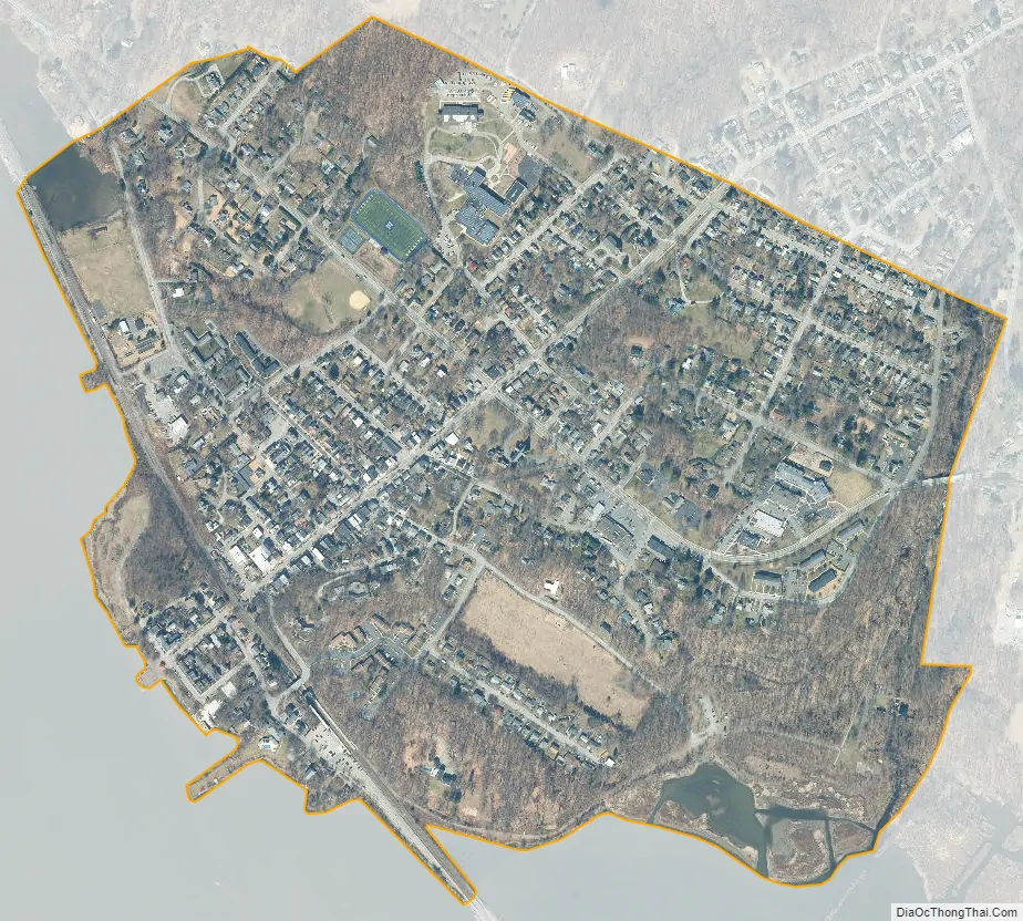
Cold Spring city Satellite Map
Geography
The village is bordered by the Hudson River to the west, and is bound by the Hudson Highlands State Park to the north, where Mount Taurus and Breakneck Ridge rise steeply and dramatically out of the banks of the Hudson and form two basically parallel ridges that track each other inland. The valley between them has an abandoned dairy farm, two lakes, and a camp. The view from the river bank is the Constitution Marsh and the US Military Academy (West Point) slightly to the south, and Crow’s Nest and Storm King Mountain to the west and northwest. All of this considered, the village is nestled in the most prominent vertical terrain on the Hudson River north of New York City prior to the Shawangunk and Catskill ranges. Being bound by these formidable terrain features has kept the size of the village small, and prevented the suburban sprawl that has come about in the less-constrained regions to the north and south and in the New York Metropolitan area generally. This unique sense of place, and the village’s historic housing stock, have made it a very popular weekend destination for tourists from New York City. Its oldest current home is located on 191 Main Street and was built in 1814. Some say Abraham Lincoln visited that house when he visited Cold Spring.
According to the United States Census Bureau, the village has a total area of 0.60 square miles (1.55 km), of which 0.59 square miles (1.54 km) is land and 0.004 square miles (0.01 km), or 0.91%, is water.
See also
Map of New York State and its subdivision:- Albany
- Allegany
- Bronx
- Broome
- Cattaraugus
- Cayuga
- Chautauqua
- Chemung
- Chenango
- Clinton
- Columbia
- Cortland
- Delaware
- Dutchess
- Erie
- Essex
- Franklin
- Fulton
- Genesee
- Greene
- Hamilton
- Herkimer
- Jefferson
- Kings
- Lake Ontario
- Lewis
- Livingston
- Madison
- Monroe
- Montgomery
- Nassau
- New York
- Niagara
- Oneida
- Onondaga
- Ontario
- Orange
- Orleans
- Oswego
- Otsego
- Putnam
- Queens
- Rensselaer
- Richmond
- Rockland
- Saint Lawrence
- Saratoga
- Schenectady
- Schoharie
- Schuyler
- Seneca
- Steuben
- Suffolk
- Sullivan
- Tioga
- Tompkins
- Ulster
- Warren
- Washington
- Wayne
- Westchester
- Wyoming
- Yates
- Alabama
- Alaska
- Arizona
- Arkansas
- California
- Colorado
- Connecticut
- Delaware
- District of Columbia
- Florida
- Georgia
- Hawaii
- Idaho
- Illinois
- Indiana
- Iowa
- Kansas
- Kentucky
- Louisiana
- Maine
- Maryland
- Massachusetts
- Michigan
- Minnesota
- Mississippi
- Missouri
- Montana
- Nebraska
- Nevada
- New Hampshire
- New Jersey
- New Mexico
- New York
- North Carolina
- North Dakota
- Ohio
- Oklahoma
- Oregon
- Pennsylvania
- Rhode Island
- South Carolina
- South Dakota
- Tennessee
- Texas
- Utah
- Vermont
- Virginia
- Washington
- West Virginia
- Wisconsin
- Wyoming