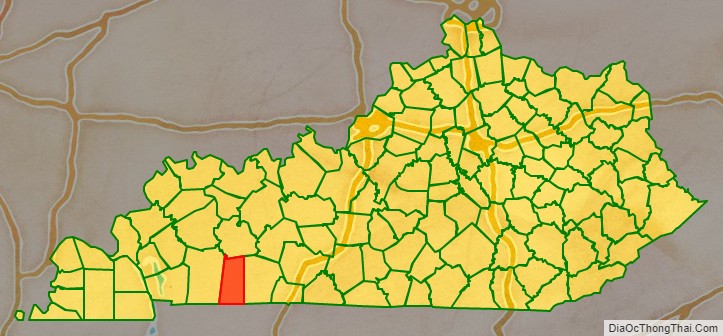
Todd County is a county located in the U.S. state of Kentucky. As of the 2020 census, the population was 12,243. Its county seat is Elkton. The county is named for Colonel John Todd, who was killed at the Battle of Blue Licks in 1782 during the American Revolution.
| Name: | Todd County |
|---|---|
| FIPS code: | 21-219 |
| State: | Kentucky |
| Founded: | 1820 |
| Named for: | Colonel John Todd |
| Seat: | Elkton |
| Largest city: | Elkton |
| Total Area: | 377 sq mi (980 km²) |
| Land Area: | 374 sq mi (970 km²) |
| Total Population: | 12,243 |
| Population Density: | 32/sq mi (13/km²) |
| Time zone: | UTC−6 (Central) |
| Summer Time Zone (DST): | UTC−5 (CDT) |
| Website: | www.toddcounty.ky.gov |
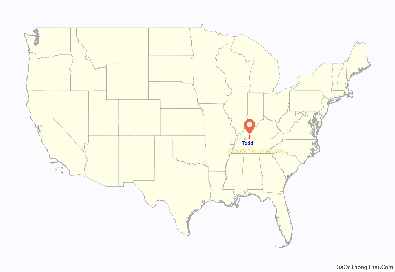
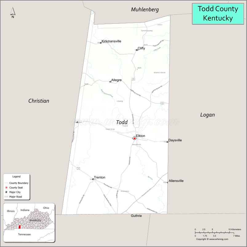
Todd County location map. Where is Todd County?
History
Early history
Todd County consists of two geographical regions known historically as the high country to the north and low country to the south. The northern highlands consist of steep-sloped sandstone terrain with forests of oak, walnut and poplar. The landscape contains steep bluffs and sharp rises and falls within the terrain. The southern lowlands consist of rolling limestone flatlands void of aquifer sinks and consist of dense but sparse forests of oak, walnut poplar and ash. The historic inhabitants of the region before European encounter were the Iroquoian language-speaking Cherokee, who had migrated centuries earlier from areas around the Great Lakes. They used the lands for hunting and gathering.
Todd County lies within what was originally considered the western portion of the Commonwealth of Virginia. Many of the original white settlers came when the area was still considered part of Virginia. This part of southern Kentucky was designated to be awarded to Virginia veterans of the American Revolutionary War as payment for their services.
Justinian Cartwright may have been the first settle in what is now Todd County. However, the first proven residents are Edward Shanklin Jr., Matthew and David Rolston, and John Huston and his sons James and Granville Huston. Samuel Davis, father of Jefferson Davis, and John Wilson were also early settlers of the county. Kentucky Governor Greenup made the first Kentucky land grants to veterans William Croghan, David Logan, Edward Shanklin Jr., and John Wilson, among others.
Todd County was created in response to a petition for “home government,” since travel to the county seats of Logan and Christian was arduous. The petition had been written by the magisterial court, consisting of Edward Shanklin, John Gray, Robert Coleman, Henry Gorin, John Taylor, H. C. Ewing, John S Anderson, William Hopper, John Mann and Joseph Frazer, had made the request. The legislature of the Commonwealth of Kentucky accordingly passed an act creating of the county from portions of Christian and Logan counties on April 1, 1820. The new county was named for Colonel John Todd, who had been killed at the Battle of Blue Licks in 1782.
Development
Agriculture is a revered tradition in Todd County. The lowlands are of the finest rich soil types, including “Pembroke” soil. The lowlands are prized for their high growth yields. In the early 19th century, Major John Gray established a stagecoach hub in the county with travel routes radiating to larger American cities from the central point. His widely known Stagecoach Inn located in “Graysville,” now Guthrie, Kentucky, was at the center of the travel routes. Major Gray’s stagecoach empire was highly successful, and he soon became wealthy due to its popularity in the region. Major Gray built a house, a simple two-story shed-roofed, brick one-pile dwelling, now known as “Halcyon,” or the John Gray House.
Gray wanted a town to be established near his home that would become the county seat. Gray designed the city, which included a town square from which hundreds of lots radiated. He called it “Elkton” after the elk herds that watered at a spring near the town center. Gray designed the town square as a trapezoid instead of a square, with the south side of the town square larger than the north so that as the sun traversed across the sky, the buildings on the east and west would benefit from prolonged periods of daily sunlight. Gray contributed funding for a county courthouse, which was erected at the center of the square. The brick building stood two stories with a cupola at the top.
After Major Gray died, the building was deemed in a state of ruin due to improper construction methods and torn down to erect a new courthouse. The new Todd County courthouse was erected by order of the Fiscal Court in 1834. R. Rowland designed the building in the Federal Style with an integration of Greek-Revival style motifs. The brick building, which is extant in the 21st century, stands two stories tall with tripartite windows and large Greek-Revival lintels. The building originally had a smaller federal style cupola, but this was later replaced with a late Victorian clock tower in the second Empire style, which remains today.
Civil War
Kentucky was a source of slaves for the cotton plantations in the lower South, and the slave trade was a profitable business for many Kentuckians. However, most Kentuckians did not own slaves. Those who did were wealthy plantation owners who stood to lose a lot if slavery were abolished. The major slave-owning areas in the state were the Bluegrass region, Henderson and Oldham counties on the Ohio River, and the western Kentucky counties of Trigg, Christian, Todd, and Warren. Many Kentuckians from these areas joined the Confederate army. Nevertheless, Kentucky’s allegiance was divided during the Civil War. The state was officially neutral until September 1861, when it pledged its support to the Union. In response, a pro-Confederate Confederate government of Kentucky was formed by representatives from several Kentucky counties, with a second capital at Bowling Green.
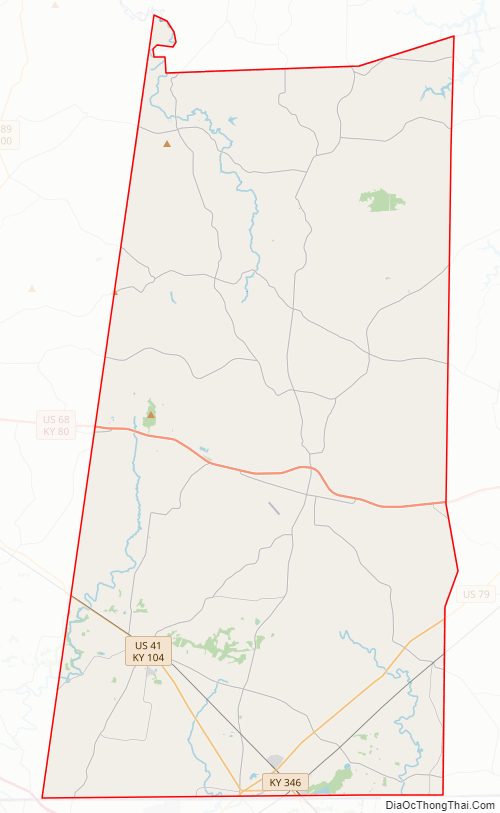
Todd County Road Map
Geography
According to the U.S. Census Bureau, the county has a total area of 377 square miles (980 km), of which 374 square miles (970 km) is land and 2.6 square miles (6.7 km) (0.7%) is water.
Adjacent counties
- Muhlenberg County (north)
- Logan County (east)
- Robertson County, Tennessee (southeast)
- Montgomery County, Tennessee (southwest)
- Christian County (west)
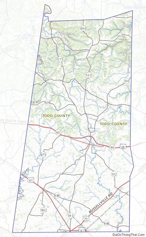
Todd County Topographic Map
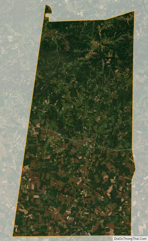
Todd County Satellite Map
Todd County Outline Map