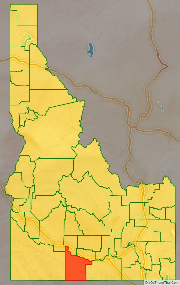
Twin Falls County is a county in the south central part of the U.S. state of Idaho. As of the 2020 Census, the county had a population of 90,046, making it the fifth-most populous county in Idaho. The county seat and largest city is Twin Falls. Twin Falls County is part of the Twin Falls, ID Twin Falls Metropolitan Statistical Area.
Prior to the 1860s, the Twin Falls County area was an unorganized part of Shoshone lands, then as part of the Oregon Country. The area was first organized as part of the original Owyhee County in 1864 as part of Idaho Territory. In 1879 it was partitioned away from Owyhee County to form part of Cassia County. The county is named for a split waterfall on the Snake River of the same name. The Snake River is the county’s northern boundary.
Even after Idaho became a state in 1890, the Twin Falls area was very sparsely populated and without significant settlements. That changed after the city of Twin Falls was founded in 1904, and Milner Dam was completed in 1905. Most of the county’s other towns were established during this period as well. In response to local government needs for these new communities, which were as much as 80 miles (130 km) away from Cassia County’s seat at Albion, Twin Falls County was created by the Idaho Legislature on February 21, 1907.
| Name: | Twin Falls County |
|---|---|
| FIPS code: | 16-083 |
| State: | Idaho |
| Founded: | February 21, 1907 |
| Named for: | Snake River waterfall |
| Seat: | Twin Falls |
| Largest city: | Twin Falls |
| Total Area: | 1,928 sq mi (4,990 km²) |
| Land Area: | 1,921 sq mi (4,980 km²) |
| Total Population: | 90,046 |
| Time zone: | UTC−7 (Mountain) |
| Summer Time Zone (DST): | UTC−6 (MDT) |
| Website: | www.twinfallscounty.org |
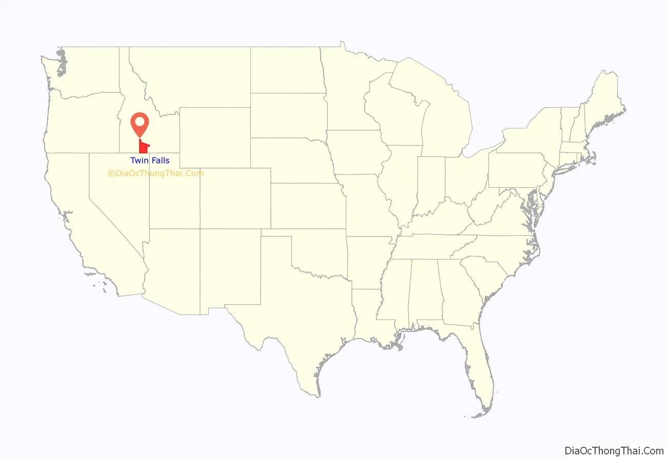
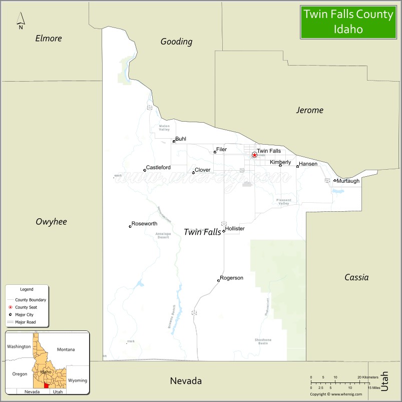
Twin Falls County location map. Where is Twin Falls County?
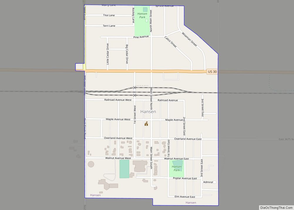
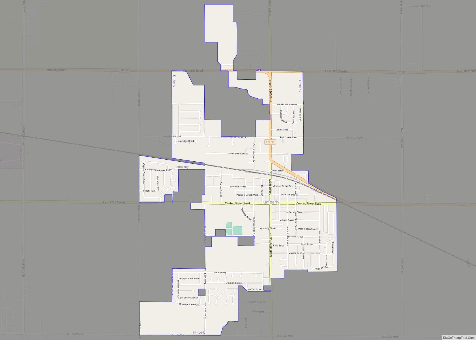
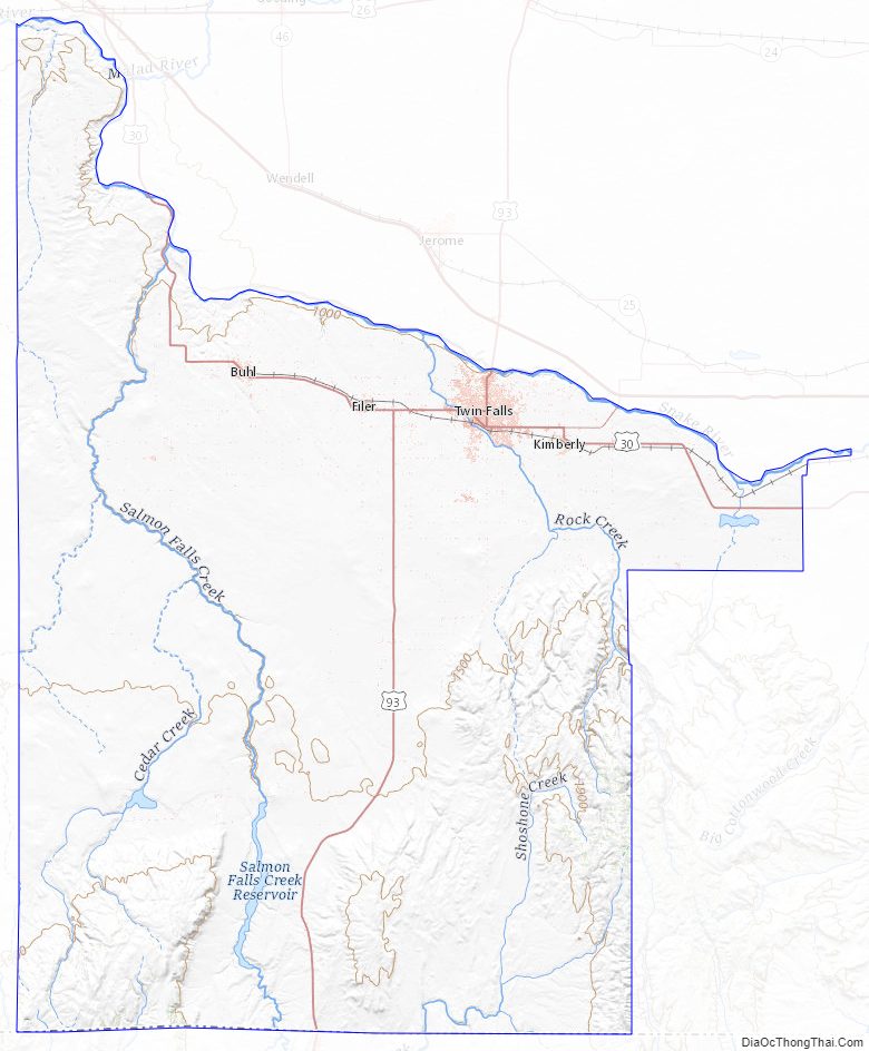
Twin Falls County Road Map
Geography
According to the U.S. Census Bureau, the county has a total area of 1,928 square miles (4,990 km), of which 1,921 square miles (4,980 km) is land and 7.1 square miles (18 km) (0.4%) is water.
Adjacent counties
- Gooding County – north
- Jerome County – northeast
- Cassia County – east
- Elko County, Nevada – south/Pacific Time Border
- Owyhee County – west
- Elmore County – northwest
Major highways
- US 30
- US 93
- SH-50
- SH-74
National protected areas
- Hagerman Fossil Beds National Monument
- Sawtooth National Forest (part)
Twin Falls County Topographic Map
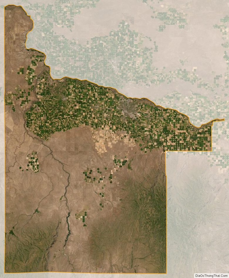
Twin Falls County Satellite Map
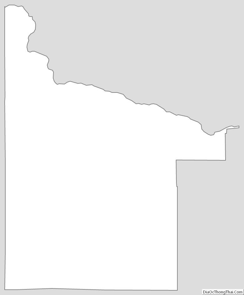
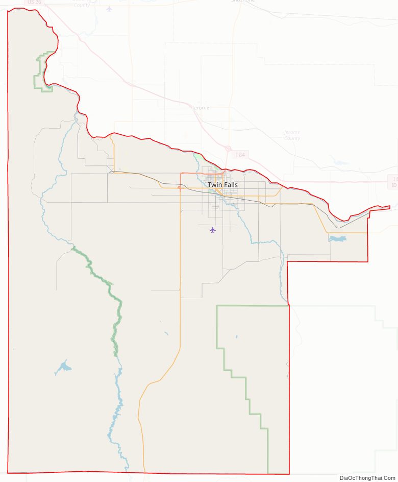
Twin Falls County Outline Map