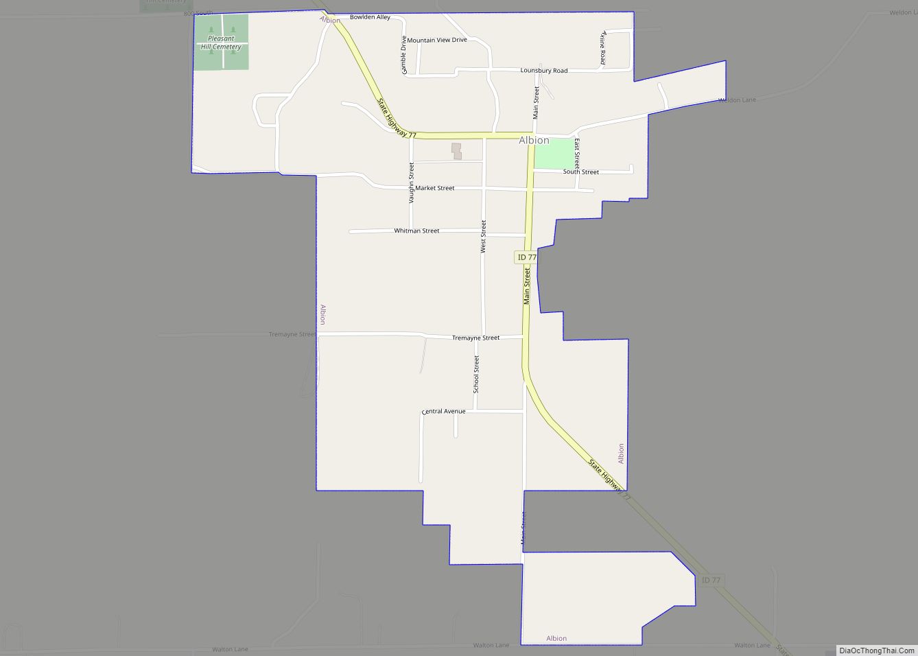
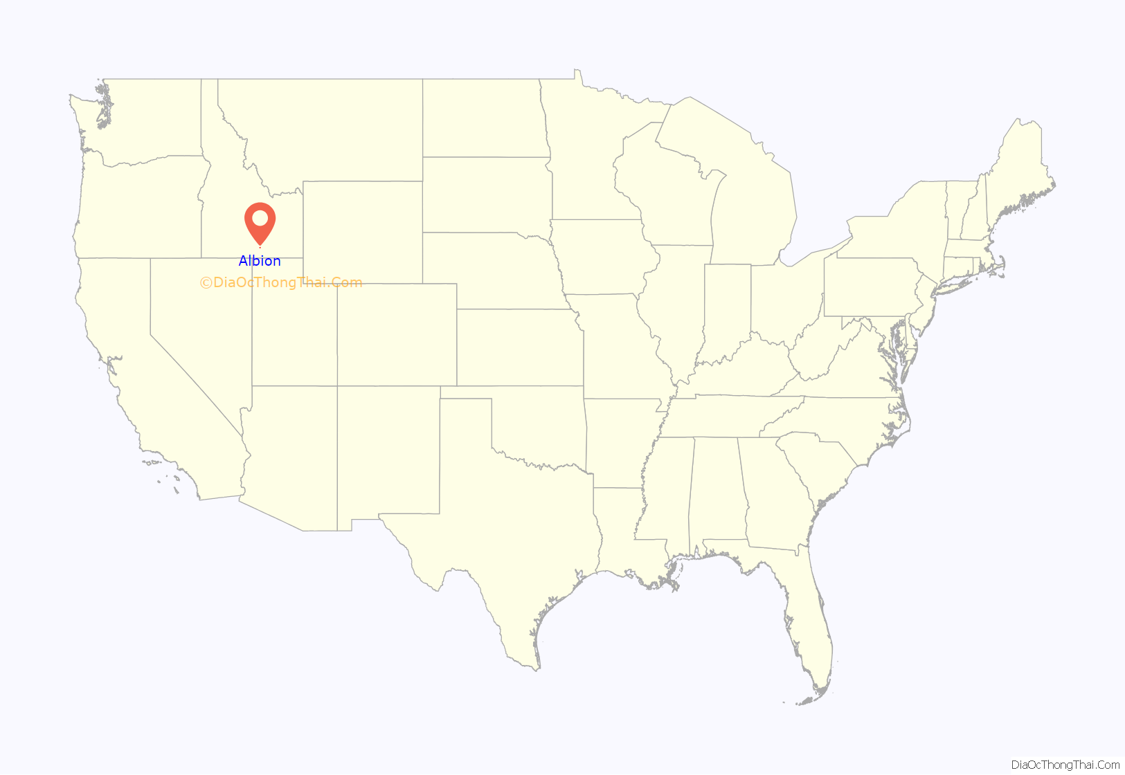
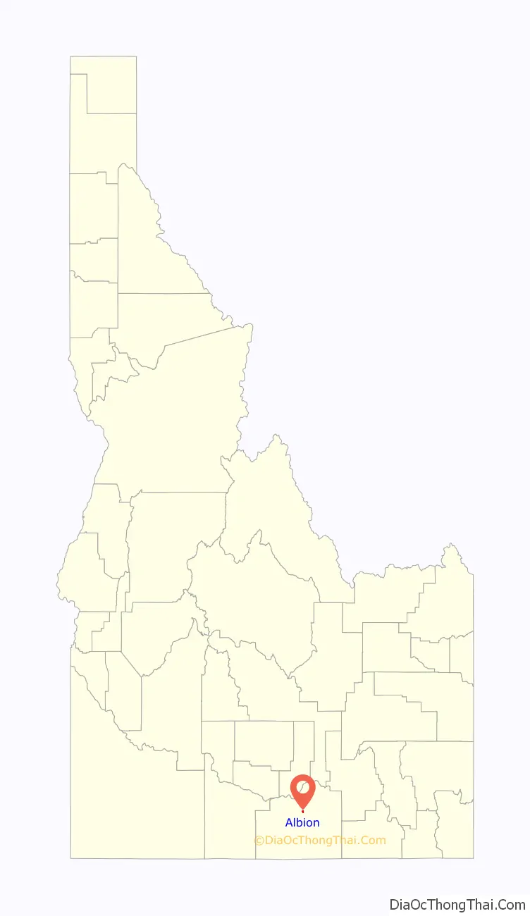
Albion is a city in Cassia County, Idaho, United States. It is part of the Burley, Idaho Micropolitan Statistical Area. The population was 234 at the 2020 census. Albion was the county seat of Cassia County from 1879 to 1918.
Albion is one of the few cities in the Magic Valley region of Idaho founded before 1900. Beginning in 1893 it was home of the Albion State Normal School, which trained many Idaho teachers. The school was closed in 1951 and its teaching programs were transferred to Idaho State College (now Idaho State University) in Pocatello. By 2006 the campus had fallen into serious disrepair.
| Name: | Albion city |
|---|---|
| LSAD Code: | 25 |
| LSAD Description: | city (suffix) |
| State: | Idaho |
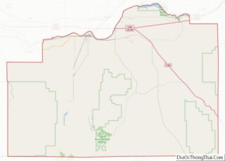
| County: | Cassia County |
| Elevation: | 4,724 ft (1,440 m) |
| Total Area: | 0.47 sq mi (1.22 km²) |
| Land Area: | 0.47 sq mi (1.22 km²) |
| Water Area: | 0.00 sq mi (0.00 km²) |
| Total Population: | 234 |
| Population Density: | 496.82/sq mi (191.71/km²) |
| ZIP code: | 83311 |
| Area code: | 208 |
| FIPS code: | 1601000 |
| GNISfeature ID: | 0397366 |
| Website: | www.albionidaho.org |
Online Interactive Map
Click on ![]() to view map in "full screen" mode.
to view map in "full screen" mode.
Albion location map. Where is Albion city?
History
The first settlement at Albion was made ca. 1875. The city was named for Albion, the poetic name for Great Britain.
D. L. Evans Bank was founded in Albion in 1904. Although the bank’s headquarters is now located in Burley, it continues to operate a branch in Albion.
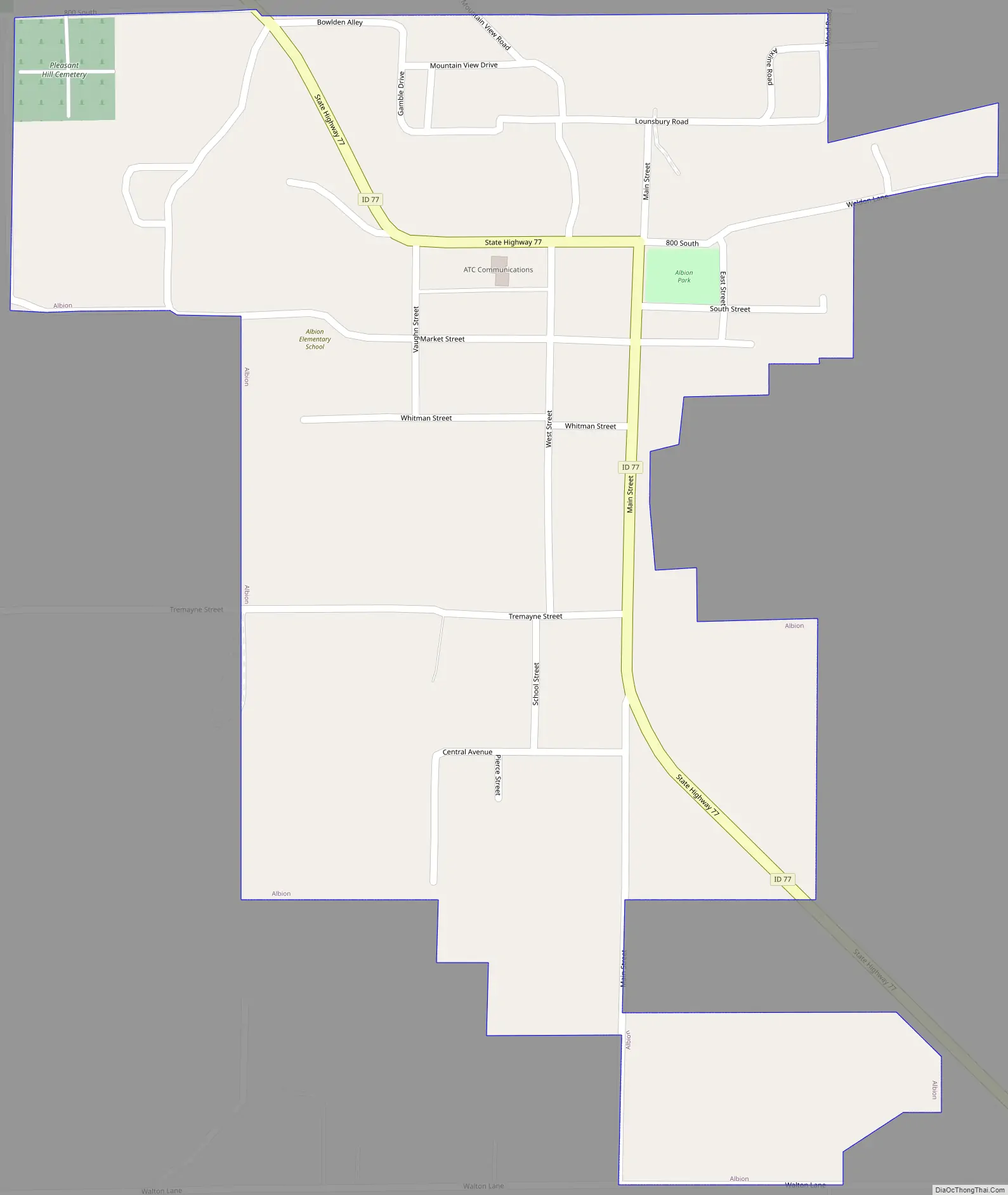
Albion Road Map
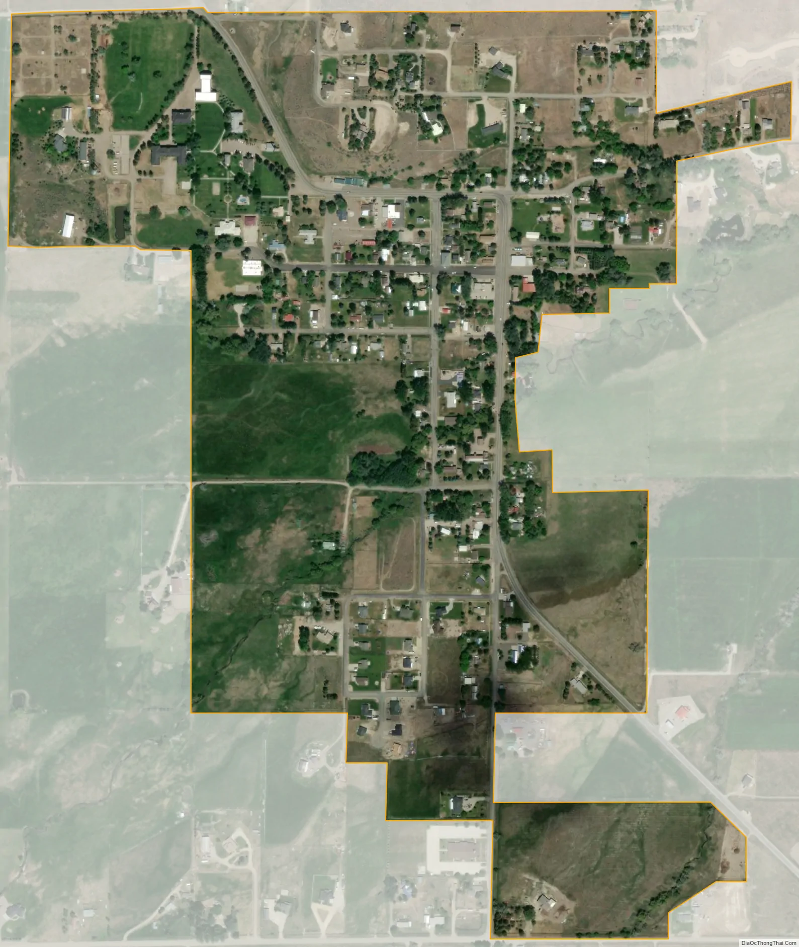
Albion city Satellite Map
Geography
Albion is located at 42°24′39″N 113°34′51″W / 42.41083°N 113.58083°W / 42.41083; -113.58083 (42.410882, -113.580901).
According to the United States Census Bureau, the city has a total area of 0.47 square miles (1.22 km), all of it land. The college was later opened by the Church of Christ as Magic Valley Christian College. This was a part of Pepperdine College in California.
See also
Map of Idaho State and its subdivision:- Ada
- Adams
- Bannock
- Bear Lake
- Benewah
- Bingham
- Blaine
- Boise
- Bonner
- Bonneville
- Boundary
- Butte
- Camas
- Canyon
- Caribou
- Cassia
- Clark
- Clearwater
- Custer
- Elmore
- Franklin
- Fremont
- Gem
- Gooding
- Idaho
- Jefferson
- Jerome
- Kootenai
- Latah
- Lemhi
- Lewis
- Lincoln
- Madison
- Minidoka
- Nez Perce
- Oneida
- Owyhee
- Payette
- Power
- Shoshone
- Teton
- Twin Falls
- Valley
- Washington
- Alabama
- Alaska
- Arizona
- Arkansas
- California
- Colorado
- Connecticut
- Delaware
- District of Columbia
- Florida
- Georgia
- Hawaii
- Idaho
- Illinois
- Indiana
- Iowa
- Kansas
- Kentucky
- Louisiana
- Maine
- Maryland
- Massachusetts
- Michigan
- Minnesota
- Mississippi
- Missouri
- Montana
- Nebraska
- Nevada
- New Hampshire
- New Jersey
- New Mexico
- New York
- North Carolina
- North Dakota
- Ohio
- Oklahoma
- Oregon
- Pennsylvania
- Rhode Island
- South Carolina
- South Dakota
- Tennessee
- Texas
- Utah
- Vermont
- Virginia
- Washington
- West Virginia
- Wisconsin
- Wyoming