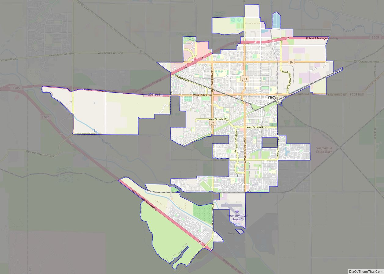
Map of Trinity Center CDP

Map of Trinity Center CDP

Trinity Center is a census-designated place (CDP) in Trinity County, California. Trinity Center is located 29 miles (47 km) north of Weaverville. It is home to Trinity Lake, a popular summer tourist destination. It is home to a store, Trinity Center Airport, a marina, a community church, several campgrounds, and several small resorts. Coffee Creek is … Read more

Map of Trinidad city

Map of Trinidad city, California

Trinidad (Spanish for “Trinity”; Yurok: Chuerey) is a seaside city in Humboldt County, located on the Pacific Ocean 8 miles (13 km) north of the Arcata-Eureka Airport and 15 miles (24 km) north of the college town of Arcata. Trinidad is noted for its coastline with ten public beaches and offshore rocks, part of the California Coastal … Read more

Map of Tres Pinos CDP

Map of Tres Pinos CDP

Tres Pinos (Spanish for “Three Pines”) is a census-designated place in San Benito County, California. The community lies along State Route 25, approximately 4 miles south of Hollister and 5 miles north of Paicines. Tres Pinos sits at an elevation of 531 feet (162 m). The 2010 United States census reported Tres Pinos’s population was 476. … Read more

Map of Trowbridge CDP

Map of Trowbridge CDP

Trowbridge is a census-designated place (CDP) in Sutter County, California. Trowbridge sits at an elevation of 52 feet (16 m). The 2010 United States census reported Trowbridge’s population was 226. Trowbridge CDP overview: Name: Trowbridge CDP LSAD Code: 57 LSAD Description: CDP (suffix) State: California County: Sutter County Elevation: 52 ft (16 m) Total Area: 6.747 sq mi (17.474 km²) Land … Read more

Map of Trona CDP

Map of Trona CDP

Trona is an unincorporated community in San Bernardino County, California. In 2015 it had a population of approximately 1,900. Trona is at the western edge of Searles Lake, a dry lake bed in Searles Valley, southwest of Death Valley. The town takes its name from the mineral trona, abundant in the lakebed. It is about … Read more

Map of Trinity Village CDP

Map of Trinity Village CDP

Trinity Village is a census-designated place (CDP) in Trinity County, California. Trinity Village sits at an elevation of 1,289 feet (393 m). Its population is 278 as of the 2020 census, down from 297 from the 2010 census. Trinity Village CDP overview: Name: Trinity Village CDP LSAD Code: 57 LSAD Description: CDP (suffix) State: California County: … Read more

Map of Tulelake city

Map of Tulelake city

Tulelake (/ˈtuːlileɪk/ TOO-lee-layk) is a city in northeastern Siskiyou County, California, United States. The town is named after nearby Tule Lake. Its population is 902 as of the 2020 census, down from 1,010 from the 2010 census. Tulelake peace officers are authorized by state law, along with cooperation of the state of Oregon, to serve … Read more

Map of Tulare city

Map of Tulare city, California

Tulare (/tʊˈlɛəri/ (listen) tuu-LAIR-ee) is a city in Tulare County, California. The population was 68,875 at the 2020 census. It is located in the heart of the San Joaquin Valley, eight miles south of Visalia and sixty miles north of Bakersfield. The city is named for the Tulare Lake, once the largest freshwater lake west … Read more

Map of Truckee town

Map of Truckee town

Truckee is an incorporated town in Nevada County, California, United States. As of the 2010 United States Census, the population was 16,180, reflecting an increase of 2,316 from the 13,864 counted in the 2000 Census and having the 316th highest population in California and 2114th in the United States. Truckee town overview: Name: Truckee town … Read more

Map of Turlock city

Map of Turlock city

Turlock is a city in Stanislaus County, California, United States. Its estimated 2019 population of 73,631 made it the second-largest city in Stanislaus County after Modesto. Turlock city overview: Name: Turlock city LSAD Code: 25 LSAD Description: city (suffix) State: California County: Stanislaus County Incorporated: February 15, 1908 Elevation: 62 ft (31 m) Total Area: 16.93 sq mi (43.85 km²) … Read more

Map of Tupman CDP

Map of Tupman CDP

Tupman is a census-designated place (CDP) in Kern County, California, United States. Tupman is located 20 miles (32 km) west-southwest of Bakersfield, at an elevation of 331 feet (101 m). The population was 161 at the 2010 census, down from 227 at the 2000 census. Tupman CDP overview: Name: Tupman CDP LSAD Code: 57 LSAD Description: CDP … Read more

Map of Tuolumne City CDP

Map of Tuolumne City CDP

Tuolumne City (/tuˈɒləmi/ (listen)) is an unincorporated town in Tuolumne County, California. A census-designated place (CDP) officially known as Tuolumne also encompasses the town. The population of the CDP was 1,779 at the 2010 census, down from 1,865 at the 2000 census. Tuolumne City CDP overview: Name: Tuolumne City CDP LSAD Code: 57 LSAD Description: … Read more