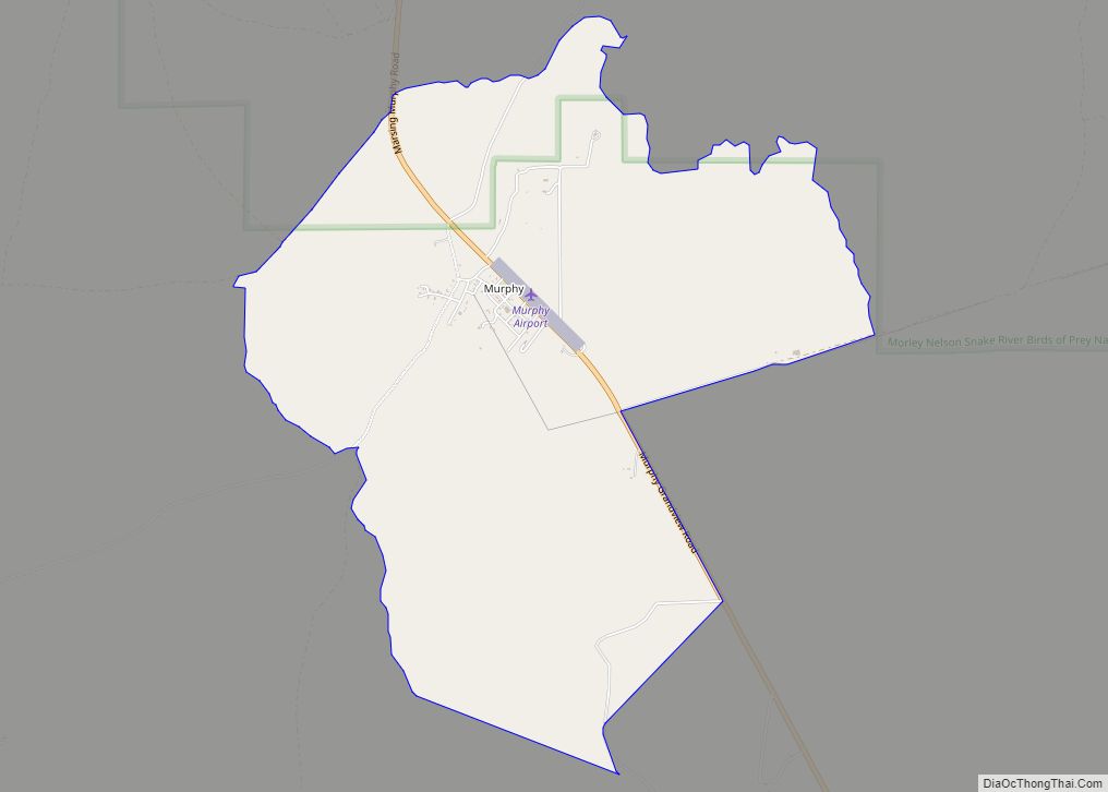
Map of Mullan city

Map of Mullan city

Mullan is a city in the northwest United States, located in the Silver Valley mining district of northern Idaho. The population was 646 at the 2020 census and 692 at the 2010 census, and 840 in 2000. In Shoshone County at the east end of the Silver Valley, Mullan is in a sheltered canyon of … Read more

Map of New Plymouth city

Map of New Plymouth city

New Plymouth is a city in Payette County, Idaho. The population was 1,538 at the 2010 census, up from 1400 in 2000. It was incorporated on February 15, 1896. It is the host of the annual Payette County Fair and rodeo. New Plymouth is part of the Ontario, OR–ID Micropolitan Statistical Area. New Plymouth city … Read more

Map of Oldtown city

Map of Oldtown city, Idaho

Oldtown is a city in Bonner County, Idaho and suburb of Newport, Washington, with a population of 184 at the 2010 census. It is located on the Pend Oreille River, just east of Newport. There are no natural or physical barriers, and it is strictly a political division, separated by the straight-line state boundary. Oldtown … Read more

Map of Oakley city, Idaho

Map of Oakley city, Idaho

Oakley is a city in Cassia County, Idaho, United States. The population was 763 at the 2010 census, up from 668 in 2000. It is part of the Burley Micropolitan Statistical Area. Oakley city overview: Name: Oakley city LSAD Code: 25 LSAD Description: city (suffix) State: Idaho County: Cassia County Elevation: 4,570 ft (1,390 m) Total Area: … Read more

Map of Notus city

Map of Notus city

Notus is a small rural city in Canyon County, Idaho. The population was 531 at the time of the 2010 census and is the smallest town out of the eight in Canyon County. It is part of the Boise metropolitan area. Notus city overview: Name: Notus city LSAD Code: 25 LSAD Description: city (suffix) State: … Read more

Map of Nezperce city

Map of Nezperce city

Nezperce is a city in and the county seat of Lewis County, Idaho, United States. The population was 466 at the 2010 census, down from 523 in 2000. Nezperce is named for the local Nez Perce tribe of Native Americans. (“Nezperce” derives from a corruption of French words nez percé, literally “pierced nose.”) There is … Read more

Map of Newdale city

Map of Newdale city

Newdale is a city in Fremont County, Idaho, United States. The population was 337 at the 2020 census. It is part of the Rexburg, Idaho Micropolitan Statistical Area. Newdale city overview: Name: Newdale city LSAD Code: 25 LSAD Description: city (suffix) State: Idaho County: Fremont County Elevation: 5,079 ft (1,548 m) Total Area: 0.18 sq mi (0.48 km²) Land Area: … Read more

Map of Paris city, Idaho

Map of Paris city, Idaho

Paris is a city and county seat of Bear Lake County, Idaho, United States. Located on the western side of the Bear Lake Valley, the city’s population was 513 at the 2010 census, down from 576 in 2000. Paris was settled on September 26, 1863, by pioneer settlers of the Church of Jesus Christ of … Read more

Map of Oxford city, Idaho

Map of Oxford city, Idaho

Oxford is a city in Franklin County, Idaho, United States. The population was 48 at the 2010 census. Oxford city overview: Name: Oxford city LSAD Code: 25 LSAD Description: city (suffix) State: Idaho County: Franklin County Elevation: 4,803 ft (1,464 m) Total Area: 0.26 sq mi (0.68 km²) Land Area: 0.26 sq mi (0.68 km²) Water Area: 0.00 sq mi (0.00 km²) Total Population: 48 Population … Read more

Map of Osburn city

Map of Osburn city

Osburn is a city in Shoshone County, Idaho, United States. Located in the Silver Valley mining region of northern Idaho, its population was 1,555 at the 2010 census. Osburn city overview: Name: Osburn city LSAD Code: 25 LSAD Description: city (suffix) State: Idaho County: Shoshone County Elevation: 2,520 ft (770 m) Total Area: 1.34 sq mi (3.46 km²) Land Area: … Read more

Map of Orofino city

Map of Orofino city

Orofino (“fine gold” [ore] in Spanish) is a city in and the county seat of Clearwater County, Idaho, along Orofino Creek and the north bank of the Clearwater River. It is the major city within the Nez Perce Indian Reservation. The population was 3,142 at the time of the 2010 census. Nearby is the historical … Read more

Map of Onaway city

Map of Onaway city, Idaho

Onaway is a city in Latah County, Idaho, United States. The population was 187 at the 2010 census, down from 230 in 2000. The name sources from the mill works at nearby Potlatch to the west, as workers would frequent the bars after work. When a wife called and asked where her husband was she … Read more