Nezperce is a city in and the county seat of Lewis County, Idaho, United States. The population was 466 at the 2010 census, down from 523 in 2000. Nezperce is named for the local Nez Perce tribe of Native Americans. (“Nezperce” derives from a corruption of French words nez percé, literally “pierced nose.”) There is one school district, Nezperce School District #302.
| Name: | Nezperce city |
|---|---|
| LSAD Code: | 25 |
| LSAD Description: | city (suffix) |
| State: | Idaho |
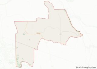
| County: | Lewis County |
| Elevation: | 3,215 ft (980 m) |
| Total Area: | 0.43 sq mi (1.11 km²) |
| Land Area: | 0.43 sq mi (1.11 km²) |
| Water Area: | 0.00 sq mi (0.00 km²) |
| Total Population: | 466 |
| Population Density: | 1,067.60/sq mi (411.98/km²) |
| ZIP code: | 83543 |
| Area code: | 208 |
| FIPS code: | 1657250 |
| GNISfeature ID: | 0396958 |
| Website: | www.cityofnezperce.com |
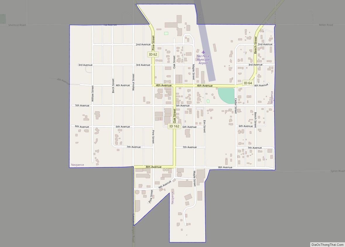
Online Interactive Map
Click on ![]() to view map in "full screen" mode.
to view map in "full screen" mode.
Nezperce location map. Where is Nezperce city?
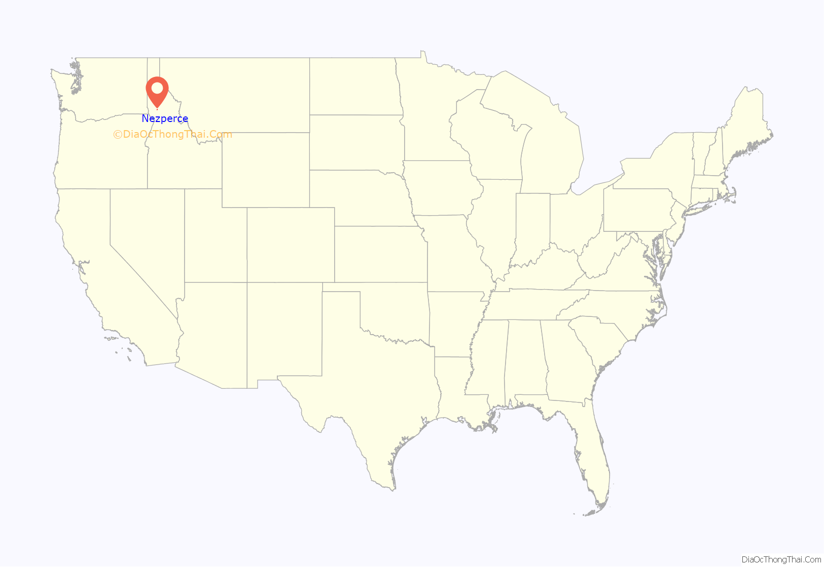
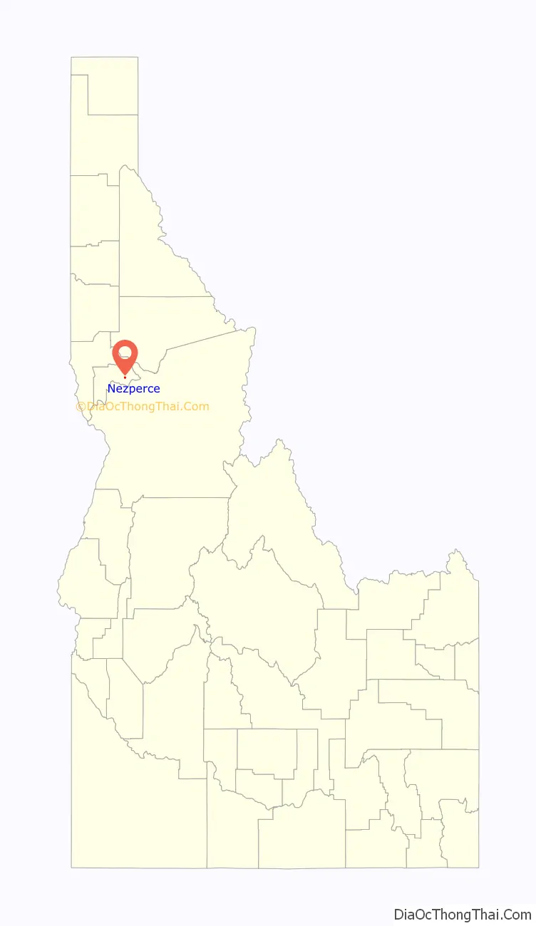
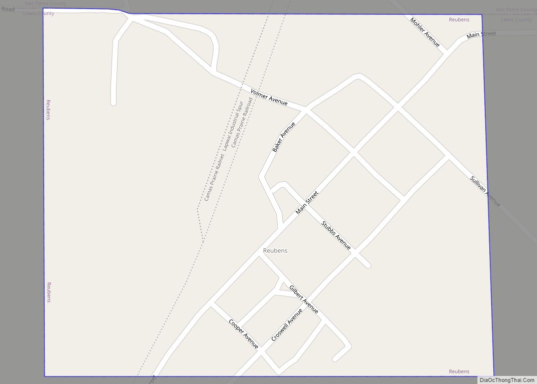
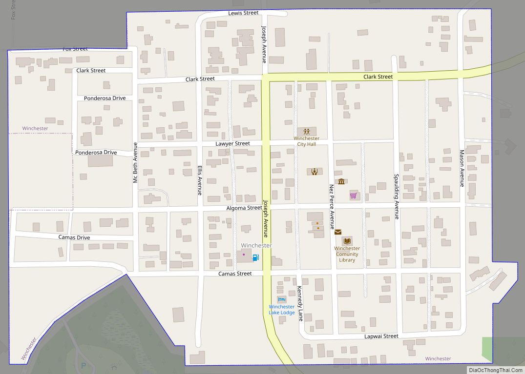
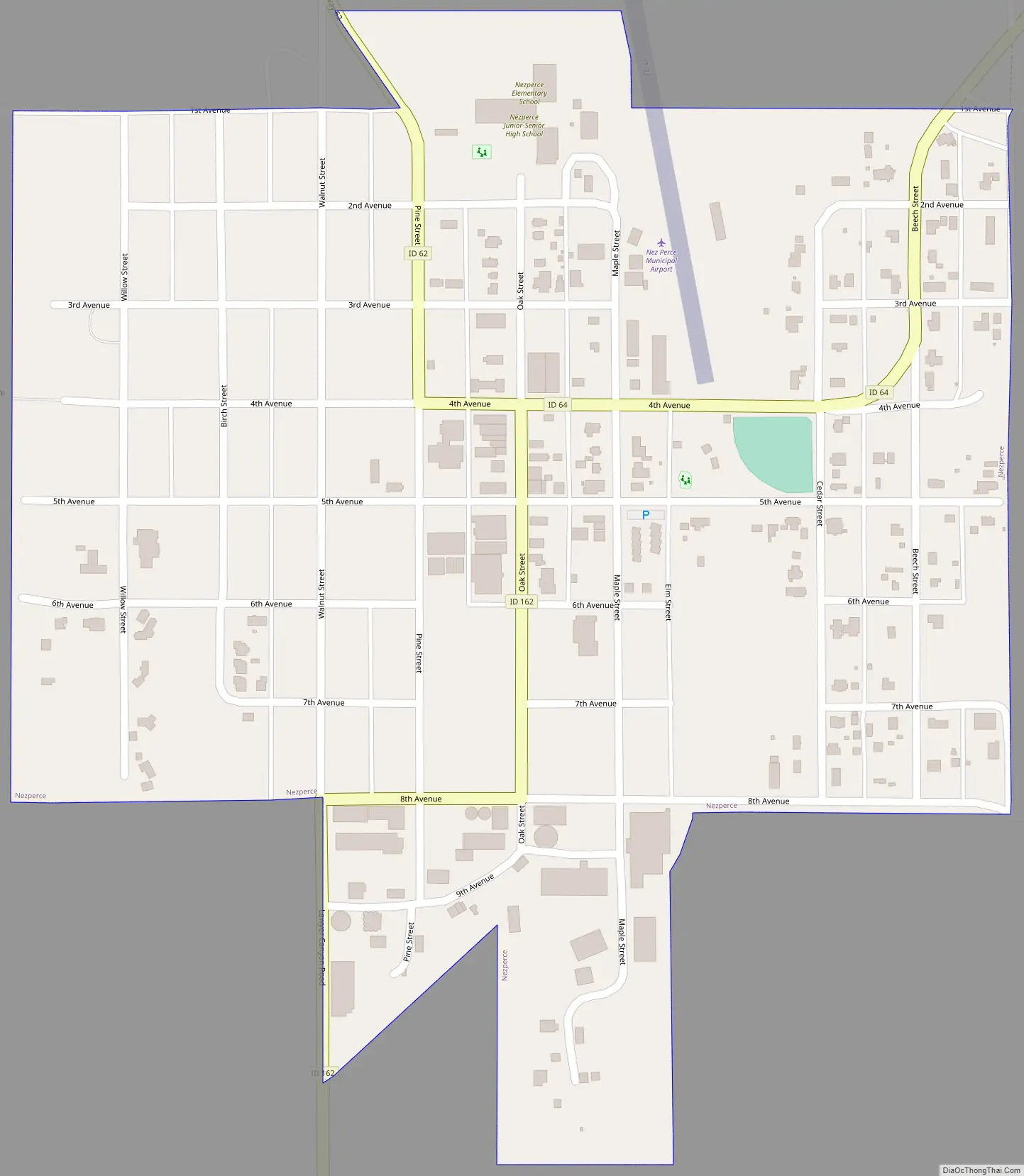
Nezperce Road Map
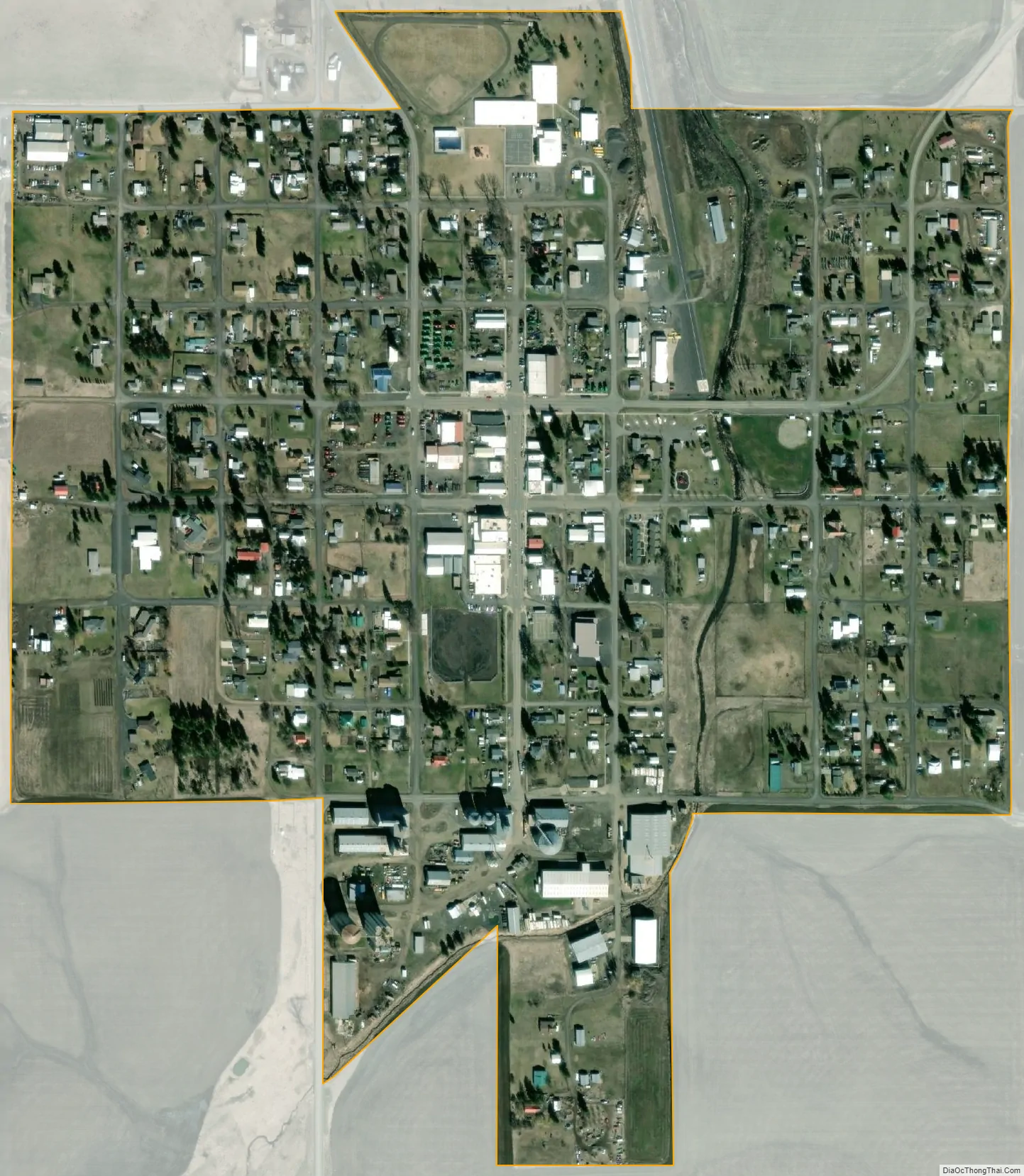
Nezperce city Satellite Map
Geography
According to the United States Census Bureau, the city has a total area of 0.40 square miles (1.04 km), all of it land.
Nezperce is located on the Camas Prairie. Idaho State Highways 64, 62 and 162 have a junction in Nezperce.
Climate
According to the Köppen climate classification system, Nezperce has a humid continental climate (Köppen Dfb).
See also
Map of Idaho State and its subdivision:- Ada
- Adams
- Bannock
- Bear Lake
- Benewah
- Bingham
- Blaine
- Boise
- Bonner
- Bonneville
- Boundary
- Butte
- Camas
- Canyon
- Caribou
- Cassia
- Clark
- Clearwater
- Custer
- Elmore
- Franklin
- Fremont
- Gem
- Gooding
- Idaho
- Jefferson
- Jerome
- Kootenai
- Latah
- Lemhi
- Lewis
- Lincoln
- Madison
- Minidoka
- Nez Perce
- Oneida
- Owyhee
- Payette
- Power
- Shoshone
- Teton
- Twin Falls
- Valley
- Washington
- Alabama
- Alaska
- Arizona
- Arkansas
- California
- Colorado
- Connecticut
- Delaware
- District of Columbia
- Florida
- Georgia
- Hawaii
- Idaho
- Illinois
- Indiana
- Iowa
- Kansas
- Kentucky
- Louisiana
- Maine
- Maryland
- Massachusetts
- Michigan
- Minnesota
- Mississippi
- Missouri
- Montana
- Nebraska
- Nevada
- New Hampshire
- New Jersey
- New Mexico
- New York
- North Carolina
- North Dakota
- Ohio
- Oklahoma
- Oregon
- Pennsylvania
- Rhode Island
- South Carolina
- South Dakota
- Tennessee
- Texas
- Utah
- Vermont
- Virginia
- Washington
- West Virginia
- Wisconsin
- Wyoming