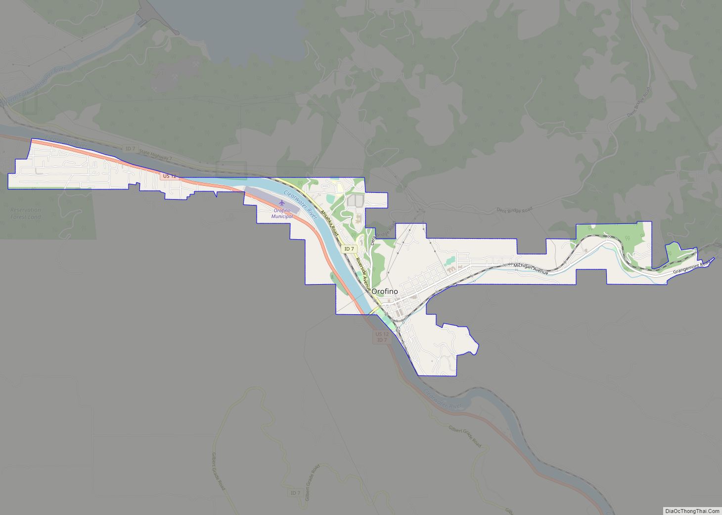
Orofino (“fine gold” [ore] in Spanish) is a city in and the county seat of Clearwater County, Idaho, along Orofino Creek and the north bank of the Clearwater River. It is the major city within the Nez Perce Indian Reservation. The population was 3,142 at the time of the 2010 census.
Nearby is the historical “Canoe Camp,” where the Lewis and Clark expedition built five new dugout canoes and embarked on October 7, 1805, downstream to the Pacific Ocean. Some four miles (6 km) north is the Dworshak Dam, third-highest dam in the United States, completed in the early 1970s. Nearby is the Dworshak National Fish Hatchery, started to try to compensate for the loss of migratory fish upstream after the dam was constructed.
Originally the name was two words, Oro Fino, applied to a gold mining camp established in 1861 two miles (3 km) south of Pierce. When the United States government opened up the Nez Percé reservation to non-tribal settlers in 1895, thousands of European Americans rushed to lay claims to land. Clifford Fuller set up a trading post on his new homestead. The town (Orofino-on-the-Clearwater) was established the next year. The railroad, later part of the Camas Prairie Railroad, was constructed from Lewiston in 1899.
Orofino is home to state institutions: Idaho State Hospital North and the Idaho Correctional Institution–Orofino. These two facilities are located adjacent to Orofino High School, which includes the junior high or middle school grades, and whose mascot is the Maniac.
Orofino hosts an annual July 4 celebration, as well as the Clearwater County Fair and Lumberjack Days in late summer. Each spring, Boomershoot, an annual precision rifle event, is held nearby.
| Name: | Orofino city |
|---|---|
| LSAD Code: | 25 |
| LSAD Description: | city (suffix) |
| State: | Idaho |
| County: | Clearwater County |
| Elevation: | 1,030 ft (310 m) |
| Total Area: | 2.61 sq mi (6.76 km²) |
| Land Area: | 2.46 sq mi (6.38 km²) |
| Water Area: | 0.15 sq mi (0.38 km²) |
| Total Population: | 3,142 |
| Population Density: | 1,257.71/sq mi (485.63/km²) |
| ZIP code: | 83544 |
| Area code: | 208 |
| FIPS code: | 1659320 |
| GNISfeature ID: | 0396986 |
| Website: | www.cityoforofino.org |
Online Interactive Map
Click on ![]() to view map in "full screen" mode.
to view map in "full screen" mode.
Orofino location map. Where is Orofino city?
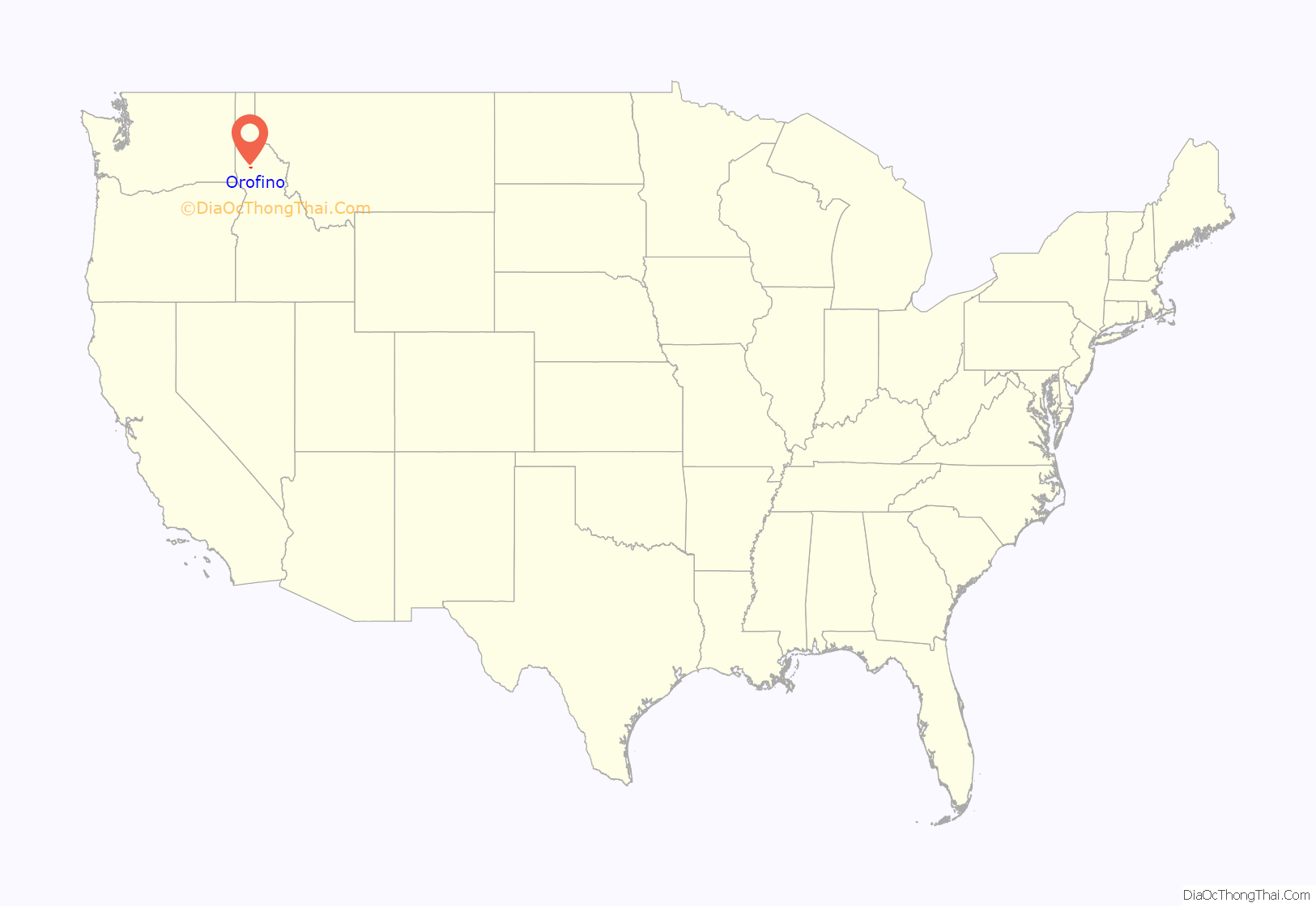

Orofino Road Map
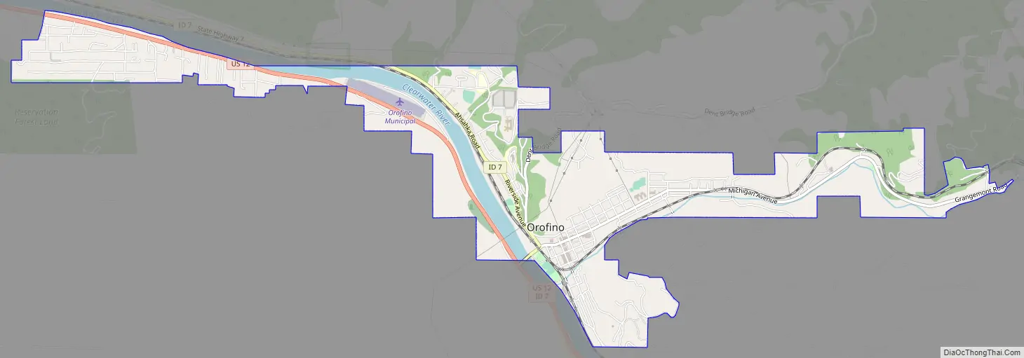
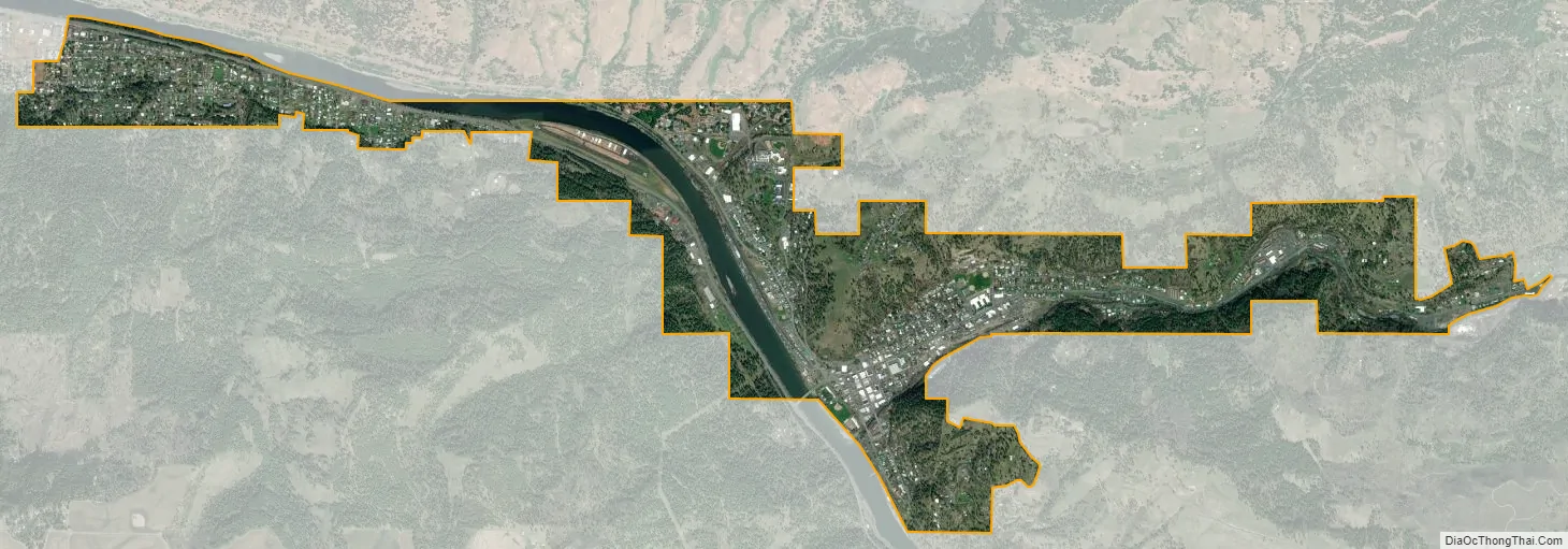
Orofino city Satellite Map
Geography
Orofino is located at 46°29′8″N 116°15′32″W / 46.48556°N 116.25889°W / 46.48556; -116.25889 (46.485485, -116.258847).
According to the United States Census Bureau, the city has a total area of 2.47 square miles (6.40 km), of which 2.33 square miles (6.03 km) is land and 0.14 square miles (0.36 km) is water.
Climate
The city has a climate typical of low-elevation areas in Idaho and eastern Washington. Orofino has a dry-summer continental climate (Köppen Dsb). Due to the warm summers, it nearly qualifies as a continental Mediterranean climate (Dsa). Idaho’s all-time highest temperature of 118 °F or 47.8 °C was recorded at Orofino on July 28, 1934.
See also
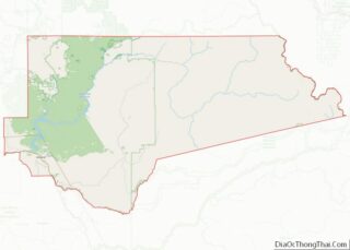
Map of Idaho State and its subdivision:- Ada
- Adams
- Bannock
- Bear Lake
- Benewah
- Bingham
- Blaine
- Boise
- Bonner
- Bonneville
- Boundary
- Butte
- Camas
- Canyon
- Caribou
- Cassia
- Clark
- Clearwater
- Custer
- Elmore
- Franklin
- Fremont
- Gem
- Gooding
- Idaho
- Jefferson
- Jerome
- Kootenai
- Latah
- Lemhi
- Lewis
- Lincoln
- Madison
- Minidoka
- Nez Perce
- Oneida
- Owyhee
- Payette
- Power
- Shoshone
- Teton
- Twin Falls
- Valley
- Washington
- Alabama
- Alaska
- Arizona
- Arkansas
- California
- Colorado
- Connecticut
- Delaware
- District of Columbia
- Florida
- Georgia
- Hawaii
- Idaho
- Illinois
- Indiana
- Iowa
- Kansas
- Kentucky
- Louisiana
- Maine
- Maryland
- Massachusetts
- Michigan
- Minnesota
- Mississippi
- Missouri
- Montana
- Nebraska
- Nevada
- New Hampshire
- New Jersey
- New Mexico
- New York
- North Carolina
- North Dakota
- Ohio
- Oklahoma
- Oregon
- Pennsylvania
- Rhode Island
- South Carolina
- South Dakota
- Tennessee
- Texas
- Utah
- Vermont
- Virginia
- Washington
- West Virginia
- Wisconsin
- Wyoming