Oakley is a city in Cassia County, Idaho, United States. The population was 763 at the 2010 census, up from 668 in 2000. It is part of the Burley Micropolitan Statistical Area.
| Name: | Oakley city |
|---|---|
| LSAD Code: | 25 |
| LSAD Description: | city (suffix) |
| State: | Idaho |
| County: | Cassia County |
| Elevation: | 4,570 ft (1,390 m) |
| Total Area: | 4.63 sq mi (11.98 km²) |
| Land Area: | 4.62 sq mi (11.97 km²) |
| Water Area: | 0.00 sq mi (0.00 km²) |
| Total Population: | 763 |
| Population Density: | 175.64/sq mi (67.82/km²) |
| ZIP code: | 83346 |
| Area code: | 208 |
| FIPS code: | 1658330 |
| GNISfeature ID: | 0396977 |
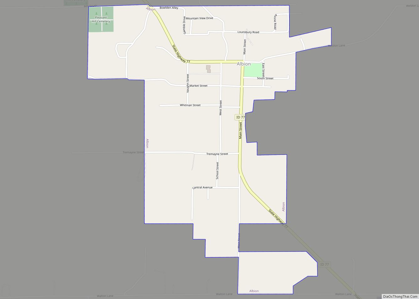
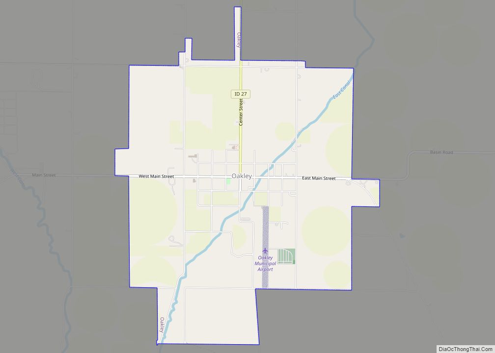
Online Interactive Map
Click on ![]() to view map in "full screen" mode.
to view map in "full screen" mode.
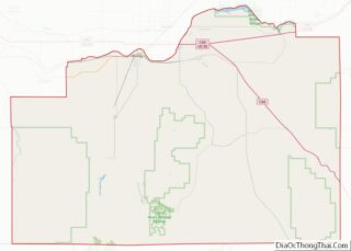
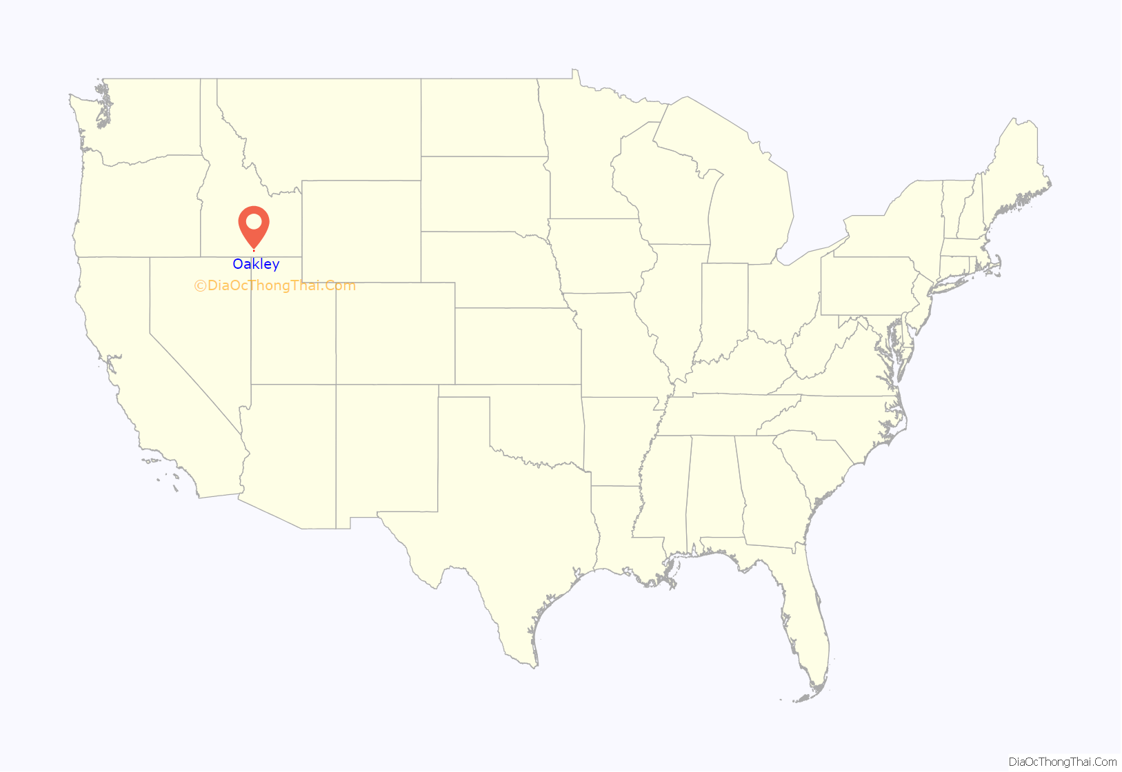
Oakley location map. Where is Oakley city?
History
The city was named for William Oakley, the proprietor of a 19th-century stagecoach station located at a spring currently located about 2 miles west of the present townsite known as Oakley Meadows. David B. Haight, former member of the Quorum of the Twelve Apostles, of the Church of Jesus Christ of Latter-day Saints was born in Oakley. The small hamlet has served as home to a surprising number of famous Americans. The former governors of Utah and Massachusetts can trace their stock to Oakley. Jon Huntsman of Utah is the grandson of David B. Haight, above, and Mitt Romney, of Massachusetts is the son of another famous Oakley-ite, George Romney. Yet another Oakley Romney, Marion G. Romney, was a Counselor in the First Presidency of the Church of Jesus Christ of Latter-day Saints.
The historic Howells Opera House was established in 1907 and still serves and the surrounding areas.
Oakley is also rich in old west lore, such as the tale of Diamondfield Jack, and another story of intrigue, the story of Gobo Fango.
This town of fewer than 800 people has turned out leaders in politics, business, and entertainment. The town is also home to the current Idaho House of Representatives Speaker Scott Bedke.
Oakley has become recognized worldwide for its Middle Mountain quarries of Rocky Mountain quartzite building stone known as Oakley Stone. Quarry operators ship out thousand of tons a month to locations around the globe.
Today Oakley is often visited for its annual Pioneer Days celebrations, as well as its historic Victorian homes.
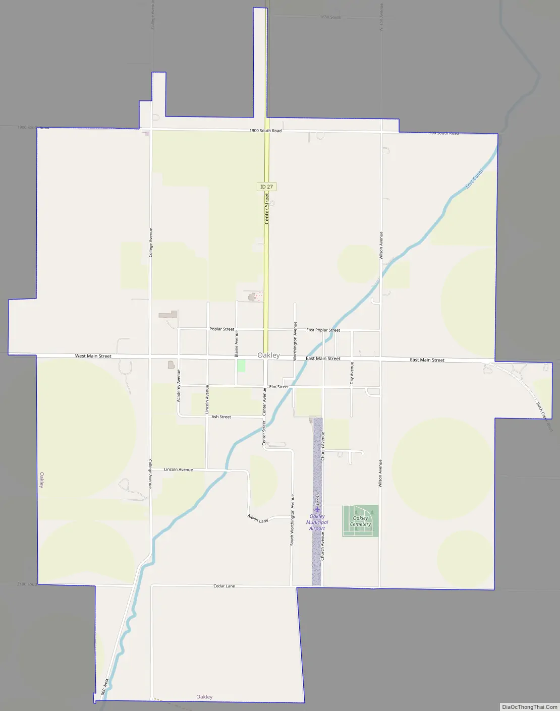
Oakley Road Map
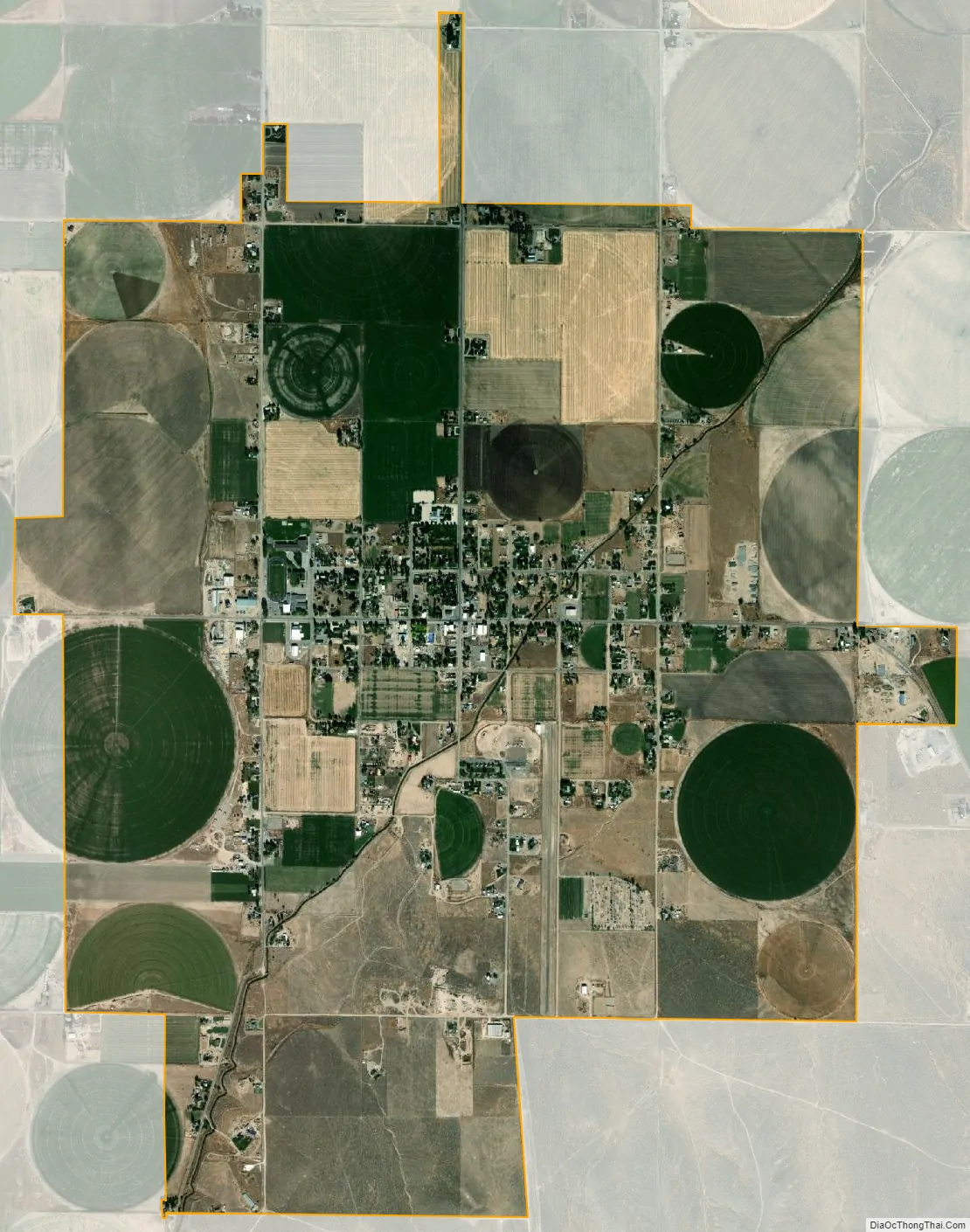
Oakley city Satellite Map
Geography
Oakley is located at 42°14′32″N 113°52′51″W / 42.24222°N 113.88083°W / 42.24222; -113.88083 (42.242360, -113.880904), at an elevation of 4,570 feet (1,393 m) above sea level. It is at the very southern limit of the Snake River Plain, and close to Goose Creek, between the Middle and Albion Mountains.
According to the United States Census Bureau, the city has a total area of 4.59 square miles (11.89 km), all of it land.
Climate
According to the Köppen Climate Classification system, Oakley has a cold semi-arid climate, abbreviated “BSk” on climate maps. The hottest temperature recorded in Oakley was 108 °F (42.2 °C) on July 21–22, 1893, while the coldest temperature recorded was −27 °F (−32.8 °C) on February 9, 1933.
See also
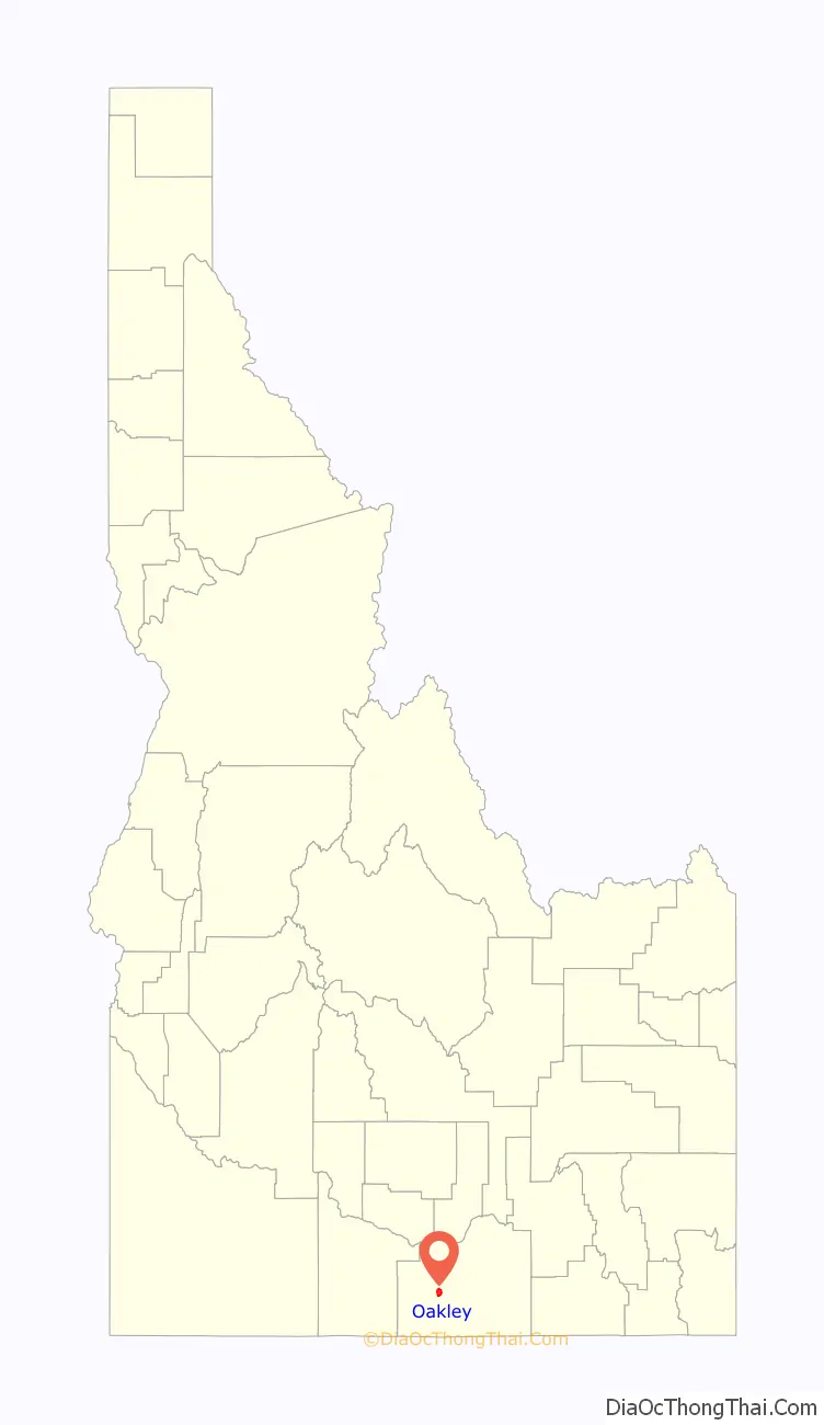
Map of Idaho State and its subdivision:- Ada
- Adams
- Bannock
- Bear Lake
- Benewah
- Bingham
- Blaine
- Boise
- Bonner
- Bonneville
- Boundary
- Butte
- Camas
- Canyon
- Caribou
- Cassia
- Clark
- Clearwater
- Custer
- Elmore
- Franklin
- Fremont
- Gem
- Gooding
- Idaho
- Jefferson
- Jerome
- Kootenai
- Latah
- Lemhi
- Lewis
- Lincoln
- Madison
- Minidoka
- Nez Perce
- Oneida
- Owyhee
- Payette
- Power
- Shoshone
- Teton
- Twin Falls
- Valley
- Washington
- Alabama
- Alaska
- Arizona
- Arkansas
- California
- Colorado
- Connecticut
- Delaware
- District of Columbia
- Florida
- Georgia
- Hawaii
- Idaho
- Illinois
- Indiana
- Iowa
- Kansas
- Kentucky
- Louisiana
- Maine
- Maryland
- Massachusetts
- Michigan
- Minnesota
- Mississippi
- Missouri
- Montana
- Nebraska
- Nevada
- New Hampshire
- New Jersey
- New Mexico
- New York
- North Carolina
- North Dakota
- Ohio
- Oklahoma
- Oregon
- Pennsylvania
- Rhode Island
- South Carolina
- South Dakota
- Tennessee
- Texas
- Utah
- Vermont
- Virginia
- Washington
- West Virginia
- Wisconsin
- Wyoming