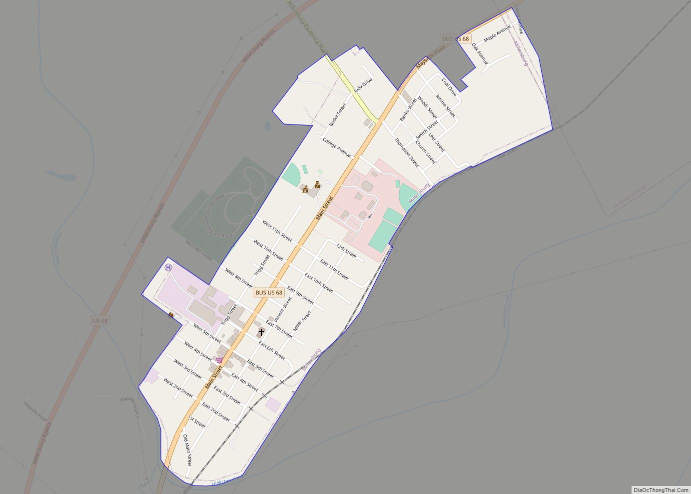
Map of Milton city, Kentucky

Map of Milton city, Kentucky

Milton is a home rule-class city along the south bank of the Ohio River in Trimble County, Kentucky, United States. The population was 597 at the time of the 2020 Census, making it the largest city in Trimble County. The Milton-Madison Bridge connects it to Madison, Indiana, and is the only road link between the … Read more

Map of Monticello city, Kentucky

Map of Monticello city, Kentucky

Monticello is city in Wayne County, Kentucky, in the United States. It is the seat of its county. The population was 6,188 at the time of the 2010 U.S. census. Monticello claims to be “The Houseboat Capital of the World” as there are numerous houseboat manufacturers in the city. The city is located along Lake … Read more

Map of Monterey city, Kentucky

Map of Monterey city, Kentucky

Monterey is a home rule-class city in Owen County, Kentucky, United States. During the 2020 US Census, the population was 112. Monterey city overview: Name: Monterey city LSAD Code: 25 LSAD Description: city (suffix) State: Kentucky County: Owen County Incorporated: 1874 Elevation: 492 ft (150 m) Total Area: 0.26 sq mi (0.67 km²) Land Area: 0.26 sq mi (0.67 km²) Water Area: 0.00 sq mi … Read more

Map of Mockingbird Valley city

Map of Mockingbird Valley city

Mockingbird Valley is a home rule-class city in Jefferson County, Kentucky, United States. Since incorporation, there has been some interest in making it a historic preservation district, largely to prevent unwanted development. The population was 167 at the 2010 census. It has the highest per capita income of any location in Kentucky and the tenth-highest … Read more

Map of Morganfield city

Map of Morganfield city

Morganfield is a home rule-class city in Union County, Kentucky, in the United States. It is the seat of its county. The population was 3,285 as of the year 2010 U.S. census. Morganfield city overview: Name: Morganfield city LSAD Code: 25 LSAD Description: city (suffix) State: Kentucky County: Union County Incorporated: March 16, 1870 Elevation: … Read more

Map of Morehead city

Map of Morehead city

Morehead is a home rule-class city located along US 60 (the historic Midland Trail) and Interstate 64 in Rowan County, Kentucky, in the United States. It is the seat of its county. The population was 7,151 at the time of the 2020 U.S. census. It was the focal point of the Rowan County War and … Read more

Map of Moorland city, Kentucky

Map of Moorland city, Kentucky

Moorland is a home rule-class city in Jefferson County, Kentucky, United States. The population was 431 as of the 2010 census. Moorland city overview: Name: Moorland city LSAD Code: 25 LSAD Description: city (suffix) State: Kentucky County: Jefferson County Incorporated: 1959 Elevation: 627 ft (191 m) Total Area: 0.09 sq mi (0.24 km²) Land Area: 0.09 sq mi (0.24 km²) Water Area: 0.00 sq mi … Read more

Map of Mount Olivet city

Map of Mount Olivet city

Mount Olivet is a home rule-class city in and the county seat of Robertson County, Kentucky, United States, located at the junction of U.S. Route 62 and Kentucky Route 165. The population was 299 at the 2010 United States census. Mount Olivet city overview: Name: Mount Olivet city LSAD Code: 25 LSAD Description: city (suffix) … Read more

Map of Mortons Gap city

Map of Mortons Gap city

Mortons Gap is a home rule-class city in Hopkins County, Kentucky, in the United States. The population was 728 at the 2020 census, down from 863 at the 2010 census. Mortons Gap city overview: Name: Mortons Gap city LSAD Code: 25 LSAD Description: city (suffix) State: Kentucky County: Hopkins County Incorporated: 1888 Elevation: 472 ft (144 m) … Read more

Map of Morgantown city, Kentucky

Map of Morgantown city, Kentucky

Morgantown is a home rule-class city in, and the seat of Butler County, Kentucky, United States. The population was 2,471 at the time of the 2020 Census. Morgantown city overview: Name: Morgantown city LSAD Code: 25 LSAD Description: city (suffix) State: Kentucky County: Butler County Incorporated: 1813; 210 years ago (1813) Elevation: 568 ft (173 m) Total Area: 3.35 sq mi … Read more

Map of Mount Washington city

Map of Mount Washington city

Mount Washington is a home rule-class city in northeast Bullitt County, Kentucky, in the United States. The population was 18,090 at the 2020 census. The city is one of several surrounding Louisville that have experienced a sharp rise in population in the past three decades, becoming a commuter town. Mount Washington city overview: Name: Mount … Read more

Map of Mount Vernon city, Kentucky

Map of Mount Vernon city, Kentucky

Mount Vernon is a home rule-class city and the seat of Rockcastle County in southeastern Kentucky. The intersection of U.S. Routes 25 and 150 is located here. The population was 2,477 at the time of the 2010 U.S. census. Mount Vernon is part of the Richmond-Berea micropolitan area. Mount Vernon city overview: Name: Mount Vernon … Read more