Morgantown is a home rule-class city in, and the seat of Butler County, Kentucky, United States. The population was 2,471 at the time of the 2020 Census.
| Name: | Morgantown city |
|---|---|
| LSAD Code: | 25 |
| LSAD Description: | city (suffix) |
| State: | Kentucky |
| County: | Butler County |
| Incorporated: | 1813; 210 years ago (1813) |
| Elevation: | 568 ft (173 m) |
| Total Area: | 3.35 sq mi (8.69 km²) |
| Land Area: | 3.33 sq mi (8.62 km²) |
| Water Area: | 0.03 sq mi (0.07 km²) |
| Total Population: | 2,505 |
| Population Density: | 752.93/sq mi (290.73/km²) |
| ZIP code: | 42261 |
| Area code: | 270 & 364 |
| FIPS code: | 2153490 |
| GNISfeature ID: | 0498600 |
| Website: | www.morgantown-ky.com |
Online Interactive Map
Click on ![]() to view map in "full screen" mode.
to view map in "full screen" mode.
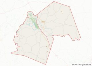
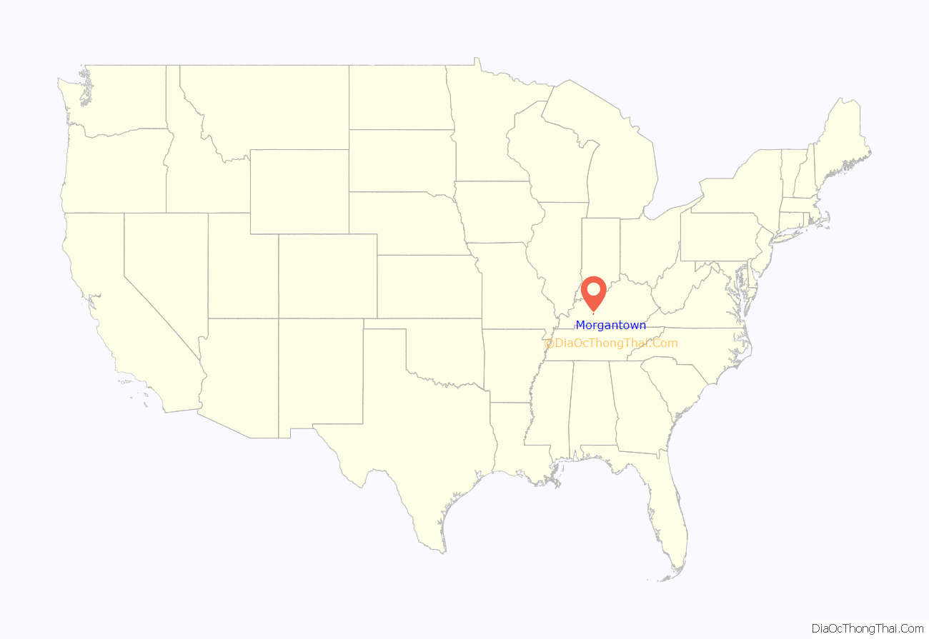
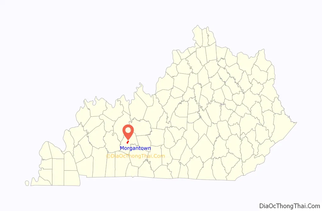
Morgantown location map. Where is Morgantown city?
History
The settlement may have originally been called Funkhouser Hill after Christopher Funkhouser, the local landowner who donated 60 acres (24 ha) of land to establish a seat for the newly formed Butler County in 1811. The etymology of the city’s present name (originally written Morgan Town) is uncertain. It may have been chosen to honor a hunter named Morgan or to honor Daniel Morgan Smith, the first white child born in the town. It was incorporated as Morgantown by the state assembly in 1813, although the post office also went by the name Butler Court House during the 19th century.
Granville Allen, a member of the 17th Kentucky Infantry, was one of the first Union soldiers to die in the Civil War, in a skirmish on October 29, 1861. A monument was erected by the Granville Allen Post #93 GAR. This first skirmish between the North and South took place on the Daniel Boone Johnson property. The Johnson Cemetery is still there and is directly above the monument, which is a limestone marker cut into the side of the old Logansport road.
Morgantown has one of only two monuments in the country dedicated to soldiers of both sides who died in the Civil War. The Confederate-Union Veterans’ Monument in Morgantown is located on the grounds of the county courthouse.
The city formerly had a sister city in Tatsuruhama, Japan, but that city is now part of Nanao.
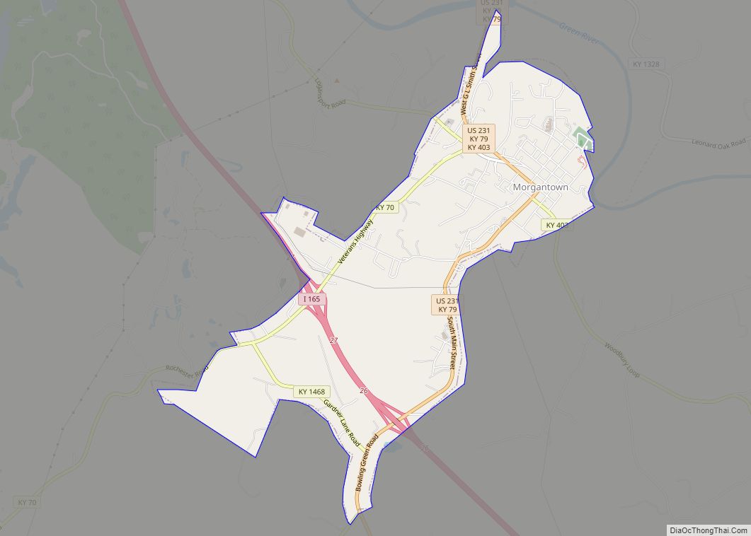
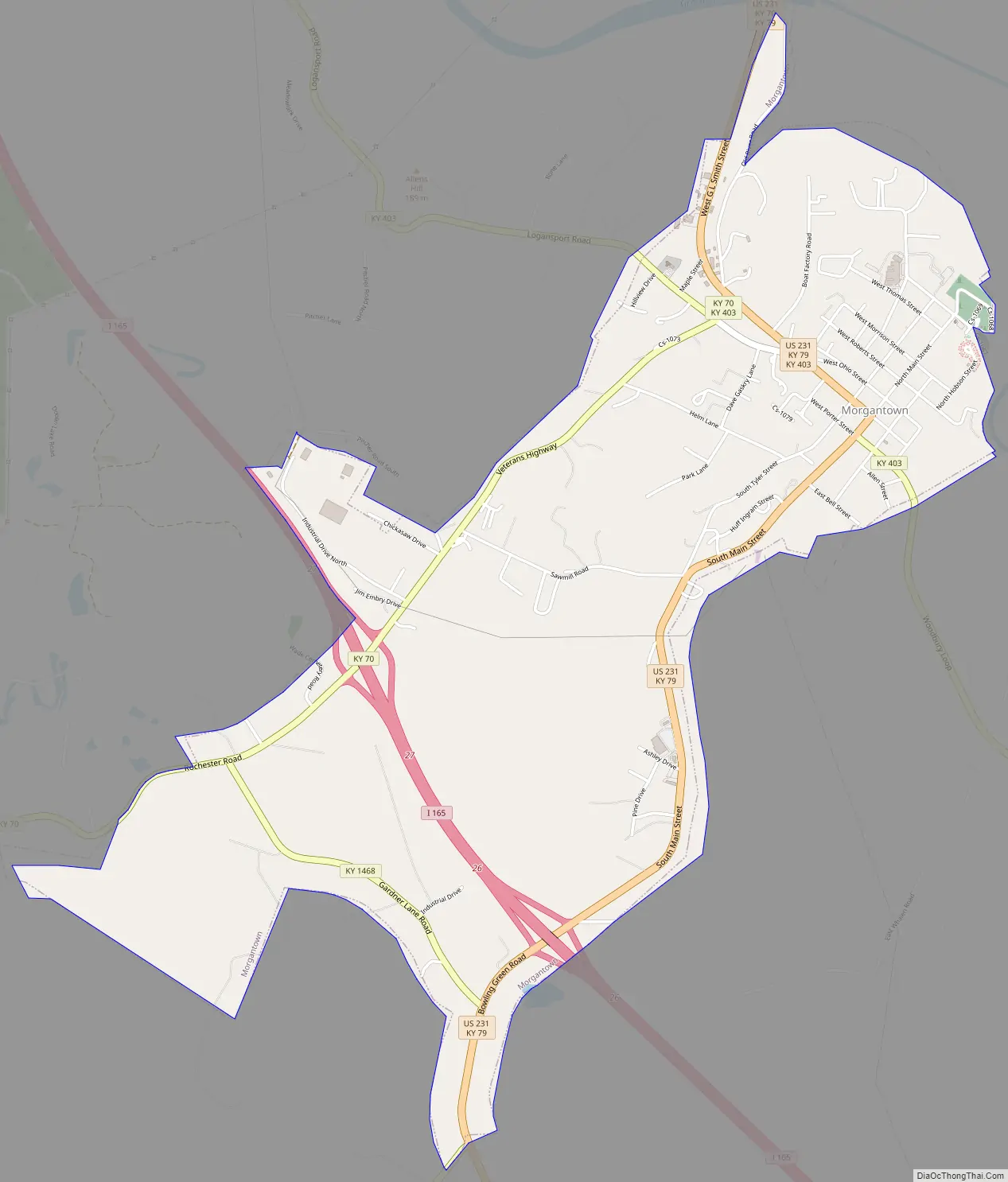
Morgantown Road Map
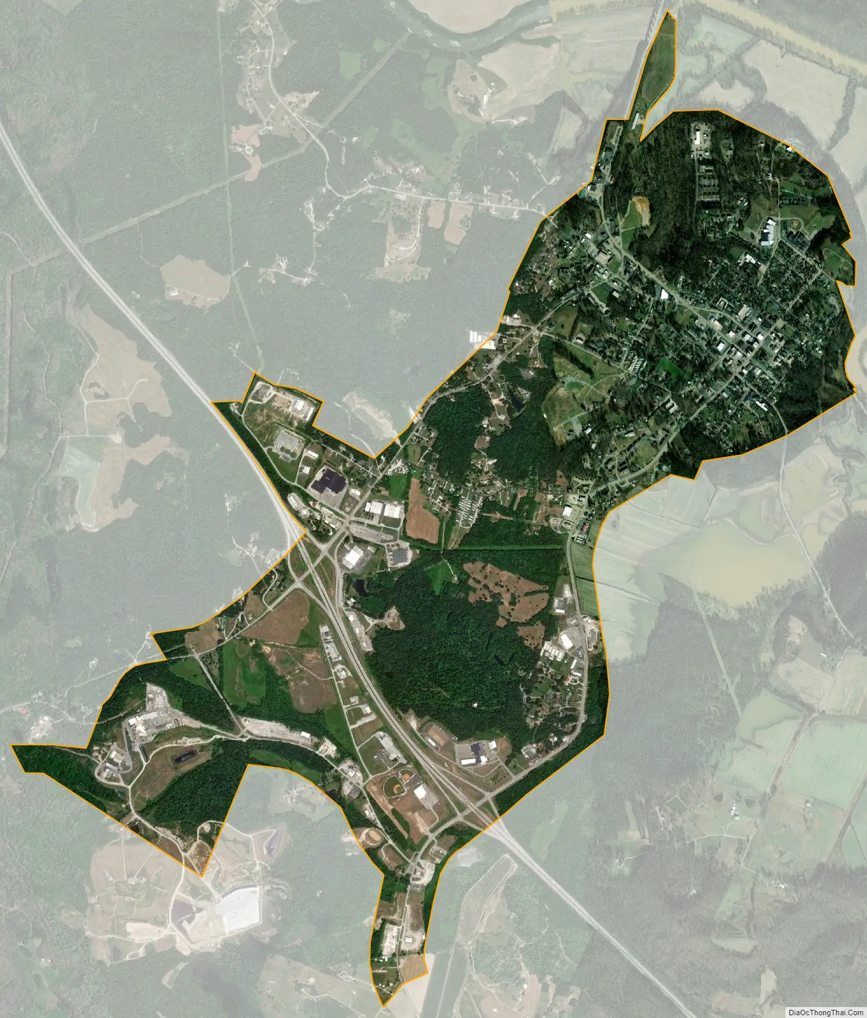
Morgantown city Satellite Map
Geography
Morgantown is located near the center of Butler County at 37°13′10″N 86°41′33″W / 37.21944°N 86.69250°W / 37.21944; -86.69250 (37.219465, -86.692513). It is situated on the top of a bluff on the west side of the Green River.
According to the United States Census Bureau, the city has a total area of 2.4 square miles (6.3 km), of which 0.012 square miles (0.03 km), or 0.49%, is water.
Climate
The climate in this area is characterized by hot, humid summers and generally mild to cool winters. According to the Köppen Climate Classification system, Morgantown has a humid subtropical climate, abbreviated “Cfa” on climate maps.
See also
Map of Kentucky State and its subdivision:- Adair
- Allen
- Anderson
- Ballard
- Barren
- Bath
- Bell
- Boone
- Bourbon
- Boyd
- Boyle
- Bracken
- Breathitt
- Breckinridge
- Bullitt
- Butler
- Caldwell
- Calloway
- Campbell
- Carlisle
- Carroll
- Carter
- Casey
- Christian
- Clark
- Clay
- Clinton
- Crittenden
- Cumberland
- Daviess
- Edmonson
- Elliott
- Estill
- Fayette
- Fleming
- Floyd
- Franklin
- Fulton
- Gallatin
- Garrard
- Grant
- Graves
- Grayson
- Green
- Greenup
- Hancock
- Hardin
- Harlan
- Harrison
- Hart
- Henderson
- Henry
- Hickman
- Hopkins
- Jackson
- Jefferson
- Jessamine
- Johnson
- Kenton
- Knott
- Knox
- Larue
- Laurel
- Lawrence
- Lee
- Leslie
- Letcher
- Lewis
- Lincoln
- Livingston
- Logan
- Lyon
- Madison
- Magoffin
- Marion
- Marshall
- Martin
- Mason
- McCracken
- McCreary
- McLean
- Meade
- Menifee
- Mercer
- Metcalfe
- Monroe
- Montgomery
- Morgan
- Muhlenberg
- Nelson
- Nicholas
- Ohio
- Oldham
- Owen
- Owsley
- Pendleton
- Perry
- Pike
- Powell
- Pulaski
- Robertson
- Rockcastle
- Rowan
- Russell
- Scott
- Shelby
- Simpson
- Spencer
- Taylor
- Todd
- Trigg
- Trimble
- Union
- Warren
- Washington
- Wayne
- Webster
- Whitley
- Wolfe
- Woodford
- Alabama
- Alaska
- Arizona
- Arkansas
- California
- Colorado
- Connecticut
- Delaware
- District of Columbia
- Florida
- Georgia
- Hawaii
- Idaho
- Illinois
- Indiana
- Iowa
- Kansas
- Kentucky
- Louisiana
- Maine
- Maryland
- Massachusetts
- Michigan
- Minnesota
- Mississippi
- Missouri
- Montana
- Nebraska
- Nevada
- New Hampshire
- New Jersey
- New Mexico
- New York
- North Carolina
- North Dakota
- Ohio
- Oklahoma
- Oregon
- Pennsylvania
- Rhode Island
- South Carolina
- South Dakota
- Tennessee
- Texas
- Utah
- Vermont
- Virginia
- Washington
- West Virginia
- Wisconsin
- Wyoming