Map of Warsaw city, Kentucky

Map of Warsaw city, Kentucky

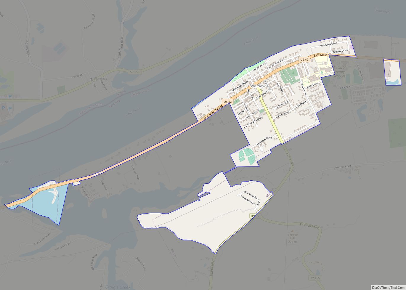
Warsaw is a home rule-class city in and the county seat of Gallatin County, Kentucky, United States, located along the Ohio River. The name was suggested by a riverboat captain, who was reading Thaddeus of Warsaw, by Jane Porter, when the city was being founded. The city had a population of 1,615 at the 2010 … Read more

Map of Wellington city, Kentucky

Map of Wellington city, Kentucky

Wellington is a home rule-class city in metro Louisville, Jefferson County, Kentucky, United States. It is considered to be part of the Upper Highlands section of Louisville. It was incorporated in 1946. The population was 565 at the 2010 census. Wellington city overview: Name: Wellington city LSAD Code: 25 LSAD Description: city (suffix) State: Kentucky … Read more

Map of Wayland city, Kentucky

Map of Wayland city, Kentucky

Wayland is a home rule-class city in Floyd County, Kentucky, United States. The population was 426 at the 2010 census, up from 298 at the 2000 census. Wayland city overview: Name: Wayland city LSAD Code: 25 LSAD Description: city (suffix) State: Kentucky County: Floyd County Incorporated: 1923 Elevation: 722 ft (220 m) Total Area: 2.71 sq mi (7.02 km²) Land … Read more

Map of Waverly city, Kentucky

Map of Waverly city, Kentucky

Waverly is a home rule-class city in Union County, Kentucky, United States. The population was 297 at the 2000 census. Founded in 1870, the city was named for founder Hugh McElroy’s nephew. Waverly city overview: Name: Waverly city LSAD Code: 25 LSAD Description: city (suffix) State: Kentucky County: Union County Elevation: 413 ft (126 m) Total Area: … Read more

Map of West Point city, Kentucky

Map of West Point city, Kentucky

West Point is a home rule-class city in Hardin County, Kentucky, United States, near the edge of Fort Knox military reservation on Dixie Highway. It is located in a former meander bend of the Ohio River. The population was 797 at the 2010 census, down from 1,100 at the 2000 census. West Point is part … Read more

Map of West Liberty city, Kentucky

Map of West Liberty city, Kentucky

West Liberty is a home rule-class city in Morgan County, Kentucky, United States. It is the county seat of Morgan County. As of the 2010 census, the city population was 3,435. It is located on the banks of the Licking River at the junction of Kentucky Route 7 and U.S. Route 460. West Liberty city … Read more

Map of West Buechel city

Map of West Buechel city

West Buechel is a home rule-class city in Jefferson County, Kentucky, United States. The population was 1,230 at the 2010 census, down from 1,301 at the 2000 census. West Buechel city overview: Name: West Buechel city LSAD Code: 25 LSAD Description: city (suffix) State: Kentucky County: Jefferson County Elevation: 479 ft (146 m) Total Area: 0.65 sq mi (1.68 km²) … Read more

Map of Wheatcroft city

Map of Wheatcroft city

Wheatcroft is a home rule-class city in Webster County, Kentucky, United States. The population was 173 at the 2000 census. Wheatcroft city overview: Name: Wheatcroft city LSAD Code: 25 LSAD Description: city (suffix) State: Kentucky County: Webster County Elevation: 377 ft (115 m) Total Area: 0.25 sq mi (0.64 km²) Land Area: 0.25 sq mi (0.64 km²) Water Area: 0.00 sq mi (0.00 km²) Total Population: … Read more

Map of Westwood CDP, Kentucky

Map of Westwood CDP, Kentucky

Westwood is a census-designated place in Boyd County, Kentucky, United States. The population was 4,387at the 2020 census. A suburb of Ashland, the two cities are closely affiliated, sharing a ZIP code and bus system. Westwood is located on a flat to hilly elevation just west of the Ohio River. The flat hilltop is unusual … Read more

Map of Westport CDP, Kentucky

Map of Westport CDP, Kentucky

Westport is an unincorporated community and census-designated place in Oldham County, Kentucky, United States. Its population was 268 as of the 2010 census. Westport has a post office with ZIP code 40077, which opened on November 29, 1815. The community is located along the Ohio River. Westport CDP overview: Name: Westport CDP LSAD Code: 57 … Read more

Map of Wheelwright city

Map of Wheelwright city

Wheelwright is a home rule-class city in Floyd County, Kentucky, United States. The population was 780 at the 2010 census, down from 1,042 in 2000. Wheelwright city overview: Name: Wheelwright city LSAD Code: 25 LSAD Description: city (suffix) State: Kentucky County: Floyd County Incorporated: February 6, 1917 Elevation: 1,138 ft (347 m) Total Area: 1.76 sq mi (4.57 km²) Land … Read more

Map of Whitesburg city, Kentucky

Map of Whitesburg city, Kentucky

Whitesburg is a home rule-class city in and the county seat of Letcher County, Kentucky, United States. The population was 2,139 at the 2010 census and an estimated 1,875 in 2018. It was named for John D. White, a state politician. Whitesburg city overview: Name: Whitesburg city LSAD Code: 25 LSAD Description: city (suffix) State: … Read more