West Point is a home rule-class city in Hardin County, Kentucky, United States, near the edge of Fort Knox military reservation on Dixie Highway. It is located in a former meander bend of the Ohio River. The population was 797 at the 2010 census, down from 1,100 at the 2000 census.
West Point is part of the Elizabethtown–Fort Knox Metropolitan Statistical Area.
| Name: | West Point city |
|---|---|
| LSAD Code: | 25 |
| LSAD Description: | city (suffix) |
| State: | Kentucky |
| County: | Hardin County |
| Elevation: | 436 ft (133 m) |
| Total Area: | 2.69 sq mi (6.97 km²) |
| Land Area: | 2.67 sq mi (6.90 km²) |
| Water Area: | 0.03 sq mi (0.06 km²) |
| Total Population: | 952 |
| Population Density: | 357.22/sq mi (137.93/km²) |
| ZIP code: | 40177 |
| Area code: | 502 |
| FIPS code: | 2181930 |
| GNISfeature ID: | 0506467 |
| Website: | westpoint.ky.gov |
Online Interactive Map
Click on ![]() to view map in "full screen" mode.
to view map in "full screen" mode.
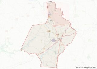
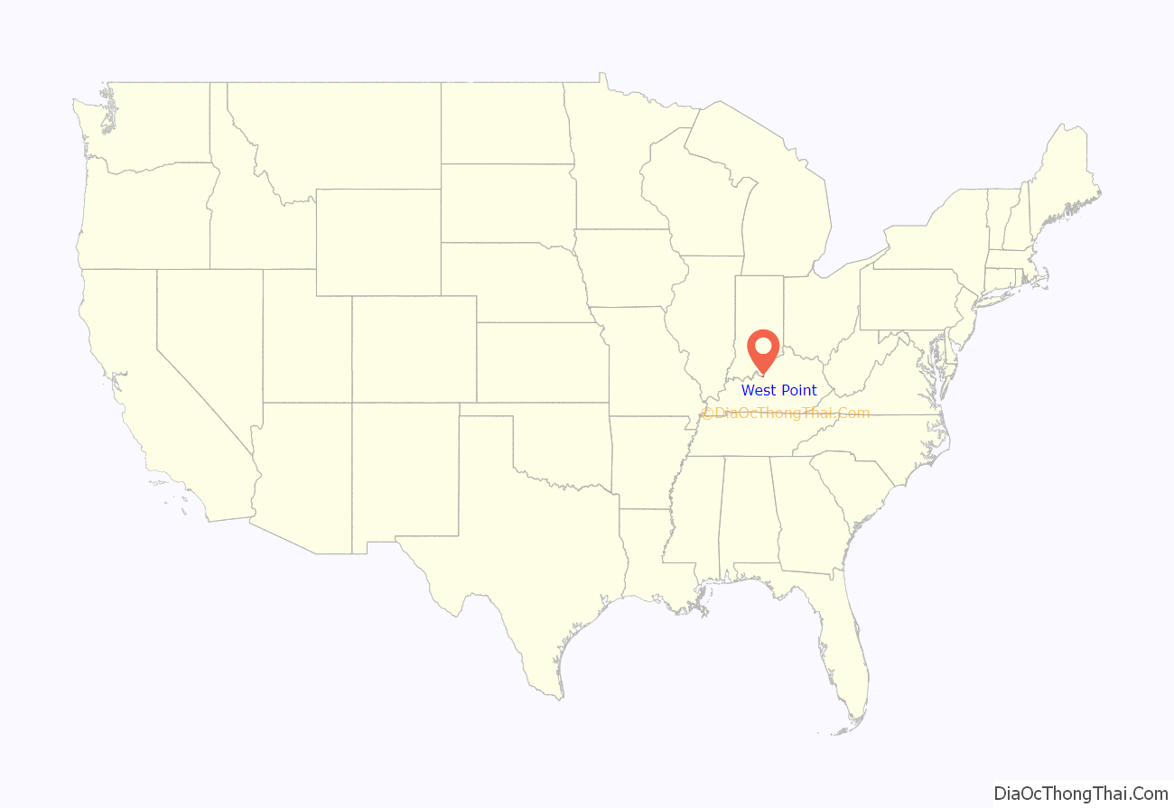
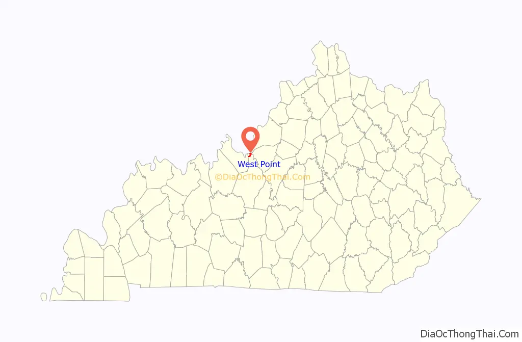
West Point location map. Where is West Point city?
History
West Point was founded by pioneer James Young, who built a cabin at the site in 1789 and, in 1797, built a brick house and inn that is still standing today. In 1803, Lewis and Clark passed nearby and recruited West Point citizen John Shields to join their Corps of Discovery.
West Point sits at the confluence of the Ohio and Salt rivers, a strategic position that led Union forces to construct a fort here during the Civil War to protect their supply routes. Fort Duffield is the state’s largest and best-preserved earthen fortification from the period.
West Point also retains many of its other historic resources, and a large portion of the community is listed in the National Register of Historic Places as a historic district.
One of the newest preservation projects in West Point is the rehabilitation of the West Point Independent Colored School (1926), one of the “Rosenwald Schools” built by philanthropist Julius Rosenwald to educate African-Americans in rural areas. Plans call for using the one-room school as a visitor, educational, and research facility.
West Point commemorated the bicentennial of Lewis and Clark’s visit with a heritage festival that celebrated local history and drew heritage tourists. Year-round, Fort Duffield is an important tourist destination, and the city recently secured a grant to fund walking trails at the site.
West Point was a childhood residence of the late Louisiana Governor James A. Noe, Sr., a wealthy oilman and landowner.
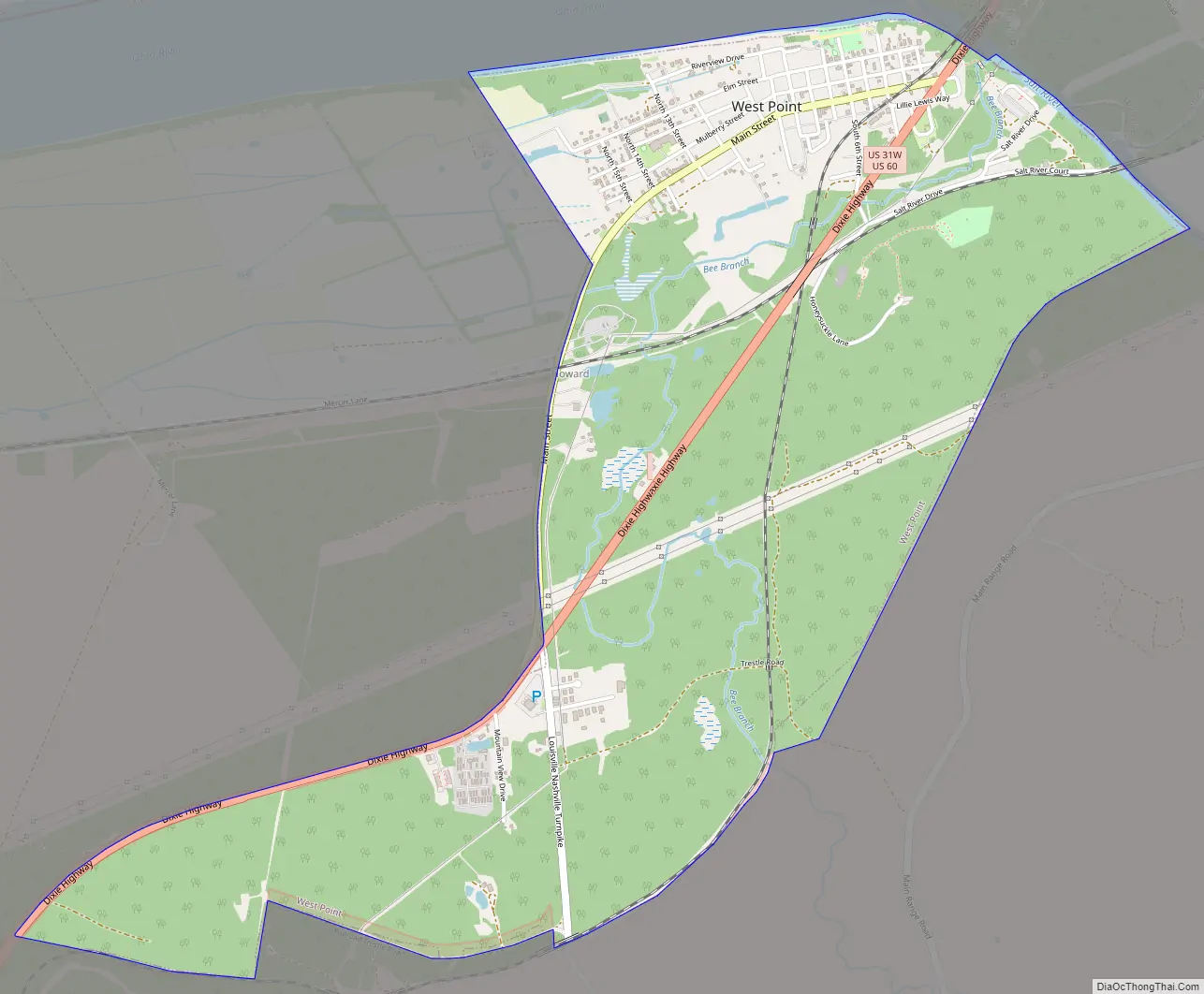
West Point Road Map
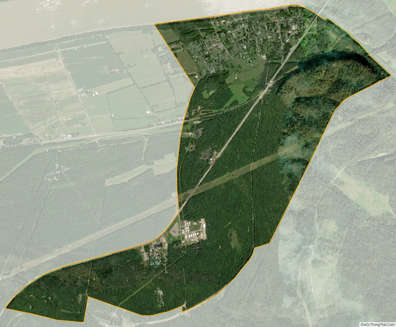
West Point city Satellite Map
Geography
West Point is located at the northern end of Hardin County at 37°59′30″N 85°57′16″W / 37.99167°N 85.95444°W / 37.99167; -85.95444 (37.991543, -85.954540), at the confluence of the Ohio and Salt rivers. The Dixie Highway (U.S. Routes 31W and 60) passes through the city just east of the downtown, leading northeast 21 miles (34 km) to Louisville and south 23 miles (37 km) to Elizabethtown, the Hardin County seat. Fort Duffield Park is located in the southern part of the city, with the remains of the fort sitting on top of a hill that rises 300 feet (91 m) above the downtown. The city is bordered to the south by the northern end of Fort Knox.
According to the United States Census Bureau, the city of West Point has a total area of 0.54 square miles (1.4 km), all land.
See also
Map of Kentucky State and its subdivision:- Adair
- Allen
- Anderson
- Ballard
- Barren
- Bath
- Bell
- Boone
- Bourbon
- Boyd
- Boyle
- Bracken
- Breathitt
- Breckinridge
- Bullitt
- Butler
- Caldwell
- Calloway
- Campbell
- Carlisle
- Carroll
- Carter
- Casey
- Christian
- Clark
- Clay
- Clinton
- Crittenden
- Cumberland
- Daviess
- Edmonson
- Elliott
- Estill
- Fayette
- Fleming
- Floyd
- Franklin
- Fulton
- Gallatin
- Garrard
- Grant
- Graves
- Grayson
- Green
- Greenup
- Hancock
- Hardin
- Harlan
- Harrison
- Hart
- Henderson
- Henry
- Hickman
- Hopkins
- Jackson
- Jefferson
- Jessamine
- Johnson
- Kenton
- Knott
- Knox
- Larue
- Laurel
- Lawrence
- Lee
- Leslie
- Letcher
- Lewis
- Lincoln
- Livingston
- Logan
- Lyon
- Madison
- Magoffin
- Marion
- Marshall
- Martin
- Mason
- McCracken
- McCreary
- McLean
- Meade
- Menifee
- Mercer
- Metcalfe
- Monroe
- Montgomery
- Morgan
- Muhlenberg
- Nelson
- Nicholas
- Ohio
- Oldham
- Owen
- Owsley
- Pendleton
- Perry
- Pike
- Powell
- Pulaski
- Robertson
- Rockcastle
- Rowan
- Russell
- Scott
- Shelby
- Simpson
- Spencer
- Taylor
- Todd
- Trigg
- Trimble
- Union
- Warren
- Washington
- Wayne
- Webster
- Whitley
- Wolfe
- Woodford
- Alabama
- Alaska
- Arizona
- Arkansas
- California
- Colorado
- Connecticut
- Delaware
- District of Columbia
- Florida
- Georgia
- Hawaii
- Idaho
- Illinois
- Indiana
- Iowa
- Kansas
- Kentucky
- Louisiana
- Maine
- Maryland
- Massachusetts
- Michigan
- Minnesota
- Mississippi
- Missouri
- Montana
- Nebraska
- Nevada
- New Hampshire
- New Jersey
- New Mexico
- New York
- North Carolina
- North Dakota
- Ohio
- Oklahoma
- Oregon
- Pennsylvania
- Rhode Island
- South Carolina
- South Dakota
- Tennessee
- Texas
- Utah
- Vermont
- Virginia
- Washington
- West Virginia
- Wisconsin
- Wyoming