Germantown is an urbanized census-designated place in Montgomery County, Maryland, United States. With a population of 91,249 as of the 2020 census, it is the third most populous place in Maryland, after Baltimore and Columbia. Germantown is located approximately 28 miles (45 km) outside the U.S. capital of Washington, D.C., and is an important part of the Washington metropolitan area.
Germantown was founded in the early 19th century by European immigrants, though much of the area’s development did not take place until the mid-20th century. The original plan for Germantown divided the area into a downtown and six town villages: Gunners Lake Village, Kingsview Village, Churchill Village, Middlebrook Village, Clopper’s Mill Village, and Neelsville Village. The Churchill Town Sector at the corner of Maryland Route 118 and Middlebrook Road most closely resembles the center of Germantown because of the location of the Upcounty Regional Services Center, the Germantown Public Library, the Black Rock Arts Center, the Regal Germantown Stadium 14, and pedestrian shopping that features an array of restaurants. Three exits to Interstate 270 are less than one mile away, the Maryland Area Regional Commuter train is within walking distance, and the Germantown Transit Center that provides Ride On shuttle service to the Shady Grove station of the Washington Metro’s Red Line.
Germantown has the assigned ZIP codes of 20874 and 20876 for delivery and 20875 for post office boxes. It is the only “Germantown, Maryland” recognized by the United States Postal Service, though three other Maryland counties have unincorporated communities with the same name.
| Name: | Germantown CDP |
|---|---|
| LSAD Code: | 57 |
| LSAD Description: | CDP (suffix) |
| State: | Maryland |
| County: | Montgomery County |
| Elevation: | 428 ft (130 m) |
| Total Area: | 17.12 sq mi (44.35 km²) |
| Land Area: | 17.03 sq mi (44.12 km²) |
| Water Area: | 0.09 sq mi (0.23 km²) |
| Total Population: | 91,249 |
| Population Density: | 5,357.19/sq mi (2,068.40/km²) |
| ZIP code: | 20874, 20875 (PO box only), 20876 |
| Area code: | 301, 240 |
| FIPS code: | 2432025 |
Online Interactive Map
Click on ![]() to view map in "full screen" mode.
to view map in "full screen" mode.
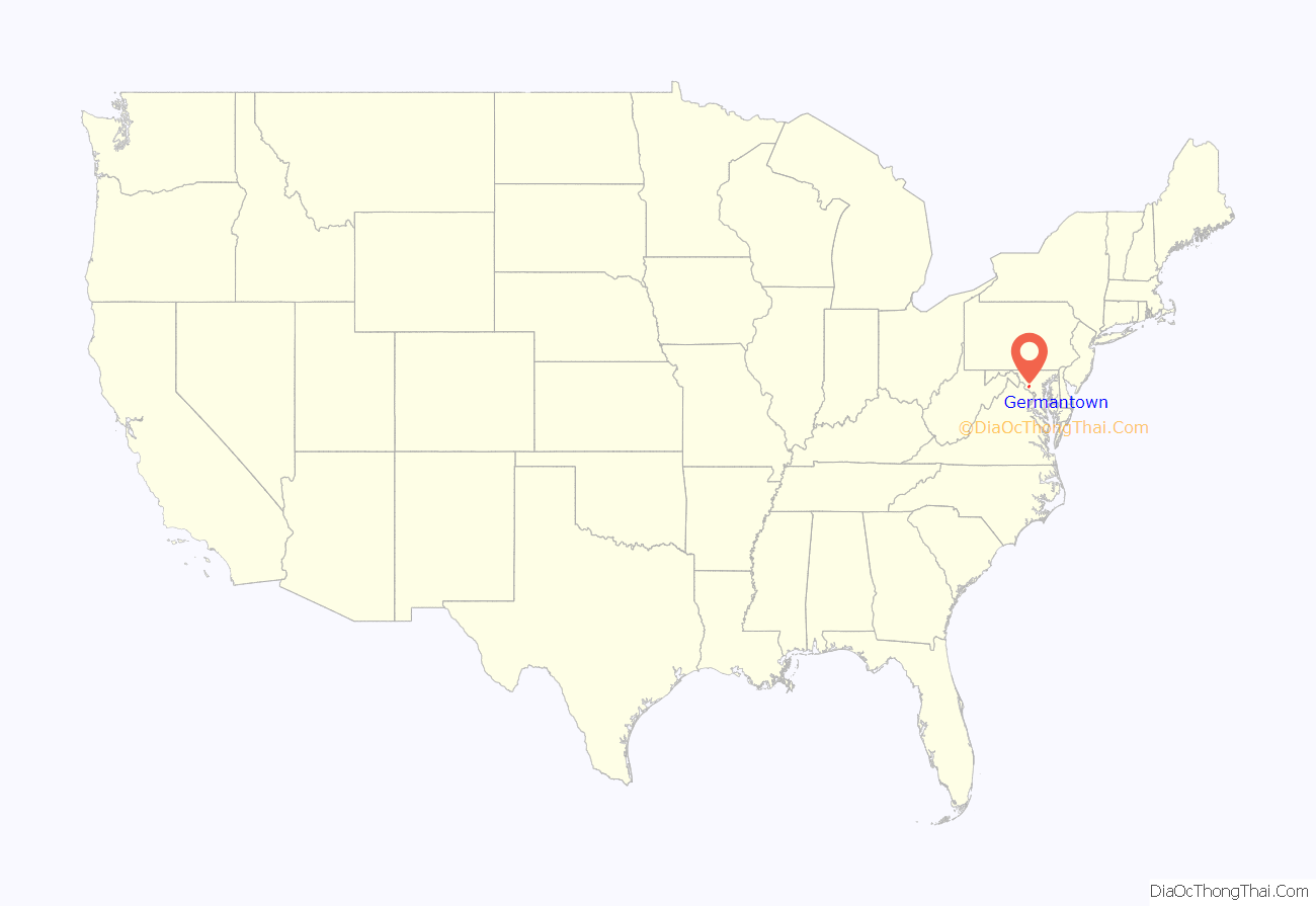
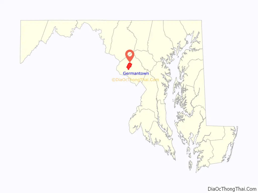
Germantown location map. Where is Germantown CDP?
History
Early history (1830–1865)
In the 1830s and 1840s, the central business area was focused around the intersection of Liberty Mill Road and Clopper Road. Several German immigrants set up shop at the intersection and the town became known as “German Town”, even though most residents of the town were of English or Scottish descent.
Although it avoided much of the physical destruction that ravaged other cities in the region, the Civil War was still a cause of resentment and division among residents of Germantown. Many Germantown residents were against slavery and had sons fighting for the Union Army. In contrast, other residents of Germantown owned slaves, and even those who were not slave-owners had sons fighting for the Confederate Army. As a result, many people in Germantown, who had been on friendly terms with each other, made an effort not to interact with each other, such as switching churches, or frequenting a store or mill miles away from the ones they would normally do business with.
Late in the summer and fall of 1861, there were more than twenty thousand Union soldiers camped to the west of Germantown, in neighboring Darnestown and Poolesville. Occasionally, these soldiers would come to Germantown and frequent the stores there. In September 1862 and in June 1863, several regiments of Union Army soldiers marched north on Maryland Route 355, on their way to the battles of Antietam and Gettysburg, respectively. In July 1864, General Jubal Early led his army of Confederate soldiers down Maryland Route 355 to attack the Union capital of Washington, D.C. Throughout the course of the war, Confederate raiders would often pass through the Germantown area. Local farmers in the Germantown area lost horses and other livestock to both Union and Confederate armies.
In 1865, George Atzerodt, a co-conspirator in the assassination of U.S. President Abraham Lincoln, was captured in Germantown. Atzerodt had come to the town with his family from Prussia when he was about nine years old. About five years later, his father moved the family to Virginia, but Atzerodt still had many friends and relatives in Germantown. He was living in Port Tobacco during the Civil War, and supplementing his meager income as a carriage painter by smuggling people across the Potomac River in a rowboat. This clandestine occupation brought him into contact with John Surratt and John Wilkes Booth and he was drawn into a plot to kidnap President Lincoln. On April 14, 1865, Booth gave Atzerodt a gun and told him that he was to kill U.S. Vice President Andrew Johnson, which he refused to do. When he found out that Booth had shot Lincoln, Atzerodt panicked and fled to the Germantown farm of his cousin Hartman Richter, on Schaeffer Road near Clopper Road. He was discovered there by soldiers on April 20, six days after the assassination. Atzerodt was tried, convicted and hanged on July 7, 1865, along with co-conspirators Mary Surratt, Lewis Powell, and David Herold at Washington, D.C.‘s Fort McNair.
Expansion (1865–1950)
Germantown did not have a public school until after the end of the American Civil War. During that time, education was handled at home. In 1868, a one-room schoolhouse was built on Maryland Route 118, near Black Rock Road, which hosted children from both Germantown and neighboring Darnestown. In 1883, a larger one-room schoolhouse was built closer to Clopper Road. Another, newer school was constructed in 1910, on what is now the site of Germantown Elementary School. This school had four rooms, with two downstairs and two upstairs, with each room housing two grade levels. After the eighth grade, the students would head via train to nearby Rockville, for further education.
The wooden structure of the Bowman Brothers Mill fell victim to a fire in 1914. Four years later, the owners were back in business again, selling the mill to the Liberty Milling Company, a brand new corporation. Augustus Selby was the first owner and manager of the new Liberty Mill, which opened in 1918. Electricity was brought into Liberty Mill and also served the homes and businesses nearby, making Germantown the first area in the northern portion of Montgomery County to receive electricity.
In 1935, professional baseball player Walter Perry Johnson, who played as a pitcher for the Washington Senators (now the Minnesota Twins), purchased a farm on what is now the site of Seneca Valley High School. Used as a dairy farm, Johnson lived there with his five children and his mother (his wife had died), until his death in 1946. A road near the school was named after him.
“Feed the Liberty Way” was used as a slogan for Liberty Mill which, with eight silos, became the second largest mill in all of Maryland, supplying flour to the United States Army during World War II. Cornmeal and animal feed were also manufactured at Liberty Mill, and a store at the mill sold specialty mixes, such as pancake and muffin mix. Following the end of World War II, the Liberty Mill went into disrepair. For over 25 years, the mill continued to deteriorate until it was destroyed by an arsonist on May 30, 1972. The cement silos were removed by the county in 1986 to make way for the MARC Germantown train station commuter parking lot.
Development and master plan (1950–1980)
In January 1958, the U.S. Atomic Energy Commission was relocated from its location in downtown Washington, D.C. to Germantown, which was considered far enough from the city to withstand a Soviet nuclear attack. The facility now operates as an administration complex for the U.S. Department of Energy and headquarters for its Office of Biological and Environmental Research.
Marshall Davis owned a farm located where Interstate 270 and Germantown Road intersect today. After Interstate 270 divided his farm in two, Davis decided to sell the last of his land to the International Development Corporation for about $1,300 per acre in 1955. Fairchild-Hiller Corporation bought the land for about $4,000 per acre in 1964, and it built an industrial park on the land four years later. Harry Unglesee and his family sold their farm near Hoyles Mill Road for less than $1,000 per acre in 1959. Other farmers soon sold their land to developers and speculators as well.
The Germantown Master Plan was adopted in 1967. The plan for the 17-square-mile (44 km) area included a dense central downtown area and less dense development surrounding it. In 1974, the Montgomery County Council approved an amended plan written by the Montgomery County Planning Board. The amended plan included a downtown area and six separate villages, each comprising smaller neighborhoods with schools, shopping areas, and public facilities. The amended plan also included the construction of a third campus for Montgomery College near the downtown area. The same year, the completion of a sewer line helped the development and growth of Germantown.
During the 1970s, Wernher von Braun, a German rocket scientist during World War II, worked for the aerospace company Fairchild Industries, which had offices in Germantown, as its vice president for Engineering and Development. Von Braun worked at Fairchild Industries from July 1, 1972, until his death on June 16, 1977.
The Germantown Campus of Montgomery College opened on October 21, 1978. At the time, it consisted of two buildings, 24 employees, and 1,200 students. Enrollment had increased to five thousand students by 2003, with eighty employees across four buildings. A steel water tower modeled after the Earth can be seen from orbiting satellites in outer space. As of 2008, a forty-acre bio-technology laboratory was nearing completion.
Economic growth and modern development (1980–present)
Since the early 1980s, Germantown has experienced rapid economic and population growth, both in the form of townhouses and single-family dwellings, and an urbanized “town center” has been built. Germantown was the fastest growing zip code in the Washington, D.C. metropolitan area and Maryland in 1986, and the 1980s saw a population growth of 323.3% for Germantown.
In 2000, the Upcounty Regional Services Center (now the Sidney Kramer Upcounty Regional Services Center) opened in Germantown, and a 16,000 square feet section of the first floor was home to the Germantown Public Library for several years until it moved to a new, 19 million dollar complex in 2007. On September 29, 2013, the Upcounty Regional Services Center in Germantown was renamed as the Sidney Kramer Upcounty Regional Services Center, after Sidney Kramer, the Montgomery County executive from 1986 to 1990.
In October 2000, the Maryland SoccerPlex opened in Germantown. The sports complex includes nineteen natural grass fields, three artificial fields, a 5,200 seat soccer stadium with lighting and press box, eight indoor convertible basketball/volleyball courts. Two miniature golf courses, a splash park, a driving range, an archery course, community garden, model boat pond, two BMX courses, tennis center, and a swim center are also located within the confines of the complex. The soccerplex was the home of the Washington Spirit of the National Women’s Soccer League from 2013 to 2019.
In March 2001, Germantown’s only movie theater, the Sony 6, opened in the 1980s, located at the Germantown Commons Shopping Center, closed down as part of a closure of 112 movie theaters across the United States by Loews Cineplex, leaving Germantown without a movie theater of its own. As a result, local residents frequented a movie theater in Kentlands or one at The Rio in Gaithersburg. Over a year later, on May 3, 2002, the Hoyts Cinema 14, now the Regal Germantown Stadium 14, opened, and Germantown now had its own movie theater once again. A Gold’s Gym now sits on the site of the former Sony 6 theater. A month later, it was announced that a Staples and Best Buy store would open at Germantown’s Milestone Shopping Center later that fall. Opening later that year, the Best Buy store replaced a Homeplace store that had closed down in 2001 following that company’s disbandment.
In 2003, one of Germantown’s trailer parks, the Cider Barrel Mobile Home Park, located at the intersection of Germantown Road and Frederick Road, closed after decades of operation, having been in business since at least the 1970s. Despite this closure, the Barrel building itself was preserved, with a cluster of garden apartments erected near it.
On August 14, 2011, a 7-Eleven convenience store in downtown Germantown fell victim to a flash mob robbery, in which nearly forty people walked into the store, grabbed merchandise, and subsequently fled with the stolen goods, all without paying. The incident garnered widespread attention in the United States and internationally.
Holy Cross Health opened a 237,000-square-foot (22,000 m) hospital on the campus of Montgomery College in October 2014, becoming the first hospital in the U.S. to be built on a community college campus. The opening of the new 93-bed hospital strengthens the college’s medical program by giving students the opportunity for hands-on work and access to more advanced medical technology. The hospital is projected to eventually bring 5,000 new jobs to the area.
In August 2017, Brandi Edinger initiated efforts to crowdfund the repurposing of the historic Cider Barrel as a bakery via Kickstarter, but failed to meet the $80,000 goal set by October. On January 1, 2020, it was reported that plans are underway to reopen the Barrel in the spring of that year after it was closed for nearly two decades. However, due to the COVID-19 pandemic occurring in the months leading up to its planned reopening, it has been delayed indefinitely to a time when the pandemic poses less of a safety risk. In the spring of 2022, after no further updates on its opening plans, it was reported that Laura Richman, the woman spearheading the effort to reopen the barrel, was unable to complete the work needed to reopen the barrel due to her current job and pursuit of an MBA in Boston, even with the pandemic subsiding, and is seeking a new operations manager in her place.
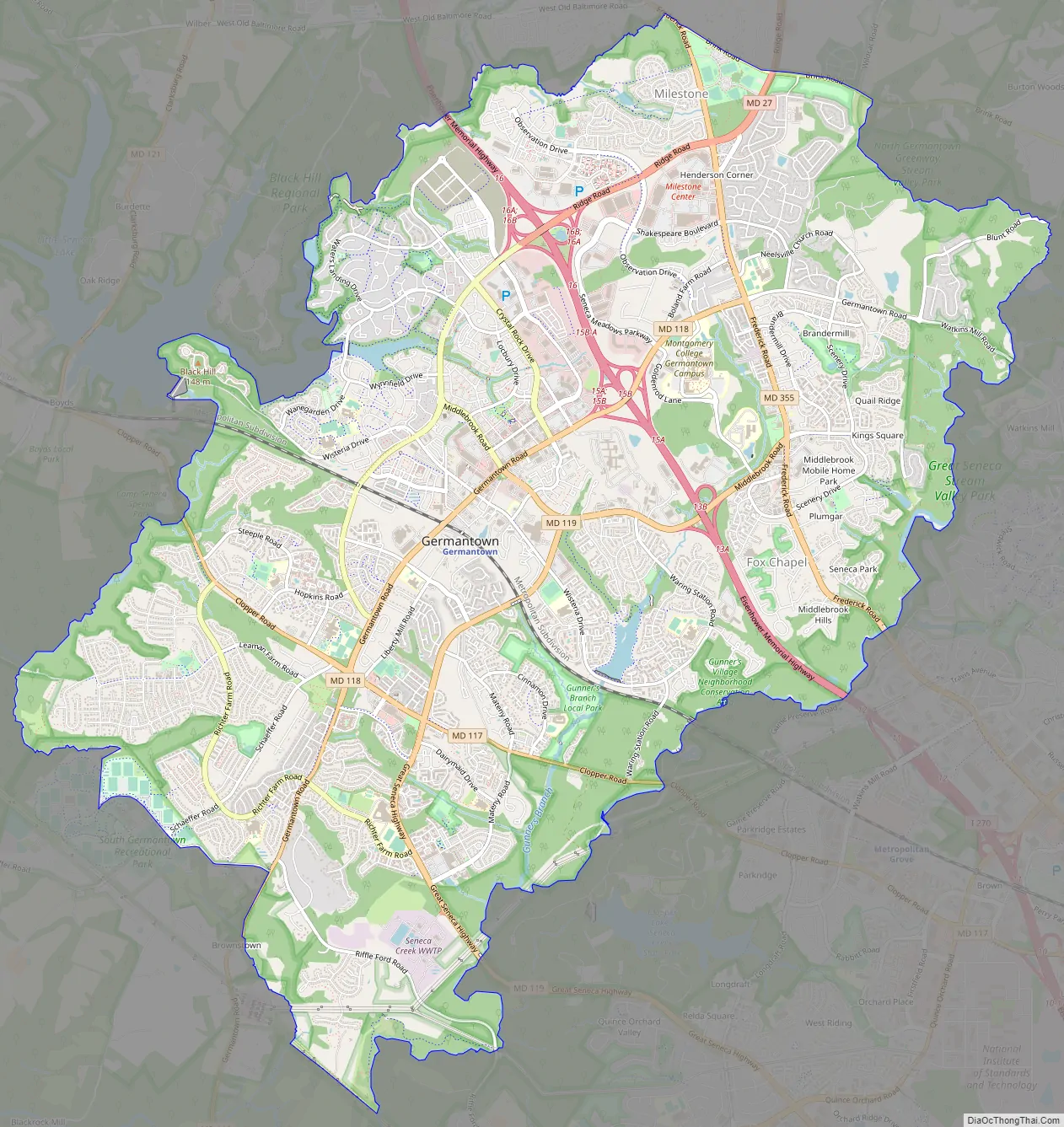
Germantown Road Map
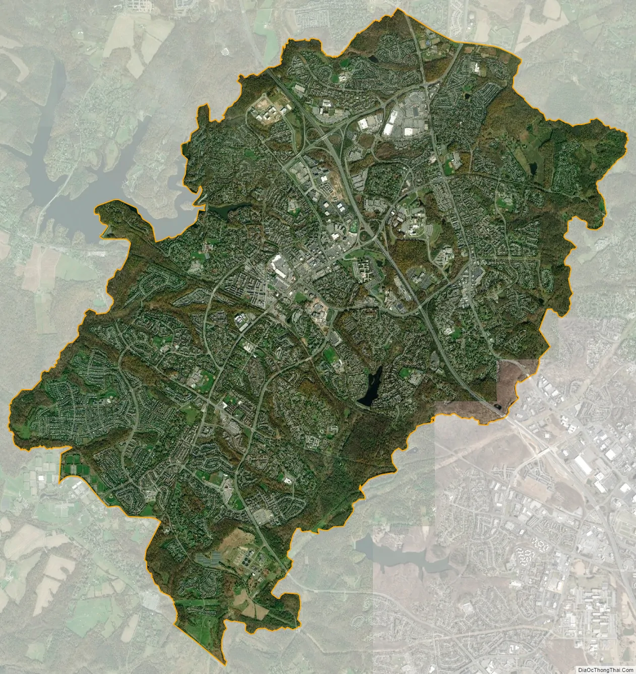
Germantown city Satellite Map
Geography
Germantown is located approximately 428 feet above sea level, at 39°11′N 77°16′W / 39.183°N 77.267°W / 39.183; -77.267.
According to the United States Census Bureau, the community has a total area of 10.9 sq mi (28.0 km), of which all but 0.039 sq mi (0.1 km) (0.46%) is land.
Climate
Germantown lies within the humid subtropical climate zone (Köppen Cfa), with hot, humid summers, cool winters, and generous precipitation year-round. Its location above the Fall Line in the Piedmont region gives it slightly lower temperatures than cities to the south and east such as Washington, D.C. and Silver Spring. Summers are hot and humid with frequent afternoon thunderstorms. July is the warmest month, with an average temperature of 86 °F (30.0 °C). Winters are cool but variable, with sporadic snowfall and lighter rain showers of longer duration. January is the coldest month, with an average temperature of 29 °F (−1.7 °C). Average annual rainfall totals 40.36 in (103 cm).
See also
Map of Maryland State and its subdivision: Map of other states:- Alabama
- Alaska
- Arizona
- Arkansas
- California
- Colorado
- Connecticut
- Delaware
- District of Columbia
- Florida
- Georgia
- Hawaii
- Idaho
- Illinois
- Indiana
- Iowa
- Kansas
- Kentucky
- Louisiana
- Maine
- Maryland
- Massachusetts
- Michigan
- Minnesota
- Mississippi
- Missouri
- Montana
- Nebraska
- Nevada
- New Hampshire
- New Jersey
- New Mexico
- New York
- North Carolina
- North Dakota
- Ohio
- Oklahoma
- Oregon
- Pennsylvania
- Rhode Island
- South Carolina
- South Dakota
- Tennessee
- Texas
- Utah
- Vermont
- Virginia
- Washington
- West Virginia
- Wisconsin
- Wyoming


