Map of Hersey village

Map of Hersey village

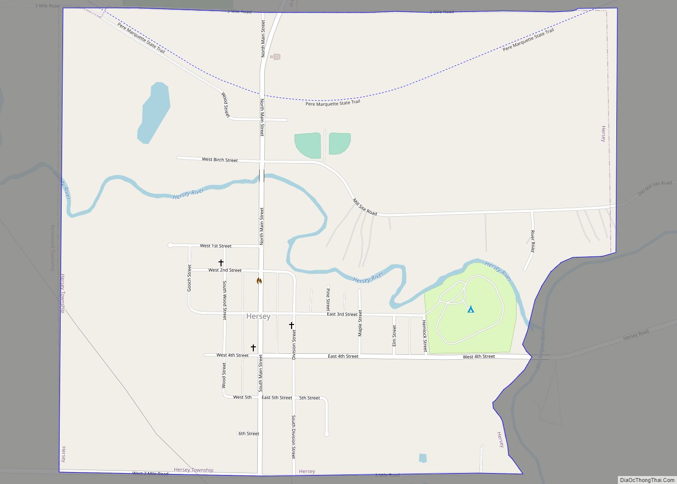
Hersey is a village in Osceola County in the U.S. state of Michigan. The population was 350 at the 2010 census. The village is located within Hersey Township. Hersey village overview: Name: Hersey village LSAD Code: 47 LSAD Description: village (suffix) State: Michigan County: Osceola County Elevation: 974 ft (297 m) Total Area: 1.10 sq mi (2.85 km²) Land Area: … Read more

Map of Henderson CDP, Michigan

Map of Henderson CDP, Michigan

Henderson is an unincorporated community and census-designated place (CDP) in Shiawassee County in the U.S. state of Michigan. The CDP had a population of 399 as of the 2010 census. The community is located within Rush Township. Henderson was named for early settler John Henderson, and the community was formerly referred to as Hendersonville and … Read more

Map of Hemlock CDP

Map of Hemlock CDP, Michigan

Hemlock is an unincorporated community in Richland Township, Saginaw County in the U.S. state of Michigan. It is also a census-designated place (CDP) for statistical purposes, but without any legal status as an incorporated municipality. The population of the CDP was 1,585 at the 2000 census. The area included in the CDP is in the … Read more

Map of Hazel Park city

Map of Hazel Park city

Hazel Park is a city in Oakland County in the U.S. state of Michigan. As a part of Metro Detroit, the city shares its southern border with the city of Detroit. As of the 2010 census, the population was 16,422. Hazel Park was incorporated as a city in 1941 and bills itself as The Friendly … Read more

Map of Hastings city, Michigan

Map of Hastings city, Michigan

Hastings is a city in the U.S. state of Michigan, the county seat of Barry County as well as the county’s only city. The population was 7,514 at the 2020 census. The city borders Hastings Charter Township on the north, east, and south, and Rutland Charter Township on the west. Hastings city overview: Name: Hastings … Read more

Map of Hillsdale city, Michigan

Map of Hillsdale city, Michigan

Hillsdale city overview: Name: Hillsdale city LSAD Code: 25 LSAD Description: city (suffix) State: Michigan County: Hillsdale County Incorporated: 1847 (village)1869 (city) Elevation: 1,119 ft (341 m) Total Area: 6.13 sq mi (15.88 km²) Land Area: 5.69 sq mi (14.74 km²) Water Area: 0.43 sq mi (1.11 km²) Total Population: 8,036 Population Density: 1,412.30/sq mi (545.29/km²) Area code: 517 FIPS code: 2638460 GNISfeature ID: 0628321 Online Interactive … Read more

Map of Hillman village

Map of Hillman village, Michigan

Hillman is a village in the Alpena and Montmorency counties in the U.S. state of Michigan. The population was 638 in 2019. Nearly all of the village is located within Hillman Township (Montmorency County), with only a small portion extending into Green Township (Alpena County). Hillman is the only village of both counties, while also … Read more

Map of Highland Park city, Michigan

Map of Highland Park city, Michigan

Highland Park is a city in Wayne County in the U.S. state of Michigan. The population was 8,977 at the 2020 census. Like its neighbor Hamtramck, Highland Park is an enclave city surrounded by the city of Detroit. Highland Park city overview: Name: Highland Park city LSAD Code: 25 LSAD Description: city (suffix) State: Michigan … Read more

Map of Hickory Corners CDP

Map of Hickory Corners CDP

Hickory Corners is a census-designated place (CDP) in Barry Township in Barry County, Michigan, United States. The population was 313 at the 2020 census. Hickory Corners CDP overview: Name: Hickory Corners CDP LSAD Code: 57 LSAD Description: CDP (suffix) State: Michigan County: Barry County Elevation: 947 ft (289 m) Total Area: 2.08 sq mi (5.38 km²) Land Area: 2.07 sq mi (5.36 km²) … Read more

Map of Hesperia village, Michigan

Map of Hesperia village, Michigan

Hesperia is a village in Newaygo and Oceana Counties in the U.S. state of Michigan; it is also the only village in Newaygo County. About half of the village lies in Newfield Township in Oceana County and half in Denver Township in Newaygo County. The population was determined to be 954 in both the 2000 … Read more

Map of Honor village

Map of Honor village

Honor is a village in Benzie County of the U.S. state of Michigan. The population was 337 at the 2020 census. The village is located within Homestead Township on U.S. Highway 31 along the Platte River. The community has the name of Honor Griffin, the daughter of a first settler. Honor village overview: Name: Honor … Read more

Map of Homer village, Michigan

Map of Homer village, Michigan

Homer is a village in Calhoun County in the U.S. state of Michigan. It is part of the Battle Creek, Michigan Metropolitan Statistical Area. The population was 1,668 at the 2010 census. Homer village overview: Name: Homer village LSAD Code: 47 LSAD Description: village (suffix) State: Michigan County: Calhoun County Elevation: 991 ft (302 m) Total Area: … Read more