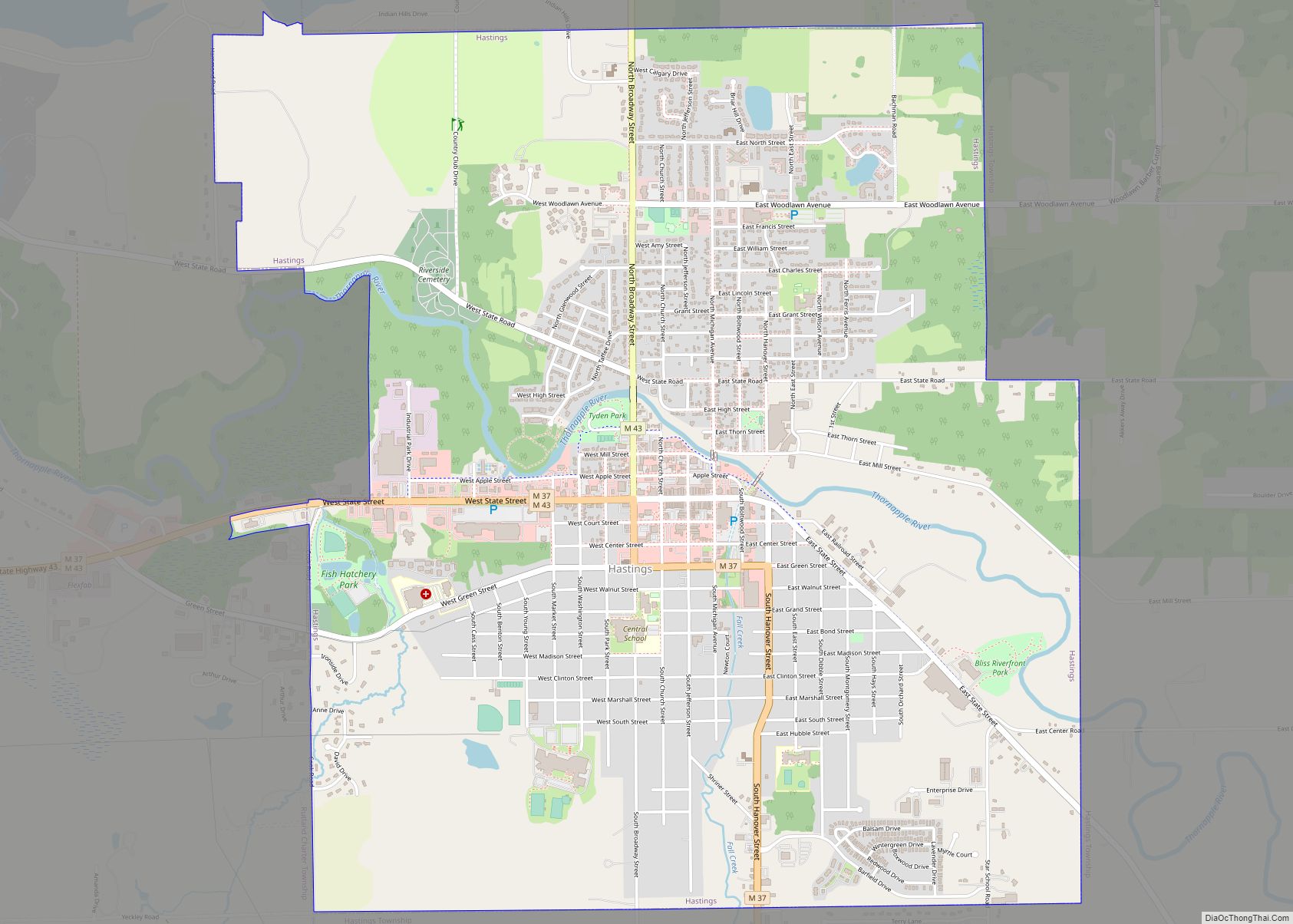
Hastings is a city in the U.S. state of Michigan, the county seat of Barry County as well as the county’s only city. The population was 7,514 at the 2020 census. The city borders Hastings Charter Township on the north, east, and south, and Rutland Charter Township on the west.
| Name: | Hastings city |
|---|---|
| LSAD Code: | 25 |
| LSAD Description: | city (suffix) |
| State: | Michigan |
| County: | Barry County |
| Elevation: | 810 ft (250 m) |
| Total Area: | 5.29 sq mi (13.70 km²) |
| Land Area: | 5.21 sq mi (13.50 km²) |
| Water Area: | 0.08 sq mi (0.20 km²) |
| Total Population: | 7,514 |
| Population Density: | 1,441.95/sq mi (556.78/km²) |
| ZIP code: | 49058 |
| Area code: | 269 |
| FIPS code: | 2637120 |
| GNISfeature ID: | 1618841 |
| Website: | www.hastingsmi.org |
Online Interactive Map
Click on ![]() to view map in "full screen" mode.
to view map in "full screen" mode.
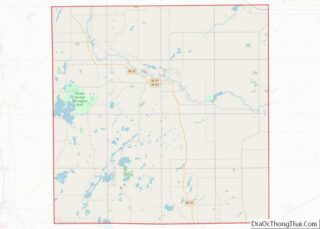
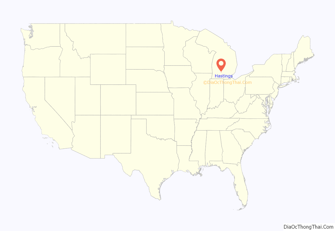
Hastings location map. Where is Hastings city?
History
In 1836 three entrepreneurs named Dibble, Kingsbury and Kendall bought 480 acres (1.9 km) along the Thornapple River from Detroit banker Eurotas P. Hastings. The three platted the area into lots, and soon a small community arose. In 1843, the state legislature designated Hastings as the County Seat of Barry County. The first paper, the Barry County Pioneer, began publishing in 1851, and a second paper, the Republican Banner, began in 1856. The latter publication, a weekly paper published on Thursdays, continues to be published as the Hastings Banner.
Hastings was incorporated as a village in 1855, with a population of around 300, and on March 11, 1871, Hastings officially became a city. The Barry County Courthouse, which is still in use today, was built in 1893. The city grew slowly, reaching 6,500 people in 1960 and remaining nearly flat through 1990.
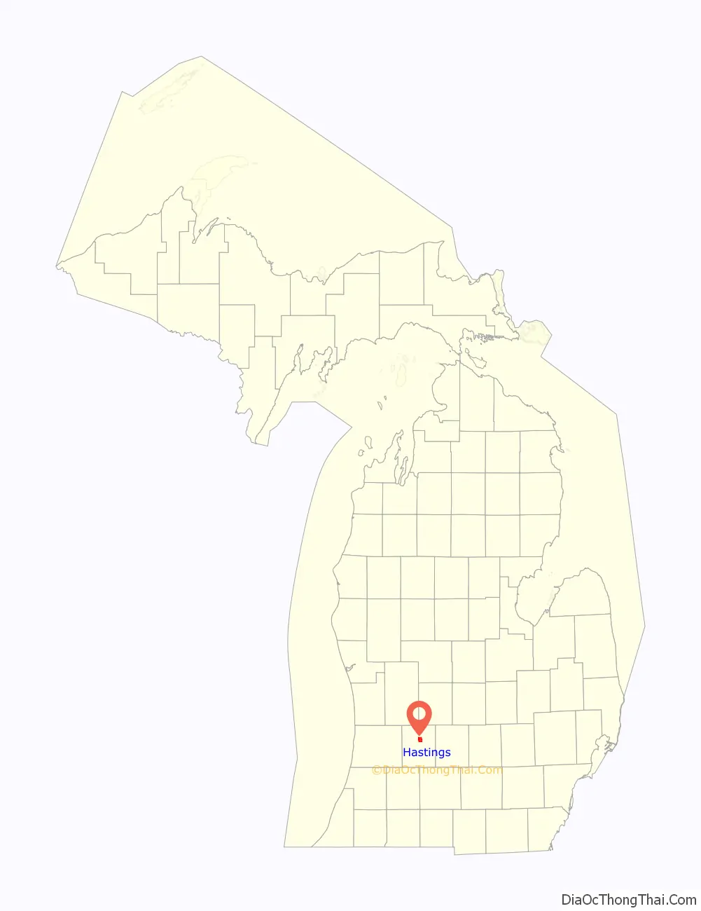
Hastings Road Map
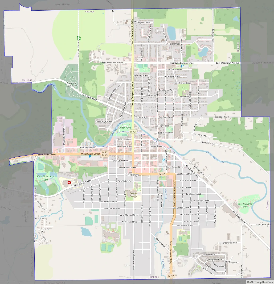
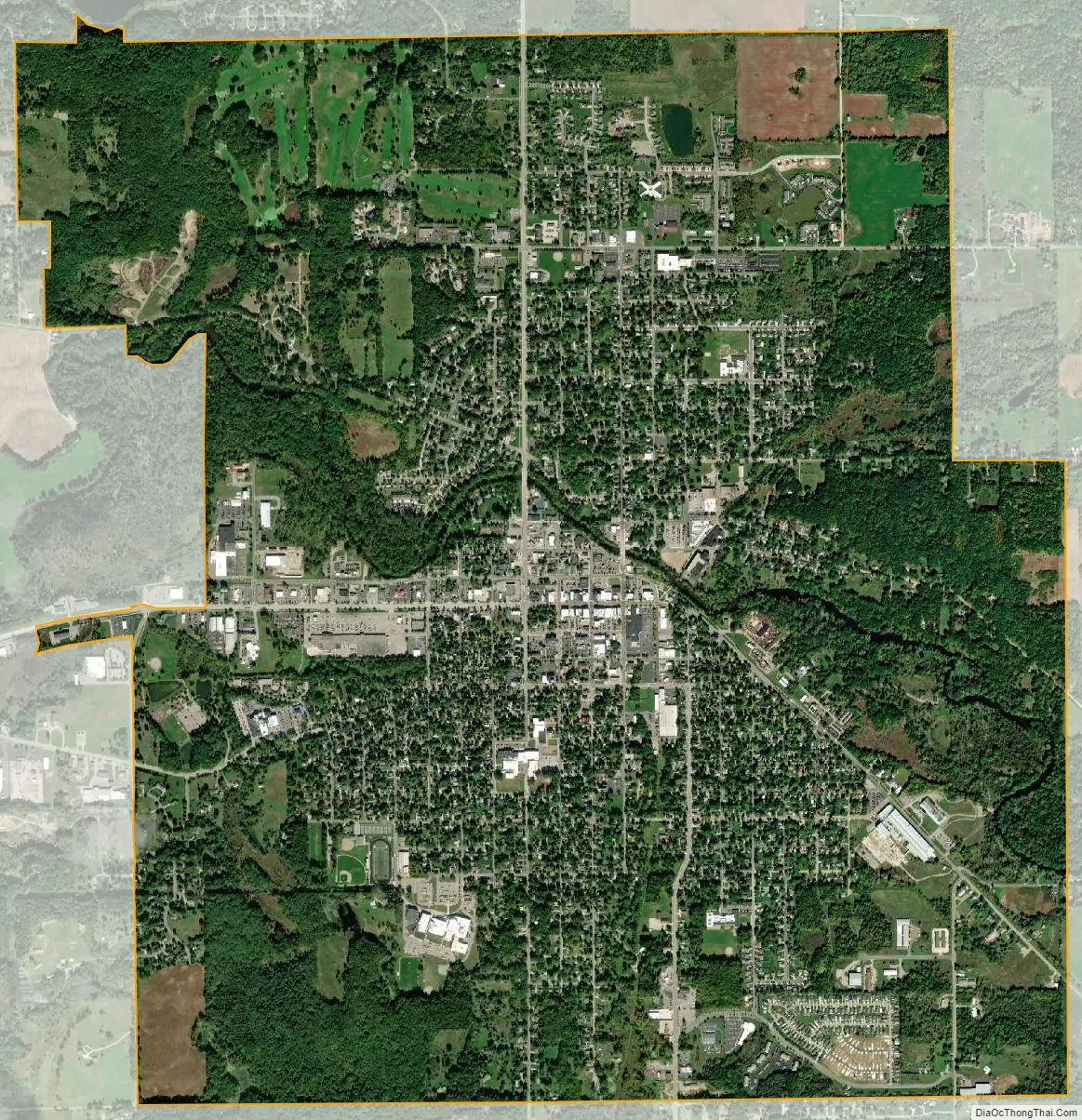
Hastings city Satellite Map
Geography
According to the United States Census Bureau, the city has a total area of 5.28 square miles (13.68 km), of which 5.20 square miles (13.47 km) is land and 0.08 square miles (0.21 km) is water. The Thornapple River passes through the city from east to west.
Climate
The Köppen Climate Classification subtype for this climate is “Dfb” (Warm Summer Continental Climate).
See also
Map of Michigan State and its subdivision:- Alcona
- Alger
- Allegan
- Alpena
- Antrim
- Arenac
- Baraga
- Barry
- Bay
- Benzie
- Berrien
- Branch
- Calhoun
- Cass
- Charlevoix
- Cheboygan
- Chippewa
- Clare
- Clinton
- Crawford
- Delta
- Dickinson
- Eaton
- Emmet
- Genesee
- Gladwin
- Gogebic
- Grand Traverse
- Gratiot
- Hillsdale
- Houghton
- Huron
- Ingham
- Ionia
- Iosco
- Iron
- Isabella
- Jackson
- Kalamazoo
- Kalkaska
- Kent
- Keweenaw
- Lake
- Lake Hurron
- Lake Michigan
- Lake St. Clair
- Lake Superior
- Lapeer
- Leelanau
- Lenawee
- Livingston
- Luce
- Mackinac
- Macomb
- Manistee
- Marquette
- Mason
- Mecosta
- Menominee
- Midland
- Missaukee
- Monroe
- Montcalm
- Montmorency
- Muskegon
- Newaygo
- Oakland
- Oceana
- Ogemaw
- Ontonagon
- Osceola
- Oscoda
- Otsego
- Ottawa
- Presque Isle
- Roscommon
- Saginaw
- Saint Clair
- Saint Joseph
- Sanilac
- Schoolcraft
- Shiawassee
- Tuscola
- Van Buren
- Washtenaw
- Wayne
- Wexford
- Alabama
- Alaska
- Arizona
- Arkansas
- California
- Colorado
- Connecticut
- Delaware
- District of Columbia
- Florida
- Georgia
- Hawaii
- Idaho
- Illinois
- Indiana
- Iowa
- Kansas
- Kentucky
- Louisiana
- Maine
- Maryland
- Massachusetts
- Michigan
- Minnesota
- Mississippi
- Missouri
- Montana
- Nebraska
- Nevada
- New Hampshire
- New Jersey
- New Mexico
- New York
- North Carolina
- North Dakota
- Ohio
- Oklahoma
- Oregon
- Pennsylvania
- Rhode Island
- South Carolina
- South Dakota
- Tennessee
- Texas
- Utah
- Vermont
- Virginia
- Washington
- West Virginia
- Wisconsin
- Wyoming