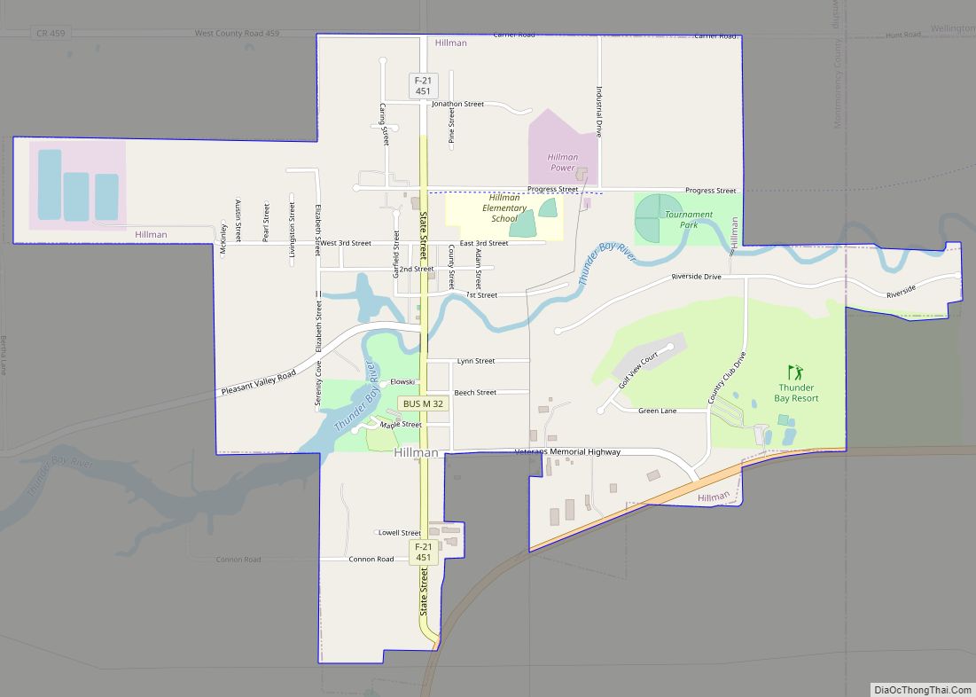
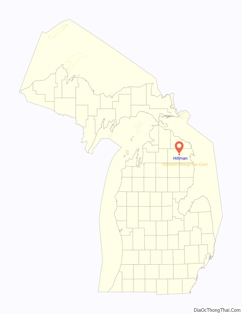
Hillman is a village in the Alpena and Montmorency counties in the U.S. state of Michigan. The population was 638 in 2019. Nearly all of the village is located within Hillman Township (Montmorency County), with only a small portion extending into Green Township (Alpena County). Hillman is the only village of both counties, while also being the only incorporated municipality in Montmorency County.
| Name: | Hillman village |
|---|---|
| LSAD Code: | 47 |
| LSAD Description: | village (suffix) |
| State: | Michigan |
| County: | Alpena County, Montmorency County |
| Elevation: | 804 ft (245 m) |
| Total Area: | 1.70 sq mi (4.42 km²) |
| Land Area: | 1.66 sq mi (4.29 km²) |
| Water Area: | 0.05 sq mi (0.13 km²) |
| Total Population: | 605 |
| Population Density: | 365.34/sq mi (141.02/km²) |
| ZIP code: | 49746 |
| Area code: | 989 |
| FIPS code: | 2638380 |
| GNISfeature ID: | 0628315 |
Online Interactive Map
Click on ![]() to view map in "full screen" mode.
to view map in "full screen" mode.
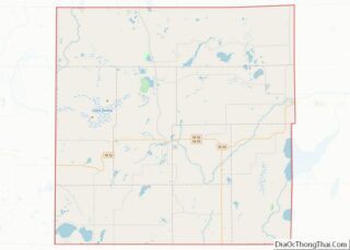
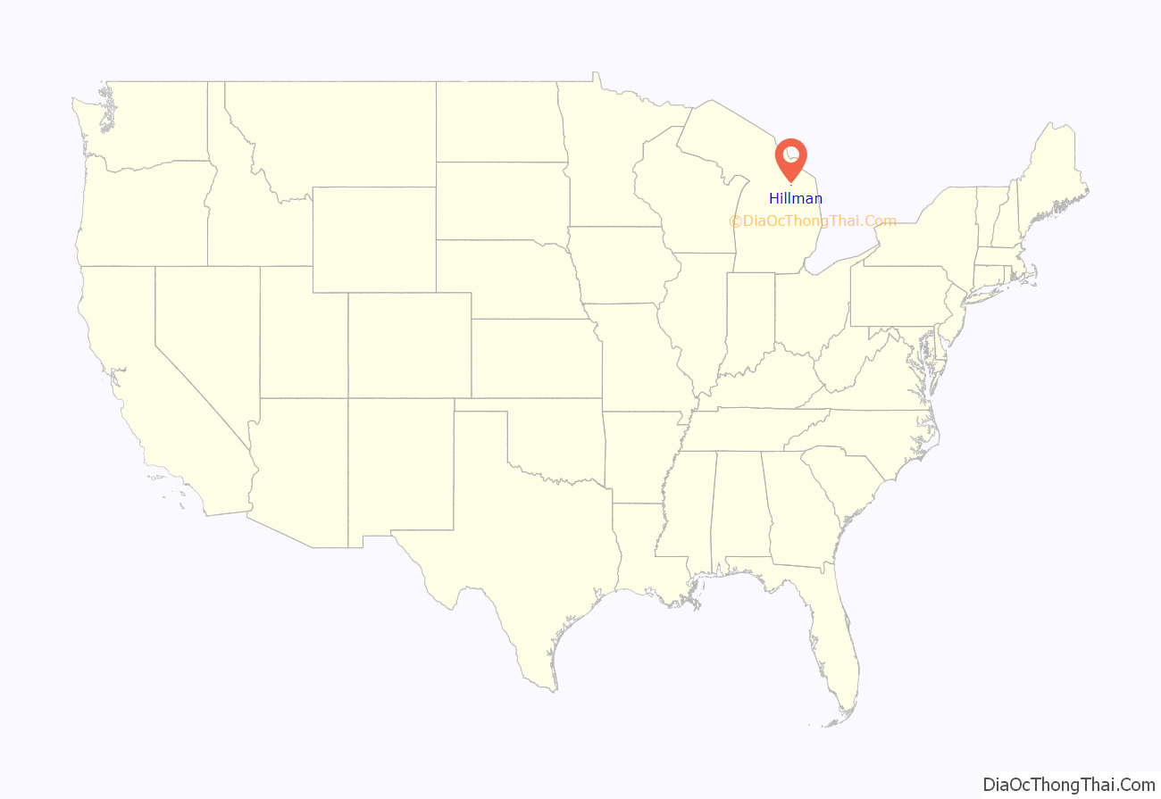
Hillman location map. Where is Hillman village?
History
Hillman was the county seat of Montmorency County from 1881 until the removal of the county seat to Atlanta in 1891.
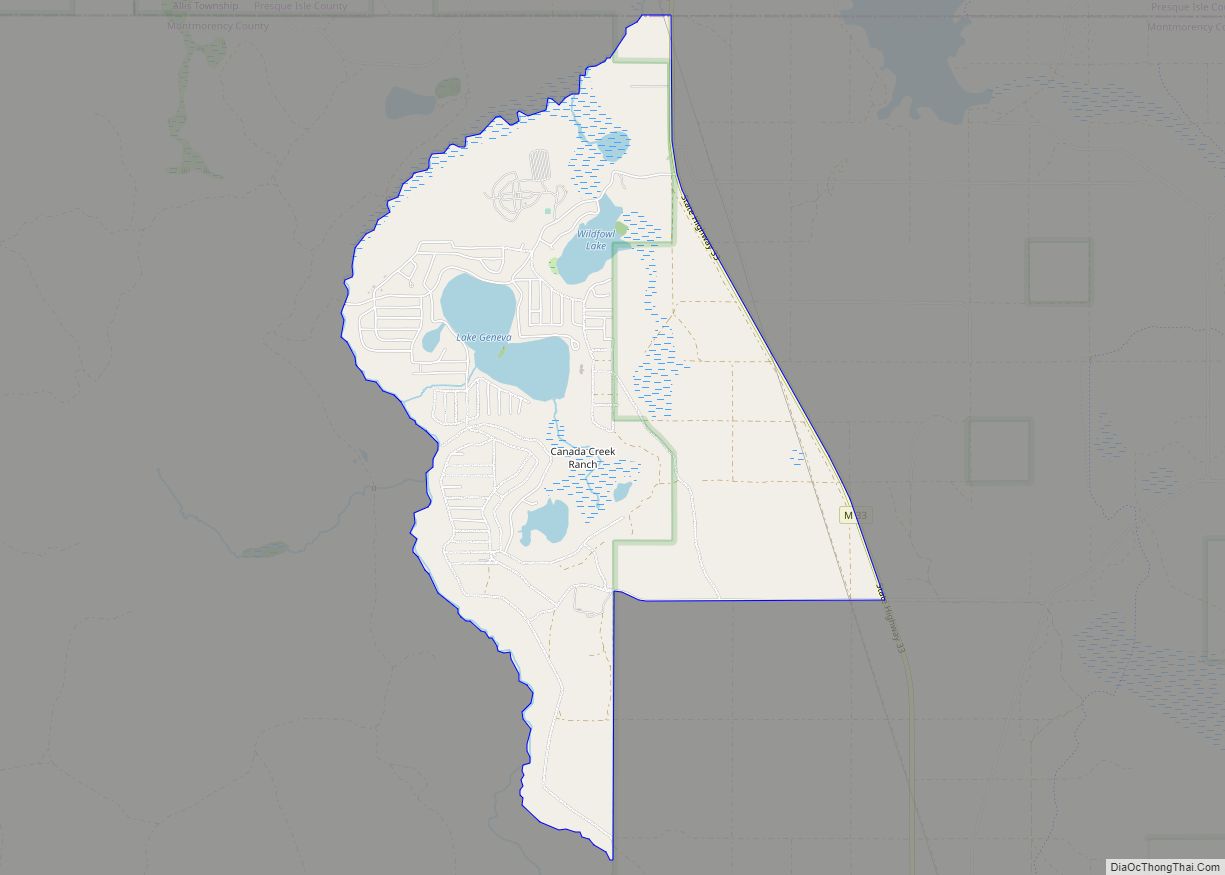
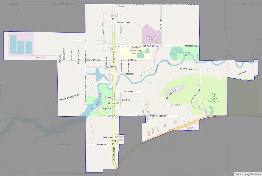
Hillman Road Map
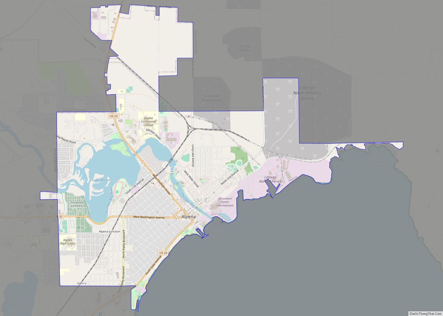
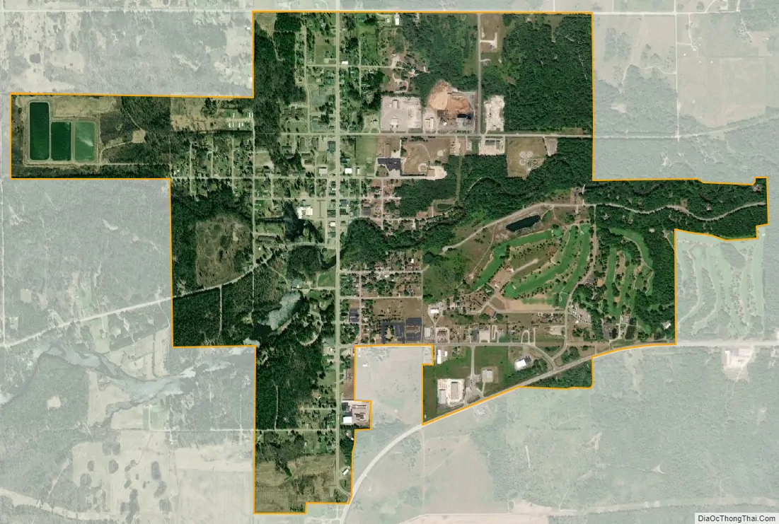
Hillman city Satellite Map
Geography
According to the United States Census Bureau, the village has a total area of 1.70 square miles (4.40 km), of which, 1.65 square miles (4.27 km) of it is land and 0.05 square miles (0.13 km) is water.
See also
Map of Michigan State and its subdivision:- Alcona
- Alger
- Allegan
- Alpena
- Antrim
- Arenac
- Baraga
- Barry
- Bay
- Benzie
- Berrien
- Branch
- Calhoun
- Cass
- Charlevoix
- Cheboygan
- Chippewa
- Clare
- Clinton
- Crawford
- Delta
- Dickinson
- Eaton
- Emmet
- Genesee
- Gladwin
- Gogebic
- Grand Traverse
- Gratiot
- Hillsdale
- Houghton
- Huron
- Ingham
- Ionia
- Iosco
- Iron
- Isabella
- Jackson
- Kalamazoo
- Kalkaska
- Kent
- Keweenaw
- Lake
- Lake Hurron
- Lake Michigan
- Lake St. Clair
- Lake Superior
- Lapeer
- Leelanau
- Lenawee
- Livingston
- Luce
- Mackinac
- Macomb
- Manistee
- Marquette
- Mason
- Mecosta
- Menominee
- Midland
- Missaukee
- Monroe
- Montcalm
- Montmorency
- Muskegon
- Newaygo
- Oakland
- Oceana
- Ogemaw
- Ontonagon
- Osceola
- Oscoda
- Otsego
- Ottawa
- Presque Isle
- Roscommon
- Saginaw
- Saint Clair
- Saint Joseph
- Sanilac
- Schoolcraft
- Shiawassee
- Tuscola
- Van Buren
- Washtenaw
- Wayne
- Wexford
- Alabama
- Alaska
- Arizona
- Arkansas
- California
- Colorado
- Connecticut
- Delaware
- District of Columbia
- Florida
- Georgia
- Hawaii
- Idaho
- Illinois
- Indiana
- Iowa
- Kansas
- Kentucky
- Louisiana
- Maine
- Maryland
- Massachusetts
- Michigan
- Minnesota
- Mississippi
- Missouri
- Montana
- Nebraska
- Nevada
- New Hampshire
- New Jersey
- New Mexico
- New York
- North Carolina
- North Dakota
- Ohio
- Oklahoma
- Oregon
- Pennsylvania
- Rhode Island
- South Carolina
- South Dakota
- Tennessee
- Texas
- Utah
- Vermont
- Virginia
- Washington
- West Virginia
- Wisconsin
- Wyoming