| Name: | Hillsdale city |
|---|---|
| LSAD Code: | 25 |
| LSAD Description: | city (suffix) |
| State: | Michigan |
| County: | Hillsdale County |
| Incorporated: | 1847 (village) 1869 (city) |
| Elevation: | 1,119 ft (341 m) |
| Total Area: | 6.13 sq mi (15.88 km²) |
| Land Area: | 5.69 sq mi (14.74 km²) |
| Water Area: | 0.43 sq mi (1.11 km²) |
| Total Population: | 8,036 |
| Population Density: | 1,412.30/sq mi (545.29/km²) |
| Area code: | 517 |
| FIPS code: | 2638460 |
| GNISfeature ID: | 0628321 |
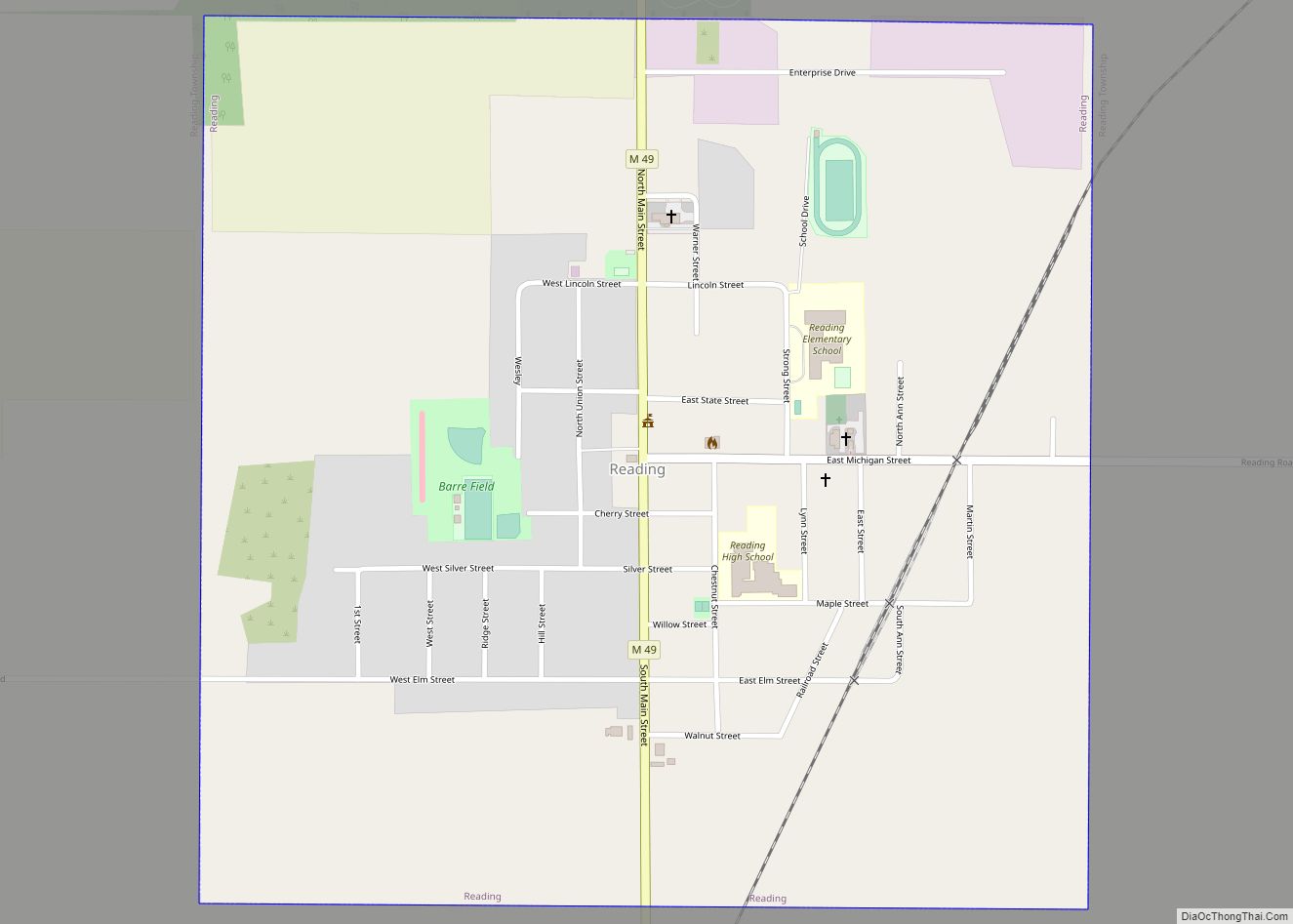
Online Interactive Map
Click on ![]() to view map in "full screen" mode.
to view map in "full screen" mode.
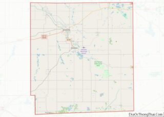
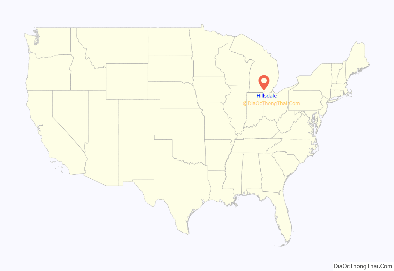
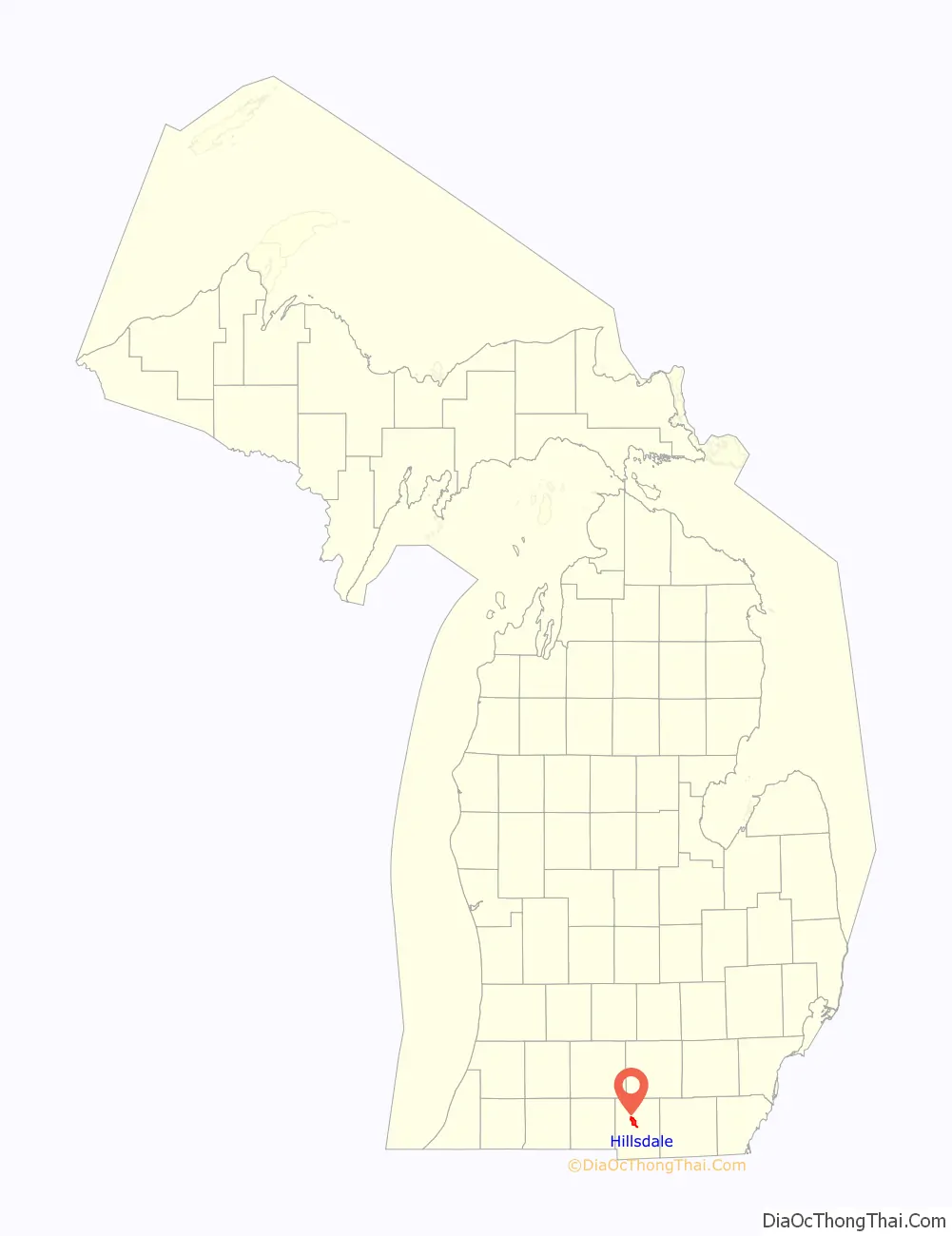
Hillsdale location map. Where is Hillsdale city?
History
This area is located in the rolling, fertile hills of South Central Michigan, bordering Indiana and Ohio, according to the boundaries set up under United States settlement. It was long occupied by the Potowatomi, an Algonquian-speaking people who were part of a long-term alliance, called the Council of Three Fires, with the Ojibwe and Odawa (Ottawa). A Potowatomi band of about 150 people, led by the chief known as Baw Beese, had a base camp near the large lake in the area.
The first European-American settler, Jeremiah Arnold, arrived in 1834 and encountered the band. They helped the early settlers. Arnold erected a cabin and moved in with his wife Percy (Round) Arnold. With the arrival of other settlers, the pioneers erected the first schoolhouse in 1838. The city was established in 1839. In 1840, the US forced out Baw Beese and his people, as well as other Potowatomi in neighboring and more distant areas of Michigan, Indiana and Ohio, making them remove to Indian Territory in present-day Kansas.
Founded in 1844 as Central Michigan College in Spring Arbor, Hillsdale College relocated to this city in 1853 and changed its name. It was the first American college to prohibit in its charter discrimination based on race, religion or sex, and became an early force for the abolition of slavery. It was the second college in the nation to grant four-year liberal arts degrees to women.
The city was chartered in 1869. In 1885 Hillsdale dedicated its first high school building, on what is now West Street. (It is now used as the middle school.) In the late 1800s, Hillsdale became a booming railroad town, served by both freight and passenger trains.
The railroad was used by tourists to enjoy cottages and other facilities on Baw Beese Lake, named after the Potowatomi chief. About 20 minutes from downtown, the area was developed as a lake resort by the Lake Shore and Michigan Southern Railroad. People could avoid dusty travel on unpaved roads by taking the train. At the turn of the 20th century, it began to attract tourists from a wider range of cities, such as Chicago, Toledo, Elkhart and others at what had been known as Archer’s Landing. People swam in the lake and could rent two types of canoes.
After World War II, the construction of interstate highways encouraged use of automobiles, and passenger traffic declined on many lines. Railroads had to restructure and the last passenger train left Hillsdale in 1956. Dozens of fine Victorian homes had been built during the prosperity of the 19th century, many of which are still occupied as private residences, contributing to the city’s historic fabric.
The 20th century brought additional improvements. In 1908 the city opened its first public library. In 1921 it opened its first hospital and in 1934 Hillsdale Municipal Airport opened.
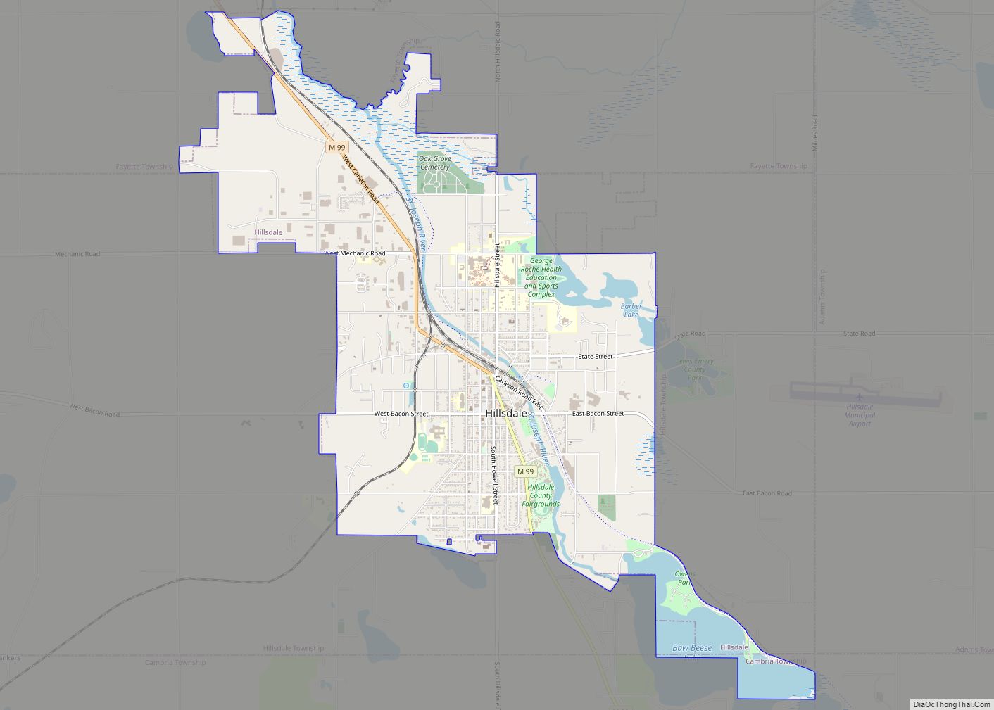
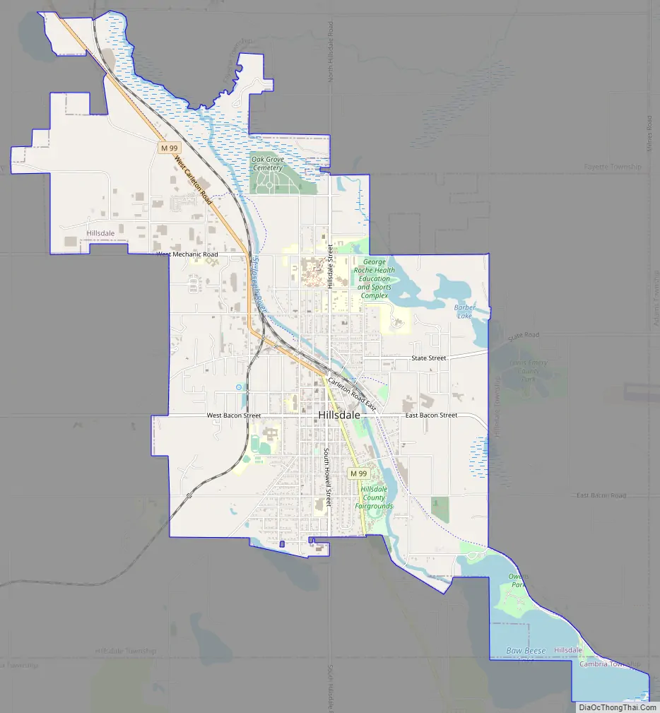
Hillsdale Road Map
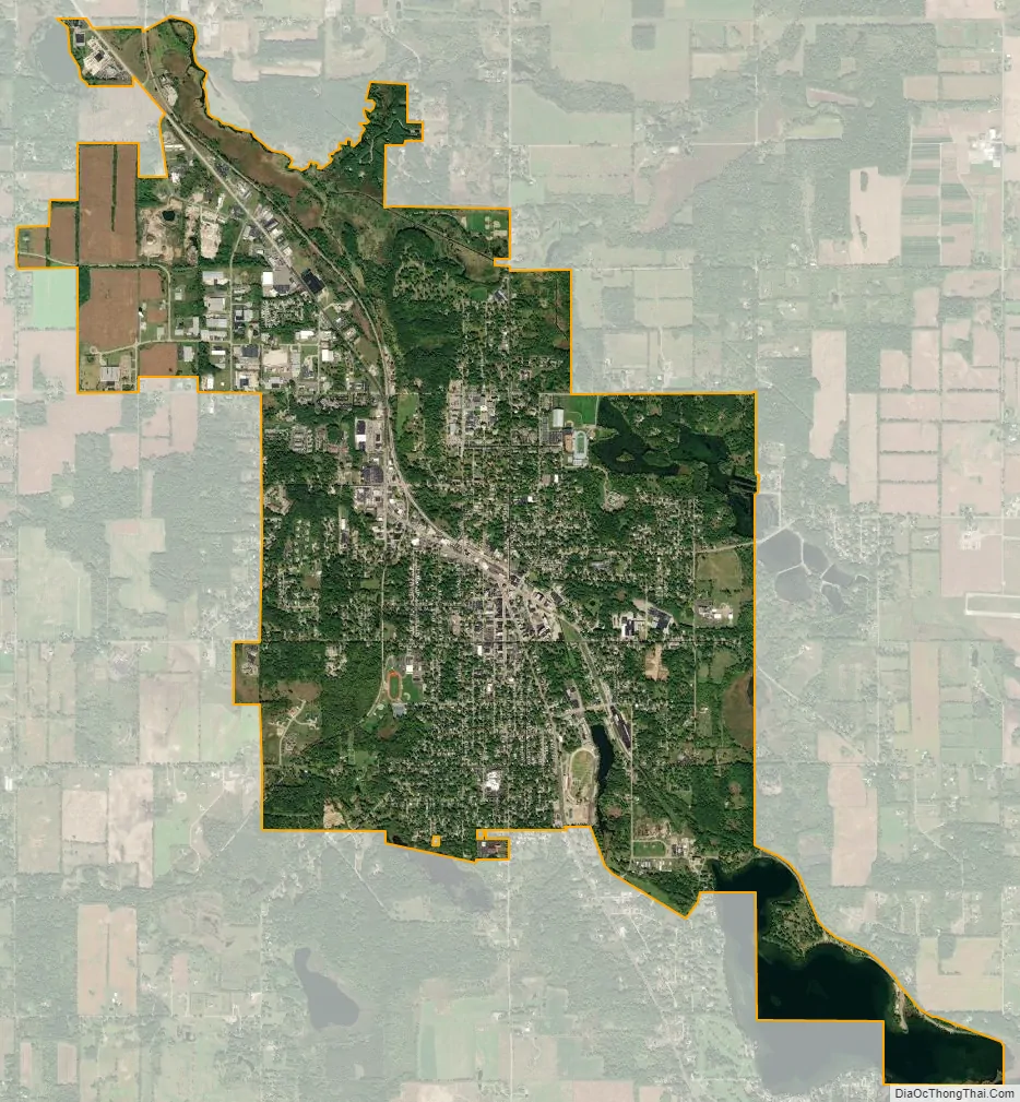
Hillsdale city Satellite Map
Geography
According to the United States Census Bureau, the city has a total area of 6.13 square miles (15.88 km), of which, 5.69 square miles (14.74 km) is land and 0.43 square miles (1.11 km) is water.
The St. Joseph River begins in Hillsdale, flowing from Lake Baw Beese. Several parks and a beach are located around this major body of water in the city.
Climate
This climatic region is typified by large seasonal temperature differences, with warm to hot summers and cold winters. According to the Köppen Climate Classification system, Hillsdale has a humid continental climate, abbreviated “Dfb” on climate maps.
See also
Map of Michigan State and its subdivision:- Alcona
- Alger
- Allegan
- Alpena
- Antrim
- Arenac
- Baraga
- Barry
- Bay
- Benzie
- Berrien
- Branch
- Calhoun
- Cass
- Charlevoix
- Cheboygan
- Chippewa
- Clare
- Clinton
- Crawford
- Delta
- Dickinson
- Eaton
- Emmet
- Genesee
- Gladwin
- Gogebic
- Grand Traverse
- Gratiot
- Hillsdale
- Houghton
- Huron
- Ingham
- Ionia
- Iosco
- Iron
- Isabella
- Jackson
- Kalamazoo
- Kalkaska
- Kent
- Keweenaw
- Lake
- Lake Hurron
- Lake Michigan
- Lake St. Clair
- Lake Superior
- Lapeer
- Leelanau
- Lenawee
- Livingston
- Luce
- Mackinac
- Macomb
- Manistee
- Marquette
- Mason
- Mecosta
- Menominee
- Midland
- Missaukee
- Monroe
- Montcalm
- Montmorency
- Muskegon
- Newaygo
- Oakland
- Oceana
- Ogemaw
- Ontonagon
- Osceola
- Oscoda
- Otsego
- Ottawa
- Presque Isle
- Roscommon
- Saginaw
- Saint Clair
- Saint Joseph
- Sanilac
- Schoolcraft
- Shiawassee
- Tuscola
- Van Buren
- Washtenaw
- Wayne
- Wexford
- Alabama
- Alaska
- Arizona
- Arkansas
- California
- Colorado
- Connecticut
- Delaware
- District of Columbia
- Florida
- Georgia
- Hawaii
- Idaho
- Illinois
- Indiana
- Iowa
- Kansas
- Kentucky
- Louisiana
- Maine
- Maryland
- Massachusetts
- Michigan
- Minnesota
- Mississippi
- Missouri
- Montana
- Nebraska
- Nevada
- New Hampshire
- New Jersey
- New Mexico
- New York
- North Carolina
- North Dakota
- Ohio
- Oklahoma
- Oregon
- Pennsylvania
- Rhode Island
- South Carolina
- South Dakota
- Tennessee
- Texas
- Utah
- Vermont
- Virginia
- Washington
- West Virginia
- Wisconsin
- Wyoming