Map of Kalkaska village

Map of Kalkaska village

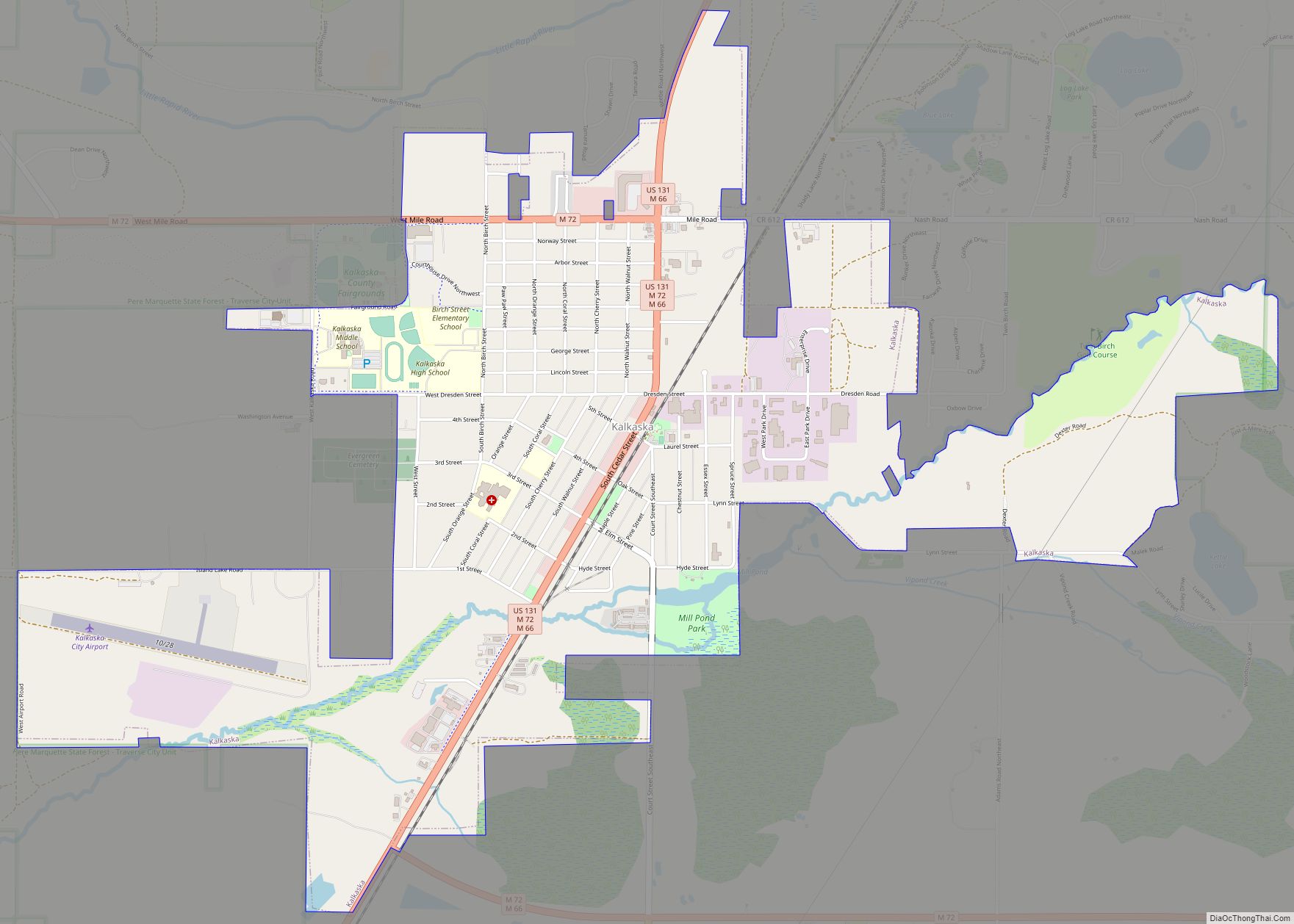
Kalkaska (/kælˈkæskə/ kal-KASS-kə) is a village in the U.S. state of Michigan. Kalkaska is the county seat and only incorporated community of Kalkaska County, and is considered part of Northern Michigan. The population was 2,132 at the 2020 census, an increase from 2,020 at the 2010 census. Kalkaska is part of the Traverse City micropolitan … Read more

Map of Kaleva village

Map of Kaleva village

Kaleva (/ˈkæləvə/ KAL-ə-və) is a village in Manistee County in the U.S. state of Michigan. The population was 507 at the 2020 census. Kaleva village overview: Name: Kaleva village LSAD Code: 47 LSAD Description: village (suffix) State: Michigan County: Manistee County Elevation: 755 ft (230 m) Total Area: 1.10 sq mi (2.86 km²) Land Area: 1.10 sq mi (2.86 km²) Water Area: 0.00 sq mi … Read more

Map of L'Anse village

Map of L’Anse village

L’Anse (/lɑːns/ LAHNSS) is a village and the county seat of Baraga County, Michigan. The population was 1,874 at the 2020 census. The village is located within L’Anse Township in the Upper Peninsula, and partially inside the L’Anse Indian Reservation. L’Anse village overview: Name: L’Anse village LSAD Code: 47 LSAD Description: village (suffix) State: Michigan … Read more

Map of Kingston village, Michigan

Map of Kingston village, Michigan

Kingston is a village in Tuscola County in the U.S. state of Michigan. The population was 440 at the 2010 census. The village is located at the southern edge of Kingston Township and is partially within Koylton Township. Kingston village overview: Name: Kingston village LSAD Code: 47 LSAD Description: village (suffix) State: Michigan County: Tuscola … Read more

Map of Kingsley village, Michigan

Map of Kingsley village, Michigan

Kingsley (/kɪŋzli/) is a village in southern Grand Traverse County in the U.S. state of Michigan. The population was 1,431 at the 2020 census. The village is located within Paradise Township and is part of the Traverse City micropolitan area. Kingsley village overview: Name: Kingsley village LSAD Code: 47 LSAD Description: village (suffix) State: Michigan … Read more

Map of Kingsford city

Map of Kingsford city

Kingsford is a city in Dickinson County in the U.S. state of Michigan, named for the developer Edward G. Kingsford. The population was 5,139 at the 2020 census, a slight increase from the 5,133 recorded at the 2010 census. It is part of the Iron Mountain, MI–WI Micropolitan Statistical Area. M-95 connects with US 2 … Read more

Map of Kinde village

Map of Kinde village

Kinde is a village in Huron County in the U.S. state of Michigan. The population was 448 at the 2010 census. The village is located on the boundary between Dwight Township and Lincoln Township, with about half of the village in both. A small portion of the village is within Meade Township. Kinde village overview: … Read more

Map of Lake City, Michigan

Map of Lake City, Michigan

Lake City is a city in and the county seat of Missaukee County in the U.S. state of Michigan. As of the 2020 census, the city population was 829. Lake City is locally known as the “Christmas Tree Capitol” because of the millions of Christmas trees produced annually. Lake City overview: Name: Lake City LSAD … Read more

Map of Lake Ann village

Map of Lake Ann village

Lake Ann is a village in northeastern Benzie County in the U.S. state of Michigan. Part of Almira Township, Lake Ann is situated 10 miles (16 km) west of Traverse City, and largely dependent upon that city. The population of Lake Ann was 273 at the 2020 census. Lake Ann village overview: Name: Lake Ann village … Read more

Map of Lake Angelus city

Map of Lake Angelus city

Lake Angelus is a city in Oakland County in the U.S. state of Michigan. It is an affluent suburb of Detroit, with one of the highest per capita incomes of any community in the state. Lake Angelus city overview: Name: Lake Angelus city LSAD Code: 25 LSAD Description: city (suffix) State: Michigan County: Oakland County … Read more

Map of Laingsburg city

Map of Laingsburg city

Laingsburg is a city in Shiawassee County in the U.S. state of Michigan. The population was 1,283 at the 2010 census. Laingsburg is located about 20 miles (32.2 km) northeast of the city of Lansing. It is mostly surrounded by Sciota Township with a small western border with Victor Township in Clinton County. The Laingsburg 48848 … Read more

Map of Lake Fenton CDP

Map of Lake Fenton CDP

Lake Fenton is a census-designated place (CDP) in Fenton Charter Township, Genesee County in the U.S. state of Michigan. As of the 2010 census the population was 5,559, up from 4,876 at the 2000 census. The CDP includes the unincorporated communities of Bayport Park and Lakeside. The Lake Fenton Community Schools district overlaps a portion … Read more