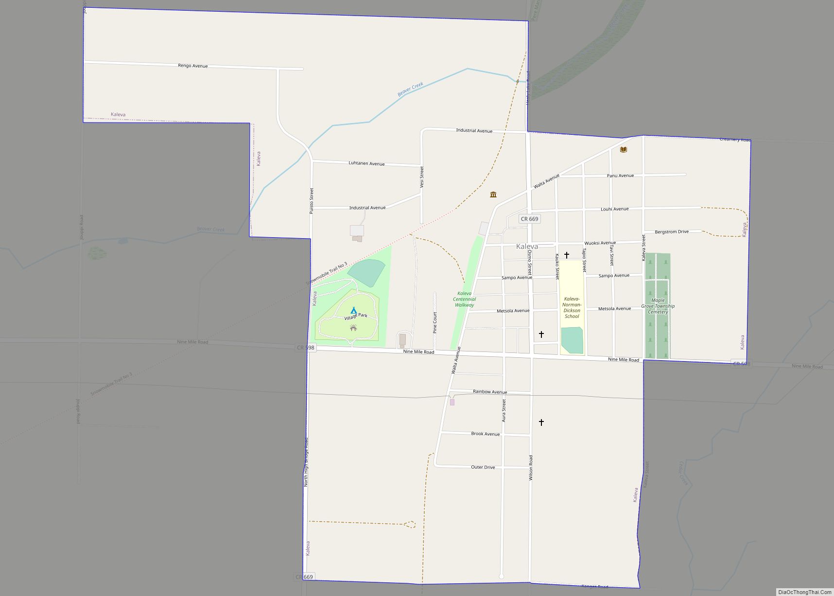
Kaleva (/ˈkæləvə/ KAL-ə-və) is a village in Manistee County in the U.S. state of Michigan. The population was 507 at the 2020 census.
| Name: | Kaleva village |
|---|---|
| LSAD Code: | 47 |
| LSAD Description: | village (suffix) |
| State: | Michigan |
| County: | Manistee County |
| Elevation: | 755 ft (230 m) |
| Total Area: | 1.10 sq mi (2.86 km²) |
| Land Area: | 1.10 sq mi (2.86 km²) |
| Water Area: | 0.00 sq mi (0.00 km²) |
| Total Population: | 507 |
| Population Density: | 458.82/sq mi (177.14/km²) |
| ZIP code: | 49645 |
| Area code: | 231 |
| FIPS code: | 2642240 |
| GNISfeature ID: | 0629449 |
| Website: | http://villageofkaleva.com |
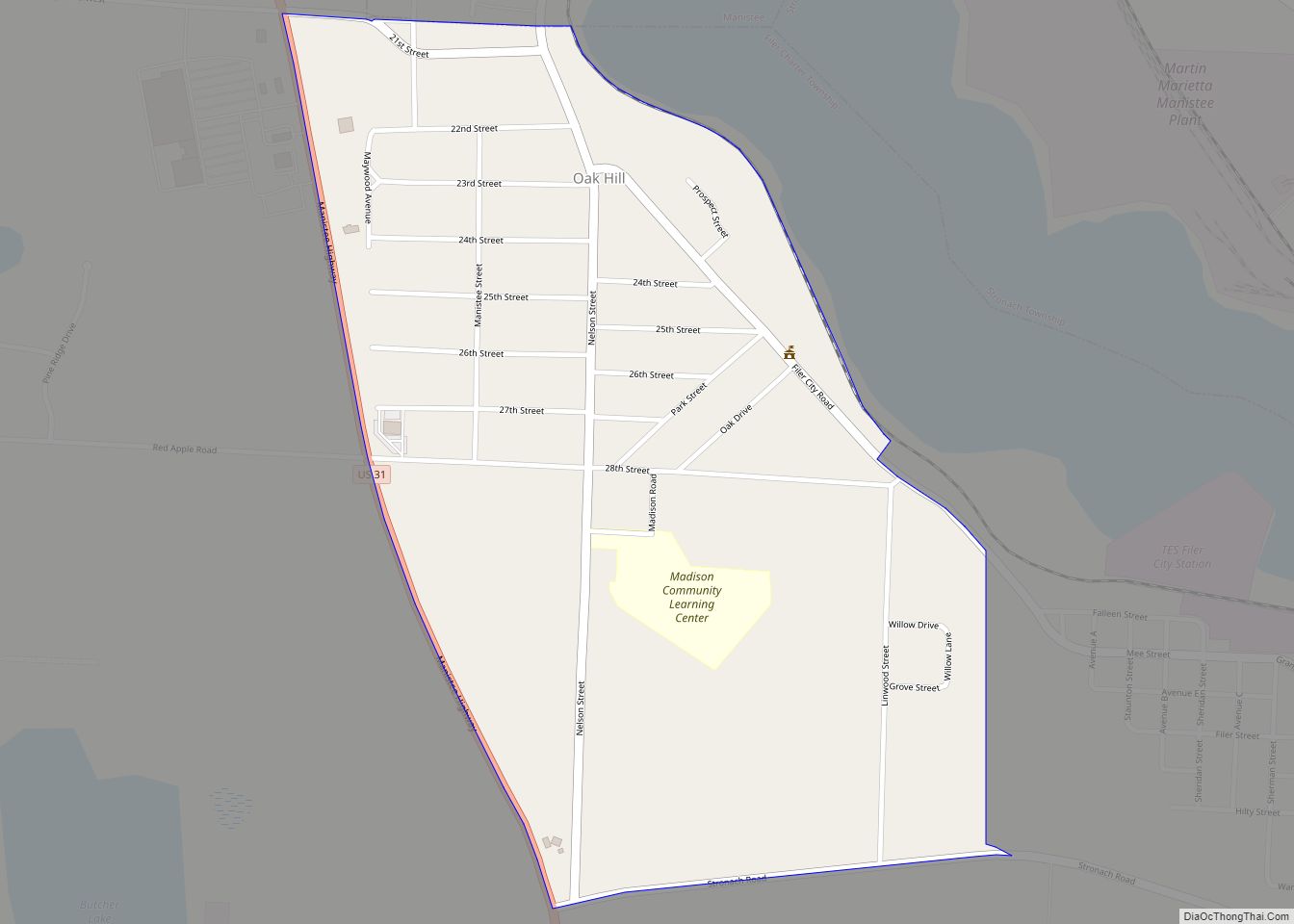
Online Interactive Map
Click on ![]() to view map in "full screen" mode.
to view map in "full screen" mode.
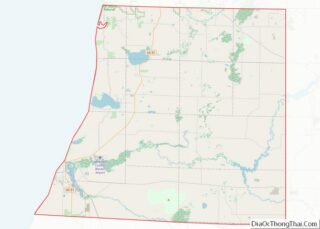
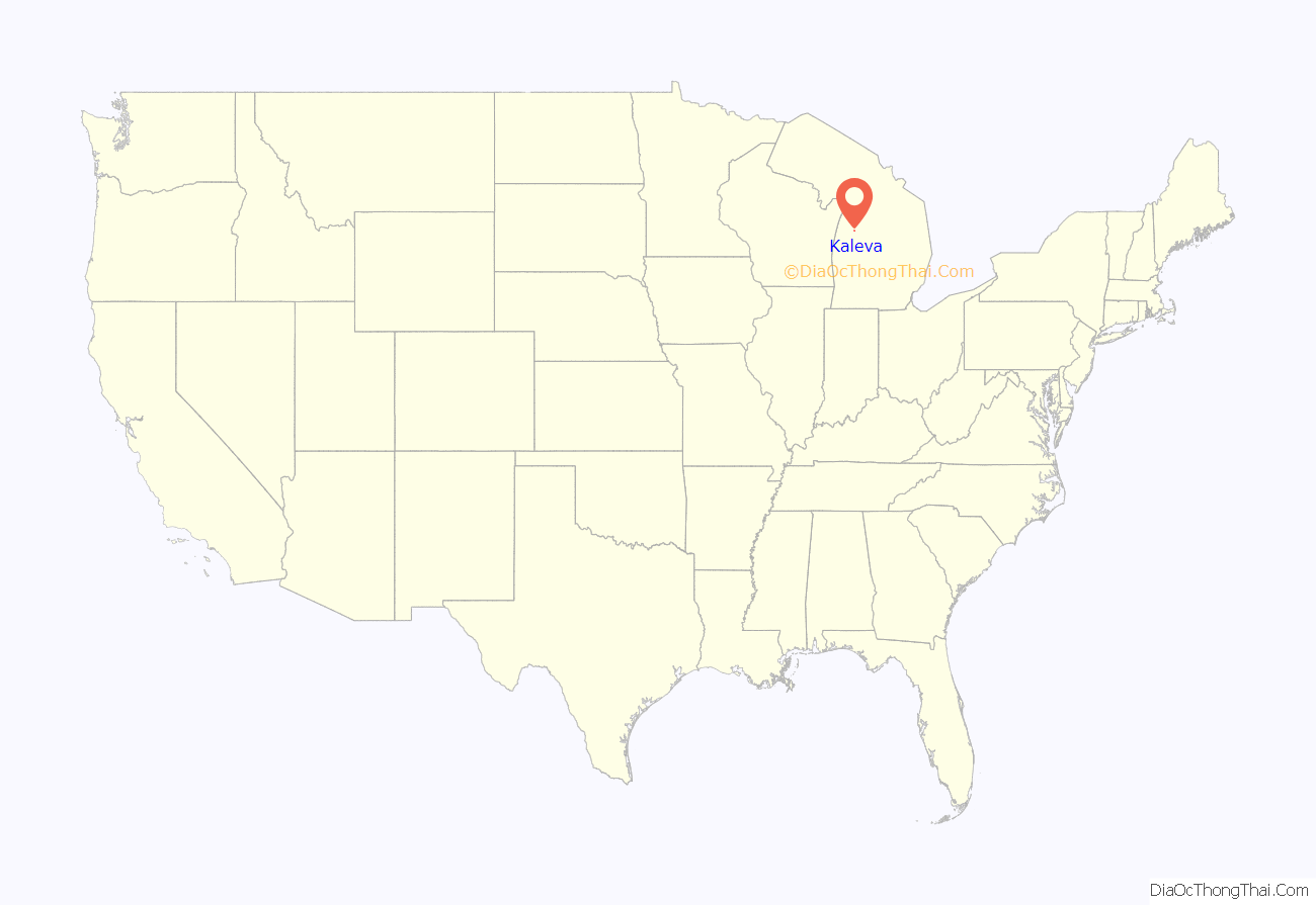
Kaleva location map. Where is Kaleva village?
History
- Kaleva was founded in 1900, and became a refuge for Finnish settlers. The name of the village comes from the Kalevala, the national epic of Finland.
- There is also now abandoned C&O Railroad Line from Manistee to Traverse City. There are no railroad tracks here today.
- There are two recognized Michigan historical markers in the town. The historic John J. Makinen Bottle House is one, and Kaleva itself is the subject of the second.
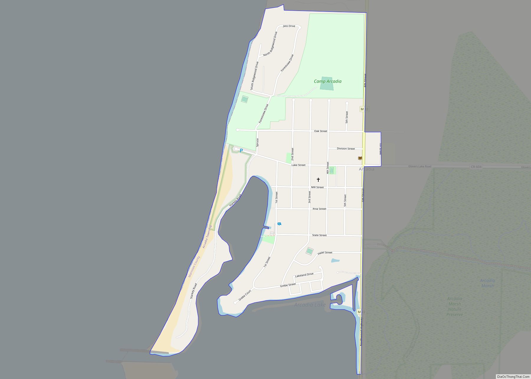
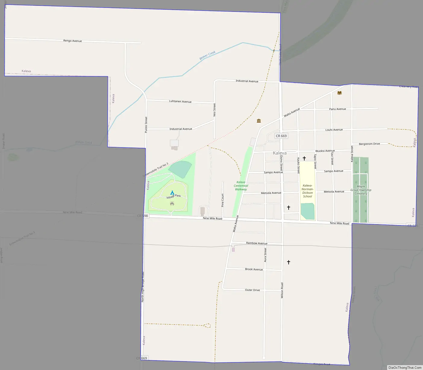
Kaleva Road Map
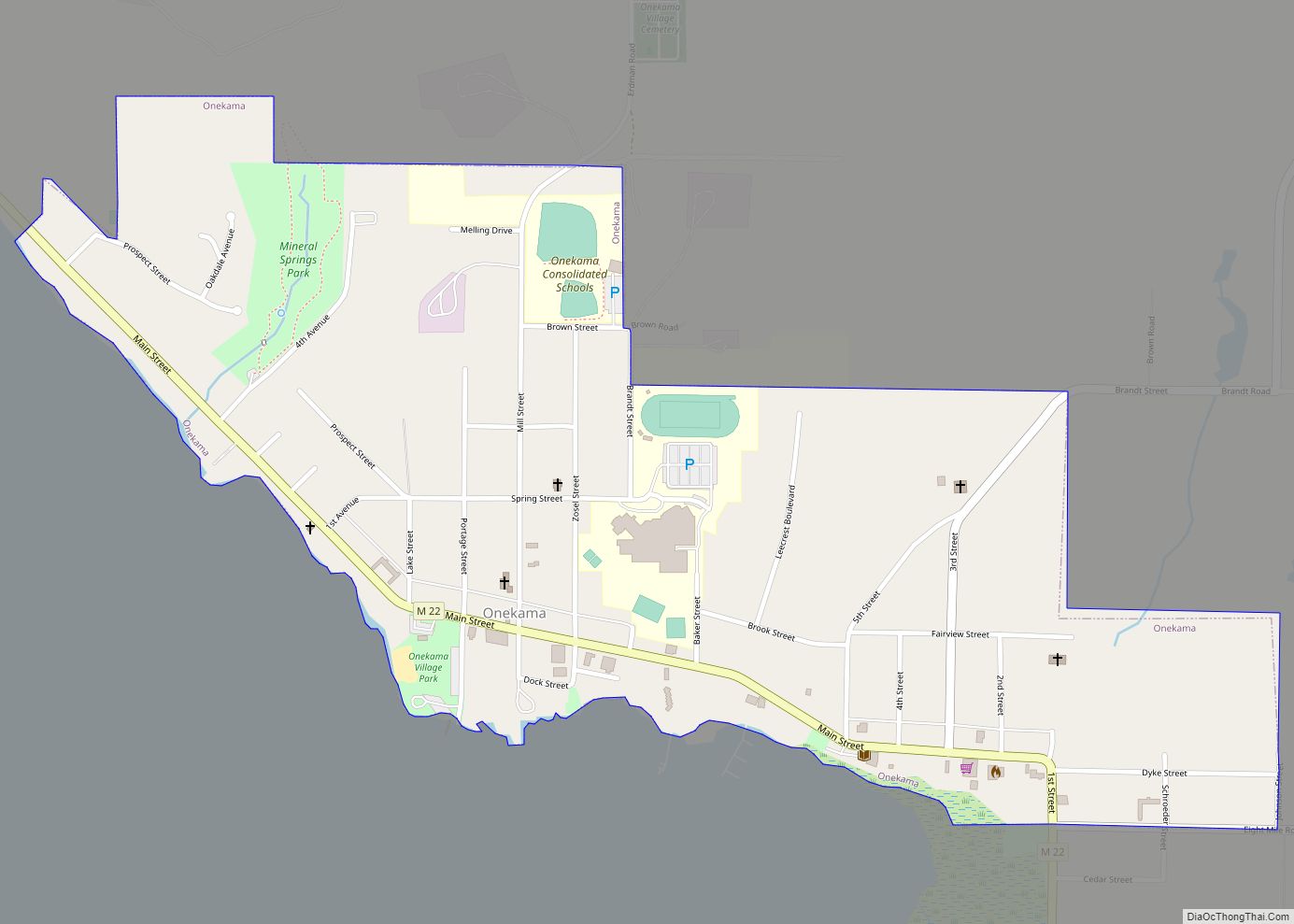
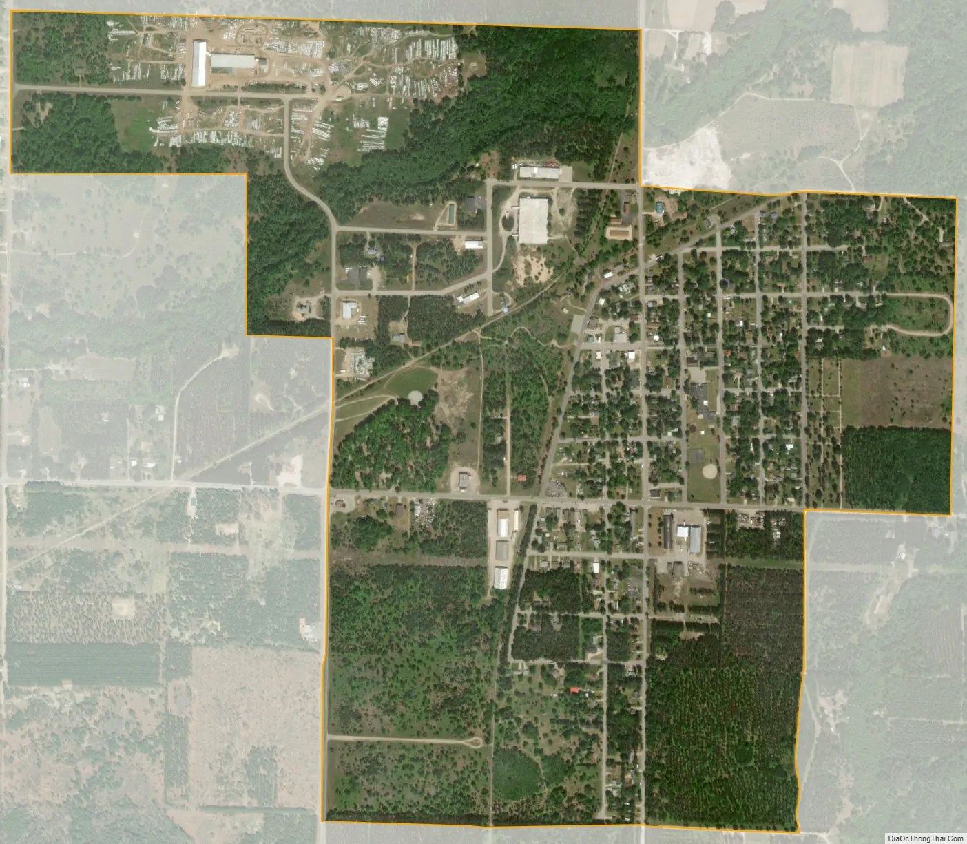
Kaleva city Satellite Map
Geography
- According to the United States Census Bureau, the village has a total area of 1.10 square miles (2.85 km), all land.
- Kaleva is part of Northern Michigan.
See also
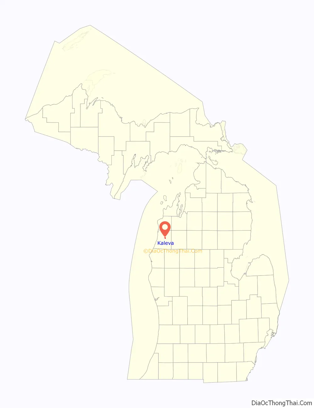
Map of Michigan State and its subdivision:- Alcona
- Alger
- Allegan
- Alpena
- Antrim
- Arenac
- Baraga
- Barry
- Bay
- Benzie
- Berrien
- Branch
- Calhoun
- Cass
- Charlevoix
- Cheboygan
- Chippewa
- Clare
- Clinton
- Crawford
- Delta
- Dickinson
- Eaton
- Emmet
- Genesee
- Gladwin
- Gogebic
- Grand Traverse
- Gratiot
- Hillsdale
- Houghton
- Huron
- Ingham
- Ionia
- Iosco
- Iron
- Isabella
- Jackson
- Kalamazoo
- Kalkaska
- Kent
- Keweenaw
- Lake
- Lake Hurron
- Lake Michigan
- Lake St. Clair
- Lake Superior
- Lapeer
- Leelanau
- Lenawee
- Livingston
- Luce
- Mackinac
- Macomb
- Manistee
- Marquette
- Mason
- Mecosta
- Menominee
- Midland
- Missaukee
- Monroe
- Montcalm
- Montmorency
- Muskegon
- Newaygo
- Oakland
- Oceana
- Ogemaw
- Ontonagon
- Osceola
- Oscoda
- Otsego
- Ottawa
- Presque Isle
- Roscommon
- Saginaw
- Saint Clair
- Saint Joseph
- Sanilac
- Schoolcraft
- Shiawassee
- Tuscola
- Van Buren
- Washtenaw
- Wayne
- Wexford
- Alabama
- Alaska
- Arizona
- Arkansas
- California
- Colorado
- Connecticut
- Delaware
- District of Columbia
- Florida
- Georgia
- Hawaii
- Idaho
- Illinois
- Indiana
- Iowa
- Kansas
- Kentucky
- Louisiana
- Maine
- Maryland
- Massachusetts
- Michigan
- Minnesota
- Mississippi
- Missouri
- Montana
- Nebraska
- Nevada
- New Hampshire
- New Jersey
- New Mexico
- New York
- North Carolina
- North Dakota
- Ohio
- Oklahoma
- Oregon
- Pennsylvania
- Rhode Island
- South Carolina
- South Dakota
- Tennessee
- Texas
- Utah
- Vermont
- Virginia
- Washington
- West Virginia
- Wisconsin
- Wyoming