Map of Bellevue village, Michigan

Map of Bellevue village, Michigan

Bellevue is a village in Eaton County in the U.S. state of Michigan. The population was 1,282 at the 2010 census. The village is located within Bellevue Township. Bellevue village overview: Name: Bellevue village LSAD Code: 47 LSAD Description: village (suffix) State: Michigan County: Eaton County Elevation: 863 ft (263 m) Total Area: 1.09 sq mi (2.83 km²) Land Area: … Read more

Map of Belleville city, Michigan

Map of Belleville city, Michigan

Belleville is a city in Wayne County in the U.S. state Michigan. The population was 3,991 at the 2010 census. As a western suburb of Metro Detroit, Belleville is 18 miles (29 km) southeast of Ann Arbor and 20 miles (32 km) southwest of Detroit. Belleville is located just south of Interstate 94 and is surrounded by … Read more

Map of Bellaire village

Map of Bellaire village, Michigan

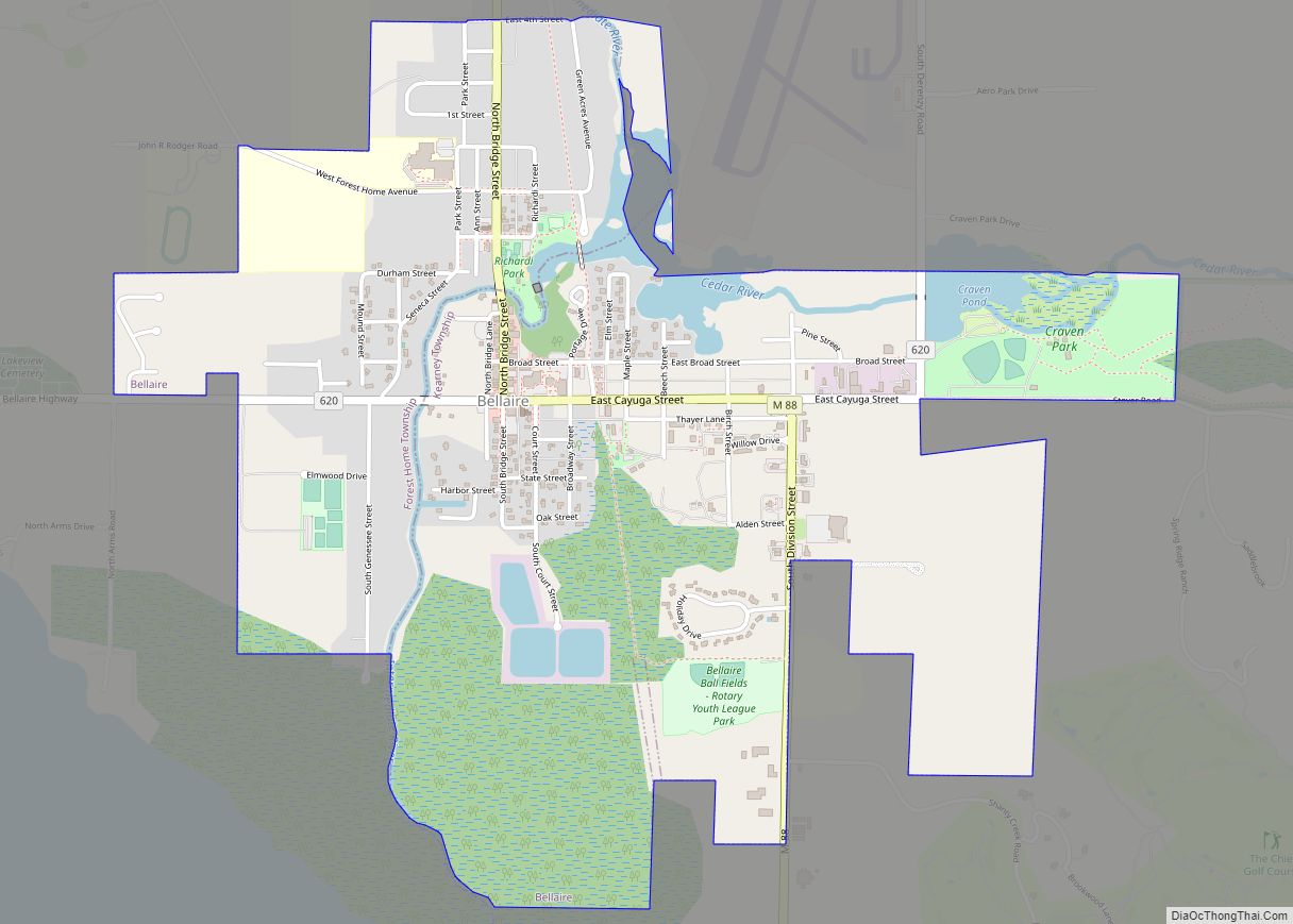
Bellaire (/ˈbɛlɛər/ bell-air) is a village in the U.S. state of Michigan. It is the county seat of Antrim County. The population was 1,053 in 2020 census. The village is split between Forest Home and Kearney townships. The historic Antrim County Courthouse is located in Bellaire. The Antrim Review, the county’s newspaper of record, is … Read more

Map of Berkley city, Michigan

Map of Berkley city, Michigan

Berkley is a city in Oakland County in the U.S. state of Michigan. It is a northern suburb of Detroit located along the Woodward Corridor (M-1) in southeastern Oakland County. The population was 15,194 as of the 2020 Census. Berkley city overview: Name: Berkley city LSAD Code: 25 LSAD Description: city (suffix) State: Michigan County: … Read more

Map of Benzonia village

Map of Benzonia village

Benzonia (/bɛnˈzoʊniə/ ben-ZOH-nee-ə) is a village in Benzie County in the U.S. state of Michigan. The population was 551 at the 2020 census, up from 497 at the 2010 census. The village is located within Benzonia Township at the southeast end of Crystal Lake on U.S. Highway 31 at the junction with M-115 west. Benzonia … Read more

Map of Benton Heights CDP

Map of Benton Heights CDP

Benton Heights is an unincorporated community in Berrien County in the U.S. state of Michigan. It is also a census-designated place (CDP) for statistical purposes without any legal status as an incorporated municipality. Per the 2020 Census, the population was 3,652.The community is a part of Benton Charter Township and is adjacent to the city … Read more

Map of Benton Harbor city

Map of Benton Harbor city

Benton Harbor is a city in Berrien County in the U.S. state of Michigan. It is 46 miles southwest of Kalamazoo and 71 miles southwest of Grand Rapids. According to the 2020 census, its population was 9,103. It is the smaller, by population, of the two principal cities in the Niles–Benton Harbor Metropolitan Statistical Area, … Read more

Map of Bendon CDP

Map of Bendon CDP

Bendon is an unincorporated community and census-designated place in Benzie County in the U.S. State of Michigan. The population was 208 at the 2010 census. Bendon is located within Inland Township. Bendon CDP overview: Name: Bendon CDP LSAD Code: 57 LSAD Description: CDP (suffix) State: Michigan County: Benzie County Elevation: 846 ft (258 m) Total Area: 2.00 sq mi … Read more

Map of Big Bay CDP

Map of Big Bay CDP

Big Bay is an unincorporated community in Marquette County of the U.S. state of Michigan. It is a census-designated place (CDP) for statistical purposes and does not have any legal status as an incorporated municipality. As of the 2020 census, the CDP had a population of 257. The community is located within Powell Township near … Read more

Map of Beverly Hills village, Michigan

Map of Beverly Hills village, Michigan

Beverly Hills is a village in Oakland County of the U.S. state of Michigan. It is a northern suburb of Metro Detroit and is about 5 miles (8.0 km) north of the city of Detroit. As of the 2010 census, the population was 10,267. Located within Southfield Township, Beverly Hills is by far the most populated … Read more

Map of Beulah village

Map of Beulah village, Michigan

Beulah (/ˈbjuːlə/ BYOO-lə) is a village in the U.S. state of Michigan. It is the county seat of Benzie County, and is located within Benzonia Township. The village had a population of 313 at the 2020 census. The village sits at the southeast end of Crystal Lake, and is immediately north of the village of … Read more

Map of Bessemer city, Michigan

Map of Bessemer city, Michigan

Bessemer is a city in the U.S. state of Michigan. As of the 2020 census, the city population was 1,805. It is the county seat of Gogebic County. The city is surrounded by Bessemer Township, but the two are administered autonomously. It is on U.S. Route 2 with Ironwood to the west and Wakefield to … Read more