Benton Harbor is a city in Berrien County in the U.S. state of Michigan. It is 46 miles southwest of Kalamazoo and 71 miles southwest of Grand Rapids. According to the 2020 census, its population was 9,103. It is the smaller, by population, of the two principal cities in the Niles–Benton Harbor Metropolitan Statistical Area, an area with 156,813 people. Benton Harbor and the city of St. Joseph are separated by the St. Joseph River and are known locally as the “Twin Cities”. Fairplain and Benton Heights are unincorporated areas adjacent to Benton Harbor.
| Name: | Benton Harbor city |
|---|---|
| LSAD Code: | 25 |
| LSAD Description: | city (suffix) |
| State: | Michigan |
| County: | Berrien County |
| Incorporated: | 1837 (village) 1891 (city) |
| Elevation: | 591 ft (180 m) |
| Total Area: | 4.63 sq mi (12.00 km²) |
| Land Area: | 4.38 sq mi (11.35 km²) |
| Water Area: | 0.25 sq mi (0.65 km²) |
| Total Population: | 9,103 |
| Population Density: | 2,077.84/sq mi (802.27/km²) |
| Area code: | 269 |
| FIPS code: | 2607520 |
| GNISfeature ID: | 0621144 |
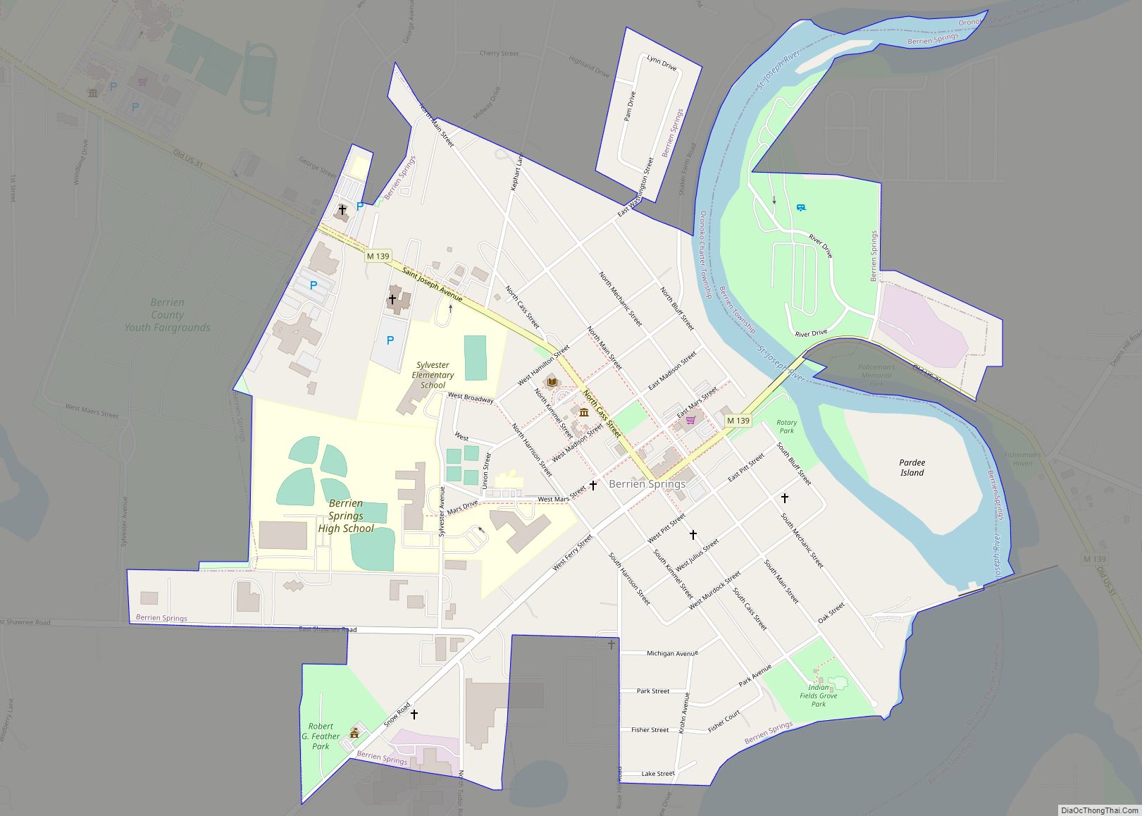
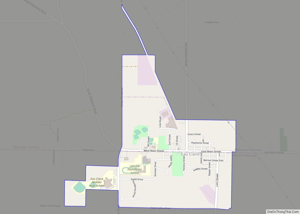
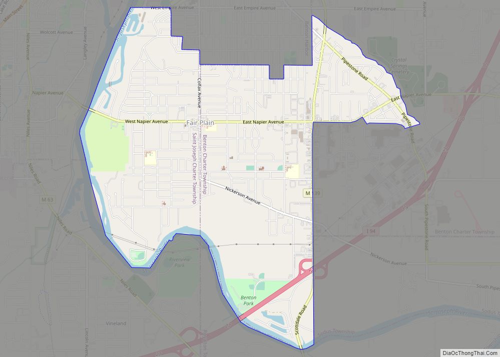
Online Interactive Map
Click on ![]() to view map in "full screen" mode.
to view map in "full screen" mode.
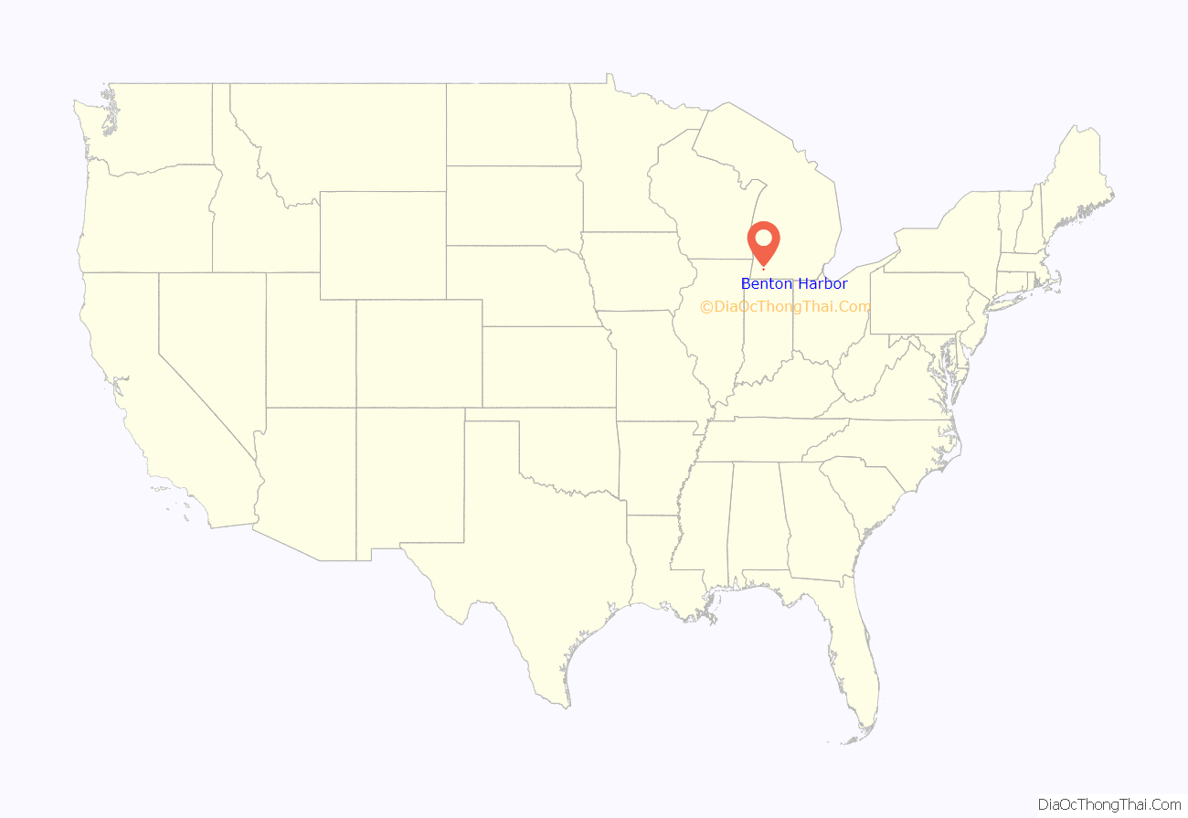
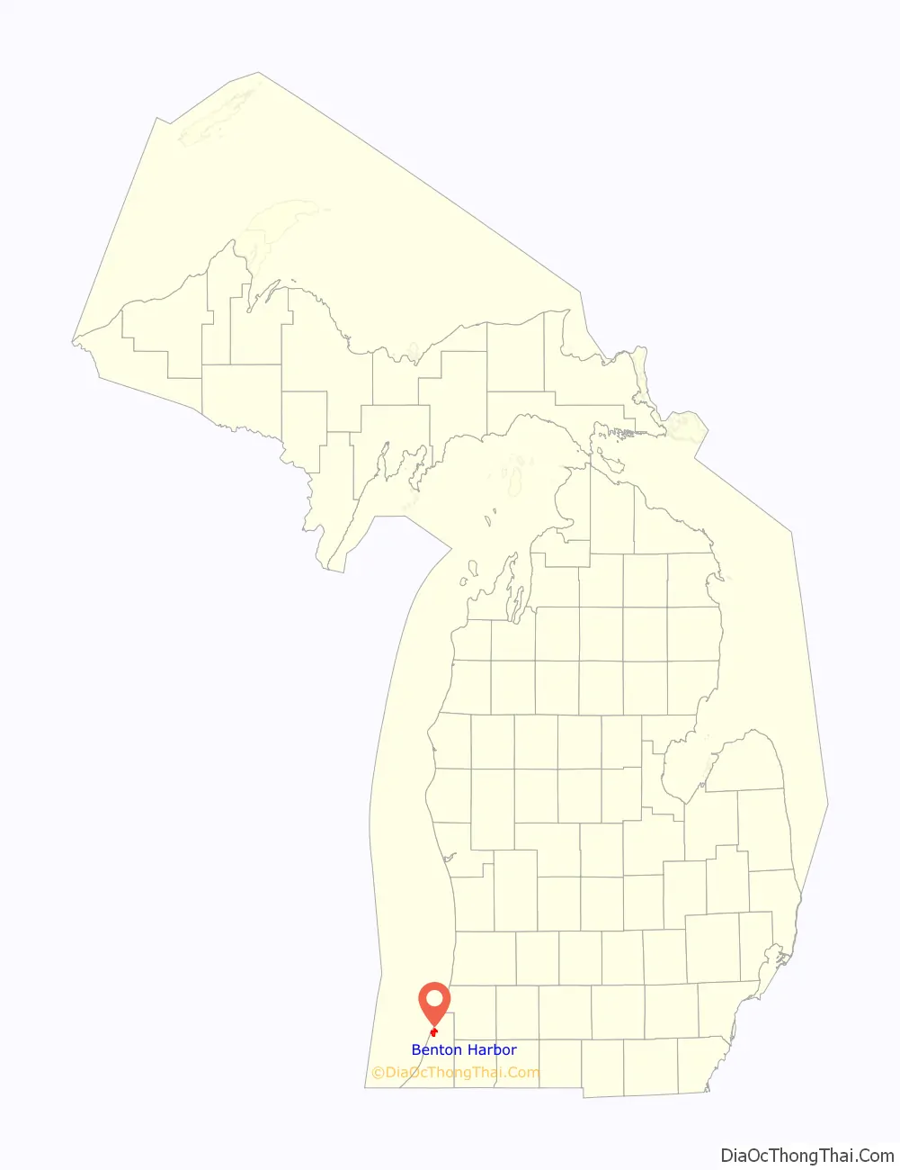
Benton Harbor location map. Where is Benton Harbor city?
History
Benton Harbor was founded by Henry C. Morton, Sterne Brunson and Charles Hull, who all now have or have had schools named after them. Benton Harbor was mainly wetlands bordered by the Paw Paw River, through which a canal was built, hence the “harbor” in the city’s name. In 1860, the village was laid out by Brunson, Morton, Hull and others, and given the name Brunson Harbor.
Brunson, Morton, and Hull also donated land and solicited subscriptions for construction of the canal, which was completed in 1862. It had long been recognized that a canal would be crucial to the town’s development, both to drain the marsh and to provide a berthing area for ships. The canal, originally 25 feet (7.6 m) wide but expanded to 50 feet (15 m) in 1868, led to the town’s becoming a shipping and manufacturing center for the area.
In 1866, the settlement’s name was changed to Benton Harbor in honor of Thomas Hart Benton, a Missouri Senator who helped Michigan achieve statehood. In 1836, Benton Harbor was organized as a village and in 1891 it was incorporated as a city.
The House of David religious group was founded there and once ran a local amusement park.
21st century
The Benton Harbor riots occurred in 1966 and 2003. The first followed a fatal shooting, the second a fatal police pursuit. Several other riots also occurred in the intervening periods.
As with the 2014–2019 public health crisis involving the drinking water in Flint, in 2018 higher-than-acceptable levels of lead were found in Benton Harbor’s tap water. Water was starting to appear “bubbly and white” to “brown”, with a “horrible” taste and poor smell. This was due to lead-based water service lines. Testing found the samples returned lead levels of 22 parts per billion, greater than the 20 parts per billion in Flint and the federal lead action level of 15 parts per billion. High levels of copper were also noted in the annual consumer confidence reports that have been required by Environmental Protection Agency.
Concerns were with the health impacts of lead poisoning. As a result, residents were supplied with free bottled water, including for use with brushing teeth and cooking, for residences and schools. In September 2021, $10 million was budgeted to replace the lead service lines.
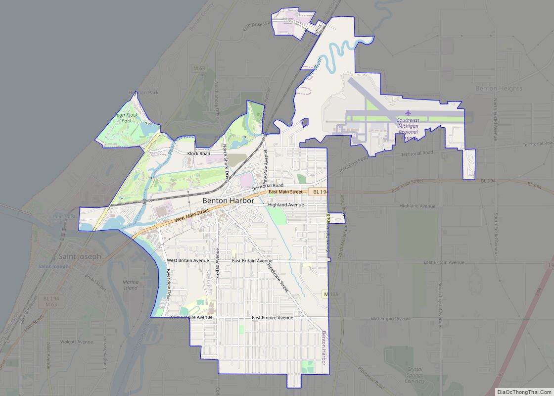
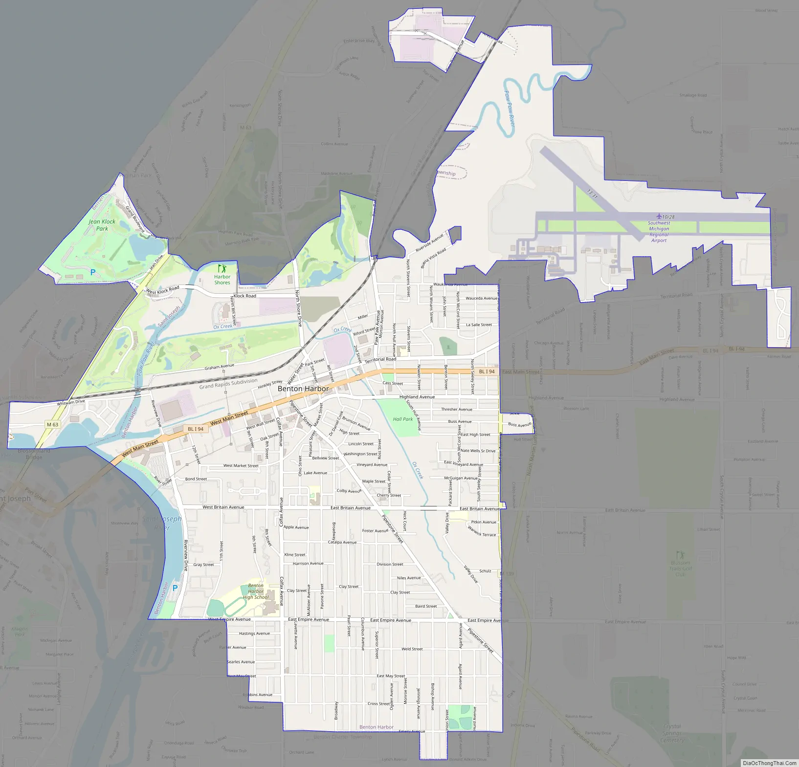
Benton Harbor Road Map
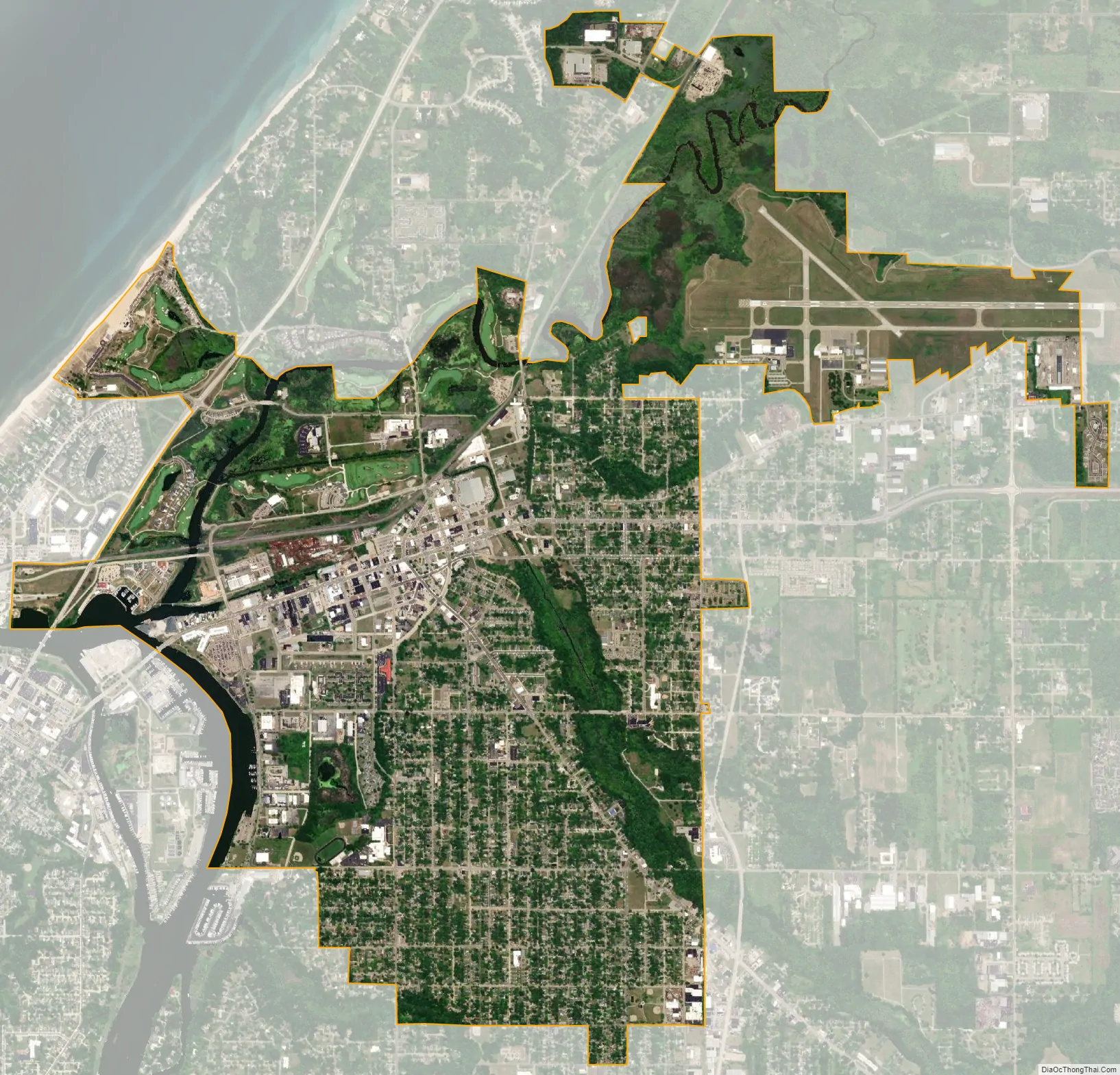
Benton Harbor city Satellite Map
Geography
According to the United States Census Bureau, the city has an area of 4.68 square miles (12.12 km), of which 4.43 square miles (11.47 km) is land and 0.25 square miles (0.65 km) is water.
Climate
Benton Harbor has a humid continental climate (Köppen: Dfa) that has very warm summers for the type and also less cold winters than many climates of the classification. Due to lake-effect snow there is very high snowfall relative to precipitation in winter, but far lower than some locations that are farther north in the state. Summer high temperatures range from 77 to 83 °F (25 to 28 °C) from June to August, but the apparent heat is normally moderated by mild nights.
See also
Map of Michigan State and its subdivision:- Alcona
- Alger
- Allegan
- Alpena
- Antrim
- Arenac
- Baraga
- Barry
- Bay
- Benzie
- Berrien
- Branch
- Calhoun
- Cass
- Charlevoix
- Cheboygan
- Chippewa
- Clare
- Clinton
- Crawford
- Delta
- Dickinson
- Eaton
- Emmet
- Genesee
- Gladwin
- Gogebic
- Grand Traverse
- Gratiot
- Hillsdale
- Houghton
- Huron
- Ingham
- Ionia
- Iosco
- Iron
- Isabella
- Jackson
- Kalamazoo
- Kalkaska
- Kent
- Keweenaw
- Lake
- Lake Hurron
- Lake Michigan
- Lake St. Clair
- Lake Superior
- Lapeer
- Leelanau
- Lenawee
- Livingston
- Luce
- Mackinac
- Macomb
- Manistee
- Marquette
- Mason
- Mecosta
- Menominee
- Midland
- Missaukee
- Monroe
- Montcalm
- Montmorency
- Muskegon
- Newaygo
- Oakland
- Oceana
- Ogemaw
- Ontonagon
- Osceola
- Oscoda
- Otsego
- Ottawa
- Presque Isle
- Roscommon
- Saginaw
- Saint Clair
- Saint Joseph
- Sanilac
- Schoolcraft
- Shiawassee
- Tuscola
- Van Buren
- Washtenaw
- Wayne
- Wexford
- Alabama
- Alaska
- Arizona
- Arkansas
- California
- Colorado
- Connecticut
- Delaware
- District of Columbia
- Florida
- Georgia
- Hawaii
- Idaho
- Illinois
- Indiana
- Iowa
- Kansas
- Kentucky
- Louisiana
- Maine
- Maryland
- Massachusetts
- Michigan
- Minnesota
- Mississippi
- Missouri
- Montana
- Nebraska
- Nevada
- New Hampshire
- New Jersey
- New Mexico
- New York
- North Carolina
- North Dakota
- Ohio
- Oklahoma
- Oregon
- Pennsylvania
- Rhode Island
- South Carolina
- South Dakota
- Tennessee
- Texas
- Utah
- Vermont
- Virginia
- Washington
- West Virginia
- Wisconsin
- Wyoming