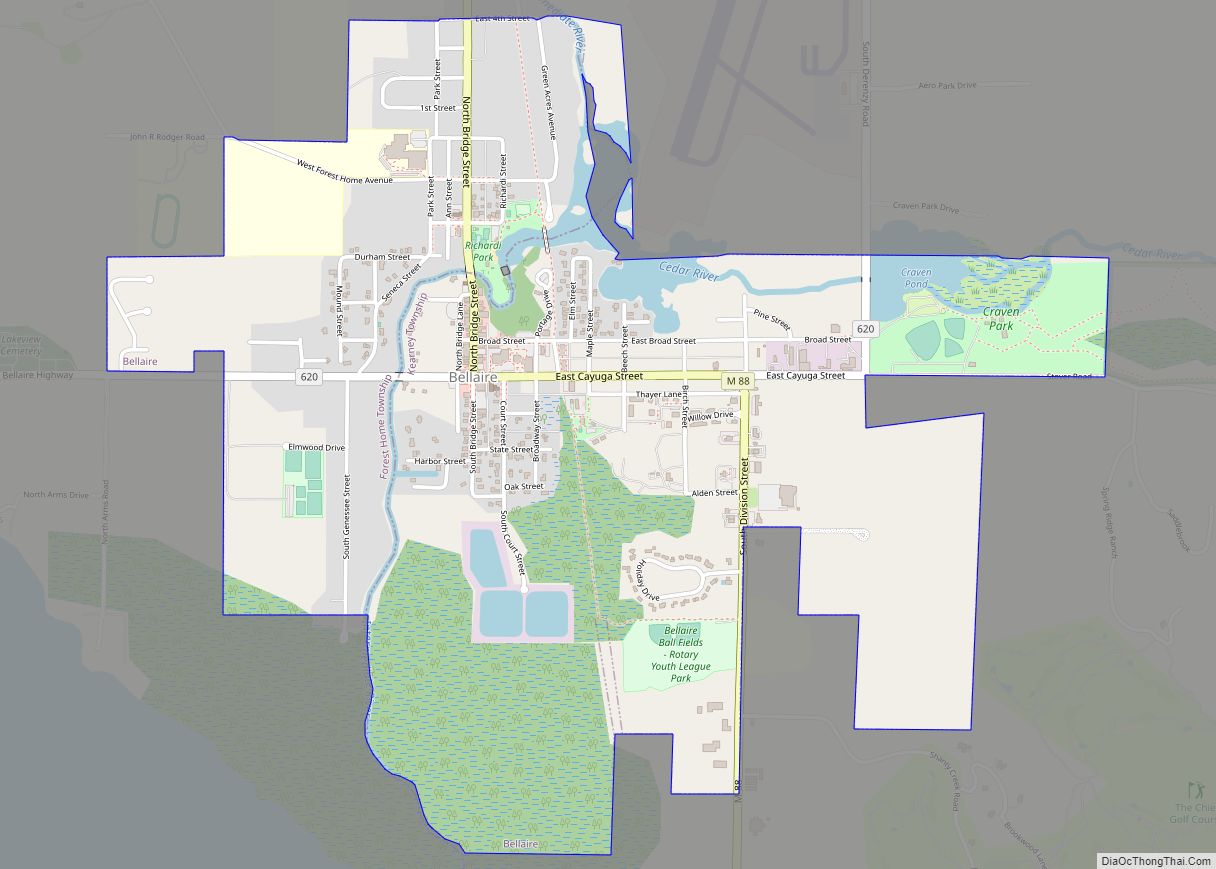
Bellaire (/ˈbɛlɛər/ bell-air) is a village in the U.S. state of Michigan. It is the county seat of Antrim County. The population was 1,053 in 2020 census.
The village is split between Forest Home and Kearney townships. The historic Antrim County Courthouse is located in Bellaire. The Antrim Review, the county’s newspaper of record, is headquartered in Bellaire.
| Name: | Bellaire village |
|---|---|
| LSAD Code: | 47 |
| LSAD Description: | village (suffix) |
| State: | Michigan |
| County: | Antrim County |
| Incorporated: | 1891 |
| Elevation: | 627 ft (191 m) |
| Total Area: | 2.01 sq mi (5.21 km²) |
| Land Area: | 1.87 sq mi (4.84 km²) |
| Water Area: | 0.14 sq mi (0.37 km²) |
| Total Population: | 1,053 |
| Population Density: | 563.70/sq mi (217.69/km²) |
| Area code: | 231 |
| FIPS code: | 2606980 |
| GNISfeature ID: | 2398074 |
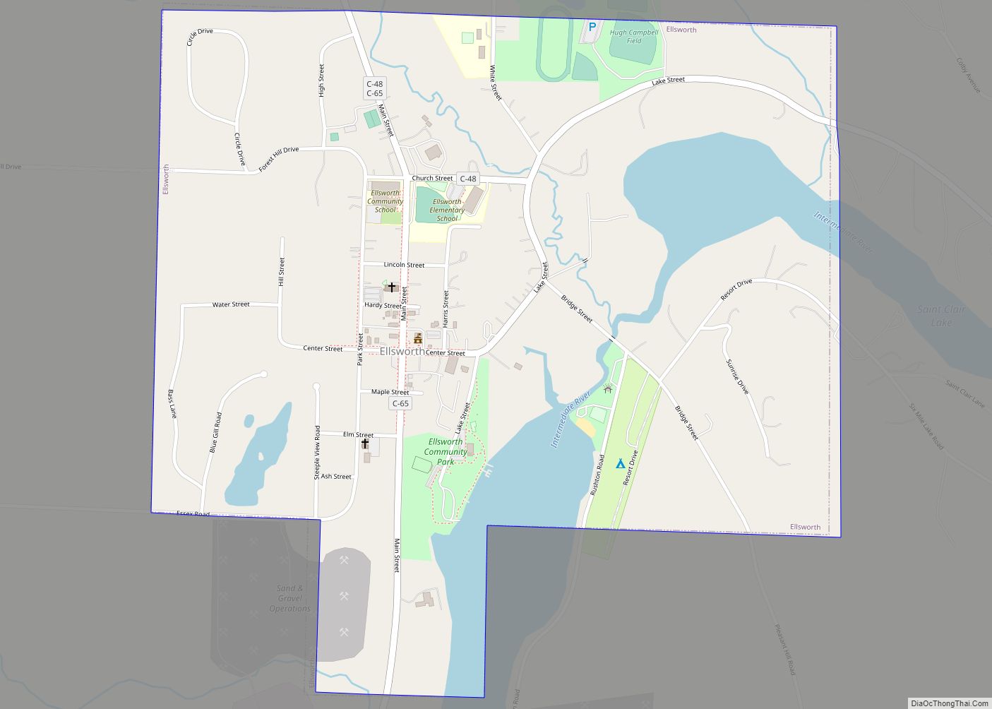
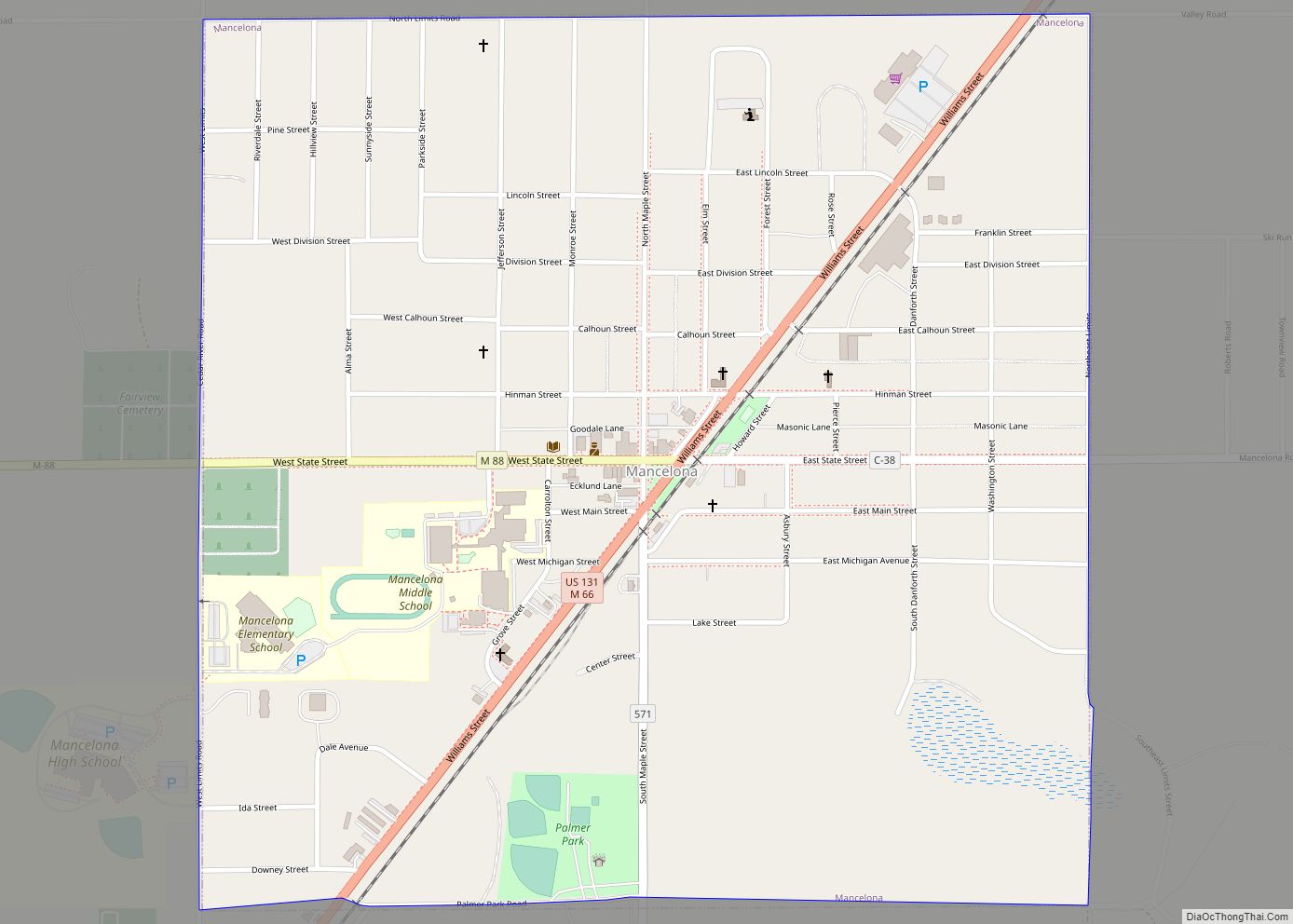
Online Interactive Map
Click on ![]() to view map in "full screen" mode.
to view map in "full screen" mode.
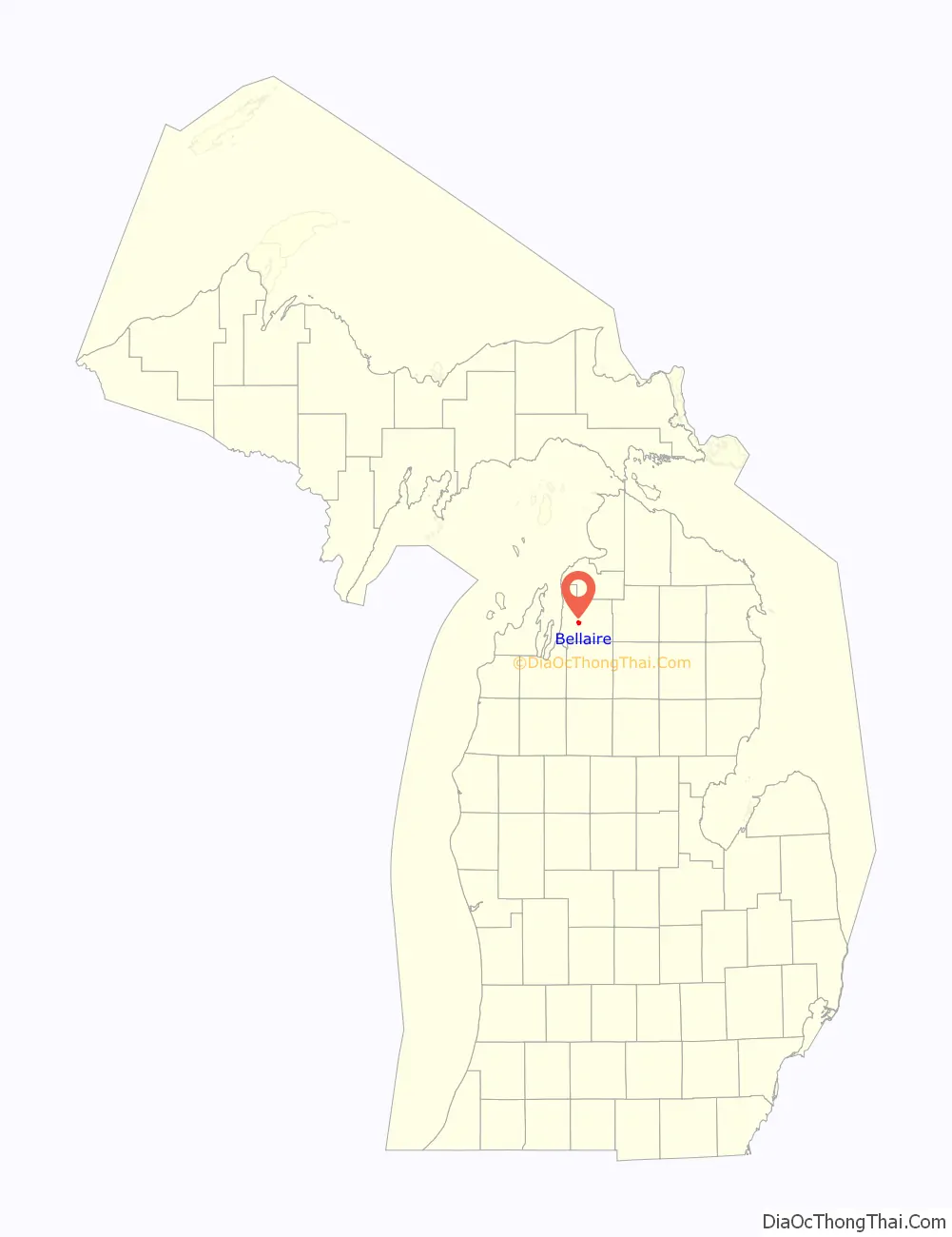
Bellaire location map. Where is Bellaire village?

History
The Bellaire post office opened under the name Keno on June 20, 1879 and changed to Bellaire on May 26, 1880. Also, in 1880, Bellaire became the county seat of Antrim County, a position that Elk Rapids had previously had. The Chicago & West Michigan Railroad built a depot in Bellaire in 1891, and the East Jordan & Southern Railroad built another line into the town in 1901. For years, Bellaire was a major railroad center in Antrim County, so the town attracted many industrial corporations. For example, the wooden bowl company (which made wooded utensils) built a factory in Bellaire because of the ease of transportation. Bellaire remained a transportation center until 1962, when the East Jordan and Southern abandoned their trackage through Bellaire, and the Chesapeake & Ohio Railway (which was using the former Chicago and West Michigan line) followed suit in 1982. Bellaire is home to the Short’s Brewing Company.
Bellaire Road Map

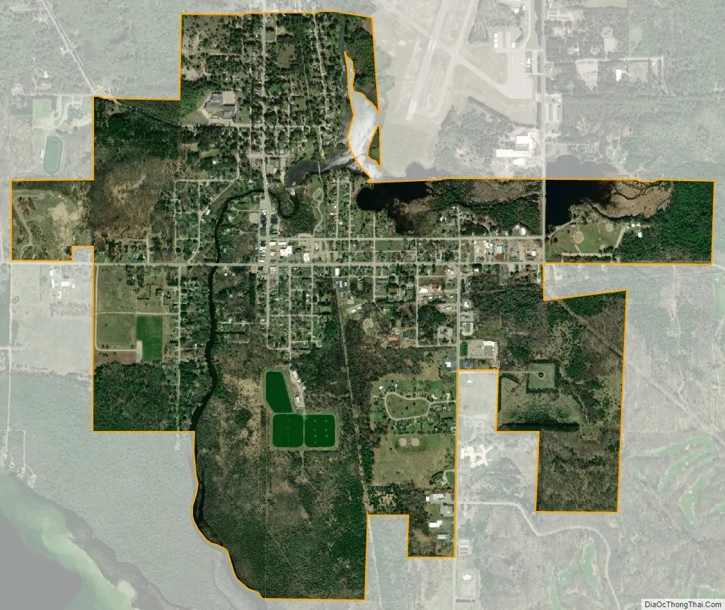
Bellaire city Satellite Map
Geography
The village is located on the boundary between Forest Home Township on the west and Kearney Township on the east, separated by the Intermediate River with the larger portion within Kearney Township. The Bellaire ZIP code, 49615, serves large portions of both townships, as well as portions of Central Lake Township to the north, Chestonia Township to the east, Custer Township to the south, and Helena Township to the southwest.
M-88 passes through the village, with Central Lake approximately 8 miles to the north and Mancelona approximately 10 miles to the southeast.
According to the United States Census Bureau, the village has a total area of 1.97 square miles (5.10 km), of which, 1.84 square miles (4.77 km) of it is land and 0.13 square miles (0.34 km) is water.
See also
Map of Michigan State and its subdivision:- Alcona
- Alger
- Allegan
- Alpena
- Antrim
- Arenac
- Baraga
- Barry
- Bay
- Benzie
- Berrien
- Branch
- Calhoun
- Cass
- Charlevoix
- Cheboygan
- Chippewa
- Clare
- Clinton
- Crawford
- Delta
- Dickinson
- Eaton
- Emmet
- Genesee
- Gladwin
- Gogebic
- Grand Traverse
- Gratiot
- Hillsdale
- Houghton
- Huron
- Ingham
- Ionia
- Iosco
- Iron
- Isabella
- Jackson
- Kalamazoo
- Kalkaska
- Kent
- Keweenaw
- Lake
- Lake Hurron
- Lake Michigan
- Lake St. Clair
- Lake Superior
- Lapeer
- Leelanau
- Lenawee
- Livingston
- Luce
- Mackinac
- Macomb
- Manistee
- Marquette
- Mason
- Mecosta
- Menominee
- Midland
- Missaukee
- Monroe
- Montcalm
- Montmorency
- Muskegon
- Newaygo
- Oakland
- Oceana
- Ogemaw
- Ontonagon
- Osceola
- Oscoda
- Otsego
- Ottawa
- Presque Isle
- Roscommon
- Saginaw
- Saint Clair
- Saint Joseph
- Sanilac
- Schoolcraft
- Shiawassee
- Tuscola
- Van Buren
- Washtenaw
- Wayne
- Wexford
- Alabama
- Alaska
- Arizona
- Arkansas
- California
- Colorado
- Connecticut
- Delaware
- District of Columbia
- Florida
- Georgia
- Hawaii
- Idaho
- Illinois
- Indiana
- Iowa
- Kansas
- Kentucky
- Louisiana
- Maine
- Maryland
- Massachusetts
- Michigan
- Minnesota
- Mississippi
- Missouri
- Montana
- Nebraska
- Nevada
- New Hampshire
- New Jersey
- New Mexico
- New York
- North Carolina
- North Dakota
- Ohio
- Oklahoma
- Oregon
- Pennsylvania
- Rhode Island
- South Carolina
- South Dakota
- Tennessee
- Texas
- Utah
- Vermont
- Virginia
- Washington
- West Virginia
- Wisconsin
- Wyoming