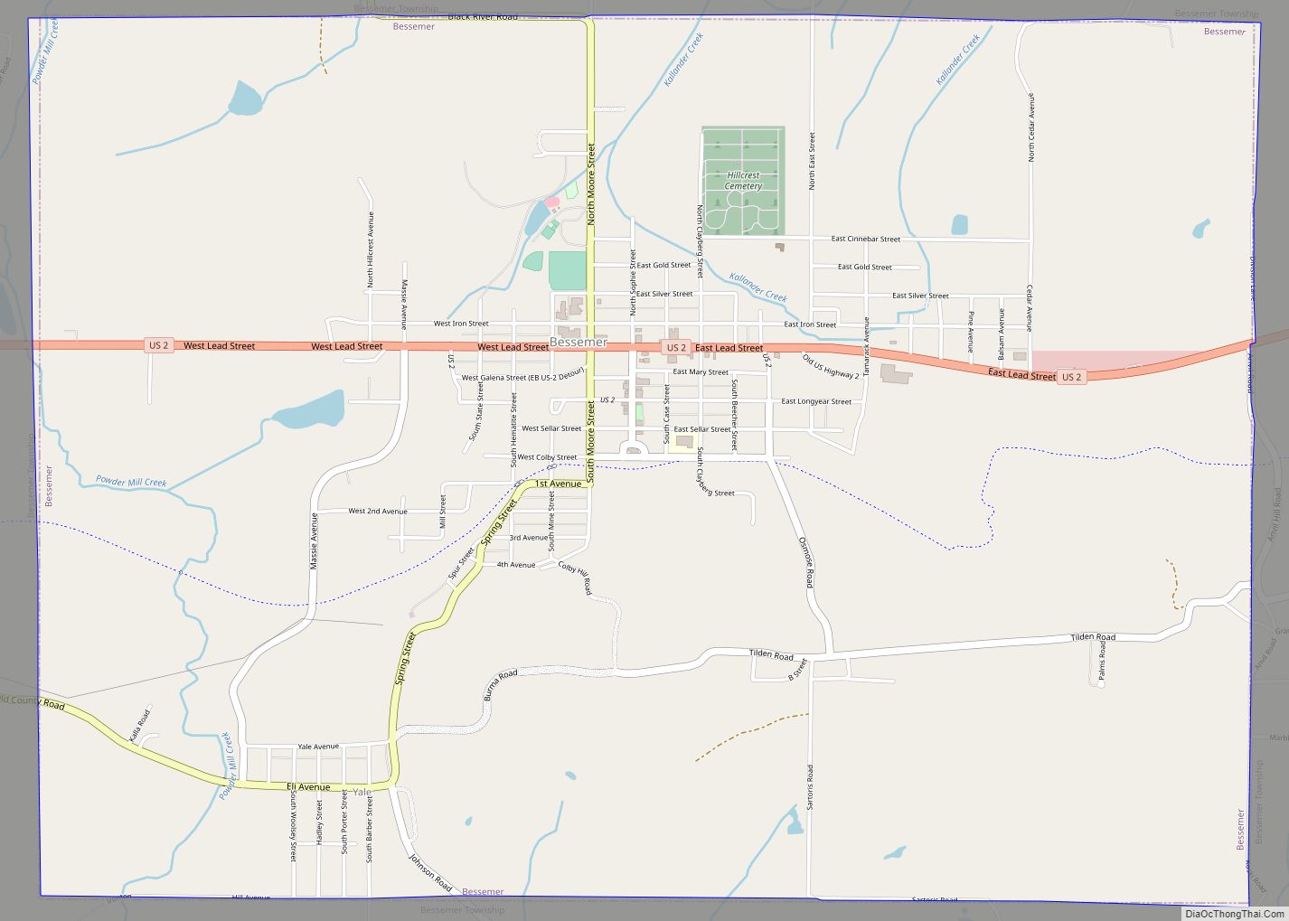
Bessemer is a city in the U.S. state of Michigan. As of the 2020 census, the city population was 1,805. It is the county seat of Gogebic County.
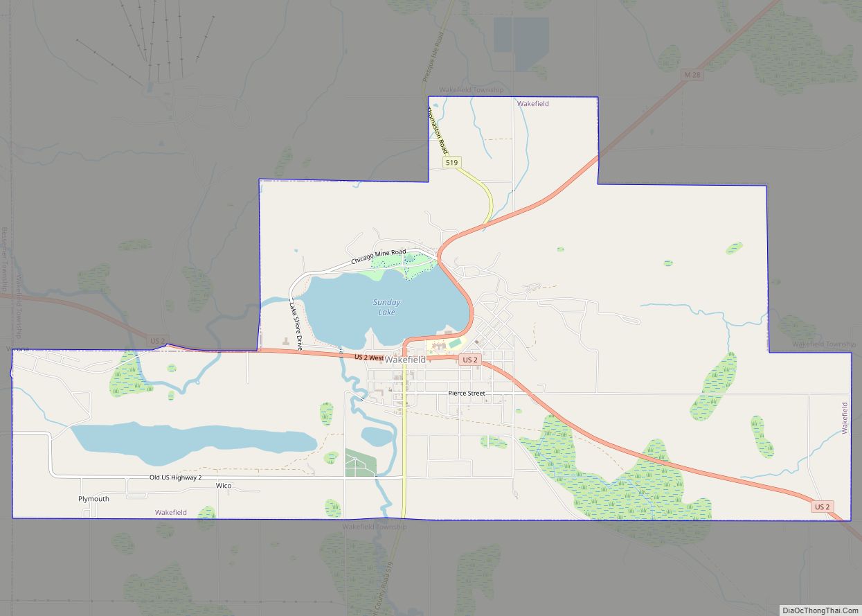
The city is surrounded by Bessemer Township, but the two are administered autonomously. It is on U.S. Route 2 with Ironwood to the west and Wakefield to the east. The Big Powderhorn and Snow River ski resorts are located within a few miles of Bessemer. Cross-country skiing and snowmobiling are also very popular in this area, due to lake-effect snow influenced by nearby Lake Superior; the area is often referred to as “Big Snow Country.” Recreational opportunities in the summer months include Bluff Valley Park, the scenic Black River Falls, and access to the Iron Belle Trail.
| Name: | Bessemer city |
|---|---|
| LSAD Code: | 25 |
| LSAD Description: | city (suffix) |
| State: | Michigan |
| County: | Gogebic County |
| Incorporated: | 1887 (village) 1889 (city) |
| Elevation: | 1,424 ft (434 m) |
| Total Area: | 5.50 sq mi (14.24 km²) |
| Land Area: | 5.50 sq mi (14.24 km²) |
| Water Area: | 0.00 sq mi (0.00 km²) |
| Total Population: | 1,805 |
| Population Density: | 328.24/sq mi (126.74/km²) |
| Area code: | 906 |
| FIPS code: | 2607960 |
| GNISfeature ID: | 0621184 |
Online Interactive Map
Click on ![]() to view map in "full screen" mode.
to view map in "full screen" mode.
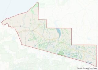
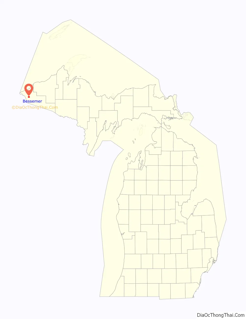
Bessemer location map. Where is Bessemer city?

History
In 1880, a hunter and trapper Richard Langford, discovered iron ore under an overturned birch tree. However, Captain N. D. Moore is credited with disclosing the ore which led to the development of the Colby property. Mining began in 1883. By 1884, the Milwaukee Lake Shore and Western Railroad (later the Chicago and Northwestern) was being built from Antigo, WI to Ashland, WI by way of the new mines. The railroad company plotted the town of Bessemer in 1884. On June 4, 1886 Gogebic County was separated from Ontonagon County. In March 1887, 360 voting members assembled and voted to organize the village of Bessemer. In the same year Gogebic County was officially created by the Michigan Legislature. Also in the year Bessemer and Ironwood called an election to see which city would be the county seat and also have the Gogebic County Courthouse. Ironwood men traveling to Bessemer to vote were made drunk and the train did not stop at the voting site. Ironwood lost and Bessemer gained the county seat. From 1884 to December 31, 1958, a period of seventy-five years, the iron ore shipment from all of Gogebic County totaled over 245 million tons. In 1966 the last mine in Bessemer, the Peterson Mine, closed. Many left the area to work in car factories in Kenosha, and the local economy underwent a serious decline.
Bessemer is named for Sir Henry Bessemer (1813-1898), English inventor of steel manufacturing.
Bessemer Road Map

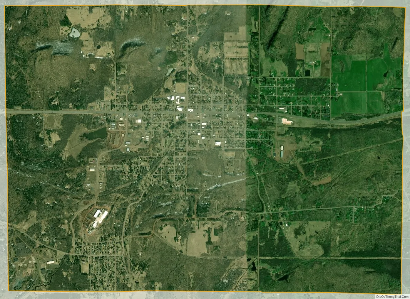
Bessemer city Satellite Map
Geography
According to the United States Census Bureau, the city has a total area of 5.47 square miles (14.17 km), all land. Majority of Bessemer is situated on the north side of Colby Hill and the city consists of many hills and valleys.
See also
Map of Michigan State and its subdivision:- Alcona
- Alger
- Allegan
- Alpena
- Antrim
- Arenac
- Baraga
- Barry
- Bay
- Benzie
- Berrien
- Branch
- Calhoun
- Cass
- Charlevoix
- Cheboygan
- Chippewa
- Clare
- Clinton
- Crawford
- Delta
- Dickinson
- Eaton
- Emmet
- Genesee
- Gladwin
- Gogebic
- Grand Traverse
- Gratiot
- Hillsdale
- Houghton
- Huron
- Ingham
- Ionia
- Iosco
- Iron
- Isabella
- Jackson
- Kalamazoo
- Kalkaska
- Kent
- Keweenaw
- Lake
- Lake Hurron
- Lake Michigan
- Lake St. Clair
- Lake Superior
- Lapeer
- Leelanau
- Lenawee
- Livingston
- Luce
- Mackinac
- Macomb
- Manistee
- Marquette
- Mason
- Mecosta
- Menominee
- Midland
- Missaukee
- Monroe
- Montcalm
- Montmorency
- Muskegon
- Newaygo
- Oakland
- Oceana
- Ogemaw
- Ontonagon
- Osceola
- Oscoda
- Otsego
- Ottawa
- Presque Isle
- Roscommon
- Saginaw
- Saint Clair
- Saint Joseph
- Sanilac
- Schoolcraft
- Shiawassee
- Tuscola
- Van Buren
- Washtenaw
- Wayne
- Wexford
- Alabama
- Alaska
- Arizona
- Arkansas
- California
- Colorado
- Connecticut
- Delaware
- District of Columbia
- Florida
- Georgia
- Hawaii
- Idaho
- Illinois
- Indiana
- Iowa
- Kansas
- Kentucky
- Louisiana
- Maine
- Maryland
- Massachusetts
- Michigan
- Minnesota
- Mississippi
- Missouri
- Montana
- Nebraska
- Nevada
- New Hampshire
- New Jersey
- New Mexico
- New York
- North Carolina
- North Dakota
- Ohio
- Oklahoma
- Oregon
- Pennsylvania
- Rhode Island
- South Carolina
- South Dakota
- Tennessee
- Texas
- Utah
- Vermont
- Virginia
- Washington
- West Virginia
- Wisconsin
- Wyoming