Map of Calcutta CDP

Map of Calcutta CDP

Calcutta is an unincorporated community and census-designated place in southeastern Columbiana County, Ohio, United States. The population was 3,941 at the 2020 census. It is part of the Salem micropolitan area, 30 miles (48 km) south of Youngstown and 35 miles (56 km) northwest of Pittsburgh. Historically a rural town, Calcutta grew as businesses from neighboring East … Read more

Map of Cairo village, Ohio

Map of Cairo village, Ohio

Cairo (/ˈkɛəroʊ/ KAIR-oh) is a village in Allen County, Ohio, United States. As of the 2020 census it had a population of 517. It is included in the Lima Metropolitan Statistical Area. Cairo village overview: Name: Cairo village LSAD Code: 47 LSAD Description: village (suffix) State: Ohio County: Allen County Elevation: 814 ft (248 m) Total Area: … Read more

Map of Cadiz village, Ohio

Map of Cadiz village, Ohio

Cadiz (/ˈkædɪs/ KAD-iss) is a village in and the county seat of Harrison County, Ohio, United States, located about 20 miles southwest of Steubenville. The population was 3,051 at the 2020 census. Cadiz village overview: Name: Cadiz village LSAD Code: 47 LSAD Description: village (suffix) State: Ohio County: Harrison County Elevation: 1,263 ft (385 m) Total Area: … Read more

Map of Byesville village

Map of Byesville village

Byesville /ˈbaɪzvɪl/ is a village in Guernsey County, Ohio, United States, along Wills Creek. The population was 2,438 at the 2010 census. Byesville village overview: Name: Byesville village LSAD Code: 47 LSAD Description: village (suffix) State: Ohio County: Guernsey County Incorporated: 1882 Elevation: 817 ft (249 m) Total Area: 1.21 sq mi (3.12 km²) Land Area: 1.20 sq mi (3.10 km²) Water Area: … Read more

Map of Butlerville village, Ohio

Map of Butlerville village, Ohio

Butlerville is a village in central Harlan Township, Warren County, Ohio, United States, located in the southwestern part of the state. The population was 155 at the 2020 census. The village is in the Little Miami Local School District. Telephone service is provided through the Butlerville exchange and mail is delivered through the Pleasant Plain … Read more

Map of Butler village, Ohio

Map of Butler village, Ohio

Butler is a village in Richland County in the U.S. state of Ohio. It is part of the Mansfield, Ohio Metropolitan Statistical Area. The population was 933 at the 2010 census. Butler village overview: Name: Butler village LSAD Code: 47 LSAD Description: village (suffix) State: Ohio County: Richland County Elevation: 1,070 ft (326 m) Total Area: 1.30 sq mi … Read more

Map of Burton village, Ohio

Map of Burton village, Ohio

Burton is a village in Geauga County, Ohio, United States. The population was 1,407 at the 2020 census. It is part of the Cleveland metropolitan area. Burton is the location of Century Village, run by the Geauga Historical Society. The museum village is composed of 19th-century buildings moved there from other locations. Many special events … Read more

Map of Burlington CDP, Ohio

Map of Burlington CDP, Ohio

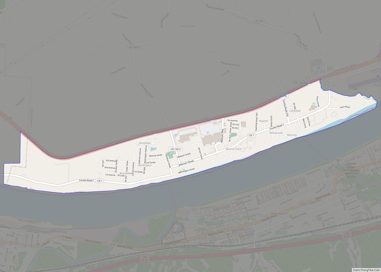
Burlington is an unincorporated community and census-designated place in Lawrence County, Ohio, United States, along the Ohio River. The population was 2,416 at the 2020 census. Connected to neighboring Huntington, West Virginia and connected via the West Huntington Bridge over the Ohio River, it is part of the Huntington–Ashland metropolitan area. Burlington was once the … Read more

Map of Burkettsville village

Map of Burkettsville village

Burkettsville /ˈbɜːrkɛtsvɪl/ is a village in Darke and Mercer counties in the U.S. state of Ohio. The population was 244 at the 2010 census. The current mayor is Joe Stammen. Burkettsville village overview: Name: Burkettsville village LSAD Code: 47 LSAD Description: village (suffix) State: Ohio County: Darke County, Mercer County Elevation: 974 ft (297 m) Total Area: … Read more

Map of Caledonia village, Ohio

Map of Caledonia village, Ohio

Caledonia is a village in Marion County, Ohio, United States. The population was 577 at the 2010 census. Caledonia village overview: Name: Caledonia village LSAD Code: 47 LSAD Description: village (suffix) State: Ohio County: Marion County Elevation: 994 ft (303 m) Total Area: 0.24 sq mi (0.63 km²) Land Area: 0.24 sq mi (0.63 km²) Water Area: 0.00 sq mi (0.00 km²) Total Population: 560 Population … Read more

Map of Canfield city

Map of Canfield city

Canfield is a city in central Mahoning County, Ohio, United States. The population was 7,699 as of the 2020 census. A suburb about 8 miles (13 km) southwest of Youngstown, the city lies at the intersection of U.S. Routes 62 and 224 and is part of the Youngstown–Warren metropolitan area. In 2005, Canfield was rated the … Read more

Map of Candlewood Lake CDP

Map of Candlewood Lake CDP

Candlewood Lake is a census-designated place in Morrow County, in the U.S. state of Ohio. Candlewood Lake CDP overview: Name: Candlewood Lake CDP LSAD Code: 57 LSAD Description: CDP (suffix) State: Ohio County: Morrow County FIPS code: 3911334 Online Interactive Map Candlewood Lake online map. Source: Basemap layers from Google Map, Open Street Map (OSM), … Read more