Burton is a village in Geauga County, Ohio, United States. The population was 1,407 at the 2020 census. It is part of the Cleveland metropolitan area. Burton is the location of Century Village, run by the Geauga Historical Society. The museum village is composed of 19th-century buildings moved there from other locations. Many special events are held there each year, as well as at the Geauga County Fairgrounds, also in Burton.
| Name: | Burton village |
|---|---|
| LSAD Code: | 47 |
| LSAD Description: | village (suffix) |
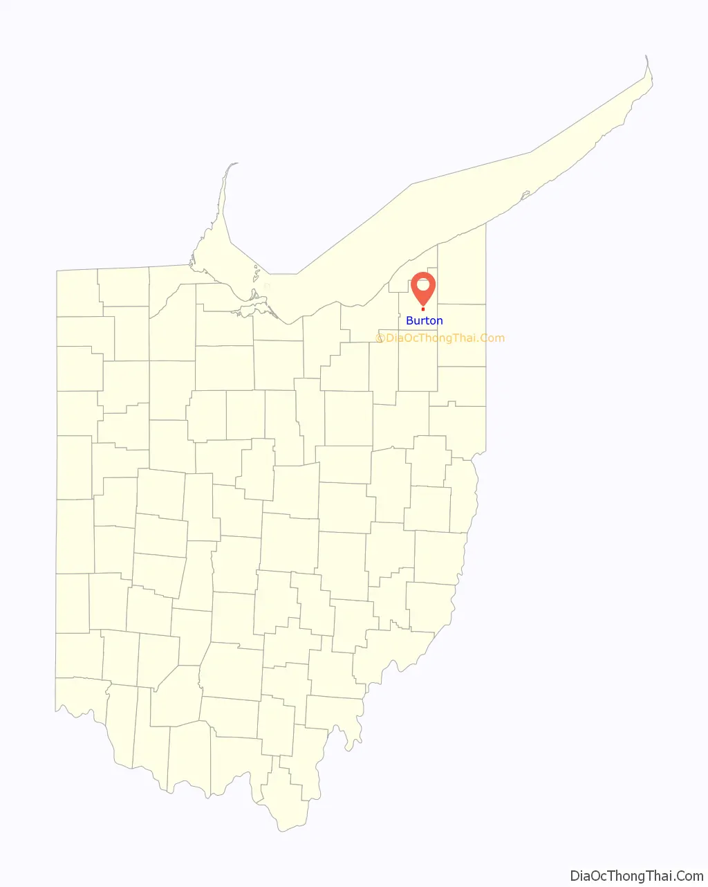
| State: | Ohio |
| County: | Geauga County |
| Elevation: | 1,316 ft (401 m) |
| Total Area: | 1.11 sq mi (2.89 km²) |
| Land Area: | 1.11 sq mi (2.88 km²) |
| Water Area: | 0.00 sq mi (0.01 km²) |
| Total Population: | 1,407 |
| Population Density: | 1,265.29/sq mi (488.61/km²) |
| ZIP code: | 44021 |
| Area code: | 440 |
| FIPS code: | 3910436 |
| GNISfeature ID: | 1048570 |
| Website: | http://www.villageofburton.org |
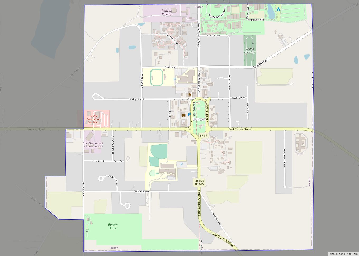
Online Interactive Map
Click on ![]() to view map in "full screen" mode.
to view map in "full screen" mode.
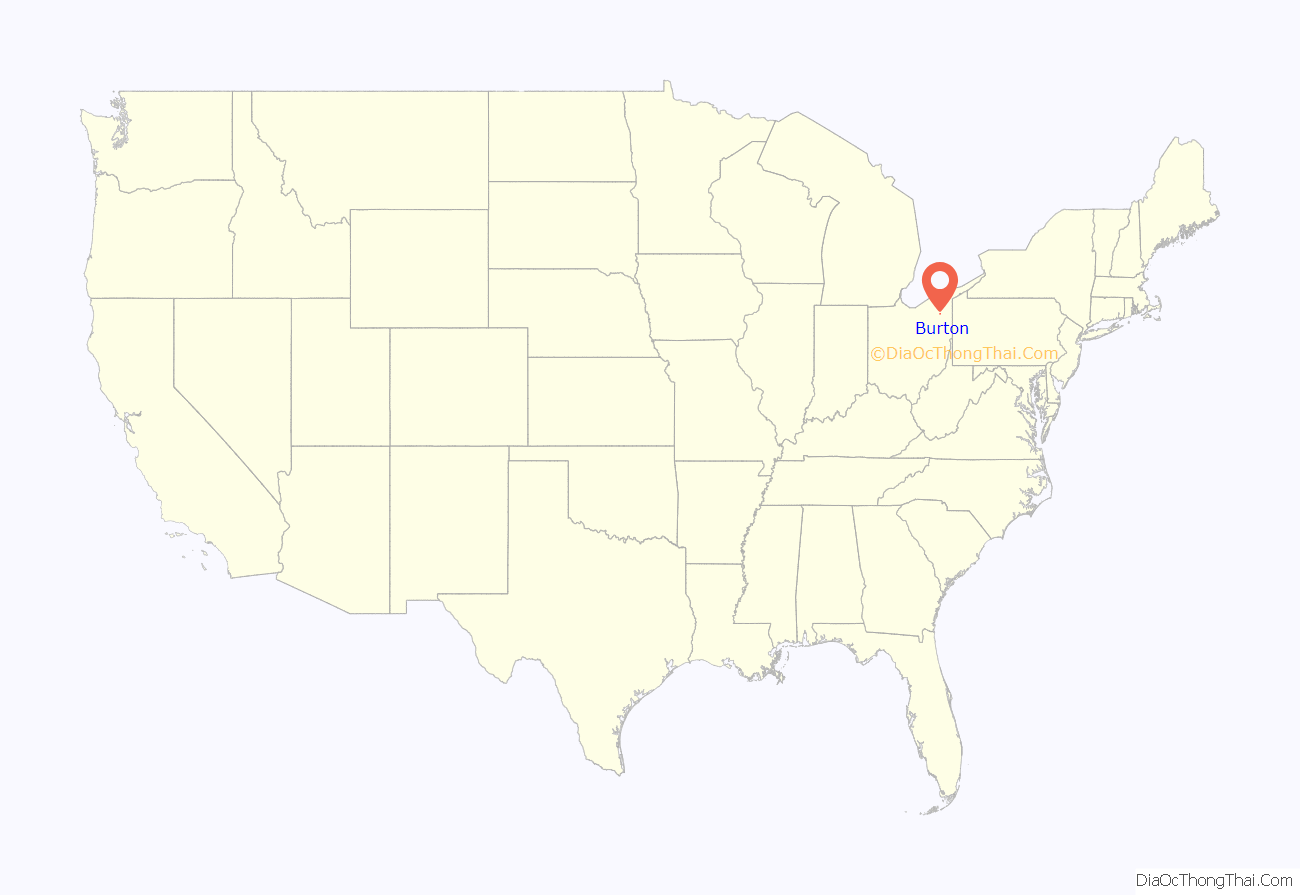
Burton location map. Where is Burton village?
History
Burton was founded in 1798 and is Geauga County’s oldest settlement. Like many other early settlements in the Connecticut Western Reserve, Burton has a town square patterned after the village greens of New England.
In 1972, an incident in Burton lead to a U.S. Supreme Court case. Hugo Zacchini performed a human cannonball act at Burton’s annual Geauga County Fair, and WEWS-TV recorded and aired the entire act against his wishes and without compensating him, as was required by Ohio law. In Zacchini v. Scripps-Howard Broadcasting Co., the high court ruled in 1977 that the First Amendment did not shield the broadcaster from liability from common law copyright claims.
A historical marker is placed at 41° 28.25′ N, 81° 8.692′ W indicating the location for the first telephone station in the state of Ohio (1877).
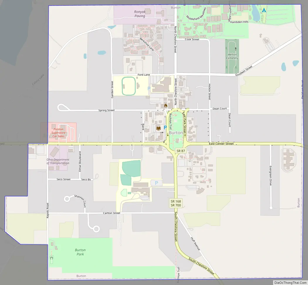
Burton Road Map
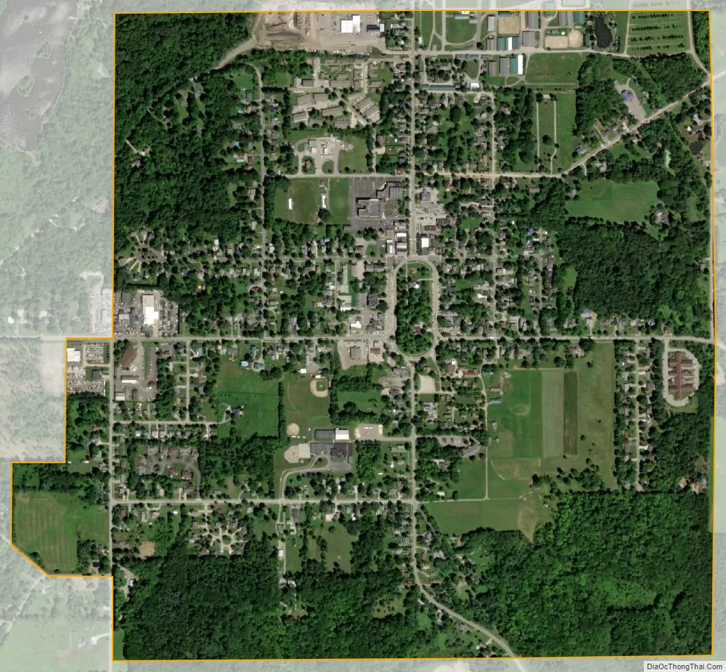
Burton city Satellite Map
Geography
Burton is located at 41°28′18″N 81°8′49″W / 41.47167°N 81.14694°W / 41.47167; -81.14694 (41.471584, -81.146888).
According to the United States Census Bureau, the village has a total area of 1.05 square miles (2.72 km), all land.
See also
Map of Ohio State and its subdivision:- Adams
- Allen
- Ashland
- Ashtabula
- Athens
- Auglaize
- Belmont
- Brown
- Butler
- Carroll
- Champaign
- Clark
- Clermont
- Clinton
- Columbiana
- Coshocton
- Crawford
- Cuyahoga
- Darke
- Defiance
- Delaware
- Erie
- Fairfield
- Fayette
- Franklin
- Fulton
- Gallia
- Geauga
- Greene
- Guernsey
- Hamilton
- Hancock
- Hardin
- Harrison
- Henry
- Highland
- Hocking
- Holmes
- Huron
- Jackson
- Jefferson
- Knox
- Lake
- Lake Erie
- Lawrence
- Licking
- Logan
- Lorain
- Lucas
- Madison
- Mahoning
- Marion
- Medina
- Meigs
- Mercer
- Miami
- Monroe
- Montgomery
- Morgan
- Morrow
- Muskingum
- Noble
- Ottawa
- Paulding
- Perry
- Pickaway
- Pike
- Portage
- Preble
- Putnam
- Richland
- Ross
- Sandusky
- Scioto
- Seneca
- Shelby
- Stark
- Summit
- Trumbull
- Tuscarawas
- Union
- Van Wert
- Vinton
- Warren
- Washington
- Wayne
- Williams
- Wood
- Wyandot
- Alabama
- Alaska
- Arizona
- Arkansas
- California
- Colorado
- Connecticut
- Delaware
- District of Columbia
- Florida
- Georgia
- Hawaii
- Idaho
- Illinois
- Indiana
- Iowa
- Kansas
- Kentucky
- Louisiana
- Maine
- Maryland
- Massachusetts
- Michigan
- Minnesota
- Mississippi
- Missouri
- Montana
- Nebraska
- Nevada
- New Hampshire
- New Jersey
- New Mexico
- New York
- North Carolina
- North Dakota
- Ohio
- Oklahoma
- Oregon
- Pennsylvania
- Rhode Island
- South Carolina
- South Dakota
- Tennessee
- Texas
- Utah
- Vermont
- Virginia
- Washington
- West Virginia
- Wisconsin
- Wyoming