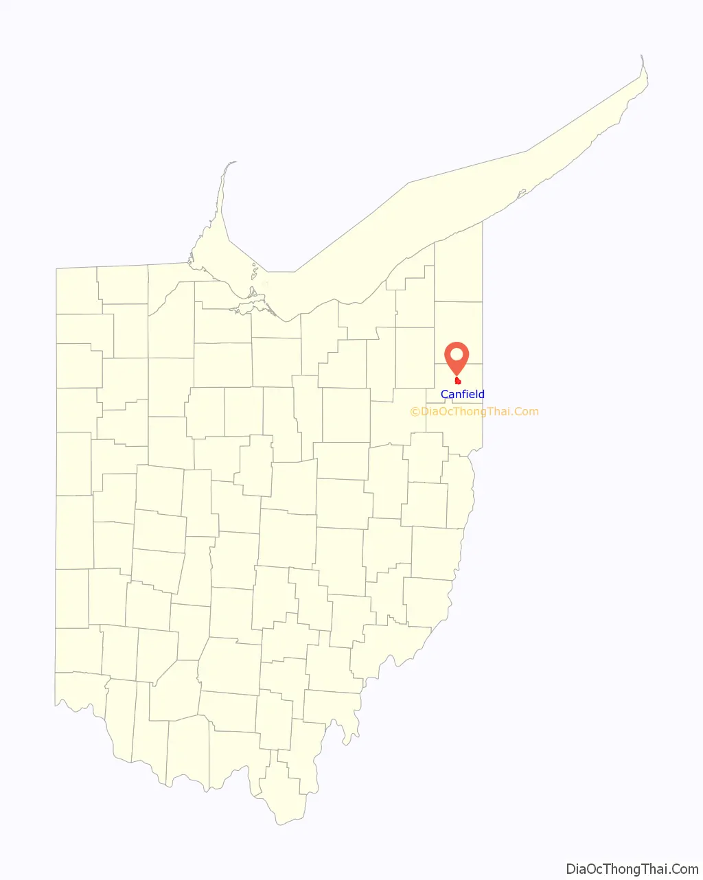
Canfield is a city in central Mahoning County, Ohio, United States. The population was 7,699 as of the 2020 census. A suburb about 8 miles (13 km) southwest of Youngstown, the city lies at the intersection of U.S. Routes 62 and 224 and is part of the Youngstown–Warren metropolitan area. In 2005, Canfield was rated the 82nd best place to live in the United States by Money magazine.
| Name: | Canfield city |
|---|---|
| LSAD Code: | 25 |
| LSAD Description: | city (suffix) |
| State: | Ohio |
| County: | Mahoning County |
| Elevation: | 1,145 ft (349 m) |
| Total Area: | 5.13 sq mi (13.30 km²) |
| Land Area: | 5.10 sq mi (13.22 km²) |
| Water Area: | 0.03 sq mi (0.08 km²) |
| Total Population: | 7,699 |
| Population Density: | 1,508.42/sq mi (582.41/km²) |
| ZIP code: | 44406 |
| Area code: | 330, 234 |
| FIPS code: | 3911360 |
| GNISfeature ID: | 1038796 |
| Website: | http://www.ci.canfield.oh.us/ |
Online Interactive Map
Click on ![]() to view map in "full screen" mode.
to view map in "full screen" mode.
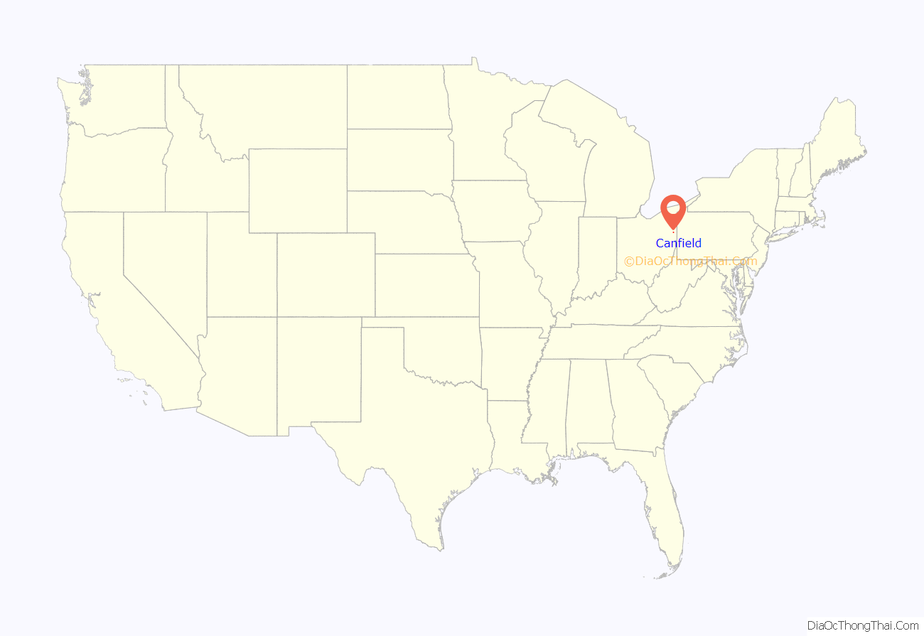
Canfield location map. Where is Canfield city?
History
Canfield Township was established in 1798 as township number 1 in range 3 by purchase from the Connecticut Land Company in the Connecticut Western Reserve. It was purchased by six men, although the majority was owned by Judson Canfield, a land agent. The township took his name in 1800. Canfield’s first settlers arrived shortly after surveying was initiated in 1798, primarily from Connecticut, although waves of German immigrants around 1805 and Irish around 1852 would occur. Goods were transported initially by horse and wagon about 55 miles (91 km) from Pittsburgh; later, the Beaver Canal served as the primary method for commerce. By 1805, Canfield had approximately 17 homes, a store and a school; it became a trade center for the region.
Canfield was part of Trumbull County until 1846, when the counties in the area were redefined and Mahoning County emerged as a new county. Canfield was made the county seat in 1846, an incorporated in 1849, igniting a three decade long feud with the larger Youngstown on which should be the seat. The Ohio State Legislature voted to move the seat to Youngstown in 1874. After the removal of the seat of government, Canfield became the center of the farming community in central Mahoning County. It is home to many examples of classic revival architecture, such as the mid-19th century Charles Ruggles House and Judge Eben Newton House on the National Register of Historic Places.
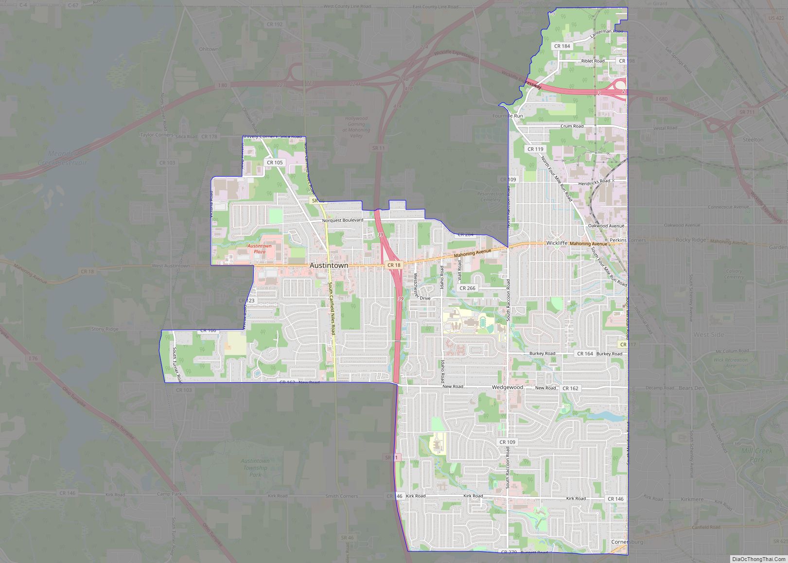
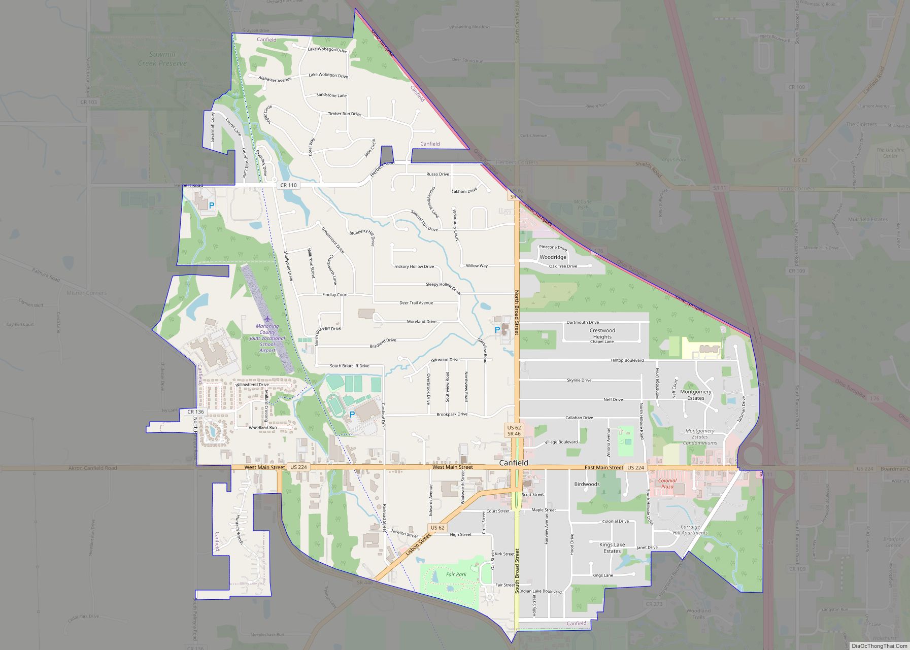
Canfield Road Map

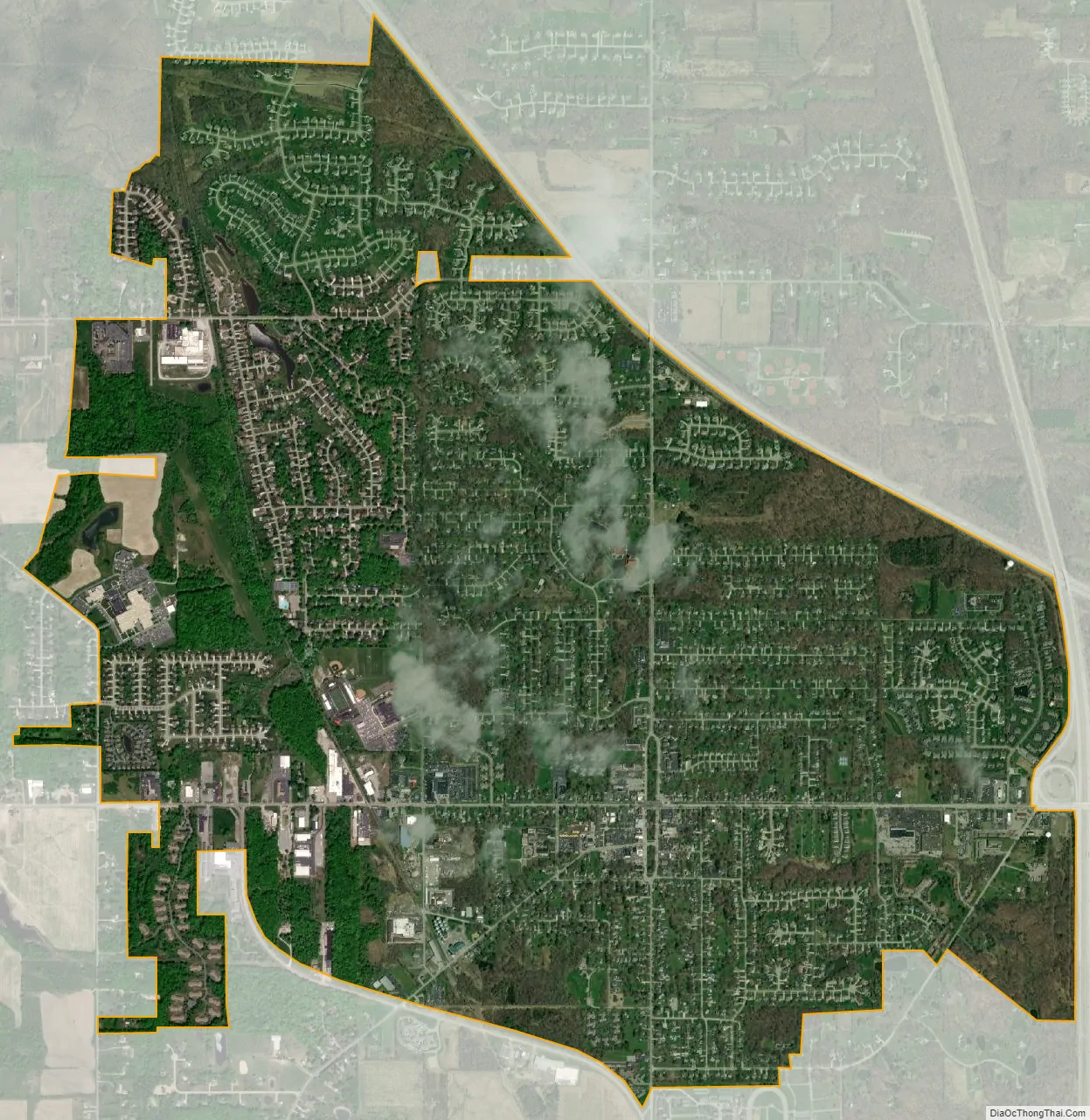
Canfield city Satellite Map
Geography
According to the United States Census Bureau, the city has a total area of 4.61 square miles (11.94 km), of which 4.58 square miles (11.86 km) is land and 0.03 square miles (0.08 km) is water. It is surrounded by Canfield Township.
See also
Map of Ohio State and its subdivision:- Adams
- Allen
- Ashland
- Ashtabula
- Athens
- Auglaize
- Belmont
- Brown
- Butler
- Carroll
- Champaign
- Clark
- Clermont
- Clinton
- Columbiana
- Coshocton
- Crawford
- Cuyahoga
- Darke
- Defiance
- Delaware
- Erie
- Fairfield
- Fayette
- Franklin
- Fulton
- Gallia
- Geauga
- Greene
- Guernsey
- Hamilton
- Hancock
- Hardin
- Harrison
- Henry
- Highland
- Hocking
- Holmes
- Huron
- Jackson
- Jefferson
- Knox
- Lake
- Lake Erie
- Lawrence
- Licking
- Logan
- Lorain
- Lucas
- Madison
- Mahoning
- Marion
- Medina
- Meigs
- Mercer
- Miami
- Monroe
- Montgomery
- Morgan
- Morrow
- Muskingum
- Noble
- Ottawa
- Paulding
- Perry
- Pickaway
- Pike
- Portage
- Preble
- Putnam
- Richland
- Ross
- Sandusky
- Scioto
- Seneca
- Shelby
- Stark
- Summit
- Trumbull
- Tuscarawas
- Union
- Van Wert
- Vinton
- Warren
- Washington
- Wayne
- Williams
- Wood
- Wyandot
- Alabama
- Alaska
- Arizona
- Arkansas
- California
- Colorado
- Connecticut
- Delaware
- District of Columbia
- Florida
- Georgia
- Hawaii
- Idaho
- Illinois
- Indiana
- Iowa
- Kansas
- Kentucky
- Louisiana
- Maine
- Maryland
- Massachusetts
- Michigan
- Minnesota
- Mississippi
- Missouri
- Montana
- Nebraska
- Nevada
- New Hampshire
- New Jersey
- New Mexico
- New York
- North Carolina
- North Dakota
- Ohio
- Oklahoma
- Oregon
- Pennsylvania
- Rhode Island
- South Carolina
- South Dakota
- Tennessee
- Texas
- Utah
- Vermont
- Virginia
- Washington
- West Virginia
- Wisconsin
- Wyoming