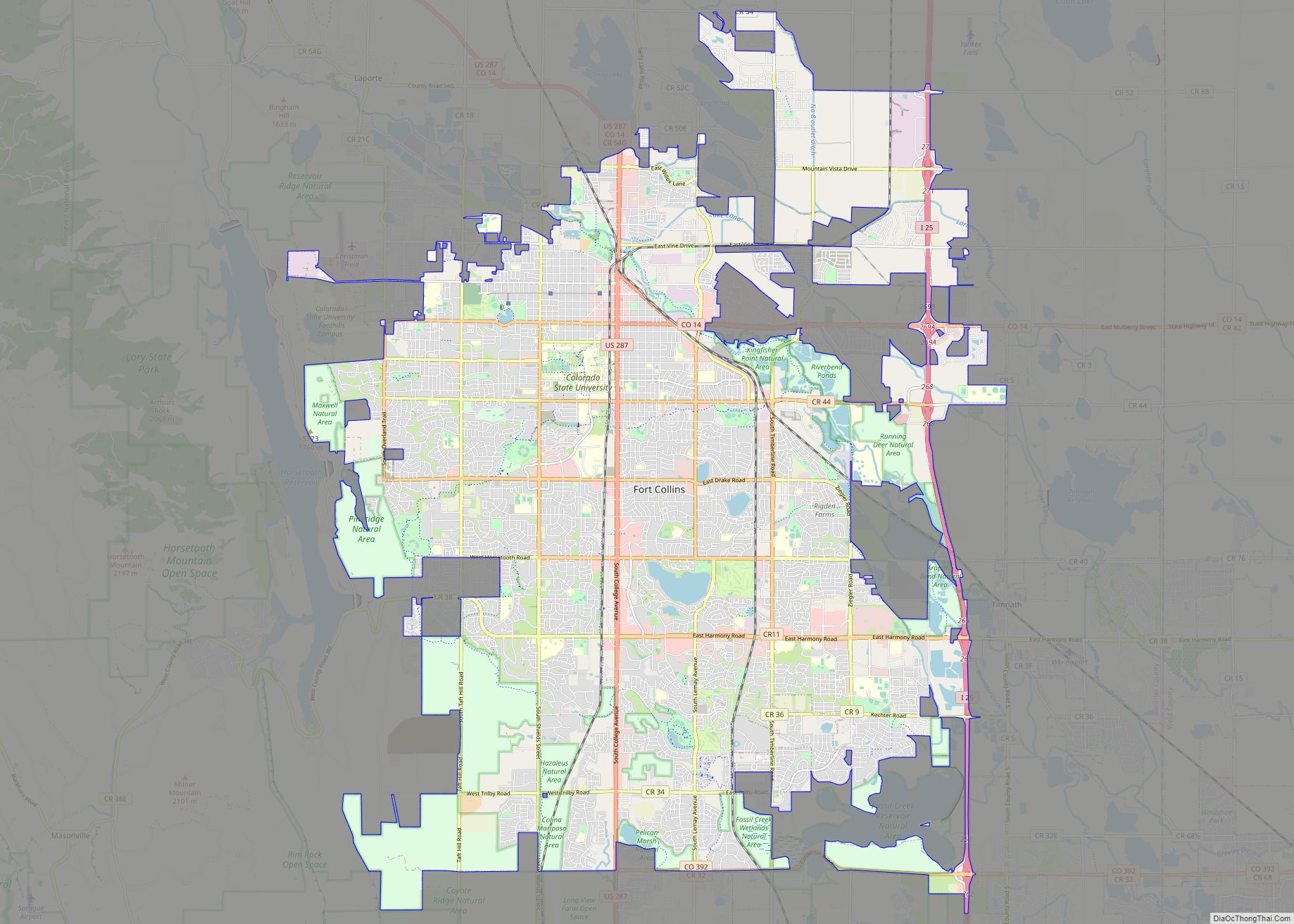
Map of Pembroke Pines city

Map of Pembroke Pines city

Pembroke Pines is a city in southern Broward County, Florida, United States. The city is located 22 miles (35 km) north of Miami. The population of Pembroke Pines was 171,178 at the 2020 census. It is a suburb of and the fourth-most populous city in the Miami metropolitan area, which was home to an estimated … Read more

Map of Corona city

Map of Corona city, California

Corona (Spanish for “Crown”) is a city in northwestern Riverside County, California, United States. At the 2020 census, the city had a population of 157,136, up from 152,374 at the 2010 census. The cities of Norco and Riverside lie to the north and northeast, Chino Hills and Yorba Linda to the northwest, Anaheim to the … Read more

Map of Salinas city

Map of Salinas city, California

Salinas (/səˈliːnəs/; Spanish for “Salt Marsh or Salt Flats”) is a city in California and the county seat of Monterey County. With a population of 163,542 in the 2020 Census, Salinas is the most populous city in Monterey County. Salinas is an urban area located along the eastern limits of the Monterey Bay Area, lying … Read more

Map of Paterson city

Map of Paterson city

Paterson (/ˈpætərsən/ PAT-ər-sən) is the largest city in and the county seat of Passaic County, in the U.S. state of New Jersey. As of the 2020 United States census, the city was the state’s third-most-populous municipality, with a population of 159,732, an increase of 13,533 (+9.3%) from the 2010 census count of 146,199, which in … Read more

Map of Macon-Bibb County

Map of Macon-Bibb County

Macon-Bibb County overview: Name: Macon-Bibb County LSAD Code: 00 LSAD Description: 0 State: Georgia FIPS code: 1349008 Online Interactive Map Macon-Bibb County online map. Source: Basemap layers from Google Map, Open Street Map (OSM), Arcgisonline, Wmflabs. Boundary Data from Database of Global Administrative Areas. Macon-Bibb County location map. Where is Macon-Bibb County? Macon-Bibb County Road … Read more

Map of Murfreesboro city, Tennessee

Map of Murfreesboro city, Tennessee

Murfreesboro is a city in, and county seat of, Rutherford County, Tennessee, United States. The population was 152,769 according to the 2020 census, up from 108,755 residents certified in 2010. Murfreesboro is located in the Nashville metropolitan area of Middle Tennessee, 34 miles (55 km) southeast of downtown Nashville. Serving as the state capital from 1818 … Read more

Map of Lakewood city, Colorado

Map of Lakewood city, Colorado

The City of Lakewood is the home rule municipality that is the most populous municipality in Jefferson County, Colorado, United States. The city population was 155,984 at the 2020 U.S. Census, making Lakewood the fifth most populous city in Colorado and the 167th most populous city in the United States. Lakewood is a suburb of … Read more

Map of Killeen city

Map of Killeen city

Killeen is a city in Bell County, Texas, United States. According to the 2020 census, its population was 153,095, making it the 19th-most populous city in Texas and the largest of the three principal cities of Bell County. It is the principal city of the Killeen–Temple–Fort Hood Metropolitan Statistical Area. Killeen is 55 miles (89 km) … Read more

Map of Springfield city, Massachusetts

Map of Springfield city, Massachusetts

Springfield is the largest city in and the seat of Hampden County, Massachusetts, United States. Springfield sits on the eastern bank of the Connecticut River near its confluence with three rivers: the western Westfield River, the eastern Chicopee River, and the eastern Mill River. At the 2020 census, the city’s population was 155,929, making it … Read more

Map of Kansas City city

Map of Kansas City, Kansas

Kansas City (abbreviated as KCK) is the third-most populous city in the U.S. state of Kansas, and the county seat of Wyandotte County. It is an inner suburb of the older and more populous Kansas City, Missouri, after which it is named. As of the 2020 census, the population of the city was 156,607, making … Read more