Corona (Spanish for “Crown”) is a city in northwestern Riverside County, California, United States. At the 2020 census, the city had a population of 157,136, up from 152,374 at the 2010 census. The cities of Norco and Riverside lie to the north and northeast, Chino Hills and Yorba Linda to the northwest, Anaheim to the west, Cleveland National Forest and the Santa Ana Mountains to the southwest, and unincorporated Riverside County along the rest of the city’s borders. Downtown Corona is approximately 48 miles (77 kilometers) southeast of Downtown Los Angeles and 95 miles (153 km) north-northwest of San Diego.
Corona, located along the western edge of Southern California’s Inland Empire region, is known as the “Circle City” due to Grand Boulevard’s 3 mi (4.8 km) circular layout. It is one of the most residential cities in the Inland Empire, but also has a large industrial portion on the northern half, being the headquarters of companies such as Fender Musical Instruments Corporation, Monster Beverage Corporation, and supercar manufacturer Saleen.
| Name: | Corona city |
|---|---|
| LSAD Code: | 25 |
| LSAD Description: | city (suffix) |
| State: | California |
| County: | Riverside County |
| Elevation: | 679 ft (207 m) |
| Land Area: | 39.94 sq mi (103.45 km²) |
| Water Area: | 0.02 sq mi (0.05 km²) 0.27% |
| Population Density: | 3,934.20/sq mi (1,519.02/km²) |
| ZIP code: | 92877–92883 |
| Area code: | 951 |
| FIPS code: | 0616350 |
Online Interactive Map
Click on ![]() to view map in "full screen" mode.
to view map in "full screen" mode.
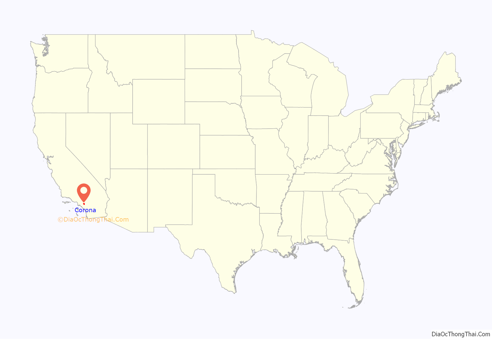
Corona location map. Where is Corona city?

History
Indigenous
Prior to the late eighteenth century, the area was primarily inhabited by the Tongva and Payómkawichum, who lived in a series of villages throughout the area. What is now Corona stood at the southeastern extent of Tovaangar, or the Tongva world, and at the northern edge of Payómkawichum territory.
The primary settlement in the area was the village of Paxauxa, which was established along the banks of the Temescal Creek at about where Corona is situated today. The settlement was shared by both the Tongva and Payómkawichum people. Cooperation and marriage between the two villages was common. High above the city of Corona, the village of Pamajam was also located in a small valley of the Santa Ana Mountains.
Colonial period
The founding of Mission San Juan Capistrano in 1776 and Mission San Luis Rey in 1798 saw the introduction of Spanish soldiers and missionaries in the area. This resulted in villagers being brought to the mission to be baptized and as labor.
Spanish influence increased in the area with the establishment of the San Antonio de Pala Asistencia in 1816. Two years following the construction of this mission outpost, the Temescal Valley’s first European resident, Leandro Serrano, was given permission by the Spanish to use the area for cattle grazing. His first order was to kill the local bear and mountain lion population for the imported herds.
After the secularization of the Spanish missions by the First Mexican Republic in 1833, the land under influence by the missions in Alta California was gradually granted to large landowners as ranches. In 1848, Californio governor Pio Pico issued this land to Bernardo Yorba, which included present-day city of Corona.
Establishment
Corona was founded at the height of the Southern California citrus boom in 1886, and is situated at the upper end of the Santa Ana River Canyon, a significant pass through the Santa Ana Mountains. The town of Corona was once the “Lemon Capital of the World”. A museum there presents the lemon’s former role in the local economy. The city’s name means crown in Spanish due to the circular shape of a crown and the circular shape of Grand Blvd. The nickname of Corona is “The Circle City” from the unique layout of its streets, with a standard grid enclosed by the circular Grand Boulevard, 2.75 miles (4.43 km) in circumference. The street layout was designed by Hiram Clay Kellogg, a civil engineer from Anaheim who was an influential figure in the early development of Orange County.
Corona was established as a town by the South Riverside Land and Water Company. The company was incorporated in 1886; founding members included ex-Governor of Iowa Samuel Merrill, R.B. Taylor, George L. Joy, A.S. Garretson, and Adolph Rimpau. Originally a citrus growers’ organization, it purchased the lands of Rancho La Sierra of Bernardo Yorba, and the Rancho Temescal grant and the colony of South Riverside was laid out. They also secured the water rights to Temescal Creek, its tributaries and Lee Lake. Dams and pipelines were built to carry the water to the colony. In 1889, the Temescal Water Company was incorporated, to supply water for the new colony. This company purchased all the water-bearing lands in the Temescal valley and began drilling artesian wells.
Originally located in San Bernardino County, the city was named “South Riverside” and received its post office in that name on either May 27 or August 11, 1887 with Charles H. Cornell as the town’s first postmaster. In 1893, South Riverside became part of the new Riverside County. In 1896, the city was renamed “Corona” for its circular Grand Boulevard, where three international automobile races were held in 1913, 1914 and 1916.
20th century
The city of Corona has been popular among celebrities drawn to its upscale areas and relative privacy compared to Los Angeles. Lucille Ball and Desi Arnaz spent time at their ranch, located in north Corona, and played golf often at the Cresta Verde Golf Course in the northeastern section of the city. After their divorce, Mr. Arnaz continued to live in Corona.
In recent years Corona has been known as the “Gateway to the Inland Empire”. Prior to the 1980s, the city was largely an agricultural community, dominated by citrus orchards, ranches, and dairy farms. High real estate prices in Los Angeles and Orange counties made the area’s land desirable to developers and industrialists, and by the late 1990s Corona was considered a major suburb of Los Angeles.
Housing development in the city has been accelerated by access to the area via the SR 91, with many families leaving Orange County to larger, more affordable housing available in the city. The construction of the nearby SR 71 has linked Corona to the Pomona and San Gabriel valleys. Due to traffic caused by Corona’s considerable growth, toll lanes have been built along the 91 freeway, with future toll lane expansions under construction and in the planning stages along Interstate 15. While there were talks to construct a proposed 10-mile (16 km) automobile and rail tunnel under Santiago Peak to connect Interstate 15 in Corona with Interstate 5 and SR 55 in Orange County to reduce commuter traffic on the crowded 91 freeway, this concept has been shelved indefinitely.
21st century
In 2002, the city government considered an initiative to secede from Riverside County and form an autonomous Corona County because the city government and some residents were dissatisfied with how services were handled in nearby areas. The effort was also considered by areas in other cities in the western part of the county as far south as Murrieta. Whether nearby cities such as Norco would have been included in the new county are unknown. The proposed county would have been bordered by San Bernardino County to the northwest and by Orange County to the west, but it never came to fruition.
Corona Road Map

Corona city Satellite Map

Geography
Corona is located in western Riverside County, east of Orange County.
According to the United States Census Bureau, the city has a total area of 38.9 square miles (101 km), of which 38.8 square miles (100 km) of it is land and 0.1 square miles (0.26 km) of it, or 0.27%, is water.
Corona experiences a warm Mediterranean climate (Köppen climate classification: CSa) and has mild to cool winters and hot summers. Most of the rainfall (as in all of Southern California) occurs during winter and early spring.
Winter days are pleasant, with the average highs staying in the mid to upper 60s. But compared to other areas in Southern California, winter lows are colder, with common frost and chilly mornings. Snowfall within city limits is rare. Snow flurries will occasionally fall, usually once every other year, but it very rarely snows to the point where it accumulates. The nearby Santa Ana Mountains receive a dusting of snow a few times each winter.
Spring brings pleasant weather with daytime temperatures in the mid to upper 70s, and nighttime lows in the upper 40s. Spring showers are common during the beginning of the season but are a rarity by late May.
Summertime is hot, with highs averaging in the low to mid 90s. During the hottest months, daytime temperatures in Corona can exceed 100 °F (38 °C). In early summer, Corona receives common overcast weather known as “May Gray” and “June Gloom”. Summer thunderstorms are sporadic and usually happen between July and September from the North American Monsoons, bringing increased humidity and scattered thunderstorms.
Autumn features warm days and sharply cooler evenings, but can be windy due to the Santa Ana winds, blowing in two or three times a year from October to December.
See also
Map of California State and its subdivision:- Alameda
- Alpine
- Amador
- Butte
- Calaveras
- Colusa
- Contra Costa
- Del Norte
- El Dorado
- Fresno
- Glenn
- Humboldt
- Imperial
- Inyo
- Kern
- Kings
- Lake
- Lassen
- Los Angeles
- Madera
- Marin
- Mariposa
- Mendocino
- Merced
- Modoc
- Mono
- Monterey
- Napa
- Nevada
- Orange
- Placer
- Plumas
- Riverside
- Sacramento
- San Benito
- San Bernardino
- San Diego
- San Francisco
- San Joaquin
- San Luis Obispo
- San Mateo
- Santa Barbara
- Santa Clara
- Santa Cruz
- Shasta
- Sierra
- Siskiyou
- Solano
- Sonoma
- Stanislaus
- Sutter
- Tehama
- Trinity
- Tulare
- Tuolumne
- Ventura
- Yolo
- Yuba
- Alabama
- Alaska
- Arizona
- Arkansas
- California
- Colorado
- Connecticut
- Delaware
- District of Columbia
- Florida
- Georgia
- Hawaii
- Idaho
- Illinois
- Indiana
- Iowa
- Kansas
- Kentucky
- Louisiana
- Maine
- Maryland
- Massachusetts
- Michigan
- Minnesota
- Mississippi
- Missouri
- Montana
- Nebraska
- Nevada
- New Hampshire
- New Jersey
- New Mexico
- New York
- North Carolina
- North Dakota
- Ohio
- Oklahoma
- Oregon
- Pennsylvania
- Rhode Island
- South Carolina
- South Dakota
- Tennessee
- Texas
- Utah
- Vermont
- Virginia
- Washington
- West Virginia
- Wisconsin
- Wyoming


