Paterson (/ˈpætərsən/ PAT-ər-sən) is the largest city in and the county seat of Passaic County, in the U.S. state of New Jersey. As of the 2020 United States census, the city was the state’s third-most-populous municipality, with a population of 159,732, an increase of 13,533 (+9.3%) from the 2010 census count of 146,199, which in turn reflected a decline of 3,023 (-2.0%) from the 149,222 counted in the 2000 census. The Census Bureau’s Population Estimates Program calculated that the city’s population was 157,794 in 2021, ranking the city as the 163rd-most-populous in the country.
Paterson has been known as the Silk City for its once-dominant role in silk production during the latter half of the 19th century. It has since evolved into a major destination for Hispanic immigrants as well as for immigrants from Turkey, the Arab world, and South Asia. Paterson has the nation’s second-largest per capita Muslim population.
| Name: | Paterson city |
|---|---|
| LSAD Code: | 25 |
| LSAD Description: | city (suffix) |
| State: | New Jersey |
| County: | Passaic County |
| Incorporated: | April 11, 1831 (as township) |
| Elevation: | 112 ft (34.1376 m) |
| Total Area: | 8.71 sq mi (22.55 km²) |
| Land Area: | 8.41 sq mi (21.79 km²) |
| Water Area: | 0.29 sq mi (0.76 km²) 3.38% |
| Total Population: | 159,732 |
| Population Density: | 18,986.3/sq mi (7,330.7/km²) |
| Area code: | 201 and 973 |
| FIPS code: | 3457000 |
| GNISfeature ID: | 0885343 |
| Website: | www.patersonnj.gov |
Online Interactive Map
Click on ![]() to view map in "full screen" mode.
to view map in "full screen" mode.
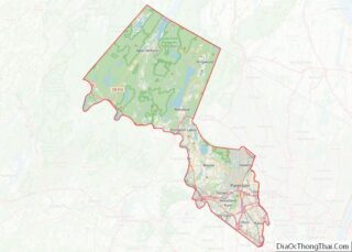
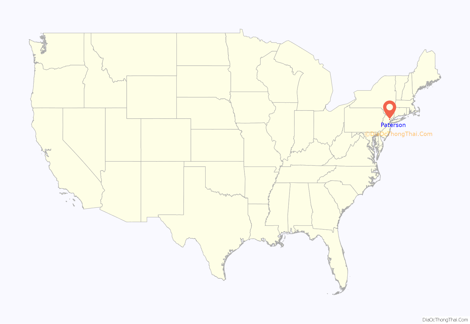
Paterson location map. Where is Paterson city?
History
The area of Paterson was inhabited by the Algonquian-speaking Native American Acquackanonk tribe of the Lenape, also known as the Delaware Indians. The land was known as the Lenapehoking. The Dutch claimed the land as New Netherlands, followed by the British as the Province of New Jersey.
Establishment
In 1791, Alexander Hamilton (1755/57–1804), first United States Secretary of the Treasury, helped found the Society for Establishing Useful Manufactures (S.U.M.), which helped encourage the harnessing of energy from the Great Falls of the Passaic River to secure economic independence from British manufacturers. The society founded Paterson, which became the cradle of the industrial revolution in America. Paterson was named for William Paterson, statesman, signer of the Constitution and Governor of New Jersey, who signed the 1792 charter that established the Town of Paterson.
Architect, engineer, and city planner Pierre L’Enfant (1754–1825), who had earlier developed the initial plans for Washington, D.C., was the first planner for the S.U.M. project. His plan proposed to harness the power of the Great Falls through a channel in the rock and an aqueduct. The society’s directors felt he was taking too long and was over budget, and he was replaced by Peter Colt, who used a less complicated reservoir system to get the water flowing to factories in 1794. Eventually, Colt’s system developed some problems and a scheme resembling L’Enfant’s original plan was used after 1846.
Paterson was originally formed as a township from portions of Acquackanonk Township on April 11, 1831, while the area was still part of Essex County. It became part of the newly created Passaic County on February 7, 1837, and was incorporated as a city on April 14, 1851, based on the results of a referendum held that day. The city was reincorporated on March 14, 1861.
Industrial growth
The 77-foot (23 m) high Great Falls and a system of water raceways that harnessed the falls’ power provided power for the mills in the area until 1914 and fostered growth of the city. The district originally included dozens of mill buildings and other manufacturing structures associated with the textile industry and, later, the firearms, silk, and railroad locomotive manufacturing industries. In the latter half of the 19th century, silk production became the dominant industry and formed the basis of Paterson’s most prosperous period, earning it the nickname “Silk City.”
In 1835, Samuel Colt began producing firearms in Paterson, but within a few years he moved his business to Hartford, Connecticut. Later in the 19th century, Paterson was the site of early experiments with submarines by Irish-American inventor John Philip Holland. Two of Holland’s early models—one found at the bottom of the Passaic River—are on display in the Paterson Museum, housed in the former Rogers Locomotive and Machine Works near the Passaic Falls.
Behind Newark and New York, the brewing industry was booming in Paterson in the late 1800s. Braun Brewery, Sprattler & Mennell, Graham Brewery, The Katz Brothers, and Burton Brewery merged in 1890 to form Paterson Consolidated Brewing Company. Hinchliffe Brewing and Malting Company, founded in 1861, produced 75,000 barrels a year from its state-of-the-art facility at 63 Governor Street. All the breweries closed during Prohibition.
The city was a mecca for immigrant laborers, who worked in its factories, particularly Italian weavers from the Naples region. Paterson was the site of historic labor unrest that focused on the six-month-long Paterson silk strike of 1913 that demanded the eight-hour day and better working conditions. It was defeated, with workers returning at the end of the strike without having negotiated any changes.
In 1919, Paterson was one of eight locations bombed by self-identified anarchists.
According to the New Jersey Historical Commission, Paterson’s industrialism ended “as the economy and technological needs of the United States changed. By 1983, Paterson was the fifth poorest city in the United States. The town that had called itself Silk City, the Iron City, and the Cotton City, was in economic ruin.” Once millwork and production left the city, Paterson’s poverty became reminiscent of what occurred in the towns surrounding the Appalachian Mountains once the coal mining industry ended. In 2020, 25.2% of Paterson residents lived in poverty.
Athletics
From 1932 to 1933, Paterson constructed Hinchliffe Stadium, an Art Deco concrete stadium. Originally called City Stadium, it was renamed in honor of Mayor John V. Hinchliffe and his uncle John Hinchliffe. The New York Black Yankees of the Negro National League played at the stadium from 1933 to 1937 and from 1939 to 1945. Professional football teams, including the Paterson Panthers, Newark Bears, and Jersey City Giants, played here. The stadium was also a venue for other professional and high school athletic competitions, boxing matches, fireworks displays, and music concerts. The comedy team of Bud Abbott and Lou Costello performed at Hinchliffe before boxing matches (Abbott was from the coastal New Jersey city of Asbury Park and Costello was a Paterson native). The stadium was acquired by Paterson Public Schools since 1963 and closed in 1996. It has fallen into disrepair, although preservation and restoration efforts have taken place. The stadium is one of two surviving Negro league baseball stadiums, the other being Birmingham, Alabama‘s Rickwood Field. Hinchliffe Stadium is listed on the National Register of Historic Places. The stadium is currently home to the New Jersey Jackals minor league baseball team.
Post–World War II era
During World War II Paterson played an important part in the aircraft engine industry, but by the end of the war urban areas were in decline and Paterson was no exception. Since the late 1960s the city has suffered high unemployment rates and white flight.
Competition from malls in upscale neighboring towns like Wayne and Paramus have forced the big chain stores out of Paterson’s downtown. The biggest industries are now small businesses, with the decline of the city’s industrial base. But the city still attracts many immigrants, who have revived its economy, especially through small businesses.
The downtown area has been struck by massive fires several times, most recently on January 17, 1991. In this fire nearly a whole city block (bordered on the north and south by Main Street and Washington Street and on the east and west by Ellison Street and College Boulevard, a stretch of Van Houten Street dominated by Passaic County Community College) was engulfed in flames due to an electrical fire in the basement of a bar at 161 Main Street and spread to other buildings. Firefighter John A. Nicosia, 28, of Engine 4 went missing in the fire, having gotten lost in the basement. His body was recovered two days later. A plaque honoring his memory was later placed on a wall near the area. The area was so badly damaged that most of the burned buildings were demolished, with an outdoor mall standing in their place. The most notable of the destroyed buildings was the Meyer Brothers department store, which closed in 1987 and had since been parceled out.
Paterson includes numerous locations listed on the National Register of Historic Places, including museums, civic buildings such as City Hall, Hinchliffe Stadium, Public School Number Two and the Danforth Memorial Library, churches (Cathedral of St. John the Baptist and St. Michael’s Roman Catholic Church), individual residences, such as Lambert Castle, and districts of the city, such as the Paterson Downtown Commercial Historic District, the Great Falls/Society for the Establishment of Useful Manufactures Historic District and the Eastside Park Historic District.
In August 2011, Paterson was severely affected in the aftermath of Hurricane Irene, particularly by flooding of the Passaic River, where waters rose to levels unseen for 100 years, leading to the displacement of thousands and the closure of bridges over the river. Touring the area with Federal Emergency Management Agency Administrator Craig Fugate, U.S. Homeland Security Secretary Janet Napolitano declared, “This is as bad as I’ve seen, and I’ve been in eight states that have been impacted by Irene.” The same day, President Obama declared New Jersey a disaster area, and announced that he would visit the city.
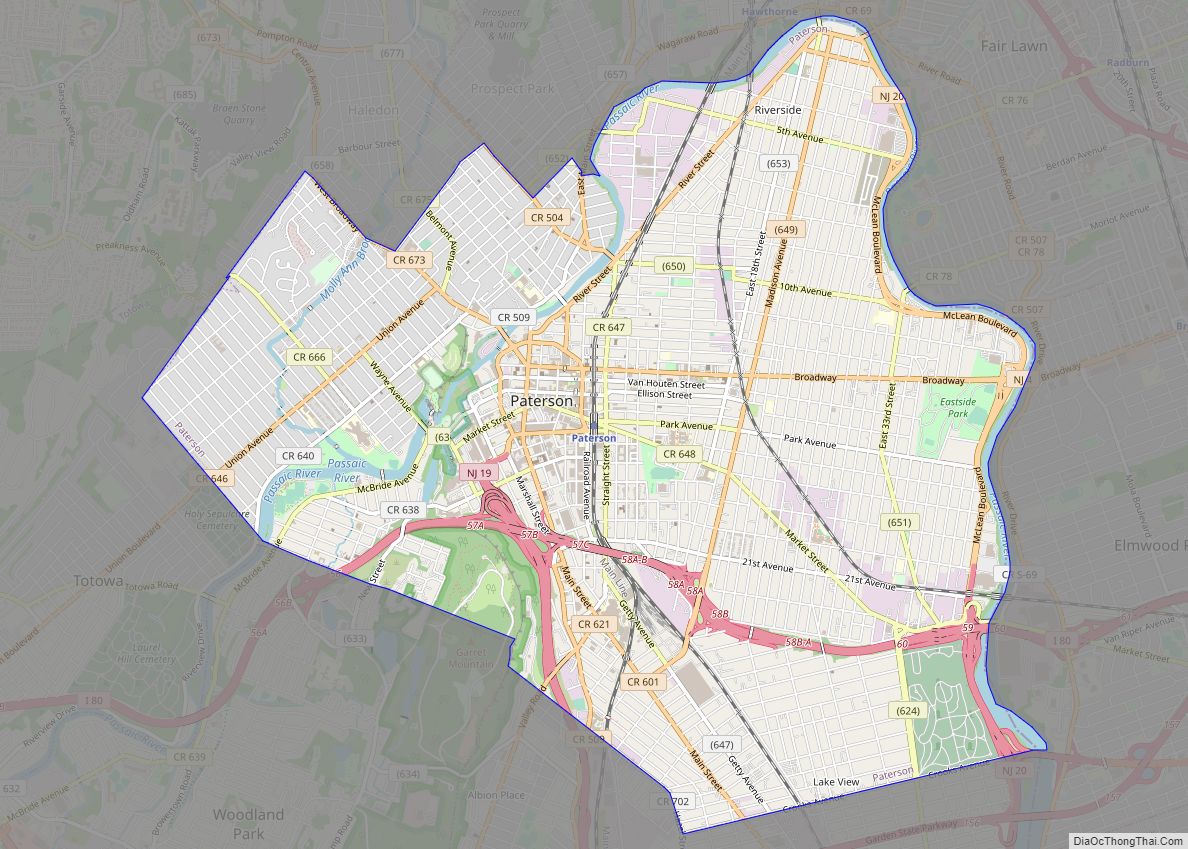
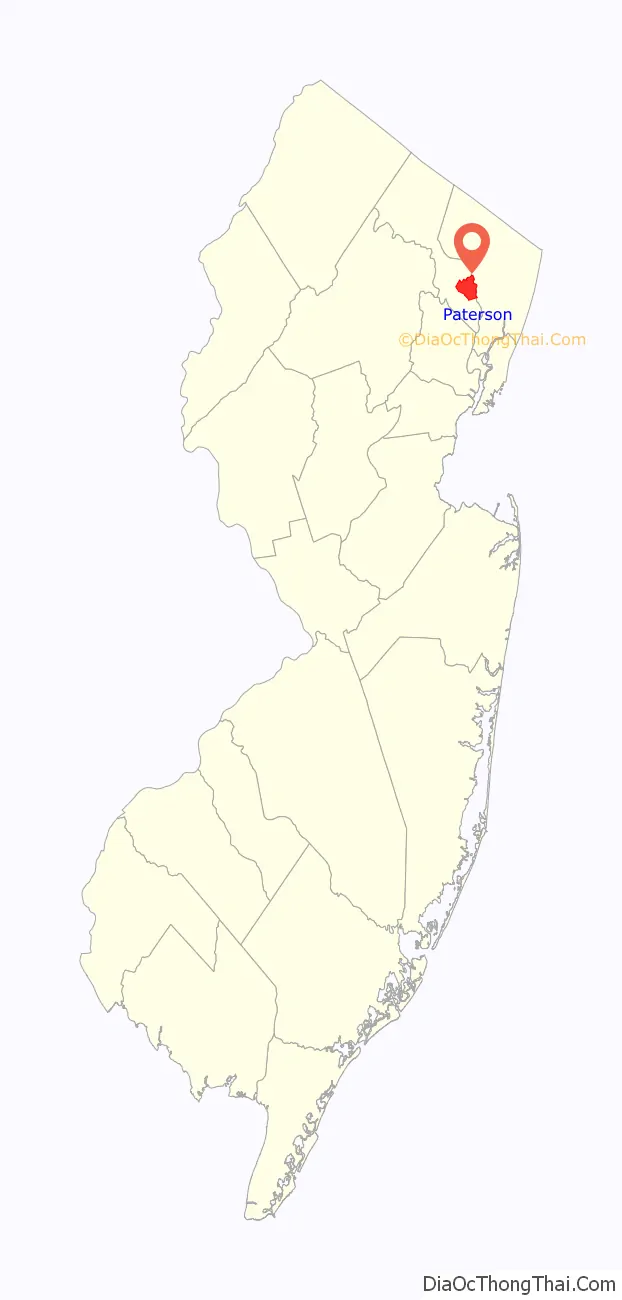
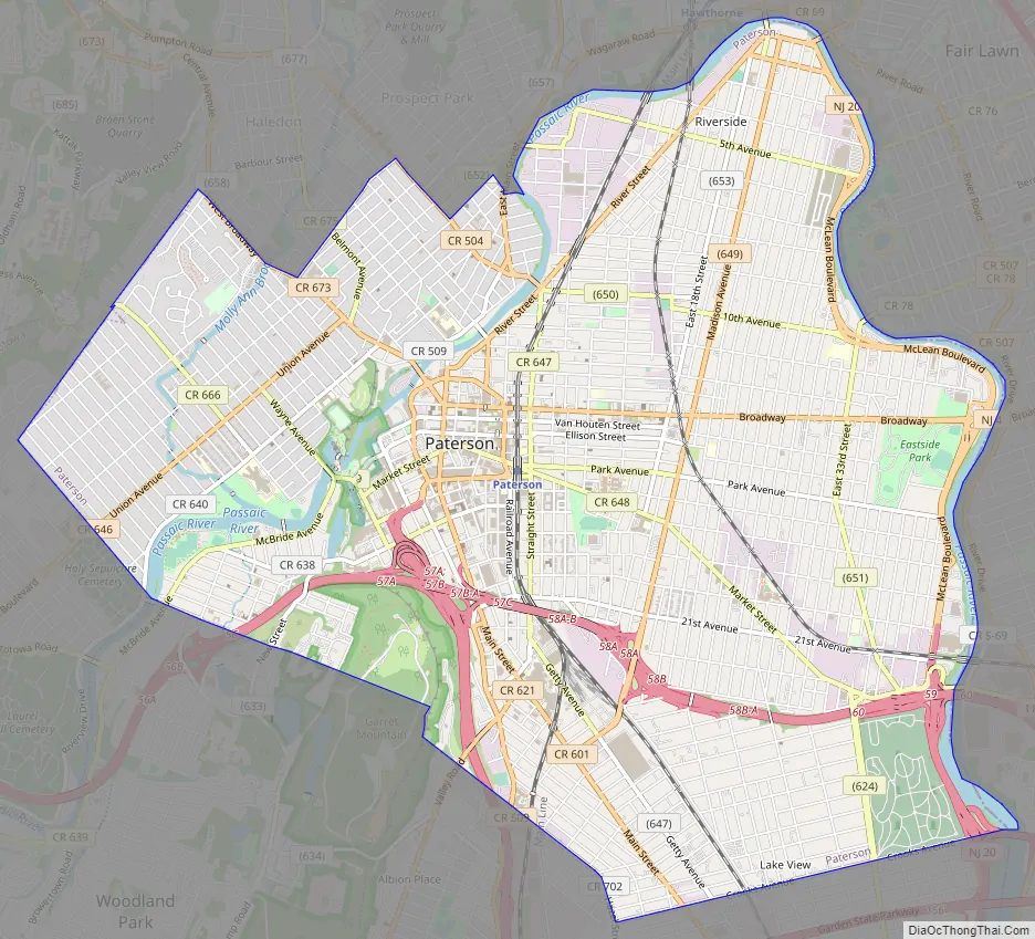
Paterson Road Map
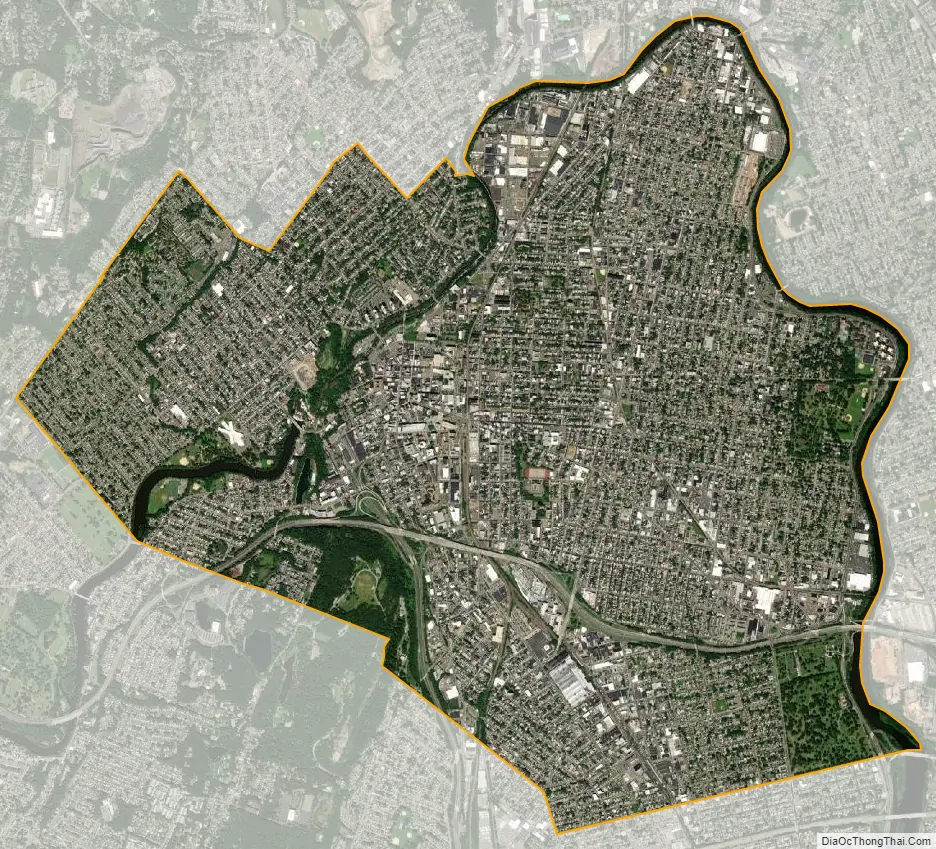
Paterson city Satellite Map
Geography
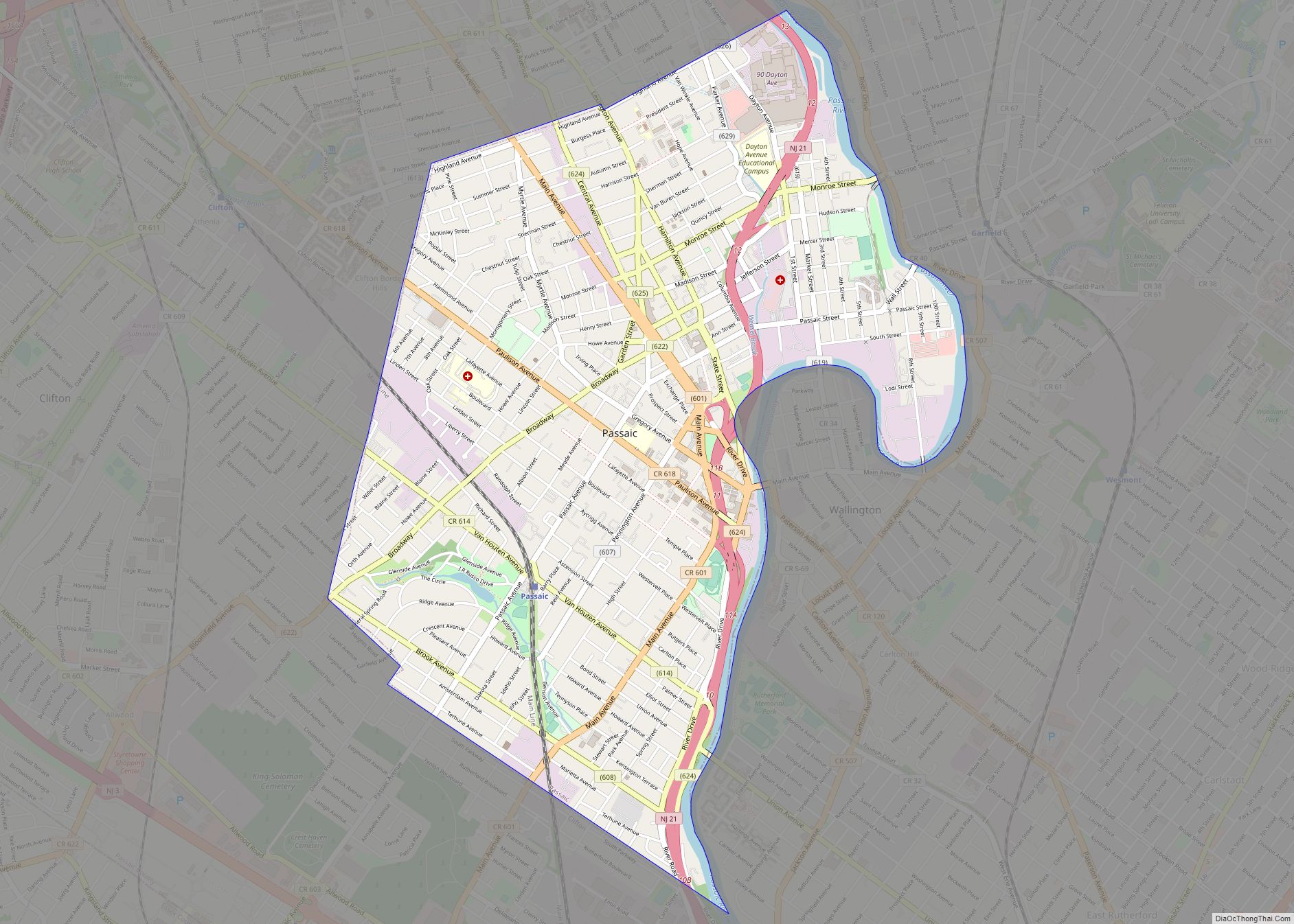
Paterson is in the southern part of Passaic County, which is near the north edge of New Jersey, as a county that spans some hilly areas and has dozens of lakes. The county covers a region about 30 × 20 miles wide (48 × 32 km). The region is split by major roads, including portions of Interstate 80, which runs through Paterson (see map at left). The Garden State Parkway (GSP) cuts across the south of Paterson, near Clifton, New Jersey. The Passaic River winds northeast past Totowa into Paterson, where the river then turns south to Passaic town, on the way to Newark, further south.
According to the U.S. Census Bureau, the city had a total area of 8.71 square miles (22.55 km), including 8.41 square miles (21.79 km) of land and 0.29 square miles (0.76 km) of water (3.38%).
Unincorporated communities, localities and place names located partially or completely within the city include Riverside and Totowa.
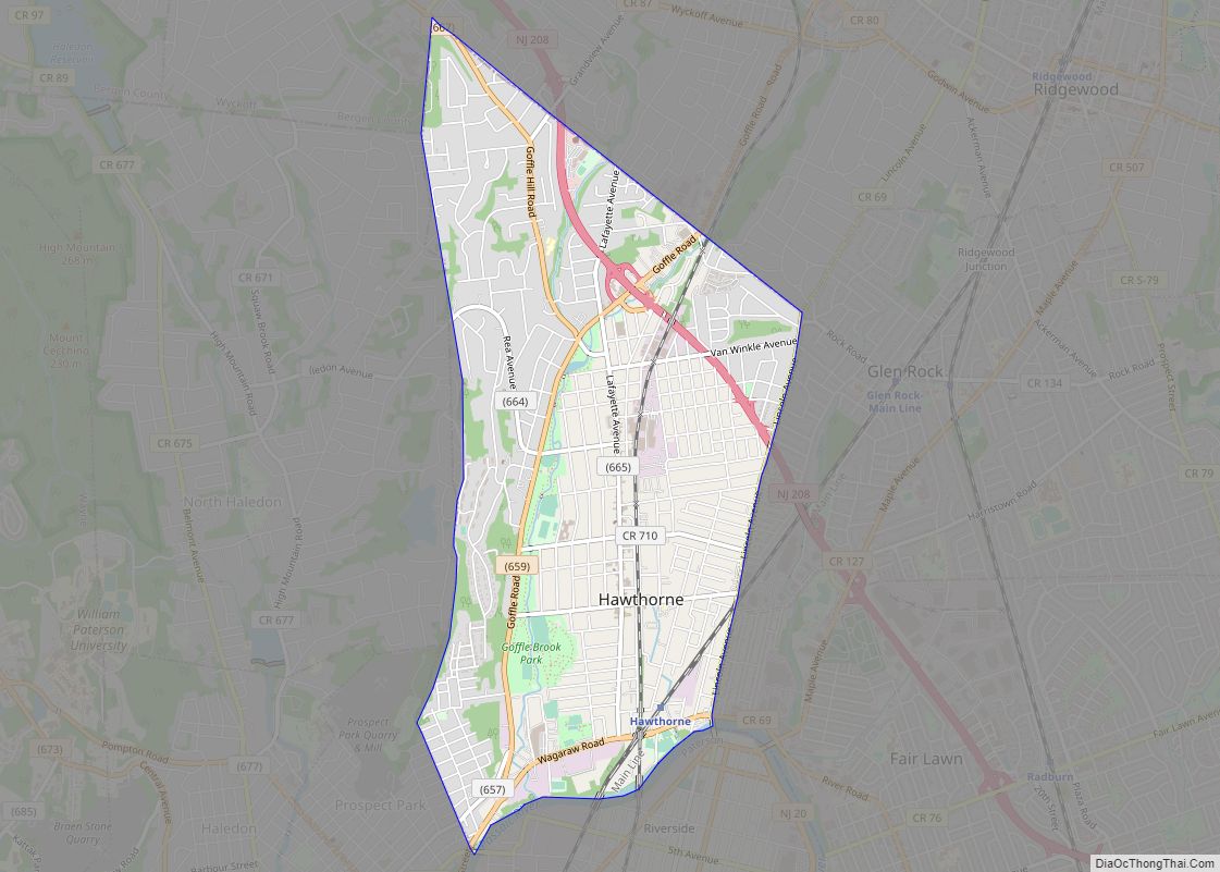
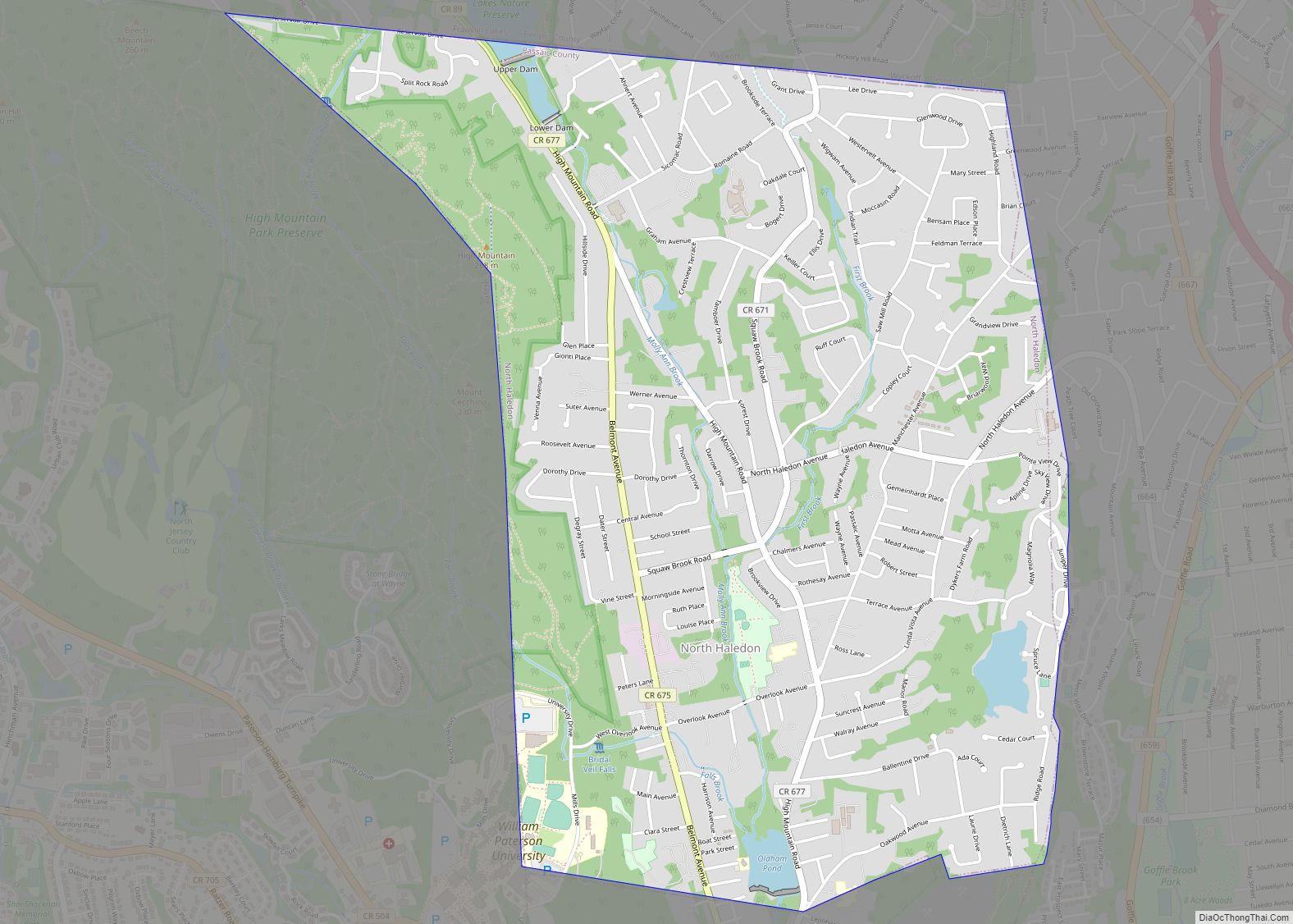
The city borders the municipalities of Clifton, Haledon, Hawthorne, Prospect Park, Totowa and Woodland Park (formerly West Paterson) in Passaic County; and both Elmwood Park (formerly East Paterson) and Fair Lawn in Bergen County.
Neighborhoods
The Great Falls Historic District is the most famous neighborhood in Paterson because of the landmark Great Falls of the Passaic River. The city has attempted to revitalize the area in recent years, including the installation of period lamp posts and the conversion of old industrial buildings into apartments and retail venues. Many artists live in this section of Paterson. A major redevelopment project is planned for this district in the coming years. The Paterson Museum of Industrial History at Rogers Locomotive and Machine Works is situated in the Historic District.
Downtown Paterson is the main commercial district of the city and was once a shopping destination for many who lived in northern New Jersey. After a devastating fire in 1902, the city rebuilt the downtown with massive Beaux-Arts-style buildings, many of which remain to this day. These buildings are usually four to seven stories tall. Downtown Paterson is home to Paterson City Hall and the Passaic County Courthouse Annex, two of the city’s architectural landmarks. City Hall was designed by the New York firm Carrere and Hastings in 1894, and was modeled after the Hôtel de Ville (city hall) in Lyon, France, capital of the silk industry in Europe.
The former Orpheum Theatre located on Van Houten Street has been converted to a mosque by the Islamic Foundation of New Jersey. The massive structure, now known as Masjid Jalalabad, can accommodate 1,500 worshipers.
As with many other old downtown districts in the United States, Downtown Paterson suffered as shoppers and retailers moved to the suburban shopping malls of the region. Many historic buildings are in disrepair or are abandoned after years of neglect. In addition, Downtown Paterson is an Urban Enterprise Zone. The city has, in recent years, begun initiatives in hopes of reviving the downtown area with the centerpiece being the Center City Mall, constructed on a large parking lot spanning Ward Street from Main to Church Streets and features retail, entertainment, and commercial space. Downtown Paterson is located in the city’s 1st Ward.
Eastside Park Historic District consists of about 1,000 homes in a variety of architectural styles, including Tudors, Georgian colonials, Victorians, Italianate villas and Dutch colonials. It is located east of downtown. Once the home of the city’s industrial and political leaders, the neighborhood experienced a significant downturn as industry fled Paterson. In recent years, gentrification has begun to occur in the neighborhood and some of the area’s historic houses have been restored.
The Eastside Park Historic District is a state and nationally registered historic place. The jewel of the neighborhood is Eastside Park and the mansions that surround it. This section of Paterson once had a large Jewish population that reached 40,000 at its peak; a synagogue still remains. Eastside Park and what is commonly known as the Upper Eastside are located in Paterson’s 3rd Ward.
East River Section is a section that is referred to by locals roughly bordering Riverside at 5th Avenue and extending south to Broadway, sandwiched in by Madison Avenue to McClean Boulevard (Route 20). However, the neighborhood’s layout unofficially extends to the “Paterson-Newark/Hudson Route” of River Road in the Paterson-Memorial Park section of Fair Lawn whose house addresses are in alignment with the now-defunct Jewish synagogue on the corner of 33rd Street and Broadway, which connects Paterson to Newark/Hudson, and at one time was the main route through River Drive, which starts in Elmwood Park and rides north to south along the East Bank of the Passaic River in Paterson’s original county.
Built when Paterson was still Bergen County, River Drive changes to River Road in the greater Eastside Sections of Upper Eastside-Manor Section, East River, and Riverside Sections, and turns into Wagaraw Road north of 1st Avenue / Maple Avenue in the old Bunker Hill extension of Columbia Heights in Fair Lawn an indication of not only entering the Industrial Section but also entering the foothills of the Ramapo Mountains in Hawthorne.
River Drive then turns into East Main Street to indicate that you have entered the Northside Section. The East River neighborhood which was and still maintains its “blue-collar” working-class identity, was at one time known for its large Jewish community, as well as a Neapolitan/Italian population and more recently other Mediterranean and Adriatic Europeans, Caribbean and South Americans, and other modern immigrant groups from all over the world, as well as African-Americans.
Manor Section is a residential neighborhood in Paterson. It is located east of East 33rd Street, north of Broadway, and south-west of Route 20 and the Passaic River. The Manor section of Paterson is located in the city’s 3rd Ward. The layout and culture of the Manor Section also extends into the neighboring Lyncrest and Rivercrest sections of Fair Lawn, with all the addresses aligning themselves to the now-defunct Jewish Temple, located at the corner of 33rd and Broadway.
South Paterson, also known as Little Istanbul or Little Ramallah, is a diverse neighborhood with a growing number of immigrants from the Middle East, with significant Turkish and Arab communities. The neighborhood is located in the 6th Ward, east of Main Street and west of West Railway Avenue. A majority of the city’s Arabs live in this section of Paterson. Many of the retail shops and restaurants cater to this community. The neighborhood is characterized by Halal meat markets which offer goat and lamb, and shop signs are in Arabic. South Paterson’s Arab community is mostly made up of Jordanians, Palestinians, Syrians, and Lebanese.
Lakeview is situated in the southern part of the city, and is a middle class neighborhood. Interstate 80 runs north of this district. Lakeview is home to the Paterson Farmers Market, where many people from across North Jersey come to buy fresh produce. The neighborhood is roughly 65% Hispanic, although this neighborhood also has sizable European, Middle-Eastern, African-American, and Asian populations, including a significant Filipino presence. Lakeview also shares some of the same characteristics as neighboring Clifton as they both share a neighborhood bearing the same name. The Lakeview section of Paterson is located in the city’s 6th ward.
Hillcrest is a largely residential, middle class enclave, to the west of the downtown area. Its borders’ limits are Preakness Avenue to the east, Cumberland Avenue to the west, and Totowa Avenue along with West Side Park and the Passaic River to the south. Hillcrest is one of Paterson’s most desirable neighborhoods. The neighborhood is very diverse having significant Italian, Arab, and Asian populations. The Hillcrest section of Paterson is located in the city’s 2nd Ward.
People’s Park is a neighborhood located north of 23rd Avenue and south of Market Street. Twenty-First Avenue, or “La Veinte y uno”, as it is known by most of Paterson’s Spanish-speaking community, is located in the People’s Park section of Paterson. It is an active and vibrant retail strip featuring a variety of shops and services catering to a diverse clientele. Twenty-First Avenue used to have a large Italian population. Although there is still a significant Italian presence left in the neighborhood, it also has a large first-generation Hispanic population, particularly Colombian.
Wrigley Park is a neighborhood that has suffered from years of poverty, crime, and neglect. It is mostly African-American. Poverty, crime, open-air drug markets, prostitution, vacant lots, and boarded-up windows are all common in this area. However, new houses are being built, and crime has dropped in recent years. This neighborhood is located north of Broadway. It is also known as the ‘4th Ward’. It was named for a Paterson paper manufacturing family.
Sandy Hill is a neighborhood in the Eastside located roughly west of Madison Avenue, north of 21st Avenue, south of Park Avenue, and east of Straight Street. Due to Paterson’s significant population turn-over, this neighborhood is now home to a large and growing Hispanic community, mostly first-generation Dominicans. The Sandy Hill section of Paterson is located in the city’s 5th Ward. Roberto Clemente Park, which was originally known as Sandy Hill Park, is located in this neighborhood.
Part of the 5th Ward is called Near Eastside by residents to differentiate it from the Eastside Park Historic District to its immediate east.
Northside, located north of Downtown, suffers from many of the social problems facing the Wrigley Park neighborhood, but to a lesser extent. This neighborhood borders the boroughs of Haledon and Prospect Park and is known for its hills and sweeping views of the New York City skyline. The Northside section of Paterson is located in the city’s 1st Ward.
Totowa section is a large neighborhood located west of the Passaic River, south-west of West Broadway and north-east of Preakness Avenue. As the name implies, it borders the town of Totowa. It is mostly Hispanic but with an increasing South Asian community, mainly Bangladeshi. Many Bengali grocery and clothing stores are located on Union Avenue and the surrounding streets. Masjid Al-Ferdous is located on Union Avenue, which accommodates the daily Bangladeshi pedestrian population.
A large Italian presence remains in this neighborhood. Many Peruvian and other Latin American restaurants and businesses are located on Union Avenue. Colonial Village and Brooks Sloate Terraces are located in this neighborhood. The Totowa Section is located in parts of the 1st and 2nd Wards of Paterson.
Stoney Road is Paterson’s most south-west neighborhood, bordering Woodland Park to the south and Totowa across the Passaic River to the west. This neighborhood is home to Pennington Park, Hayden Heights, Lou Costello Pool, the Levine reservoir, Murray Avenue, Mc Bride Avenue, and Garret Heights. A strong Italian presence remains in this neighborhood. The Stoney Road section of Paterson is located in the city’s 2nd Ward.
Riverside is a larger neighborhood in Paterson and, as its name suggests, is bound by the Passaic River to the north and east, separating the city from Hawthorne and Fair Lawn. Riverside is a working-class neighborhood. The neighborhood is mostly residential with some industrial uses. Madison Avenue cuts through the heart of this district. Route 20 runs through the eastern border of Riverside, providing an easy commute to Route 80 East and New York City. This section is ethnically diverse with a growing Hispanic community concentrating mostly north and along River Street. Many Albanians make their home in the East 18th Street and River Street areas. River View Terrace is located in this neighborhood. Riverside is located in parts of the 3rd and 4th Wards of Paterson.
Bunker Hill is a mostly industrial area west of River Street and east of the Passaic River.
Westside Park located off Totowa Avenue and best known as the site of the Holland submarine, Fenian Ram, which was built from 1879 to 1881 for the Fenian Brotherhood. It became the target of graffiti artists because the fence surrounding it was too low and too close to the submarine itself. The sub is now located in Paterson Museum.
Climate
The climate in this area is characterized by hot, humid summers and generally cool to cold winters. According to the Köppen Climate Classification system, Paterson has a humid continental climate, abbreviated “Dfa” on climate maps. Despite the size of the city, it has no weather reporting station, and thus, no historic climate data. Paterson uses Newark’s airport for its local weather.
See also
Map of New Jersey State and its subdivision: Map of other states:- Alabama
- Alaska
- Arizona
- Arkansas
- California
- Colorado
- Connecticut
- Delaware
- District of Columbia
- Florida
- Georgia
- Hawaii
- Idaho
- Illinois
- Indiana
- Iowa
- Kansas
- Kentucky
- Louisiana
- Maine
- Maryland
- Massachusetts
- Michigan
- Minnesota
- Mississippi
- Missouri
- Montana
- Nebraska
- Nevada
- New Hampshire
- New Jersey
- New Mexico
- New York
- North Carolina
- North Dakota
- Ohio
- Oklahoma
- Oregon
- Pennsylvania
- Rhode Island
- South Carolina
- South Dakota
- Tennessee
- Texas
- Utah
- Vermont
- Virginia
- Washington
- West Virginia
- Wisconsin
- Wyoming