Fort Collins is a home rule municipality that is the county seat and the most populous municipality of Larimer County, Colorado, United States. The city population was 169,810 at the 2020 census, an increase of 17.94% since 2010. Fort Collins is the principal city of the Fort Collins, CO Metropolitan Statistical Area and is a major city of the Front Range Urban Corridor. The city is the fourth most populous city in Colorado. Situated on the Cache La Poudre River along the Colorado Front Range, Fort Collins is located 56 mi (90 km) north of the Colorado State Capitol in Denver. Fort Collins is a midsize college town, home to Colorado State University and Front Range Community College’s Larimer campus.
| Name: | Fort Collins city |
|---|---|
| LSAD Code: | 25 |
| LSAD Description: | city (suffix) |
| State: | Colorado |
| County: | Larimer County |
| Incorporated: | February 12, 1883 |
| Elevation: | 5,003 ft (1,525 m) |
| Total Area: | 58.473 sq mi (151.444 km²) |
| Land Area: | 57.212 sq mi (148.179 km²) |
| Water Area: | 1.261 sq mi (3.265 km²) |
| Total Population: | 169,810 |
| Population Density: | 2,968/sq mi (1,146/km²) |
| Area code: | 970 |
| FIPS code: | 0827425 |
| GNISfeature ID: | 0204673 |
| Website: | www.fcgov.com |
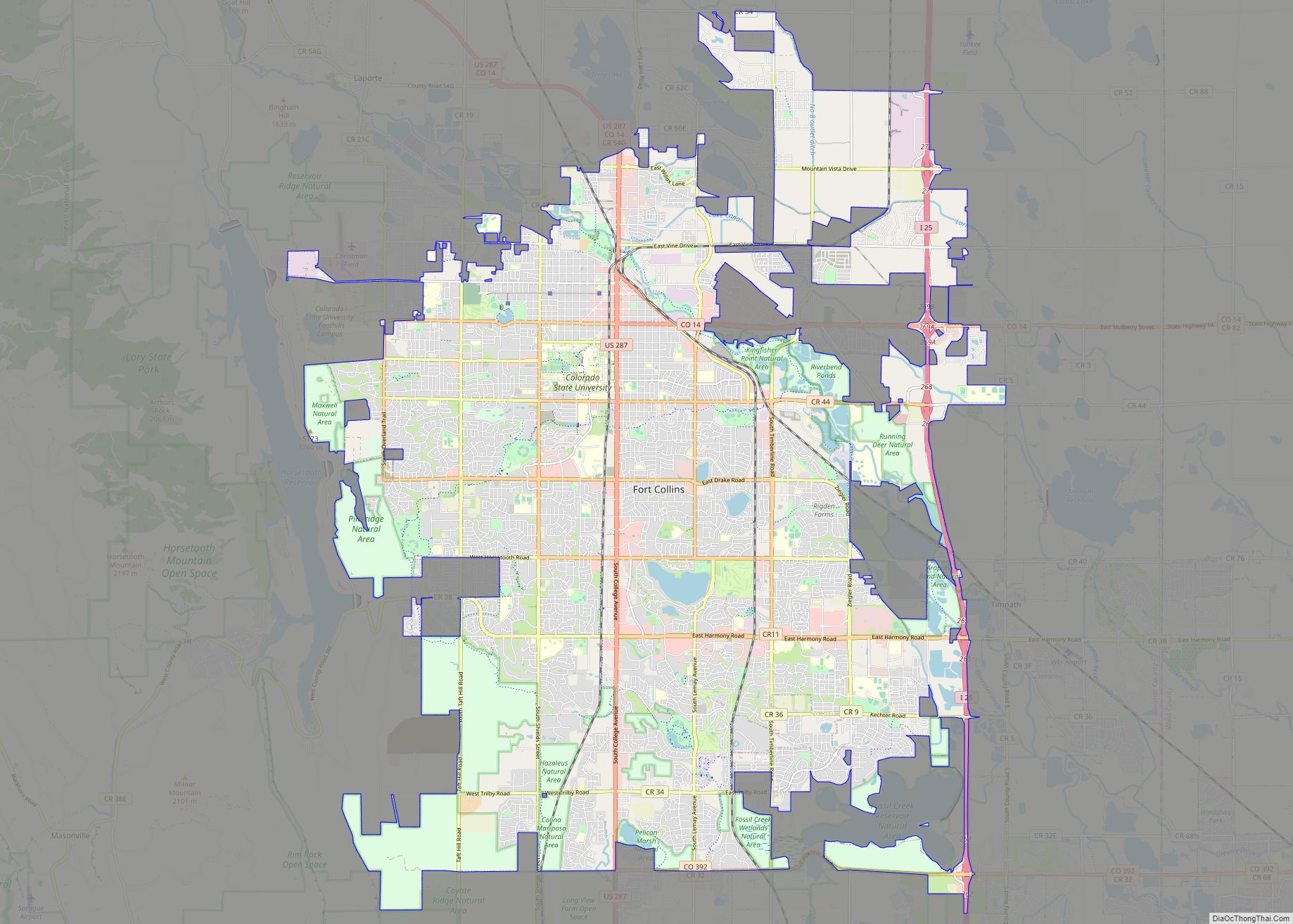
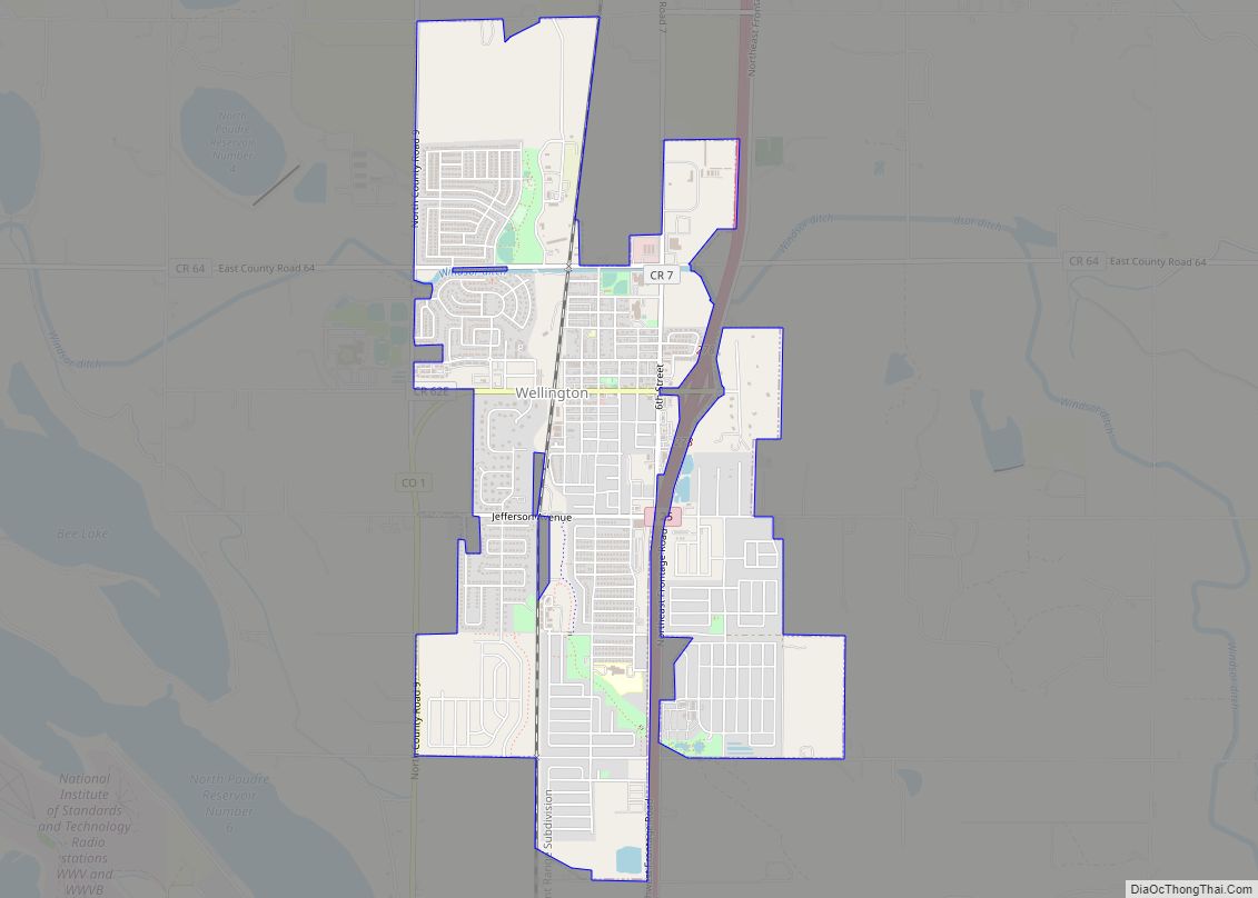
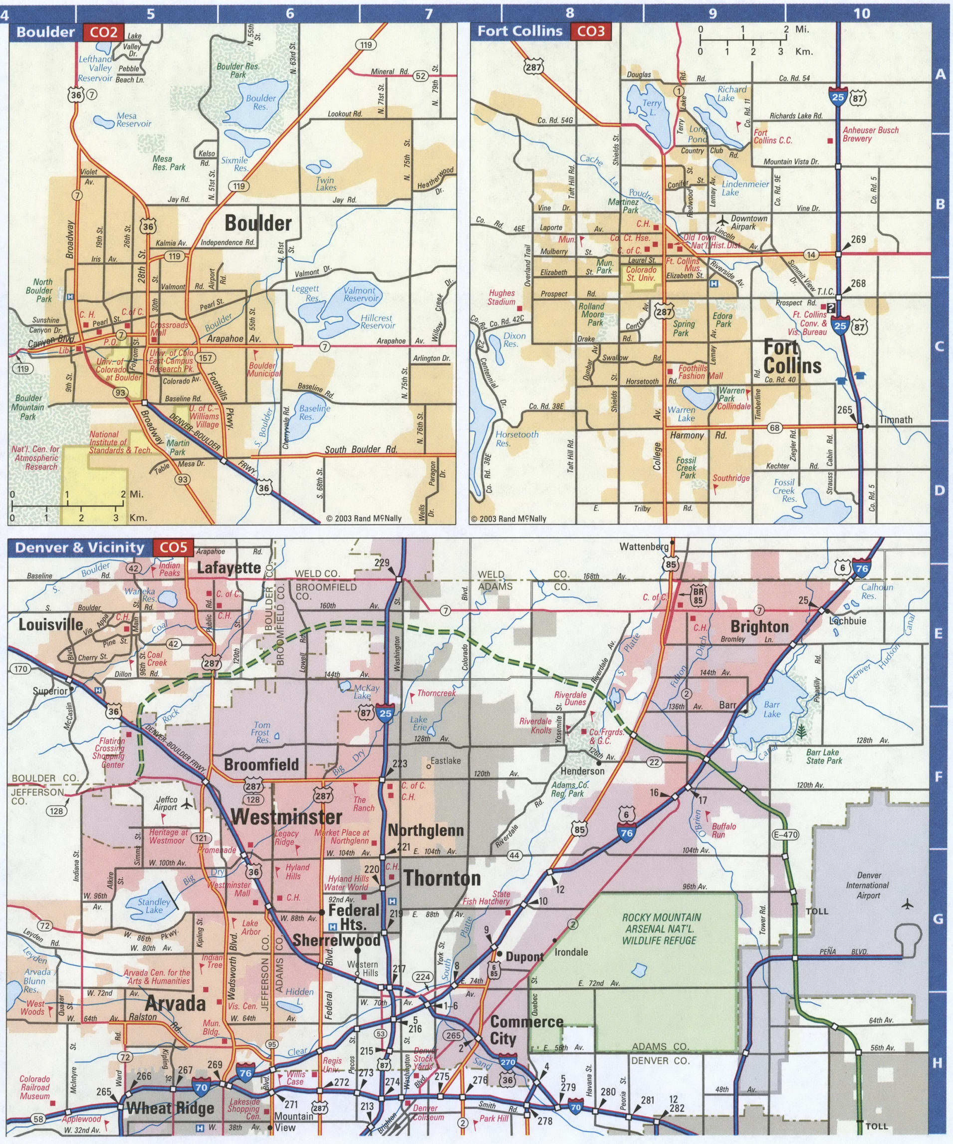
Explore the city and its surrounding area with this interactive Fort Collins map. You’ll find highways/roads, landmarks, and a list of things to do. And if you want to get a closer look at the city, check out this Google Map of Fort Collins.
Discover the beauty of Fort Collins with its lakes, parks, and trails. From Warren Lake to Fossil Creek Reservoir and Boyd Lake, you’ll find plenty of outdoor activities to enjoy. Don’t forget to take a trip to Horsetooth Reservoir, just a stone’s throw away in the west of Fort Collins.
Whether you’re a local or a visitor, get to know the city of Fort Collins with this detailed map collection. From highways/roads to landmarks and things to do, you’ll find everything you need to explore the city with this interactive Fort Collins map.
Online Interactive Map
Click on ![]() to view map in "full screen" mode.
to view map in "full screen" mode.
This map is a guide to the best places to visit in Fort Collins Colorado. It includes a list of top attractions, hotels, museums, and more. Search for the perfect place to go and find it with ease. With our interactive map, you can learn about the city’s history, top attractions, and the best restaurants in Fort Collins Colorado.
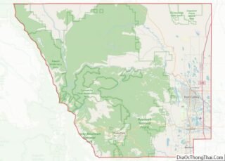
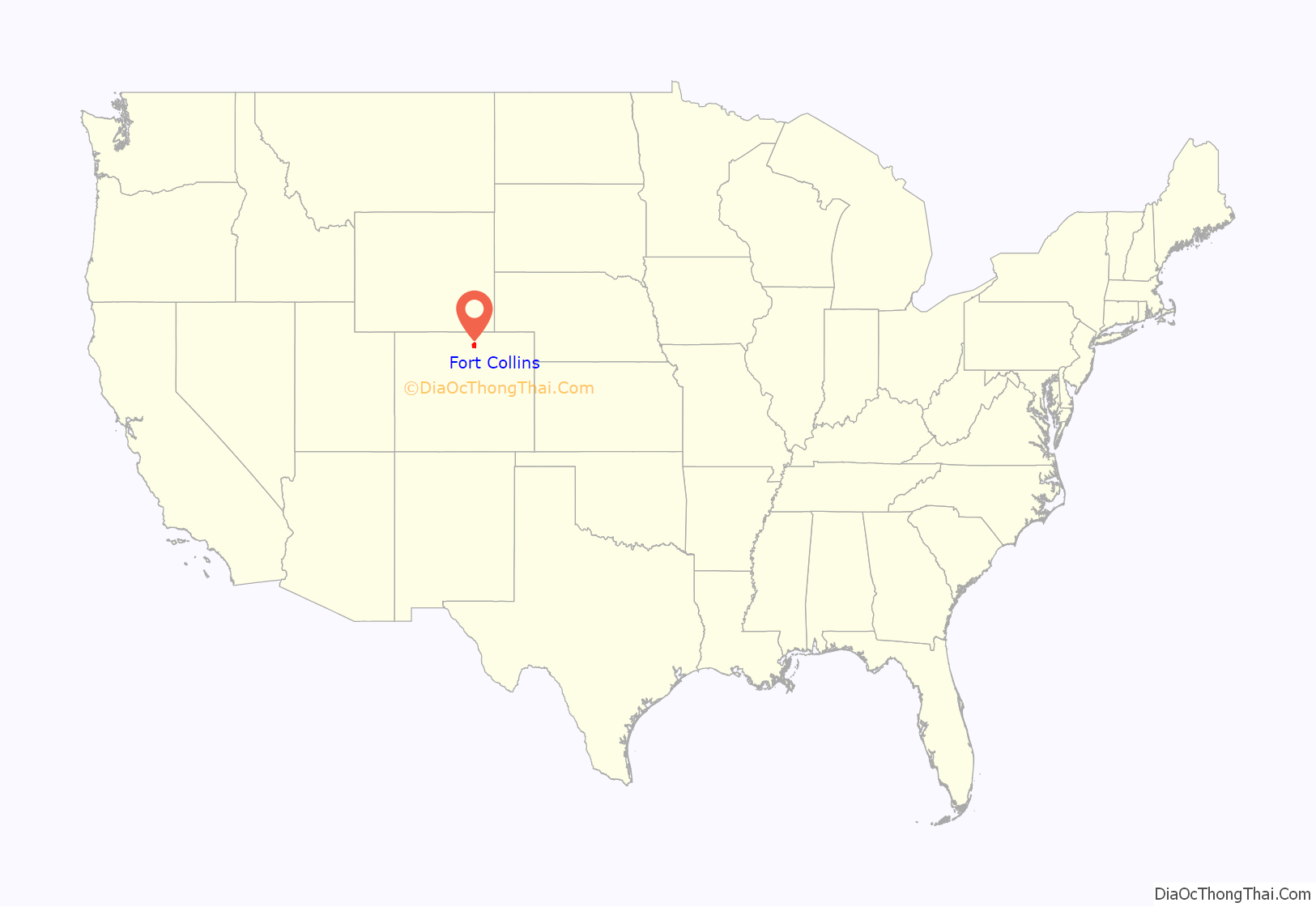
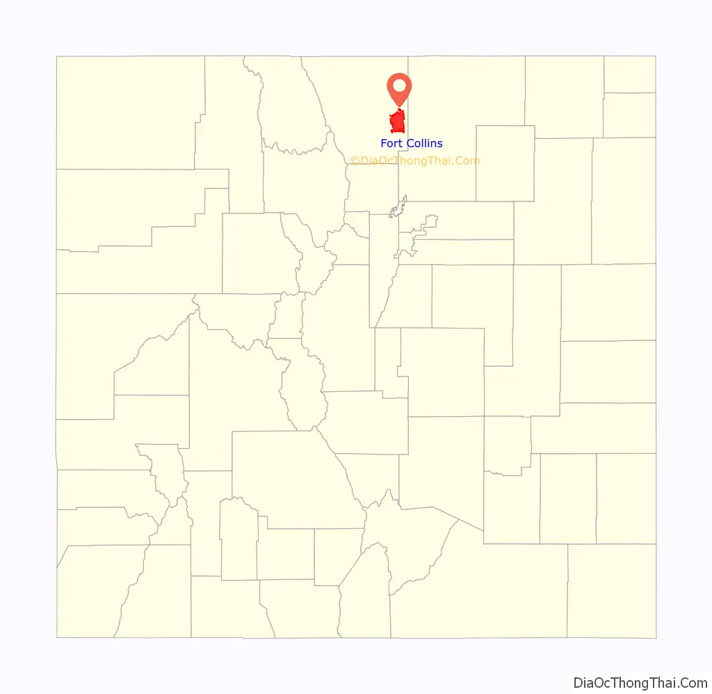
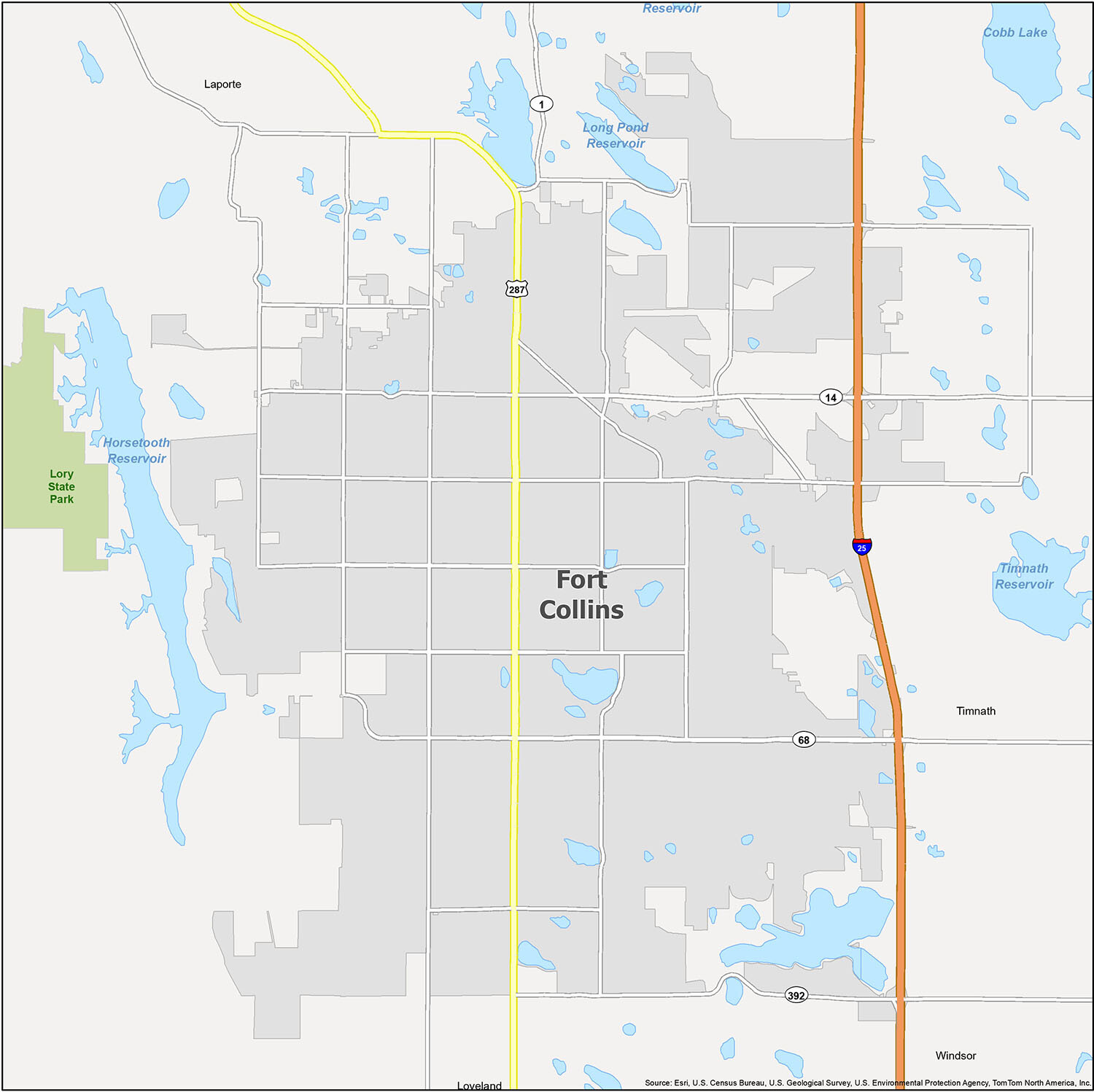
Fort Collins location map. Where is Fort Collins city?
History
Northern Arapaho were centered in the Cache la Poudre River Valley near present-day Fort Collins. Friday, who attended school in St. Louis, Missouri in his youth, was a leader of the band of Arapahos as well as an interpreter, negotiator, and peacemaker. He made friends of white settlers who moved into the area, but was pushed out of Colorado in the 1860s.
Fort Collins was founded as a military outpost of the United States Army in 1864. It succeeded a previous encampment, known as Camp Collins, on the Cache la Poudre River, near what is known today as Laporte. Camp Collins was erected during the Indian wars of the mid-1860s to protect the Overland mail route that had been recently relocated through the region. Travelers crossing the county on the Overland Trail would camp there, but a flood destroyed the camp in June 1864. Afterward, the commander of the fort wrote to the commandant of Fort Laramie in southeast Wyoming, Colonel William O. Collins, suggesting that a site several miles farther down the river would make a good location for the fort. The post was manned originally by two companies of the 11th Ohio Volunteer Cavalry and never had walls.
Settlers began arriving in the vicinity of the fort nearly immediately. The fort was decommissioned in 1867. The original fort site is now adjacent to the present historic “Old Town” portion of the city. The first school and church opened in 1866, and the town was platted in 1867. The civilian population of Fort Collins, led by local businessman Joseph Mason, led an effort to relocate the county seat to Fort Collins from LaPorte, and they were successful in 1868.
The city’s first population boom came in 1872, with the establishment of an agricultural colony. Hundreds of settlers arrived, developing lots just south of the original Old Town. Tension between new settlers and earlier inhabitants led to political divisions in the new town, which was incorporated in 1873. Although the Colorado Agricultural College was founded in 1870, the first classes were held in 1879.
The 1880s saw the construction of a number of elegant homes and commercial buildings and the growth of a distinctive identity for Fort Collins. Stone quarrying, sugar-beet farming, and the slaughter of sheep were among the area’s earliest industries. Beet tops, an industry supported by the college and its associated agricultural experiment station, proved to be an excellent and abundant food for local sheep, and by the early 1900s the area was being referred to as the “Lamb feeding capital of the world”. In 1901 the Great Western sugar processing plant was built in the neighboring city of Loveland.
Although the city was affected by the Great Depression and simultaneous drought, it nevertheless experienced slow and steady growth throughout the early part of the twentieth century. During the decade following World War II, the population doubled and an era of economic prosperity occurred. Old buildings were razed to make way for new, modern structures. Along with revitalization came many changes, including the closing of the Great Western sugar factory in 1955, and a new city charter, adopting a council-manager form of government in 1954. Similarly, Colorado State University’s enrollment doubled during the 1960s, making it the city’s primary economic force by the end of the century.
Fort Collins gained a reputation as a very conservative city in the twentieth century, with a prohibition of alcoholic beverages, a contentious political issue in the town’s early decades, being retained from the late 1890s until student activism helped bring it to an end in 1969. During that same period, civil rights activism and anti-war disturbances heightened tensions in the city, including the burning of several buildings on the CSU campus.
During the late 20th century, Fort Collins expanded rapidly to the south, adding new development, including several regional malls. Management of city growth patterns became a political priority during the 1980s, as well as the revitalization of Fort Collins’ Old Town with the creation of a Downtown Development Authority. In late July 1997, the city experienced a flash flood after and during a 31-hour period when 10–14 in (250–360 mm) of rain fell. The rainfall was the heaviest on record for an urban area of Colorado. Five people were killed and $5 million in damages were dealt to the city. The waters flooded Colorado State University’s library and brought about $140 million in damages to the institution.
Fort Collins Road Map
With its stunning scenery, vibrant culture, and bustling city life, Fort Collins, Colorado, is an ideal destination for travelers. From the Rocky Mountains to the foothills, the area has something for everyone. Whether you’re looking for outdoor recreation, culture, or nightlife, Fort Collins has it all. Make the most of your visit with this printable road map of Fort Collins, Colorado. It features all the major roads and highways so you can easily get around the city. Plus, discover the best places to go and the best routes to get there. Save time and gas with this helpful road map of Fort Collins, Colorado.
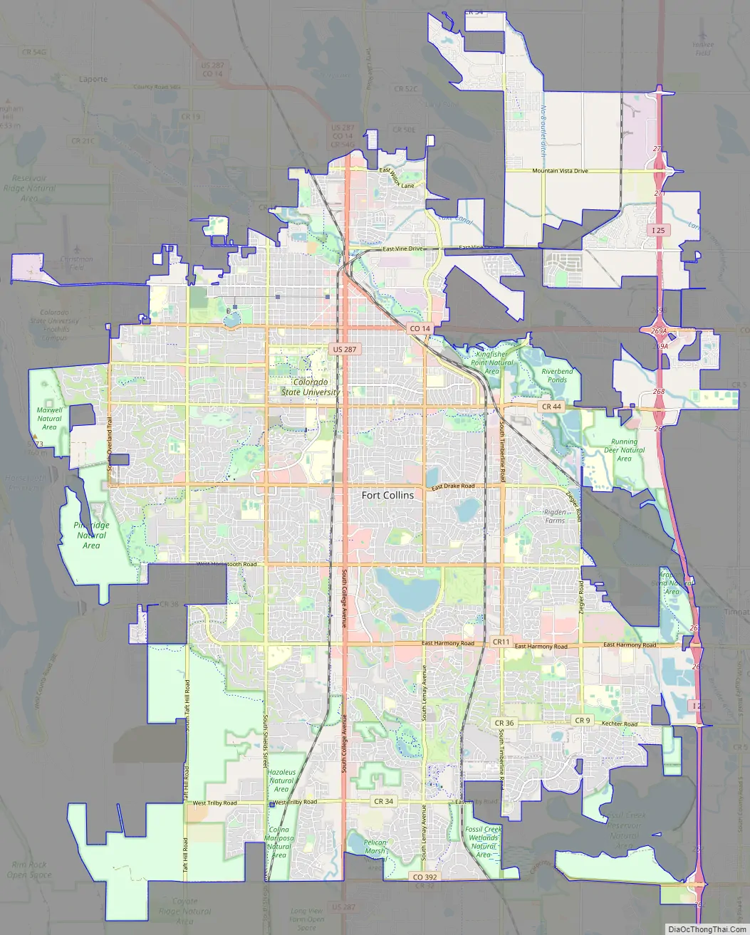
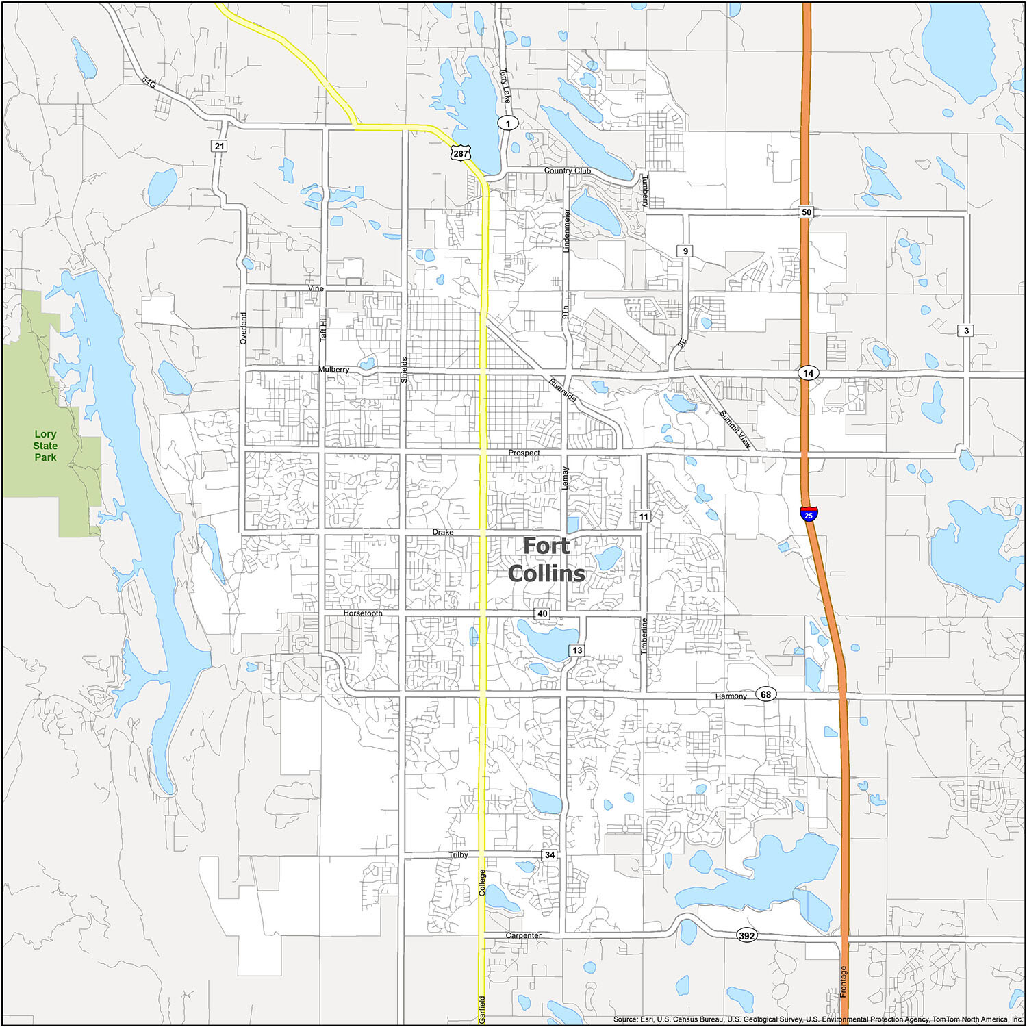
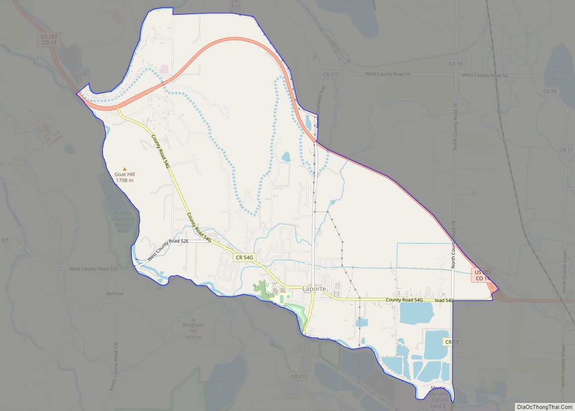
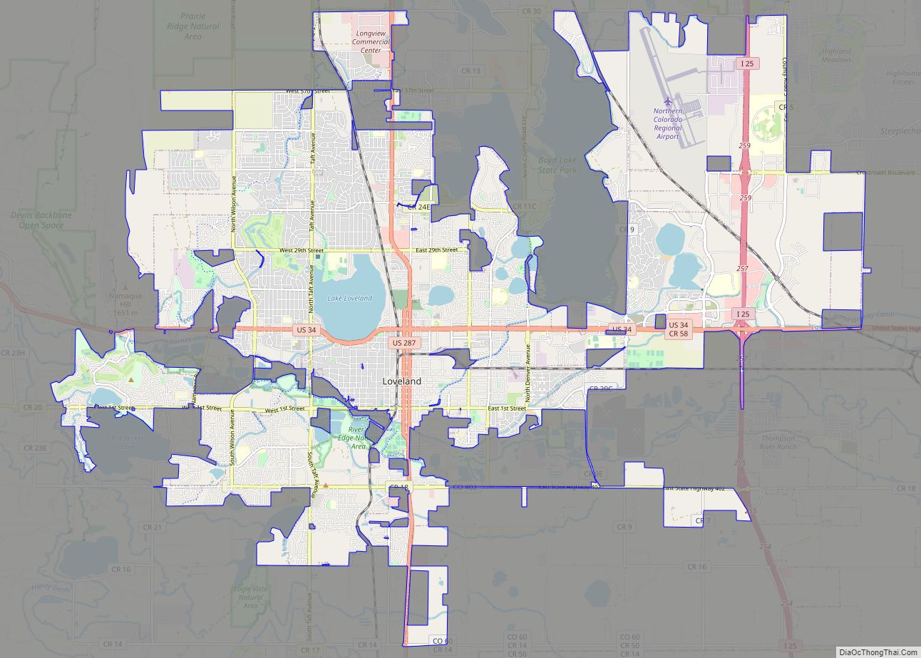
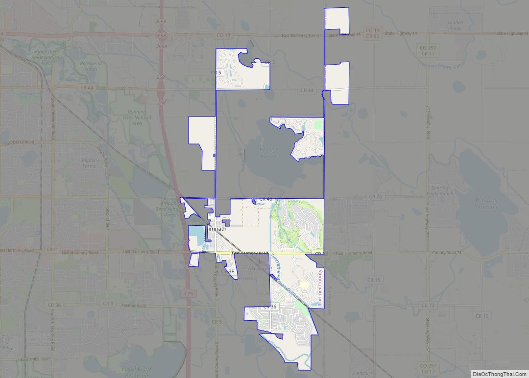
Explore the vibrant city of Fort Collins, located in north-central Colorado on the eastern plains of the Rocky Mountains. Whether you are looking for world-class outdoor adventure or a great place to raise a family, Fort Collins has something for everyone. From Loveland and Timnath to Windsor and Laporte, get to know the city and discover the best places to visit. With a bird’s eye view of the city’s attractions and landmarks, you can explore the city at your own pace and share your discoveries with friends.
10 things to do in Fort Collins city
Fort Collins is a great place to explore. With its wide range of attractions, you can make the most of your visit. Use this map to plan your trip and see the best places to visit in Fort Collins.
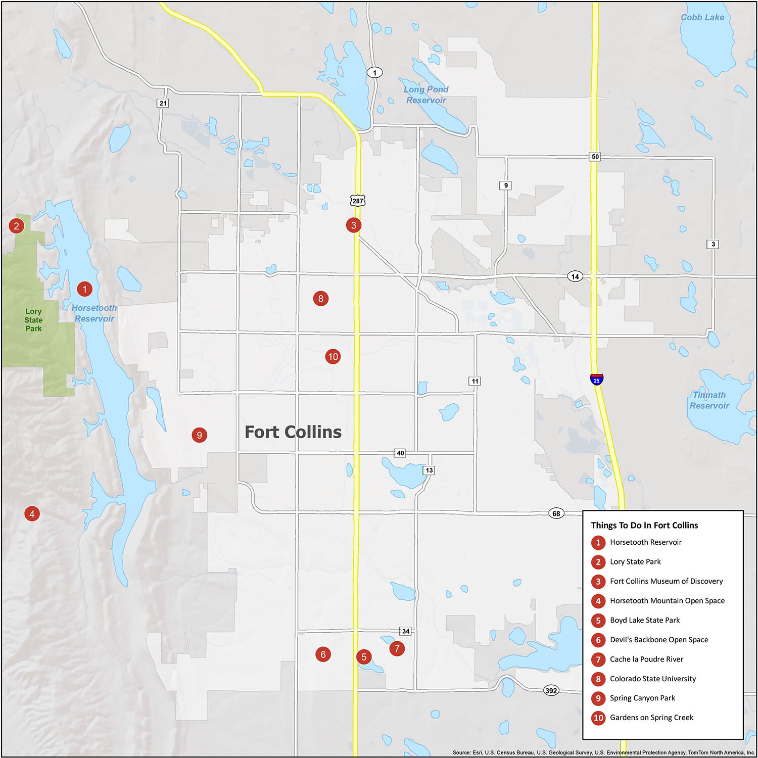
Discover Fort Collins, Colorado with this interactive map! Explore the city’s attractions, museums, parks, and open spaces. Plan your next vacation to a city that has everything, from the iconic Horsetooth Reservoir to the family-friendly Lory State Park. Check out the top 10 travel recommendations and make the most of your visit.
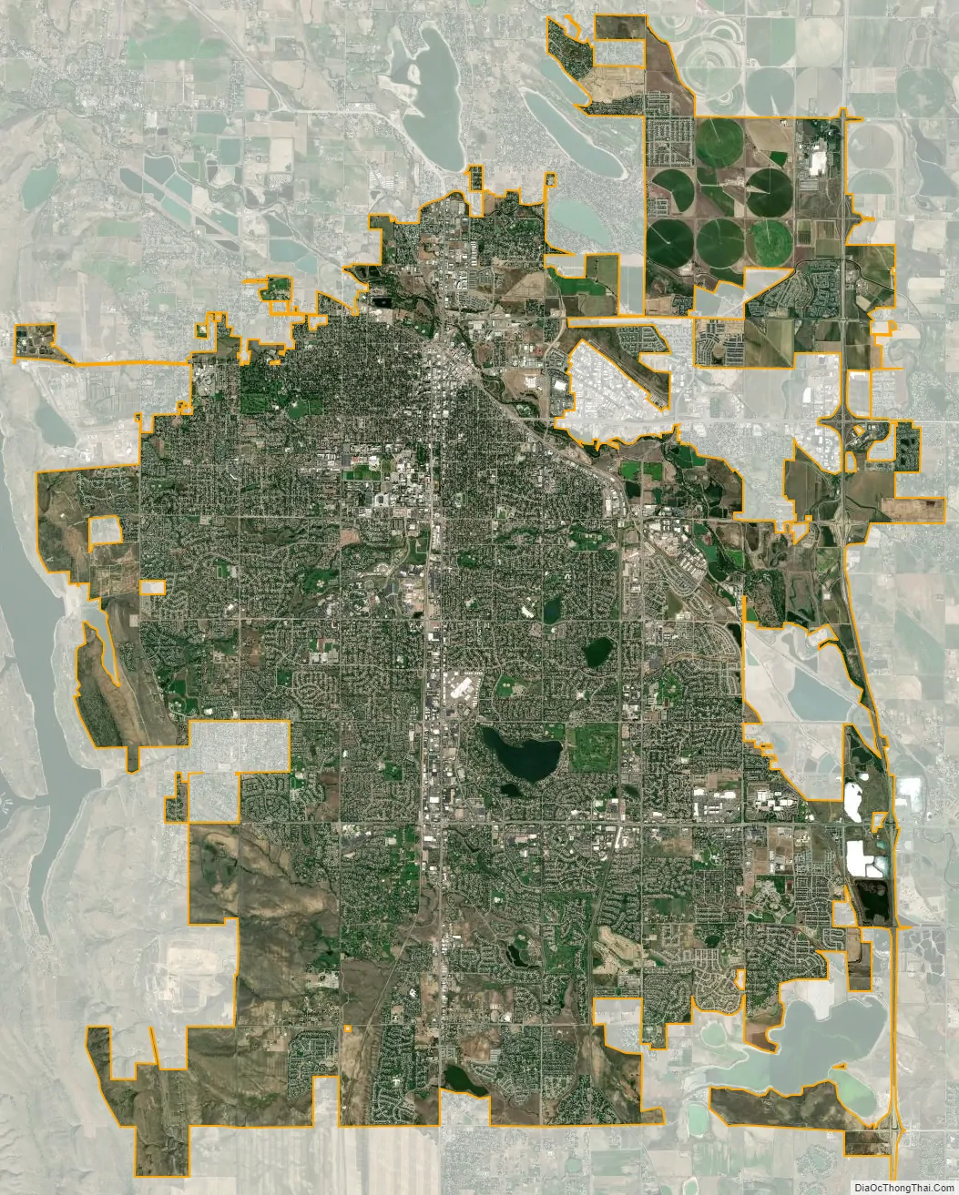
Fort Collins city Satellite Map
Geography
Fort Collins is situated at the base of the Rocky Mountain foothills of the northern Front Range, approximately 60 miles (97 km) north of Denver, Colorado, and 45 miles (72 km) south of Cheyenne, Wyoming. Elevation is 4,982 ft (1,519 m) above sea level. Geographic landmarks include Horsetooth Reservoir and Horsetooth Mountain—so named because of a tooth-shaped granite rock that dominates the city’s western skyline. Longs Peak can also clearly be seen on a clear day to the southwest of the city.
The Cache La Poudre River and Spring Creek run through Fort Collins.
At the 2020 United States Census, the town had a total area of 37,423 acres (151.444 km) including 807 acres (3.265 km) of water.
Climate
Fort Collins has a cold semi-arid climate (Köppen climate classification BSk). Its climate is characterized by warm to hot summers and long and moderately cold winters (with frequent warm spells due to downslope winds, and somewhat less common intervals of severe cold). The average temperature in December, the coldest month, is 31.1 °F (−0.5 °C). Annual snowfall averages 51.4 inches (1.31 m), and can occur from early September through the end of May. Average precipitation overall is 15.88 inches (403 mm).
See also
Map of Colorado State and its subdivision:- Adams
- Alamosa
- Arapahoe
- Archuleta
- Baca
- Bent
- Boulder
- Broomfield
- Chaffee
- Cheyenne
- Clear Creek
- Conejos
- Costilla
- Crowley
- Custer
- Delta
- Denver
- Dolores
- Douglas
- Eagle
- El Paso
- Elbert
- Fremont
- Garfield
- Gilpin
- Grand
- Gunnison
- Hinsdale
- Huerfano
- Jackson
- Jefferson
- Kiowa
- Kit Carson
- La Plata
- Lake
- Larimer
- Las Animas
- Lincoln
- Logan
- Mesa
- Mineral
- Moffat
- Montezuma
- Montrose
- Morgan
- Otero
- Ouray
- Park
- Phillips
- Pitkin
- Prowers
- Pueblo
- Rio Blanco
- Rio Grande
- Routt
- Saguache
- San Juan
- San Miguel
- Sedgwick
- Summit
- Teller
- Washington
- Weld
- Yuma
- Alabama
- Alaska
- Arizona
- Arkansas
- California
- Colorado
- Connecticut
- Delaware
- District of Columbia
- Florida
- Georgia
- Hawaii
- Idaho
- Illinois
- Indiana
- Iowa
- Kansas
- Kentucky
- Louisiana
- Maine
- Maryland
- Massachusetts
- Michigan
- Minnesota
- Mississippi
- Missouri
- Montana
- Nebraska
- Nevada
- New Hampshire
- New Jersey
- New Mexico
- New York
- North Carolina
- North Dakota
- Ohio
- Oklahoma
- Oregon
- Pennsylvania
- Rhode Island
- South Carolina
- South Dakota
- Tennessee
- Texas
- Utah
- Vermont
- Virginia
- Washington
- West Virginia
- Wisconsin
- Wyoming