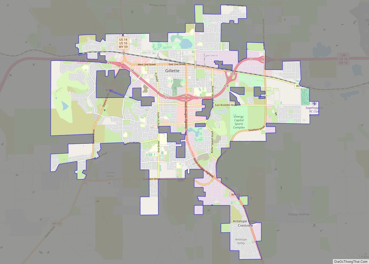
Map of Cheyenne city, Wyoming

Map of Cheyenne city, Wyoming

Cheyenne (/ʃaɪˈæn/ shy-AN or /ʃaɪˈɛn/ shy-EN) is the capital and most populous city of the U.S. state of Wyoming, as well as the county seat of Laramie County, with 65,132 residents, per the 2020 US Census. It is the principal city of the Cheyenne metropolitan statistical area which encompasses all of Laramie County and had … Read more

Map of Casper city

Map of Casper city

Casper is a city in, and the county seat of, Natrona County, Wyoming, United States. Casper is the second-largest city in the state, with the population at 59,038 as of the 2020 census. Only Cheyenne, the state capital, is larger. Casper is nicknamed “The Oil City” and has a long history of oil boomtown and … Read more

Map of Rock Springs city, Wyoming

Map of Rock Springs city, Wyoming

Rock Springs is a city in Sweetwater County, Wyoming, United States. The population was 23,036 at the 2010 census, making it the fifth most populated city in the state of Wyoming, and the most populous city in Sweetwater County. Rock Springs is the principal city of the Rock Springs micropolitan statistical area, which has a … Read more

Map of Laramie city

Map of Laramie city

Laramie /ˈlærəmi/ is a city in and the county seat of Albany County, Wyoming, United States. The population was estimated 32,711 in 2019, making it the third-largest city in Wyoming after Cheyenne and Casper. Located on the Laramie River in southeastern Wyoming, the city is north west of Cheyenne, at the junction of Interstate 80 … Read more

Map of Kauai island

Kauai island overview: Name: Kauai island State: Hawaii Explore Kauai Island like never before with our collection of maps. Whether you’re looking for a detailed map of Kauai or a simple overview of the island, you’re sure to find something that suits your needs. Discover the beauty and charm of Kauai with our Kauai Island … Read more

Map of Adak city

Map of Adak city

Adak (/ˈeɪdæk/, Aleut: Adaax, Russian: Адак), formerly Adak Station, is a city located on Adak Island, in the Aleutians West Census Area, Alaska, United States. At the 2020 census, the population was 171, down from 326 in 2010. It is the westernmost municipality in the United States and the southernmost city in Alaska. (See Extreme … Read more

Map of Oahu island

Oahu island overview: Name: Oahu island State: Hawaii Let’s explore the island of Oahu with this interactive map. It features highways, roads, places of interest, and things to do. Get better acquainted with a detailed map of Oahu, Hawaii provided by Google Maps. Oahu is Hawaii’s third-largest island and is sometimes nicknamed the “Gathering Place”. … Read more

Map of Maui island

Maui island overview: Name: Maui island State: Hawaii Explore Maui’s unique geography with our interactive map of the island. Our Maui map collection includes roads, landmarks, and a list of things to do. Whether you’re looking for a secluded beach or a fun activity, you’ll find it all on our map. If you’re planning a … Read more

Map of Akiak city

Map of Akiak city

Akiak (ACK-ee-ack) (Central Yupik: Akiaq) is a city in Bethel Census Area, Alaska, United States. The population was 462 at the 2020 census, up from 346 in 2010. It is the home of the Akiak Native Community. Akiak city overview: Name: Akiak city LSAD Code: 25 LSAD Description: city (suffix) State: Alaska County: Bethel Census … Read more

Map of Akiachak CDP

Map of Akiachak CDP

Akiachak (ACK-ee-uh-chuck; Central Yupik: Akiacuaq) is a census-designated place (CDP) in the Bethel Census Area in the U.S. state of Alaska. The population was 627 at the 2010 census, up from 585 in 2000. Akiachak CDP overview: Name: Akiachak CDP LSAD Code: 57 LSAD Description: CDP (suffix) State: Alaska County: Bethel Census Area Elevation: 13 ft … Read more

Map of Akhiok city

Map of Akhiok city

Akhiok (Kasukuak in Alutiiq; Russian: Акхиок) is a second-class city in Kodiak Island Borough, Alaska, United States. Akhiok is Kodiak’s southernmost village. The population was 63 at the 2020 census. Akhiok, which does not have a post office, is a rural location in postal code 99615 that belongs to Kodiak. The village is sometimes called … Read more

Map of Alatna CDP

Map of Alatna CDP

Alatna /əˈlætnə/ (Alaasuq in Iñupiaq [ɐˈlaːsoq]) is a census-designated place (CDP) in the Yukon-Koyukuk Census Area of the Unorganized Borough in the U.S. state of Alaska. The population was 37 at the 2010 census. Alatna CDP overview: Name: Alatna CDP LSAD Code: 57 LSAD Description: CDP (suffix) State: Alaska County: Yukon-Koyukuk Census Area Total Area: … Read more