Map of Jenkinsville town

Map of Jenkinsville town

Jenkinsville is an incorporated town in western Fairfield County, South Carolina, United States, between the Broad and the Little rivers. It is located east of Monticello Reservoir and is near the Virgil C. Summer Nuclear Generating Station. Also in the area is the Kincaid-Anderson House and quarry. The town was incorporated in 2008. Jenkinsville’s population … Read more

Map of Jefferson town, South Carolina

Map of Jefferson town, South Carolina

Jefferson is a town in western Chesterfield County, South Carolina, United States at the junction of SC routes 265 and 151. Jefferson is located in the Piedmont region of South Carolina just in the edge meeting the Sandhills region. Jefferson is located 16 miles northwest of McBee, 8 miles south of Pageland, 50 miles southeast … Read more

Map of Jamestown town, South Carolina

Map of Jamestown town, South Carolina

Jamestown is a town in Berkeley County, South Carolina, United States. The population was 72 at the 2010 census. Jamestown is included within the Charleston-North Charleston-Summerville metropolitan area. Jamestown town overview: Name: Jamestown town LSAD Code: 43 LSAD Description: town (suffix) State: South Carolina County: Berkeley County Elevation: 30 ft (9 m) Total Area: 0.61 sq mi (1.57 km²) Land … Read more

Map of James Island town

Map of James Island town

James Island is a town in Charleston County, South Carolina, United States. It is located in the central and southern parts of James Island. James Island is included within the Charleston-North Charleston-Summerville metropolitan area and the Charleston-North Charleston Urbanized Area. James Island town overview: Name: James Island town LSAD Code: 43 LSAD Description: town (suffix) … Read more

Map of Jacksonboro CDP

Map of Jacksonboro CDP

Jacksonboro is an unincorporated community and census-designated place located in southeastern Colleton County, South Carolina, United States, along the west side of the Edisto River. Jacksonboro serves as a primary junction along U.S. Highway 17 between Charleston 32 miles (51 km) to the east and Beaufort 41 miles (66 km) to the southwest. Walterboro, the Colleton County … Read more

Map of Jackson town, South Carolina

Map of Jackson town, South Carolina

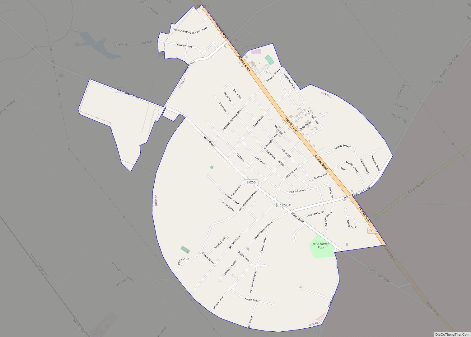
Jackson is a town in Aiken County, South Carolina, United States. The population was 1,700 at the 2010 census. It is part of the Augusta, Georgia metropolitan area. Jackson town overview: Name: Jackson town LSAD Code: 43 LSAD Description: town (suffix) State: South Carolina County: Aiken County Elevation: 203 ft (62 m) Total Area: 3.52 sq mi (9.12 km²) Land … Read more

Map of Iva town

Map of Iva town

Iva is a town in Anderson County, South Carolina, United States. The population was 1,218 at the 2010 census. Iva town overview: Name: Iva town LSAD Code: 43 LSAD Description: town (suffix) State: South Carolina County: Anderson County Elevation: 712 ft (217 m) Total Area: 1.03 sq mi (2.66 km²) Land Area: 1.02 sq mi (2.65 km²) Water Area: 0.00 sq mi (0.01 km²) Total Population: … Read more

Map of Judson CDP

Map of Judson CDP

Judson is a census-designated place (CDP) in Greenville County, South Carolina, United States. The population was 2,050 at the 2010 census, down from 2,456 at the 2000 census. It is part of the Greenville–Mauldin–Easley Metropolitan Statistical Area. Judson CDP overview: Name: Judson CDP LSAD Code: 57 LSAD Description: CDP (suffix) State: South Carolina County: Greenville … Read more

Map of Jonesville town, South Carolina

Map of Jonesville town, South Carolina

Jonesville is a town in Union County, South Carolina, United States. The population was 911 at the 2010 United States Census. Jonesville town overview: Name: Jonesville town LSAD Code: 43 LSAD Description: town (suffix) State: South Carolina County: Union County Elevation: 686 ft (209 m) Total Area: 1.02 sq mi (2.65 km²) Land Area: 1.01 sq mi (2.63 km²) Water Area: 0.01 sq mi (0.02 km²) … Read more

Map of Lake Secession CDP

Map of Lake Secession CDP

Lake Secession is a census-designated place (CDP) in Abbeville County, South Carolina, United States located near a lake by the same name. The population was 1,083 at the 2010 census. Lake Secession CDP overview: Name: Lake Secession CDP LSAD Code: 57 LSAD Description: CDP (suffix) State: South Carolina County: Abbeville County Elevation: 558 ft (170 m) Total … Read more

Map of Lake Murray of Richland CDP

Map of Lake Murray of Richland CDP

Lake Murray of Richland is a census-designated place (CDP) in Richland County, South Carolina, United States. The population was 5,484 at the 2010 census. It is part of the Columbia, South Carolina Metropolitan Statistical Area. Lake Murray of Richland CDP overview: Name: Lake Murray of Richland CDP LSAD Code: 57 LSAD Description: CDP (suffix) State: … Read more

Map of Lake City, South Carolina

Map of Lake City, South Carolina

Lake City is a city in Florence County, South Carolina, United States. The population was 6,675 at the 2010 census. Located in central South Carolina, it is south of Florence and included as part of the Florence Metropolitan Statistical Area. Lake City overview: Name: Lake City LSAD Code: 25 LSAD Description: city (suffix) State: South … Read more