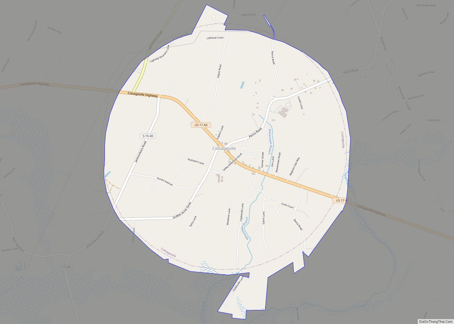
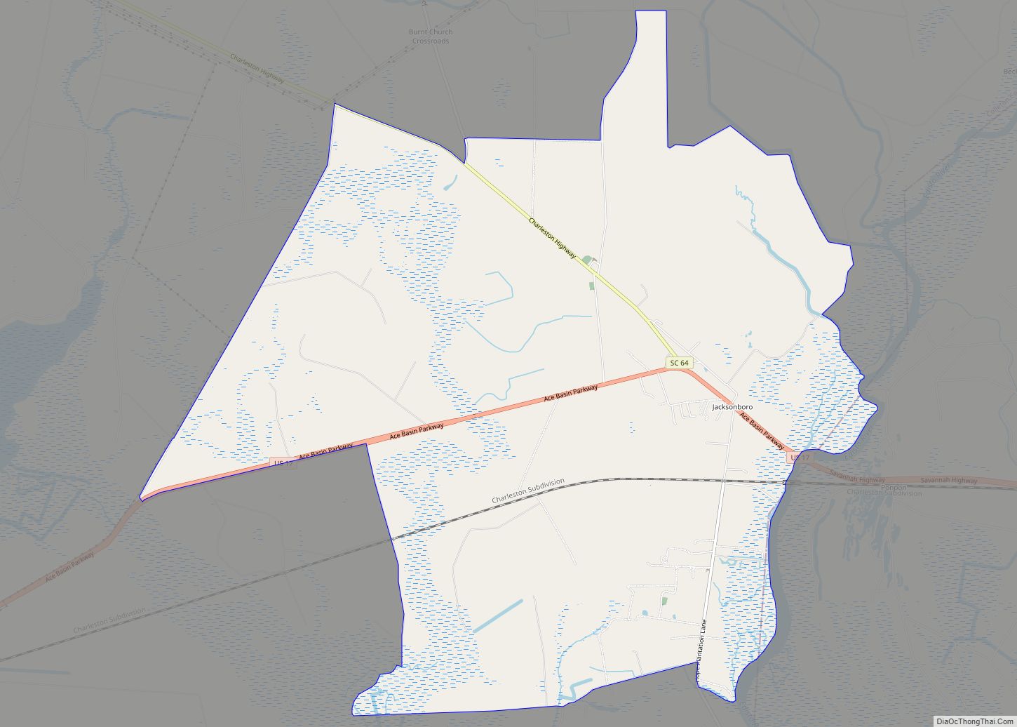
Jacksonboro is an unincorporated community and census-designated place located in southeastern Colleton County, South Carolina, United States, along the west side of the Edisto River. Jacksonboro serves as a primary junction along U.S. Highway 17 between Charleston 32 miles (51 km) to the east and Beaufort 41 miles (66 km) to the southwest. Walterboro, the Colleton County seat, is 16 miles (26 km) to the northwest via South Carolina Highway 64. The population of Jacksonboro was 478 as of the 2010 census.
Jacksonboro was founded in the 1730s, and named after John Jackson, the original owner of the town site. The Pon Pon Chapel was listed in the National Register of Historic Places in 1972.
| Name: | Jacksonboro CDP |
|---|---|
| LSAD Code: | 57 |
| LSAD Description: | CDP (suffix) |
| State: | South Carolina |
| County: | Colleton County |
| Elevation: | 23 ft (7 m) |
| Total Area: | 14.47 sq mi (37.47 km²) |
| Land Area: | 14.47 sq mi (37.47 km²) |
| Water Area: | 0.00 sq mi (0.00 km²) |
| Total Population: | 412 |
| Population Density: | 28.47/sq mi (10.99/km²) |
| ZIP code: | 29446 |
| Area code: | 843 and 854 |
| FIPS code: | 4536250 |
| GNISfeature ID: | 1246146 |
Online Interactive Map
Click on ![]() to view map in "full screen" mode.
to view map in "full screen" mode.
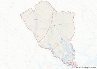
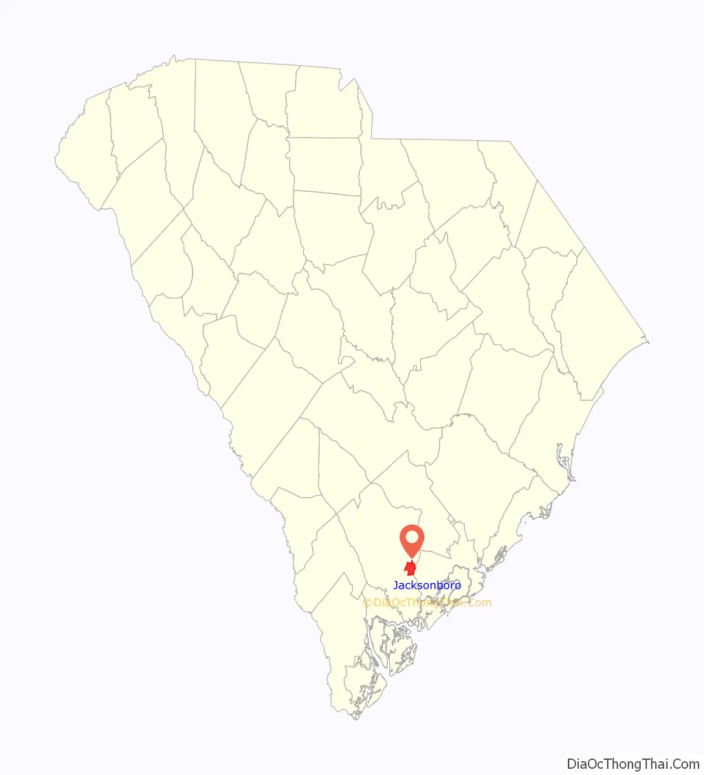
Jacksonboro location map. Where is Jacksonboro CDP?

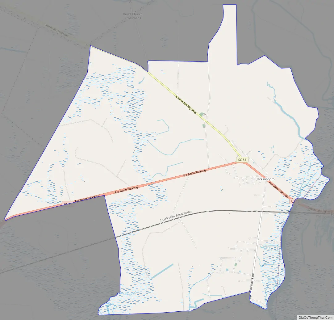
Jacksonboro Road Map
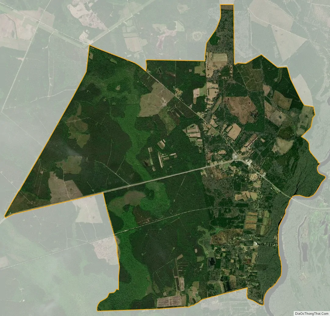
Jacksonboro city Satellite Map
See also
Map of South Carolina State and its subdivision:- Abbeville
- Aiken
- Allendale
- Anderson
- Bamberg
- Barnwell
- Beaufort
- Berkeley
- Calhoun
- Charleston
- Cherokee
- Chester
- Chesterfield
- Clarendon
- Colleton
- Darlington
- Dillon
- Dorchester
- Edgefield
- Fairfield
- Florence
- Georgetown
- Greenville
- Greenwood
- Hampton
- Horry
- Jasper
- Kershaw
- Lancaster
- Laurens
- Lee
- Lexington
- Marion
- Marlboro
- McCormick
- Newberry
- Oconee
- Orangeburg
- Pickens
- Richland
- Saluda
- Spartanburg
- Sumter
- Union
- Williamsburg
- York
- Alabama
- Alaska
- Arizona
- Arkansas
- California
- Colorado
- Connecticut
- Delaware
- District of Columbia
- Florida
- Georgia
- Hawaii
- Idaho
- Illinois
- Indiana
- Iowa
- Kansas
- Kentucky
- Louisiana
- Maine
- Maryland
- Massachusetts
- Michigan
- Minnesota
- Mississippi
- Missouri
- Montana
- Nebraska
- Nevada
- New Hampshire
- New Jersey
- New Mexico
- New York
- North Carolina
- North Dakota
- Ohio
- Oklahoma
- Oregon
- Pennsylvania
- Rhode Island
- South Carolina
- South Dakota
- Tennessee
- Texas
- Utah
- Vermont
- Virginia
- Washington
- West Virginia
- Wisconsin
- Wyoming