Map of Altamont town, Tennessee

Map of Altamont town, Tennessee

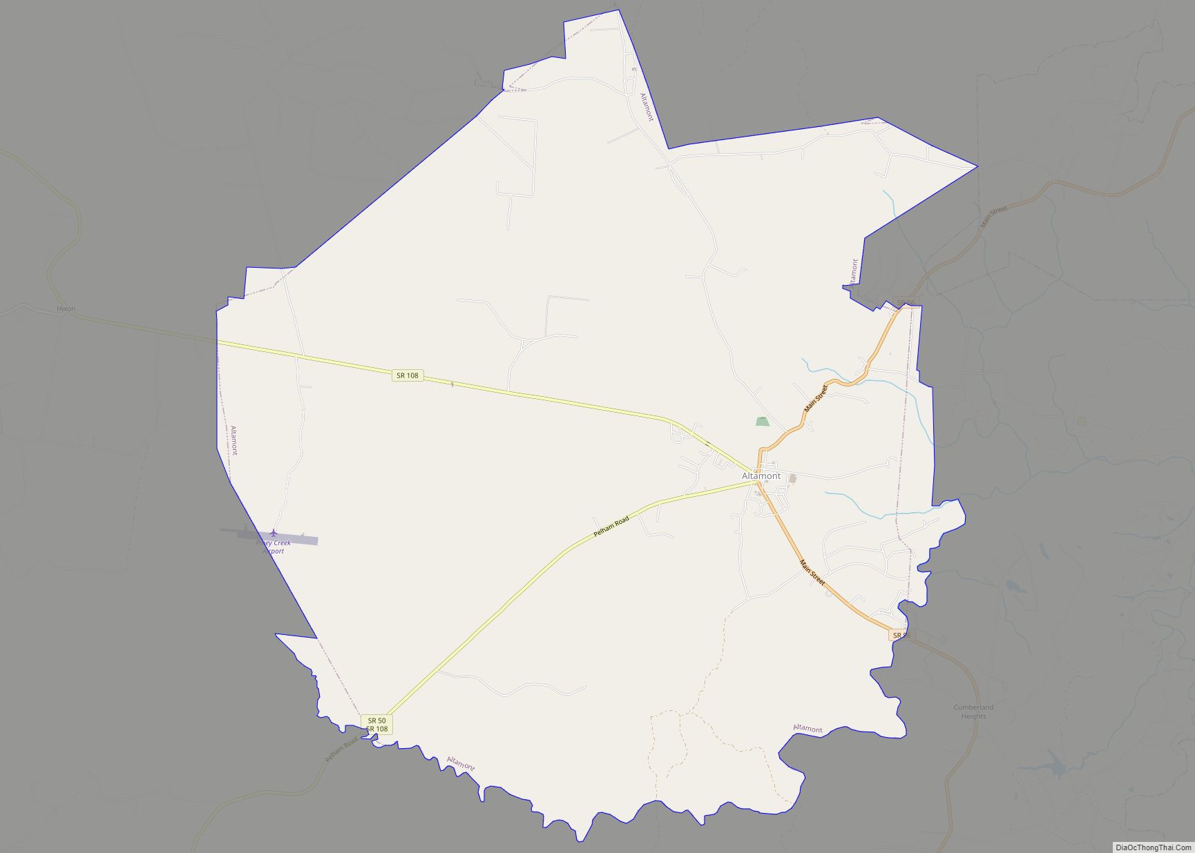
Altamont is a town in Grundy County, Tennessee, United States. The population was 1,117 at the 2020 census. It is the county seat of Grundy County. Altamont town overview: Name: Altamont town LSAD Code: 43 LSAD Description: town (suffix) State: Tennessee County: Grundy County Incorporated: 1854 Elevation: 1,854 ft (565 m) Total Area: 19.82 sq mi (51.35 km²) Land Area: … Read more

Map of Allardt city

Map of Allardt city

Allardt is a city in Fentress County, Tennessee, United States. The population was 555 at the 2020 census. The current mayor Ms. Patricia (Pat) Brown Clark was elected in 2018. According to the city charter, there are three city council board members, currently (as of 2018) Chris Crabtree, Thomas Potter, and Michael Wiley. Allardt city … Read more

Map of Algood city

Map of Algood city

Algood is a city in Putnam County, Tennessee, United States. The population was 3,963 at the 2020 census. It is part of the Cookeville Micropolitan Statistical Area. Algood city overview: Name: Algood city LSAD Code: 25 LSAD Description: city (suffix) State: Tennessee County: Putnam County Incorporated: 1911 Elevation: 1,112 ft (339 m) Total Area: 4.09 sq mi (10.59 km²) Land … Read more

Map of Alexandria town, Tennessee

Map of Alexandria town, Tennessee

Alexandria is a town in DeKalb County, Tennessee, United States. The population was 966 at the 2010 census. Alexandria town overview: Name: Alexandria town LSAD Code: 43 LSAD Description: town (suffix) State: Tennessee County: DeKalb County Elevation: 653 ft (199 m) Total Area: 2.02 sq mi (5.25 km²) Land Area: 2.02 sq mi (5.25 km²) Water Area: 0.00 sq mi (0.00 km²) Total Population: 981 Population … Read more

Map of Alcoa city

Map of Alcoa city

Alcoa is a city in Blount County, Tennessee, United States, south of Knoxville. Its population was 10,978 at the 2020 census. It is part of the Knoxville, Tennessee Metropolitan Statistical Area. As its name suggests, Alcoa was the site of a large aluminum smelting plant owned and operated by the Alcoa corporation (Aluminum Company of … Read more

Map of Alamo town, Tennessee

Map of Alamo town, Tennessee

Alamo is a town in Crockett County, Tennessee. Its population was 2,461 at the time of the 2010 U.S. Census. Alamo, located in the central part of West Tennessee, is the county seat of Crockett County. Alamo town overview: Name: Alamo town LSAD Code: 43 LSAD Description: town (suffix) State: Tennessee County: Crockett County Incorporated: … Read more

Map of Athens city, Tennessee

Map of Athens city, Tennessee

Athens is the county seat of McMinn County, Tennessee, United States and the principal city of the Athens Micropolitan Statistical Area has a population of 53,569. The city is located almost equidistantly between the major cities of Knoxville and Chattanooga. The population was 14,084 at the 2020 census. The population of the zipcode area is … Read more

Map of Ashland City town

Map of Ashland City town

Ashland City is a town in and the county seat of Cheatham County, Tennessee, United States. The population was 5,193 as of the 2020 census. Ashland City town overview: Name: Ashland City town LSAD Code: 43 LSAD Description: town (suffix) State: Tennessee County: Cheatham County Founded: 1856 Incorporated: 1859 Elevation: 430 ft (130 m) Total Area: 11.41 sq mi … Read more

Map of Baxter town, Tennessee

Map of Baxter town, Tennessee

Baxter is a city in Putnam County, Tennessee, United States. The population was 1,578 at the 2020 census. It is part of the Cookeville, Tennessee Micropolitan Statistical Area. Baxter town overview: Name: Baxter town LSAD Code: 43 LSAD Description: town (suffix) State: Tennessee County: Putnam County Incorporated: 1915 Elevation: 1,027 ft (313 m) Total Area: 3.15 sq mi (8.14 km²) … Read more

Map of Bartlett city, Tennessee

Map of Bartlett city, Tennessee

Bartlett is a city in Shelby County, Tennessee, United States. The population was 57,786 at the 2020 U.S. Census. Bartlett city overview: Name: Bartlett city LSAD Code: 25 LSAD Description: city (suffix) State: Tennessee County: Shelby County Founded: 1829 Incorporated: 1866 Elevation: 298 ft (90.8 m) Total Area: 32.31 sq mi (83.68 km²) Land Area: 32.30 sq mi (83.64 km²) Water Area: 0.01 sq mi … Read more

Map of Banner Hill CDP

Map of Banner Hill CDP

Banner Hill is a census-designated place (CDP) in Unicoi County, Tennessee, United States. The population was 1,497 at the 2010 census. It is part of the Johnson City Metropolitan Statistical Area, which is a component of the Johnson City–Kingsport–Bristol, TN-VA Combined Statistical Area – commonly known as the “Tri-Cities” region. Banner Hill is a suburb … Read more

Map of Baneberry city

Map of Baneberry city

Baneberry is a city in Jefferson County, Tennessee, United States. It is part of the Morristown, Tennessee Metropolitan Statistical Area. The population was 523 at the 2020 census. The community was named for native baneberry bushes near the original town site. Baneberry city overview: Name: Baneberry city LSAD Code: 25 LSAD Description: city (suffix) State: … Read more