Allardt is a city in Fentress County, Tennessee, United States. The population was 555 at the 2020 census. The current mayor Ms. Patricia (Pat) Brown Clark was elected in 2018. According to the city charter, there are three city council board members, currently (as of 2018) Chris Crabtree, Thomas Potter, and Michael Wiley.
| Name: | Allardt city |
|---|---|
| LSAD Code: | 25 |
| LSAD Description: | city (suffix) |
| State: | Tennessee |
| County: | Fentress County |
| Incorporated: | 1964 |
| Elevation: | 1,677 ft (511 m) |
| Total Area: | 3.77 sq mi (9.76 km²) |
| Land Area: | 3.77 sq mi (9.76 km²) |
| Water Area: | 0.00 sq mi (0.00 km²) |
| Population Density: | 147.21/sq mi (56.84/km²) |
| ZIP code: | 38504 |
| Area code: | 931 |
| FIPS code: | 4700660 |
| GNISfeature ID: | 1269300 |
Online Interactive Map
Click on ![]() to view map in "full screen" mode.
to view map in "full screen" mode.
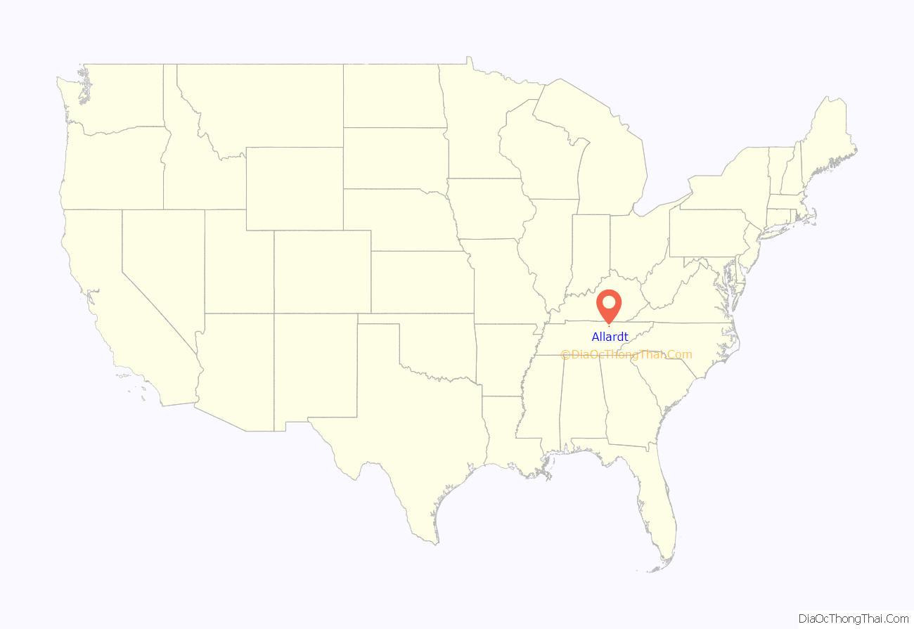
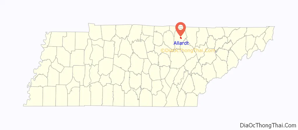
Allardt location map. Where is Allardt city?
History
After 1880, Frederick Allardt and Bruno Gernt brought a group of Germans from Michigan to settle in the area. The town was incorporated in 1964.
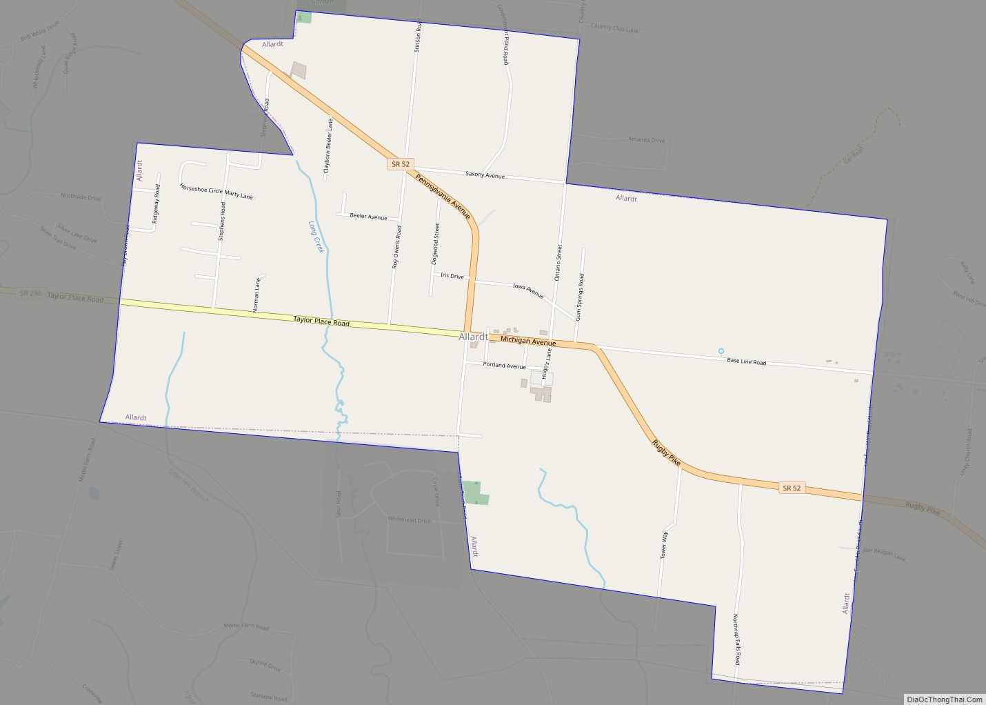
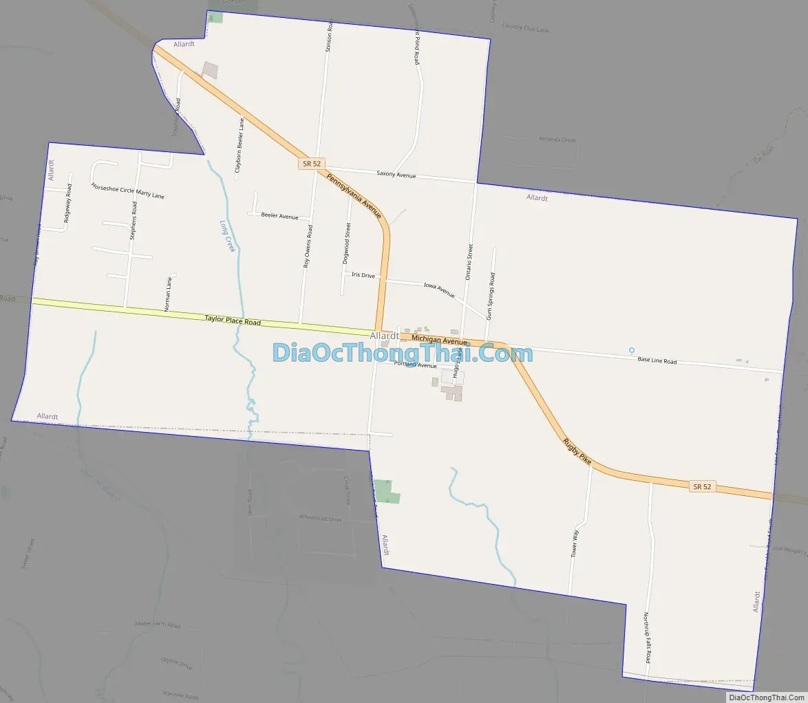
Allardt Road Map
Allardt city Satellite Map

Geography
According to the United States Census Bureau, the city has a total area of 3.8 square miles (9.8 km), all of it land. The city is situated atop the western Cumberland Plateau in a relatively broad area surrounded by rugged hills. Tennessee State Route 52 passes roughly west-to-east through the city, connecting it with Jamestown to the northwest and Rugby to the east. State Route 296 intersects State Route 52 near the center of Allardt, and continues directly westward to U.S. Route 127.
Colditz Cove State Natural Area, best known for the 60-foot (18 m) Northrup Falls, lies just southeast of Allardt. The Big South Fork National River and Recreation Area lies a few miles to the northeast.
See also
Map of Tennessee State and its subdivision:- Anderson
- Bedford
- Benton
- Bledsoe
- Blount
- Bradley
- Campbell
- Cannon
- Carroll
- Carter
- Cheatham
- Chester
- Claiborne
- Clay
- Cocke
- Coffee
- Crockett
- Cumberland
- Davidson
- Decatur
- DeKalb
- Dickson
- Dyer
- Fayette
- Fentress
- Franklin
- Gibson
- Giles
- Grainger
- Greene
- Grundy
- Hamblen
- Hamilton
- Hancock
- Hardeman
- Hardin
- Hawkins
- Haywood
- Henderson
- Henry
- Hickman
- Houston
- Humphreys
- Jackson
- Jefferson
- Johnson
- Knox
- Lake
- Lauderdale
- Lawrence
- Lewis
- Lincoln
- Loudon
- Macon
- Madison
- Marion
- Marshall
- Maury
- McMinn
- McNairy
- Meigs
- Monroe
- Montgomery
- Moore
- Morgan
- Obion
- Overton
- Perry
- Pickett
- Polk
- Putnam
- Rhea
- Roane
- Robertson
- Rutherford
- Scott
- Sequatchie
- Sevier
- Shelby
- Smith
- Stewart
- Sullivan
- Sumner
- Tipton
- Trousdale
- Unicoi
- Union
- Van Buren
- Warren
- Washington
- Wayne
- Weakley
- White
- Williamson
- Wilson
- Alabama
- Alaska
- Arizona
- Arkansas
- California
- Colorado
- Connecticut
- Delaware
- District of Columbia
- Florida
- Georgia
- Hawaii
- Idaho
- Illinois
- Indiana
- Iowa
- Kansas
- Kentucky
- Louisiana
- Maine
- Maryland
- Massachusetts
- Michigan
- Minnesota
- Mississippi
- Missouri
- Montana
- Nebraska
- Nevada
- New Hampshire
- New Jersey
- New Mexico
- New York
- North Carolina
- North Dakota
- Ohio
- Oklahoma
- Oregon
- Pennsylvania
- Rhode Island
- South Carolina
- South Dakota
- Tennessee
- Texas
- Utah
- Vermont
- Virginia
- Washington
- West Virginia
- Wisconsin
- Wyoming