Spokane Valley is a city in Spokane County, Washington, United States, and the largest suburb of Spokane. It is located east of Spokane, west of Coeur d’Alene, Idaho, and surrounds the city of Millwood on three sides. The city incorporated as the City of Spokane Valley on March 31, 2003. The population was 102,976 at the 2020 census, making it the eighth-largest city in Washington state. Spokane Valley is named after the valley of the Spokane River, in which it is located. The city and the general area is colloquially referred to as “The Valley” by residents of the Spokane–Coeur d’Alene area.
Spokane Valley hosts a variety of community events such as the Spokane County Interstate Fair, Valleyfest, and the Inland Northwest Craft Beer Festival and is home to the Spokane Valley Heritage Museum and the home ground of the Spokane Indians minor league baseball team.
| Name: | Spokane Valley city |
|---|---|
| LSAD Code: | 25 |
| LSAD Description: | city (suffix) |
| State: | Washington |
| County: | Spokane County |
| Incorporated: | March 31, 2003 |
| Elevation: | 2,002 ft (610 m) |
| Land Area: | 37.72 sq mi (97.69 km²) |
| Water Area: | 0.29 sq mi (0.75 km²) |
| Population Density: | 2,679.22/sq mi (1,034.46/km²) |
| ZIP code: | 99206, 99216, 99212, 99016, 99027, 99037 |
| Area code: | 509 |
| FIPS code: | 5367167 |
| GNISfeature ID: | 1967430 |
| Website: | spokanevalley.org |
Online Interactive Map
Click on ![]() to view map in "full screen" mode.
to view map in "full screen" mode.
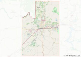
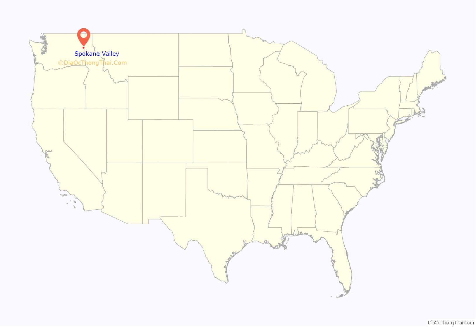
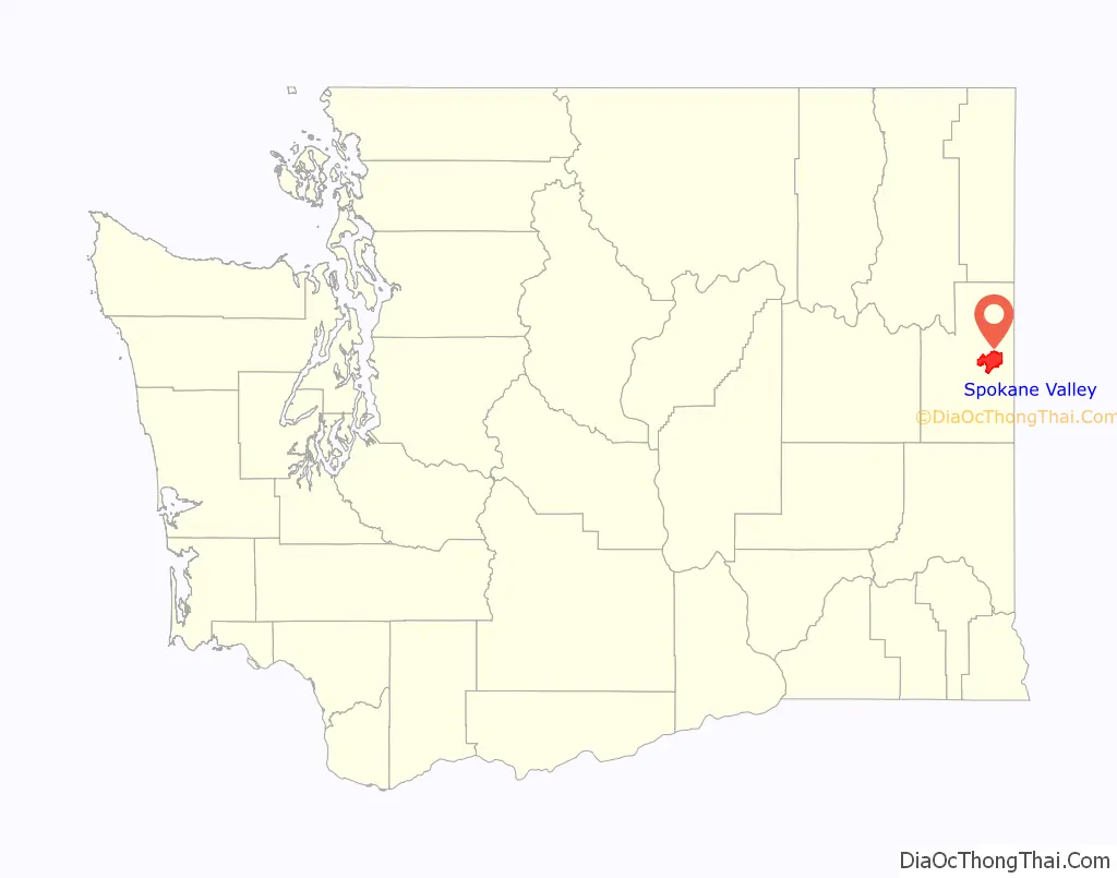
Spokane Valley location map. Where is Spokane Valley city?
History
The City of Spokane Valley incorporated on March 31, 2003. At its creation, it was the third-largest newly incorporated city in US history (after Centennial, Colorado, which incorporated in 2001; and Miami Gardens, Florida, which incorporated about five weeks before Spokane Valley).
The city formed from combining the urbanized unincorporated areas east of Spokane City, including census-designated places (CDPs) of Dishman, Opportunity, Trentwood, Veradale, part of Greenacres, and East Spokane. The new city boundaries did not include the incorporated areas such as Millwood and Liberty Lake, nor the protected areas such as the Dishman Hills Natural Area. It was initially delayed by a petition from Spokane, because it included the Yardley industrial area, to which Spokane had already extended utilities, and had plans to annex. Prior to the successful vote May 21, 2002, there had been four failed attempts to form a city in the Valley. The main arguments for incorporation centered around increased voice in local governance and the threat of annexation by the City of Spokane. The main arguments against incorporation included contentment with Spokane County provided services and the threat of increased taxes and bureaucracy by the new city. Both sides claimed their opponents’ arguments were entirely untrue scare tactics.
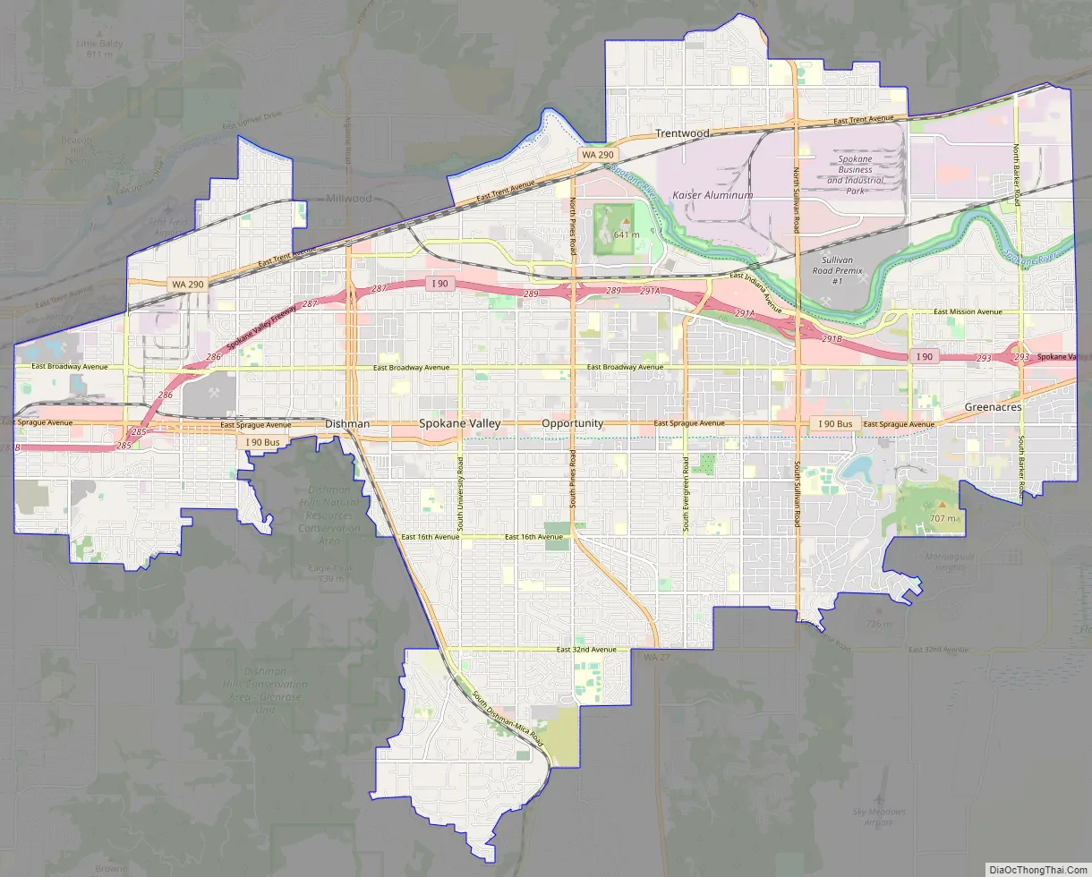
Spokane Valley Road Map
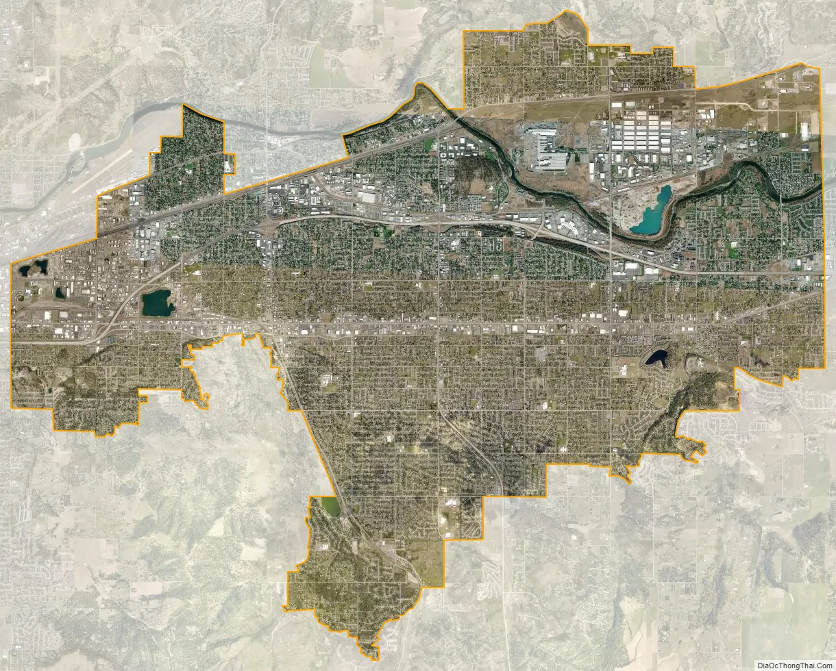
Spokane Valley city Satellite Map
Geography
According to the United States Census Bureau, the city has a total area of 38.06 square miles (98.57 km), of which 37.77 square miles (97.82 km) is land and 0.29 square miles (0.75 km) is water. Water features in the city include Shelley Lake, a small lake which is fed by the Saltese Creek.
The City of Spokane Valley lies along the banks of the Spokane River as it flows from its source in Lake Coeur d’Alene on its way to the Columbia River at the Franklin D. Roosevelt Lake reservoir. The city lies along both banks of the river, but most of the city lies to the south of the river. To the south of the valley in which the city sits is the southern extent of the Selkirk Mountains, which are most prominent in the area east of Coeur d’Alene. The valley is within the Northern Rockies Level III ecoregion. The valley exhibits signs of the prehistoric geologic events that shaped the area and region such as the Missoula Floods which ended 12,000 to 15,000 years ago. The Spokane valley was gouged out by repeated failures in the ice dam that held Glacial Lake Missoula.
The city limits are roughly defined to the west and southwest by Havana Street and the Dishman Hills Conservation Area; to the north by Felts Field, the City of Millwood, the Spokane River, and a few minor roads north of the river; to the east by Barker Road; and to the south by the small hills which divide the city from the Palouse region.
The city of Spokane Valley is part of the Spokane–Coeur d’Alene Combined Statistical Area (CSA) and lies between the two anchor cities, directly east of Spokane and to the west of Coeur d’Alene. The city is also part of the wider Inland Northwest region, consisting of eastern Washington, northern Idaho, northwestern Montana, and northeastern Oregon.
Neighborhoods and communities
Prior to World War II, Spokane Valley had been a predominantly rural area, a productive site for farms and orchards since it was first irrigated in 1895. In 1940, the population of the valley was 10,000. During World War II, with increased industrial activity in the central business district, particularly the railroads, new migrants to the Spokane area began to settle, shop, and do business in outlying areas where it was more quiet and less crowded and blighted. In 1960 the population of the valley was about 45,000 and by 1970 it had become a suburb of 60,000 residents. The City of Spokane Valley incorporated in 2003, centered around the historic communities of Opportunity, Dishman, and Veradale and including the communities of Greenacres, Trentwood, Yardley, and Chester, forging together an assemblage of small townships, mercantile hubs, and unincorporated communities. Because the City of Spokane Valley shares its name with the unincorporated area it was carved from, the term “Spokane Valley” is often used in reference to an area greater than that defined by the city limits.
Climate
Spokane Valley experiences a temperate climate (Köppen Csa), with a warm summer and rainy winter. Precipitation averages just over 16 inches (410 mm) annually, with December averaging the most precipitation with 3.5 inches (89 mm) and July the least with 0.6 inches (15 mm). July is the hottest month of the year, with an average temperature of 73 °F (23 °C) and January is the coldest, with an average temperature of 28.3 °F (−2.1 °C).
See also
Map of Washington State and its subdivision:- Adams
- Asotin
- Benton
- Chelan
- Clallam
- Clark
- Columbia
- Cowlitz
- Douglas
- Ferry
- Franklin
- Garfield
- Grant
- Grays Harbor
- Island
- Jefferson
- King
- Kitsap
- Kittitas
- Klickitat
- Lewis
- Lincoln
- Mason
- Okanogan
- Pacific
- Pend Oreille
- Pierce
- San Juan
- Skagit
- Skamania
- Snohomish
- Spokane
- Stevens
- Thurston
- Wahkiakum
- Walla Walla
- Whatcom
- Whitman
- Yakima
- Alabama
- Alaska
- Arizona
- Arkansas
- California
- Colorado
- Connecticut
- Delaware
- District of Columbia
- Florida
- Georgia
- Hawaii
- Idaho
- Illinois
- Indiana
- Iowa
- Kansas
- Kentucky
- Louisiana
- Maine
- Maryland
- Massachusetts
- Michigan
- Minnesota
- Mississippi
- Missouri
- Montana
- Nebraska
- Nevada
- New Hampshire
- New Jersey
- New Mexico
- New York
- North Carolina
- North Dakota
- Ohio
- Oklahoma
- Oregon
- Pennsylvania
- Rhode Island
- South Carolina
- South Dakota
- Tennessee
- Texas
- Utah
- Vermont
- Virginia
- Washington
- West Virginia
- Wisconsin
- Wyoming