Tacoma (/təˈkoʊmə/ tə-KOH-mə) is the county seat of Pierce County, Washington, United States. A port city, it is situated along Washington’s Puget Sound, 32 miles (51 km) southwest of Seattle, 31 miles (50 km) northeast of the state capital, Olympia, and 58 miles (93 km) northwest of Mount Rainier National Park. The city’s population was 219,346 at the time of the 2020 census. Tacoma is the second-largest city in the Puget Sound area and the third-largest in the state. Tacoma also serves as the center of business activity for the South Sound region, which has a population of about 1 million.
Tacoma adopted its name after the nearby Mount Rainier, called təˡqʷuʔbəʔ in the Puget Sound Salish dialect. It is locally known as the “City of Destiny” because the area was chosen to be the western terminus of the Northern Pacific Railroad in the late 19th century. The decision of the railroad was influenced by Tacoma’s neighboring deep-water harbor, Commencement Bay. By connecting the bay with the railroad, Tacoma’s motto became “When rails meet sails”. Commencement Bay serves the Port of Tacoma, a center of international trade on the Pacific Coast and Washington’s largest port. The city gained notoriety in 1940 for the collapse of the Tacoma Narrows Bridge, which earned the nickname “Galloping Gertie” due to the vertical movement of the deck during windy conditions.
Like most industrial cities, Tacoma suffered a prolonged decline in the mid-20th century as a result of suburbanization and divestment. Since the 1990s, downtown Tacoma has experienced a period of revitalization. Developments in the downtown include the University of Washington Tacoma; the T Line (formerly Tacoma Link), the first modern electric light rail service in the state; the state’s highest density of art and history museums; and a restored urban waterfront, the Thea Foss Waterway.
| Name: | Tacoma city |
|---|---|
| LSAD Code: | 25 |
| LSAD Description: | city (suffix) |
| State: | Washington |
| County: | Pierce County |
| Incorporated: | November 12, 1875 |
| Elevation: | 243 ft (74 m) |
| Land Area: | 49.71 sq mi (128.76 km²) |
| Water Area: | 12.71 sq mi (32.92 km²) |
| Population Density: | 4,412.51/sq mi (1,703.53/km²) |
| ZIP code: | 98001, 98002, 98071, 98092, 98401–98409, 98411–98413, 98415, 98416, 98418, 98421, 98422, 98424, 98430, 98431, 98433, 98438, 98439, 98442–98447, 98450, 98455, 98460, 98464, 98465, 98466, 98467, 98471, 98477, 98481, 98492, 98493, 98497–98499 |
| Area code: | 253 |
| FIPS code: | 5370000 |
| GNISfeature ID: | 1512713 |
| Website: | cityoftacoma.org |
If you’re looking for a map of Tacoma, you’ve come to the right place. We have a collection of maps that include a road map, an interactive map, and a reference map. You can also find a list of things to do in Tacoma, so you can make the most of your visit.
Online Interactive Map
Click on ![]() to view map in "full screen" mode.
to view map in "full screen" mode.
Find your way around the city with this interactive map that’s loaded with amazing highlights from Tacoma. This map will allow you to explore every nook and cranny including parks, museums, hotels, restaurants, and more. But it’s ideal because you can zoom in and out, which is a big help if you’re looking for a specific location.
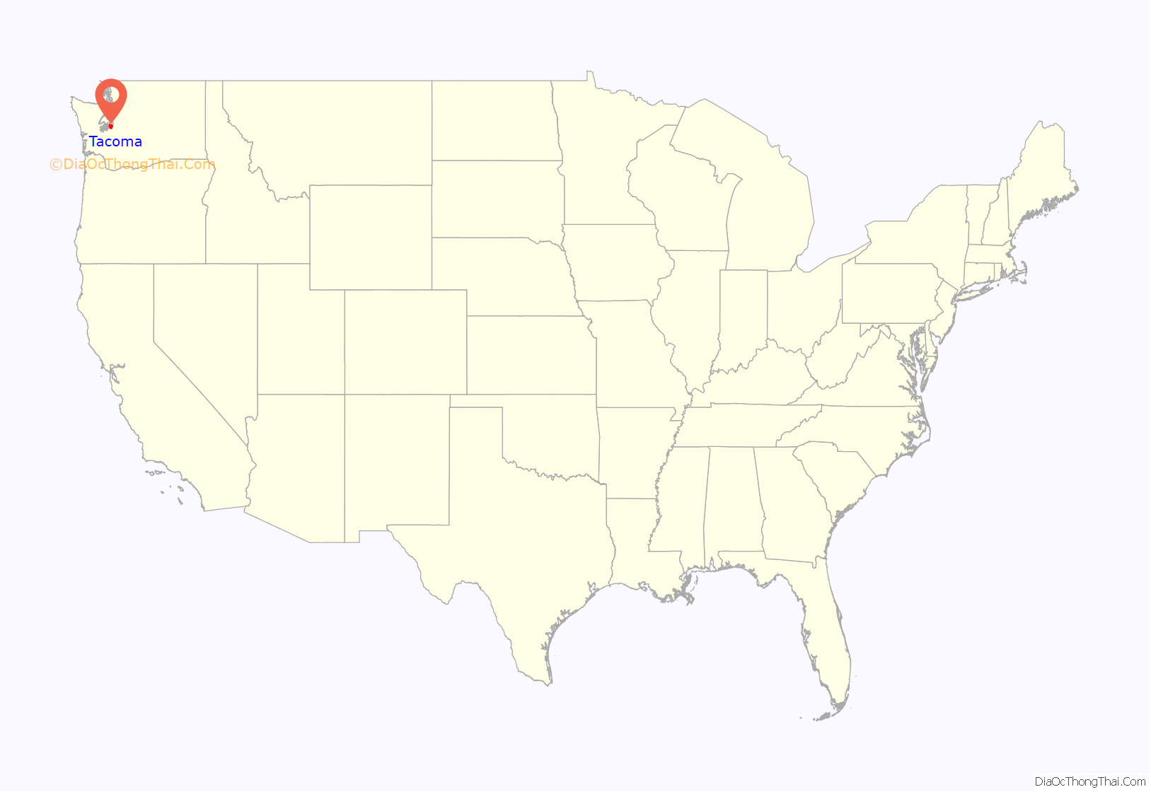
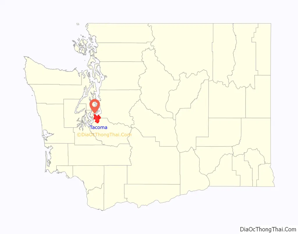
Tacoma location map. Where is Tacoma city?
History
Early history
The area was inhabited for thousands of years by American Indians, most recently the Puyallup people, who lived in settlements on the delta.
In 1852, a Swede named Nicolas Delin built a water-powered sawmill on a creek near the head of Commencement Bay, but the small settlement that grew around it was abandoned during the Indian War of 1855–56. In 1864, pioneer and postmaster Job Carr, a Civil War veteran and land speculator, built a cabin (which also served as Tacoma’s first post office; a replica was built in 2000 near the original site in “Old Town”). Carr hoped to profit from the selection of Commencement Bay as the terminus of the Transcontinental Railroad, and sold most of his claim to developer Morton M. McCarver (1807–1875), who named his project Tacoma City, derived from the indigenous name for the mountain.
Tacoma was incorporated on November 12, 1875, following its selection in 1873 as the western terminus of the Northern Pacific Railroad due to lobbying by McCarver, future mayor John Wilson Sprague, and others. However, the railroad built its depot in New Tacoma, two miles (3 km) south of the Carr–McCarver development. The two communities grew together and joined, merging on January 7, 1884. The transcontinental link was effected in 1887, and the population grew from 1,098 in 1880 to 36,006 in 1890. Rudyard Kipling visited Tacoma in 1889 and said it was “literally staggering under a boom of the boomiest”.
George Francis Train was a resident for a few years in the late 19th century. In 1890, he staged a global circumnavigation starting and ending in Tacoma to promote the city. A plaque in downtown Tacoma marks the start and finish line.
In November 1885, white citizens led by then-mayor Jacob Weisbach expelled several hundred Chinese residents peacefully living in the city. As described by the account prepared by the Chinese Reconciliation Project Foundation, on the morning of November 3, “several hundred men, led by the mayor and other city officials, evicted the Chinese from their homes, corralled them at 7th Street and Pacific Avenue, marched them to the railway station at Lakeview and forced them aboard the morning train to Portland, Oregon. The next day two Chinese settlements were burned to the ground.”
The discovery of gold in the Klondike in 1898 led to Tacoma’s prominence in the region being eclipsed by the development of Seattle.
A major tragedy marred the end of the 19th century, when a streetcar accident resulted in significant loss of life on July 4, 1900.
Early 20th century
From May to August 1907, the city was the site of a smelter workers’ strike organized by Local 545 of the Industrial Workers of the World (IWW), with the goal of a fifty-cent per day pay raise. The strike was strongly opposed by the local business community, and the smelter owners threatened to blacklist organizers and union officials. The IWW opposed this move by trying to persuade inbound workers to avoid Tacoma during the strike. By August, the strike had ended without meeting its demands.
Tacoma was briefly (1915–1922) a major destination for big-time automobile racing, with one of the nation’s top-rated racing venues just outside the city limits, at the site of today’s Clover Park Technical College.
In 1924, Tacoma’s first movie studio, H. C. Weaver Studio, was sited at present-day Titlow Beach. At the time, it was the third-largest freestanding film production space in America, with the two larger facilities being located in Hollywood. The studio’s importance has undergone a revival with the discovery of one of its most famous lost films, Eyes of the Totem.
The Great Depression
The 1929 crash of the stock market, resulting in the Great Depression, was only the first event in a series of misfortunes to hit Tacoma in the winter of 1929–30. In one of the coldest winters on record, Tacoma experienced mass power outages and eventually the shutdown of major power supply dams, leaving the city without sufficient power and heat. During the 30-day power shortage in the winter of 1929 and 1930, the engines of the aircraft carrier USS Lexington provided Tacoma with electricity.
A power grid failure paired with a newly rewritten city constitution – put into place to keep political power away from a single entity such as the railroad – created a standstill in the ability to further the local economy. Local businesses were affected as the sudden stop of loans limited progression of expansion and renewal funds for maintenance, leading to foreclosures. Families across the city experienced the fallout of economic depression as breadwinners sought to provide for their families. Shanty-town politics began to develop as the destitute needed some form of leadership to keep the peace.
At the intersection of Dock Street EXD and East D Street in the train yard, a shanty town became the solution to the growing scar of the depression. Tacoma’s Hooverville grew in 1924 as the homeless community settled on the waterfront. The population boomed in November 1930 through early 1931 as families from the neighboring McKinley and Hilltop areas were evicted.
Collecting scraps of metal and wood from local lumber stores and recycling centers, families began building shanties (shacks) for shelter. Alcoholism and suicide became a common event in the Hooverville that eventually led to its nickname of “Hollywood on the Tide Flats”, because of the Hollywood-style crimes and events taking place in the camp. In 1956, the last occupant of “Hollywood” was evicted and the police used fire to level the grounds and make room for industrial growth.
In 1935, Tacoma received national attention when George Weyerhaeuser, the nine-year-old son of prominent lumber industry executive J.P. Weyerhaeuser, was kidnapped while walking home from school. FBI agents from Portland handled the case, in which a ransom of $200,000 secured the release of the victim. Four persons were apprehended and convicted; the last to be released was paroled from McNeil Island in 1963. George Weyerhaeuser went on to become chairman of the board of the Weyerhaeuser Company.
Post-WWII
In 1951, an investigation by a state legislative committee revealed widespread corruption in Tacoma’s government, which had been organized commission-style since 1910. Voters approved a mayor and city-manager system in 1952.
Tacoma was featured prominently in the garage rock sound of the mid-1960s with bands including The Wailers and The Sonics. The surf rock band The Ventures were also from Tacoma.
Downtown Tacoma experienced a long decline through the mid-20th century. Harold Moss, later the city’s mayor, characterized late-1970s Tacoma as looking “bombed out” like “downtown Beirut” (a reference to the Lebanese Civil War that occurred at that time); “Streets were abandoned, storefronts were abandoned and City Hall was the headstone and Union Station the footstone” on the grave of downtown.
The first local referendums in the U.S. on computerized voting occurred in Tacoma in 1982 and 1987. On both occasions, voters rejected the computer voting systems that local officials sought to purchase. The campaigns, organized by Eleanora Ballasiotes, a conservative Republican, focused on the vulnerabilities of computers to fraud.
In 1998, Tacoma installed a high-speed fiber optic network throughout the community. The municipally owned power company, Tacoma Power, wired the city.
Downtown revival
Beginning in the early 1990s, city residents and planners took steps to revitalize Tacoma, particularly its downtown. Among the projects were the federal courthouse in the former Union Station (1991); Save Our Station community group; Merritt+Pardini Architect (1991); Reed & Stem Architects (1911); the adaptation of a group of century-old brick warehouses into a branch campus of the University of Washington; the numerous privately financed renovation projects near the campus; the Washington State History Museum (1996), echoing the architecture of Union Station; the Museum of Glass (2002); the Tacoma Art Museum (2003); and the region’s first light-rail line (2003). The glass and steel Greater Tacoma Convention and Trade Center opened in November 2004. America’s Car Museum was completed in late 2011 near the Tacoma Dome.
The Pantages Theater (first opened in 1918) anchors downtown Tacoma’s Theatre District. Tacoma Arts Live manages the Pantages, the Rialto Theater, and the Theatre on the Square. Tacoma Little Theatre (opened in 1918) bridges the Theater District and the Hilltop neighborhood. Other attractions include the Grand Cinema and the Landmark Temple Theatre.
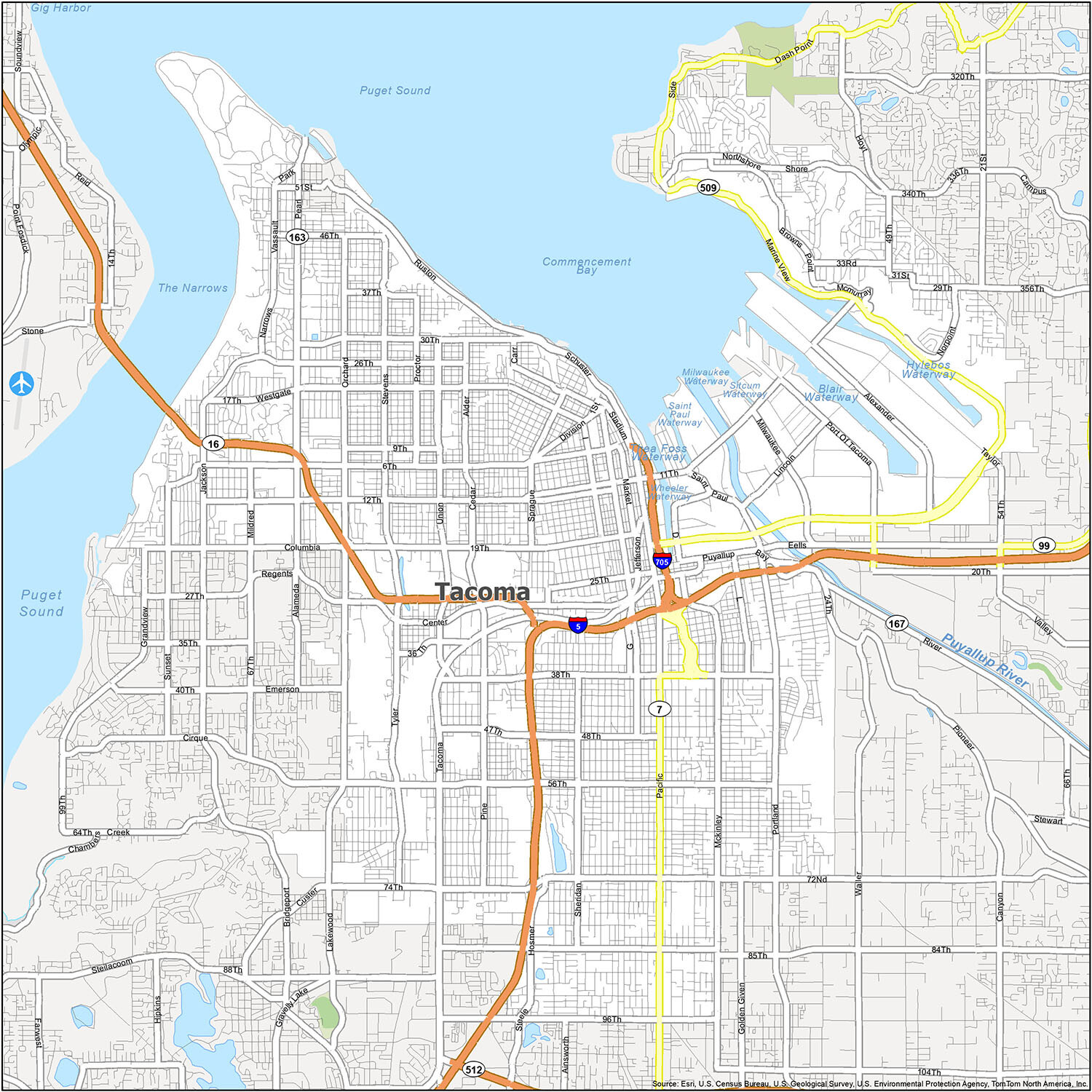
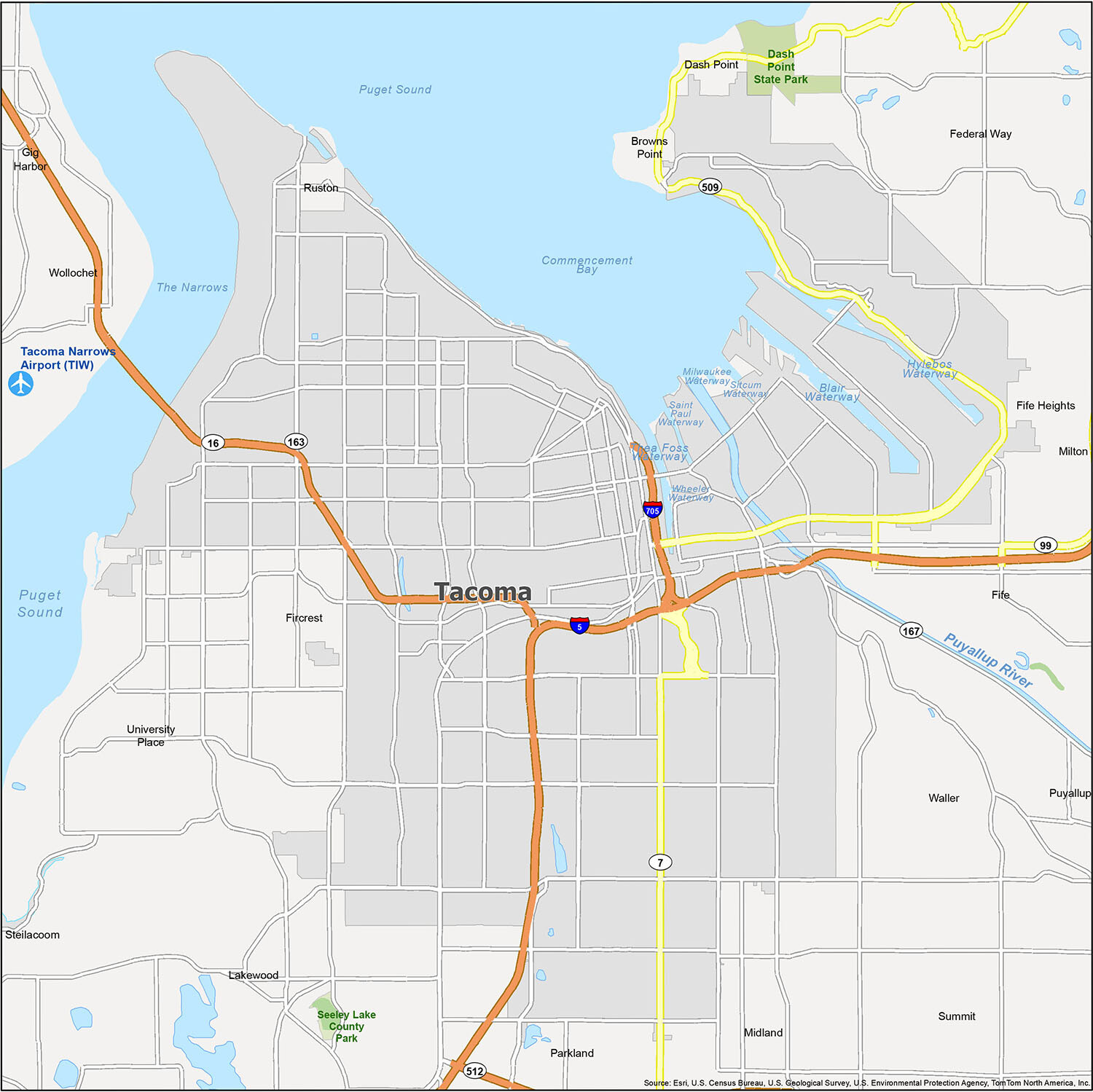
Tacoma Road Map
This map will help you gain a better understanding of where you are and the lay of the land. Whether you’re a Tacoma native or visiting from out of town, this Tacoma road map will give you all the information you need to explore Tacoma and the surrounding region. It includes interstates, highways, and major roads so you can explore this city with ease. But if you plan on doing a road trip outside Tacoma, refer to our Washington road map for highway information outside the city.
Interstate Highways: I-5, I-705
US Highways: 7, 16, 167, 509, Pacific Hwy
Parkways: Northshore Pky, Schuster Pky, Shore Pky
Major Roads: 38th St, 56th St, Browns Point Blvd, Division Ave, Grandview Dr, Jefferson Ave, Marine View Dr, McKinley Ave, Orchard St, Pacific Ave, Port Of Tacoma Rd, Pioneer Way, River Rd, Sheridan Ave, Side Dr, Sprague Ave, Stadium Way, Tacoma Way
Discover Tacoma and its surroundings with this comprehensive reference map. It includes nearby cities, towns, lakes, rivers, parks, and the Tacoma Narrows Airport (TIW) to give you an in-depth overview of the city. Explore the Federal Way, Fife, Fircrest, Gig Harbor, Lakewood, Milton, Puyallup, Tacoma, University Place, Browns Point, Dash Point, Fife Heights, Maplewood, Midland, Parkland, Summit, Vashon, Waller, Wollochet, Ruston, Steilacoom, Blair Waterway, Commencement Bay, Hylebos Waterway, Milwaukee Waterway, Puget Sound, Puyallup River, The Narrows, Saint Paul Waterway, Sitcum Waterway, Thea Foss Waterway, Wheeler Waterway, Dash Point State Park, and Seeley Lake County Park with this helpful reference map!
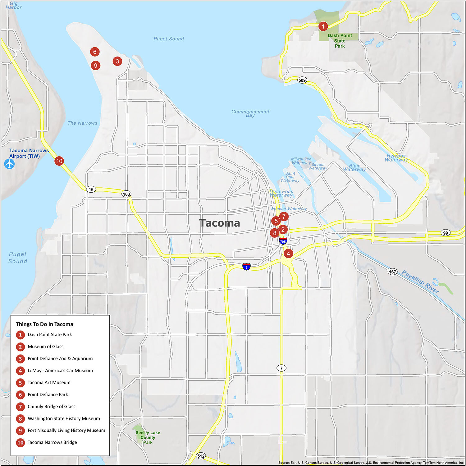
10 things to do in Tacoma city
Discover the hidden gems of Tacoma, Washington with this helpful map! From Dash Point State Park to the Museum of Glass, explore the best of Tacoma even if you are not from the area. Check out our list of 10 must-visit destinations, including the Point Defiance Zoo & Aquarium, LeMay – America’s Car Museum, and Tacoma Art Museum. Don’t forget to visit the Chihuly Bridge of Glass, Washington State History Museum, Fort Nisqually Living History Museum, and Tacoma Narrows Bridge for a truly unforgettable experience.
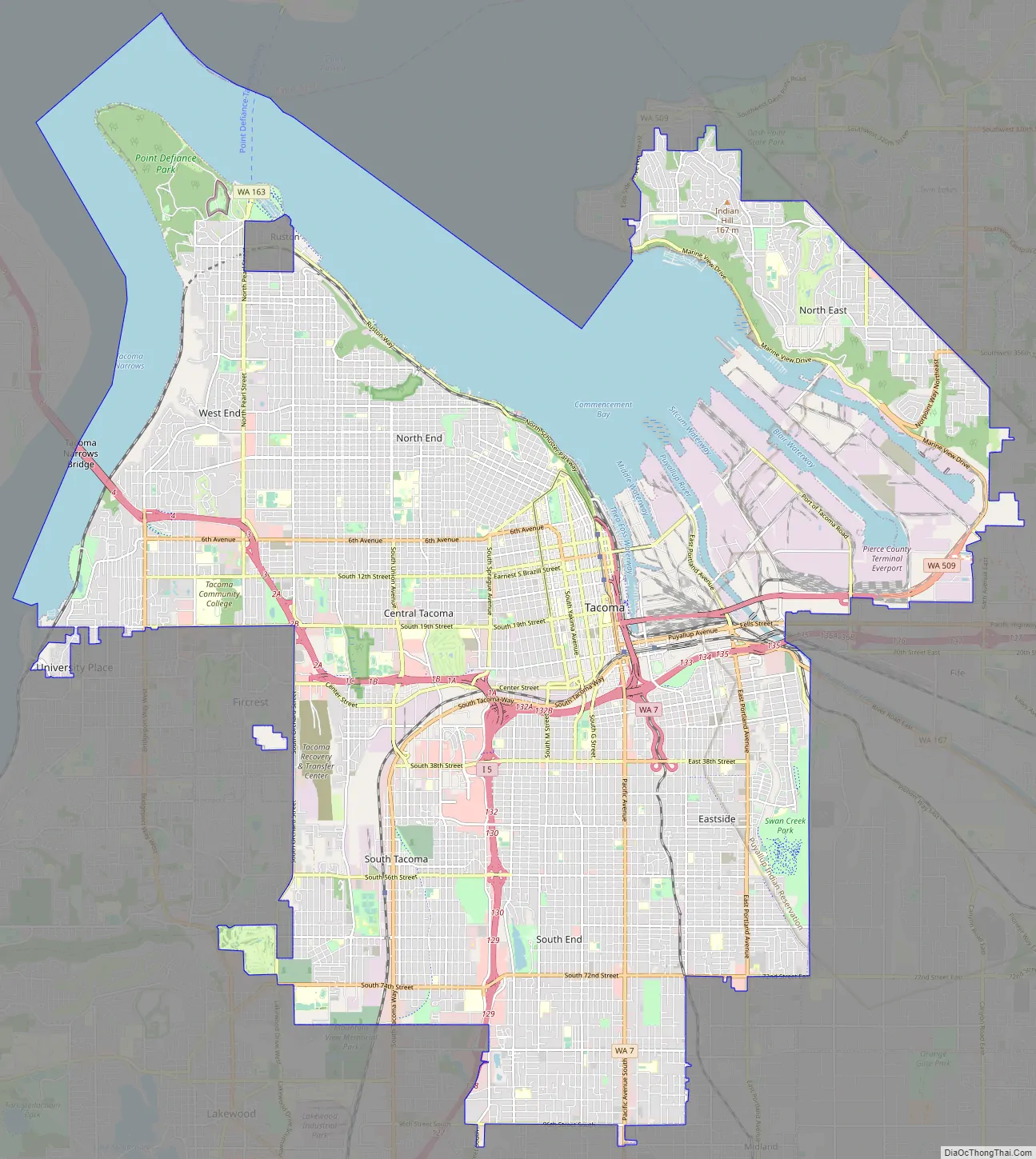
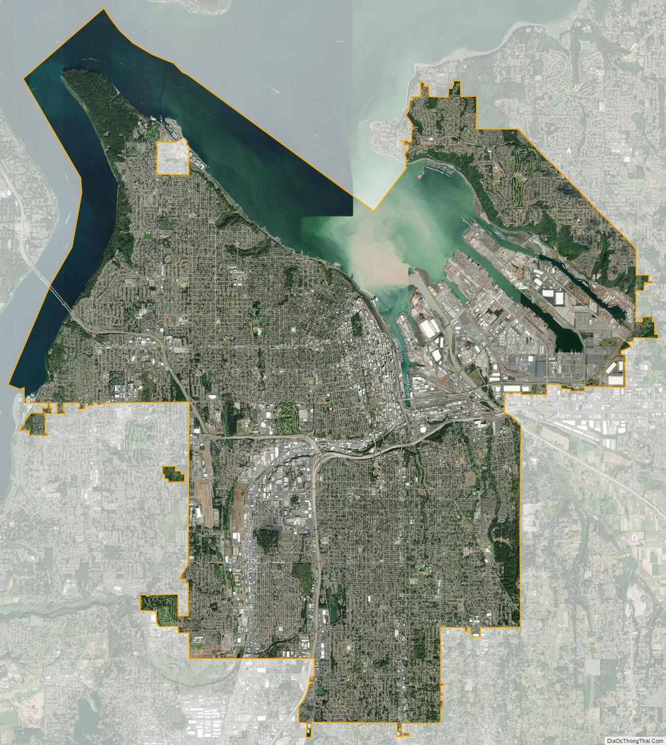
Tacoma city Satellite Map
Geography
Tacoma is at 47°14′29″N 122°27′34″W / 47.24139°N 122.45944°W / 47.24139; -122.45944 (47.241371, −122.459389). Its official elevation is 381 feet (116 m), varying between sea level and about 500 feet (150 m).
According to the United States Census Bureau, the city has an area of 62.34 square miles (161.46 km), of which 49.72 square miles (128.77 km) is land and 12.62 square miles (32.69 km) is water.
Tacoma straddles the neighboring Commencement Bay with several smaller cities surrounding it. Large areas of Tacoma have views of Mount Rainier. In the event of a major eruption of Mount Rainier, the low-lying areas of Tacoma near the Port of Tacoma are at risk from a lahar flowing down the Puyallup River.
The city is several miles north of Joint Base Lewis–McChord, formerly known separately as Fort Lewis and McChord Air Force Base.
Neighborhoods
- Central Tacoma
- Hilltop (shared with Downtown)
- Delong Park
- The Wedge
- McCarver (shared with New Tacoma/Downtown)
- Bryant
- College Heights
- New Tacoma
- Downtown Tacoma
- St. Helens Neighborhood
- Theater District
- Central Business District
- Warehouse/Brewery District
- Thea Foss Waterway
- The McCarver Neighborhood (shared with Central Tacoma/Hilltop)
- Stadium District (shared with North Tacoma)
- Dome District
- Downtown Tacoma
- Nalley Valley
- Port of Tacoma
- East Tacoma
- McKinley Hill
- Salishan
- Hillsdale
- Swan Creek
- Strawberry Hill
- North Tacoma
- College Park
- North Slope
- Old Tacoma
- Proctor District
- Prospect Hill
- Ruston (separately incorporated)
- Ruston Way
- Sixth Ave District Tacoma, Washington
- Skyline
- Stadium District (shared with Downtown)
- Westgate (shared with West Tacoma)
- Yakima Hill
- Northeast Tacoma
- Browns Point (unincorporated)
- Crescent Heights
- South End
- Fern Hill
- Lincoln International District
- Wapato
- Stewart Heights
- Larchmont
- South Tacoma
- Edison
- South Park
- Manitou
- Oakland/Madrona
- Tacoma Mall
- West Tacoma
- Highlands
- Narrows
- Titlow
- Salmon Beach
- Westgate (shared with North Tacoma)
Climate
According to the Köppen climate classification, Tacoma has a warm-summer Mediterranean climate (Köppen Csb). The warmest months are July and August; the coldest month is December.
See also
Map of Washington State and its subdivision:- Adams
- Asotin
- Benton
- Chelan
- Clallam
- Clark
- Columbia
- Cowlitz
- Douglas
- Ferry
- Franklin
- Garfield
- Grant
- Grays Harbor
- Island
- Jefferson
- King
- Kitsap
- Kittitas
- Klickitat
- Lewis
- Lincoln
- Mason
- Okanogan
- Pacific
- Pend Oreille
- Pierce
- San Juan
- Skagit
- Skamania
- Snohomish
- Spokane
- Stevens
- Thurston
- Wahkiakum
- Walla Walla
- Whatcom
- Whitman
- Yakima
- Alabama
- Alaska
- Arizona
- Arkansas
- California
- Colorado
- Connecticut
- Delaware
- District of Columbia
- Florida
- Georgia
- Hawaii
- Idaho
- Illinois
- Indiana
- Iowa
- Kansas
- Kentucky
- Louisiana
- Maine
- Maryland
- Massachusetts
- Michigan
- Minnesota
- Mississippi
- Missouri
- Montana
- Nebraska
- Nevada
- New Hampshire
- New Jersey
- New Mexico
- New York
- North Carolina
- North Dakota
- Ohio
- Oklahoma
- Oregon
- Pennsylvania
- Rhode Island
- South Carolina
- South Dakota
- Tennessee
- Texas
- Utah
- Vermont
- Virginia
- Washington
- West Virginia
- Wisconsin
- Wyoming


