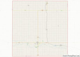
Yavapai County is near the center of the U.S. state of Arizona. As of the 2020 census, its population was 236,209, making it the fourth-most populous county in Arizona. The county seat is Prescott. Yavapai County comprises the Prescott, AZ Metropolitan Statistical Area as well as the northern portions of Peoria and Wickenburg, the balance ... Read more
Map of US Counties
Conway County is a county located in the U.S. state of Arkansas. Created as Arkansas’s 11th county on October 20, 1825, Conway County has four incorporated municipalities, including Morrilton, the county seat and most populous city. The county is also the site of numerous unincorporated communities and ghost towns. The county is named for Henry ... Read more
Howard County is a county located in the U.S. state of Arkansas. As of the 2020 census, the population was 12,785. The county seat is Nashville. Howard County is Arkansas’s 74th county, formed on April 17, 1873, and named for James Howard, a state senator. It is a dry county. Howard County overview: Name: Howard ... Read more
Mississippi County is the easternmost county in the U.S. state of Arkansas. As of the 2020 census, the population was 40,685. There are two county seats, Blytheville and Osceola. The county was formed on November 1, 1833, and named for the Mississippi River which borders the county to the east. Mississippi County is part of ... Read more
Saline County (/ˈsʌ.liːn/ suh-LEAN) is located in the U.S. state of Arkansas. As of the 2020 census, the population was 123,416. Its county seat and largest city is Benton. Saline County was formed on November 2, 1835, and named for the salt water (brine) springs in the area, despite a differing pronunciation from saline. Until ... Read more
Butte County (/ˈbjuːt/ (listen)) is a county located in the northern part of the U.S. state of California. In the 2020 census, its population was 211,632. The county seat is Oroville. Butte County comprises the Chico, CA metropolitan statistical area. It is in the California Central Valley, north of the state capital of Sacramento. Butte ... Read more
Madera County (/məˈdɛərə/ (listen)), officially the County of Madera, is a county at the geographic center of the U.S. state of California. As of the 2020 census, the population was 156,255. The county seat is Madera. Madera County comprises the Madera, CA Metropolitan Statistical Area, which is included in the Fresno-Madera, CA Combined Statistical Area. ... Read more
San Bernardino County (/sæn ˌbɜːrnəˈdiːnoʊ/ (listen)), officially the County of San Bernardino, is a county located in the southern portion of the U.S. state of California, and is located within the Inland Empire area. As of the 2020 U.S. Census, the population was 2,181,654, making it the fifth-most populous county in California and the 14th-most ... Read more
Tehama County (/təˈheɪmə/ (listen) tə-HAY-mə; Wintun for “high water”) is a county located in the northern part of the U.S. state of California. As of the 2020 census, the population was 65,829. The county seat and largest city is Red Bluff. Tehama County comprises the Red Bluff, California micropolitan statistical area, which is also included ... Read more
Cheyenne County is a county located in the U.S. state of Colorado. The county population was 1,748 at 2020 census. The county seat is Cheyenne Wells. Cheyenne County overview: Name: Cheyenne County FIPS code: 08-017 State: Colorado Founded: March 25, 1889 Named for: The Cheyenne Nation Seat: Cheyenne Wells Largest town: Cheyenne Wells Total Area: ... Read more
Grand County overview: Name: Grand County FIPS code: 08-049 State: Colorado Founded: February 2, 1874 Named for: Grand Lake and Grand River Seat: Hot Sulphur Springs Largest town: Granby Total Area: 1,870 sq mi (4,800 km²) Land Area: 1,846 sq mi (4,780 km²) Total Population: 15,860 Population Density: 8.5/sq mi (3.3/km²) Time zone: UTC−7 (Mountain) Summer Time Zone (DST): UTC−6 (MDT) Website: ... Read more
Moffat County is a county located in the U.S. state of Colorado. As of the 2020 census, the population was 13,292. The county seat is Craig. With an area of 4,751 square miles, it is the 2nd largest county by area in Colorado, behind Las Animas County. Moffat County comprises the Craig, CO Micropolitan Statistical ... Read more