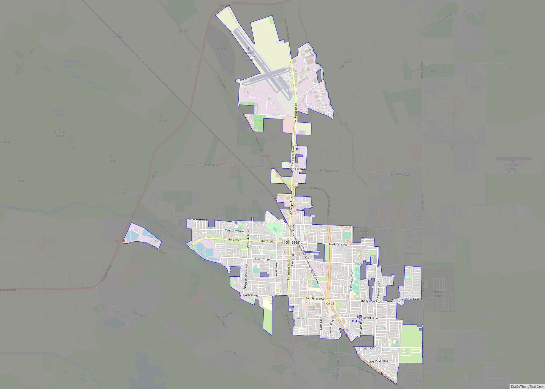
San Benito County (/ˌsæn bəˈniːtoʊ/ (listen); San Benito, Spanish for “St. Benedict”), officially the County of San Benito, is a county located in the Coast Range Mountains of the U.S. state of California. As of the 2020 census, the population was 64,209. The county seat is Hollister.
San Benito County is included in the San Jose–Sunnyvale–Santa Clara, CA Metropolitan Statistical Area, which is also included in the San Jose-San Francisco–Oakland, CA Combined Statistical Area.
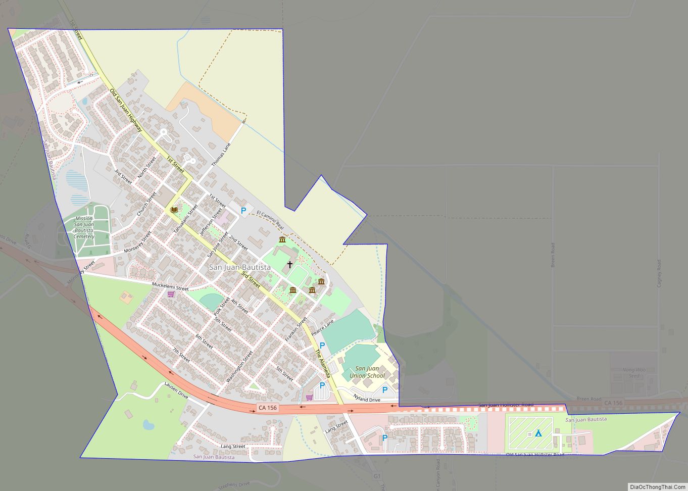
El Camino Real passes through the county and includes one mission in San Juan Bautista.
| Name: | San Benito County |
|---|---|
| FIPS code: | 06-069 |
| State: | California |
| Founded: | 1874 |
| Named for: | San Benito River |
| Seat: | Hollister |
| Largest city: | Hollister |
| Total Area: | 1,390 sq mi (3,600 km²) |
| Land Area: | 1,389 sq mi (3,600 km²) |
| Total Population: | 64,209 |
| Population Density: | 46/sq mi (18/km²) |
| Time zone: | UTC−8 (Pacific Time Zone) |
| Summer Time Zone (DST): | UTC−7 (Pacific Daylight Time) |
| Website: | www.cosb.us |
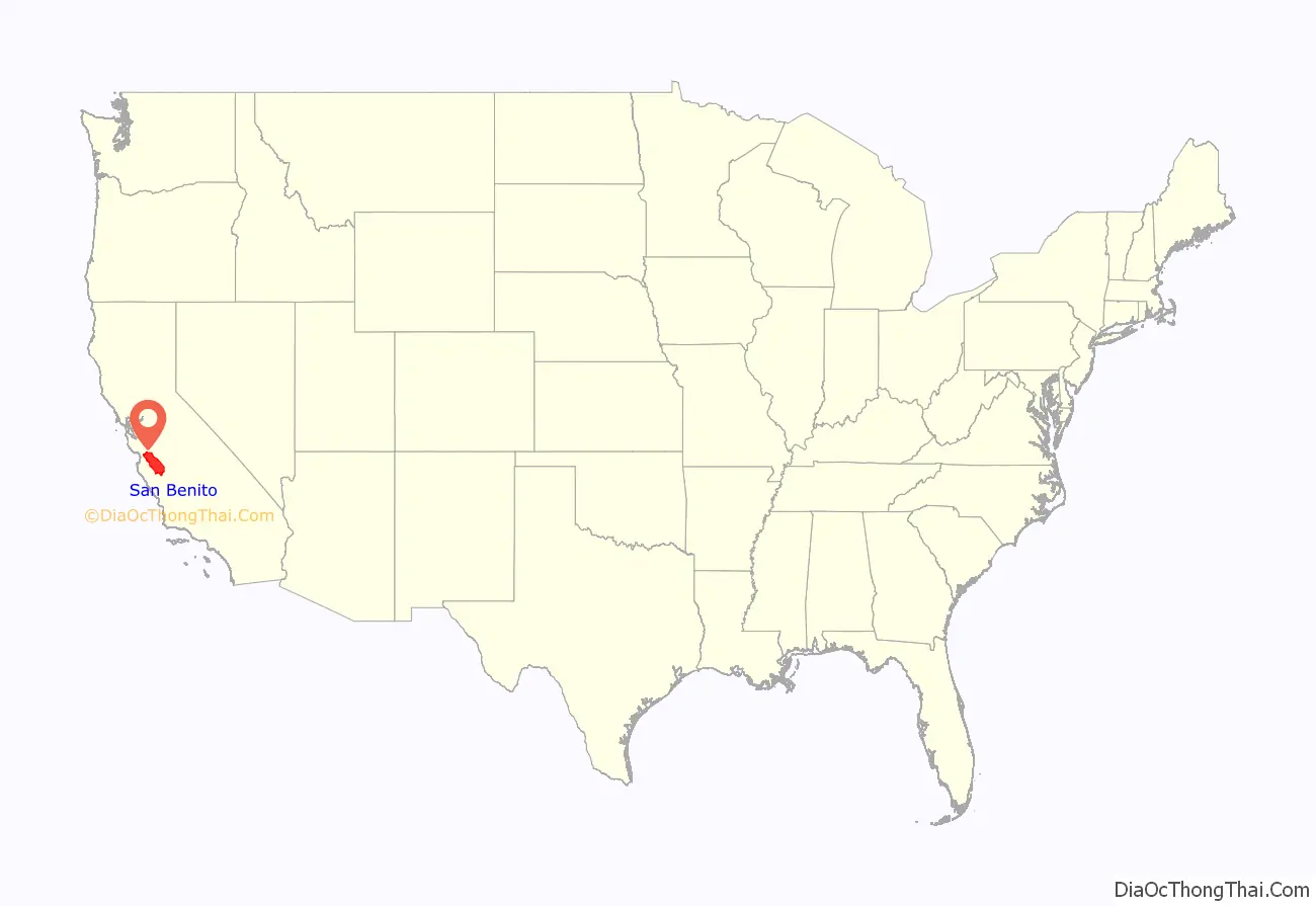
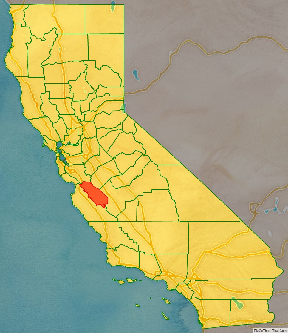
San Benito County location map. Where is San Benito County?
History
Before the arrival of the first European settlers, the San Benito County area was inhabited by the Mutsun sub-group of the Ohlone Native Americans. In 1772 Father Juan Crespí conducted a brief expedition into the area and named a small river which he found in honor of San Benito de Nursia (Saint Benedict), the patron saint of monasticism. The county was later named after the San Benito Valley, the valley surrounding this river. Thus it was from the Spanish version of the saint’s name that the county eventually took its name.
In 1797 Spanish missionaries founded the first European settlement in the county as the San Juan Bautista mission. In 1848 the United States government gained control over what would soon become the state of California, which included the area now known as San Benito county. The town of New Idria was the next town to develop in the area and was founded ca. 1857. New Idria was centered around the New Idria Mercury Mine. When the mine played out fairly recently in 1972, New Idria was abandoned, and the town is now one of California’s many ghost-towns.
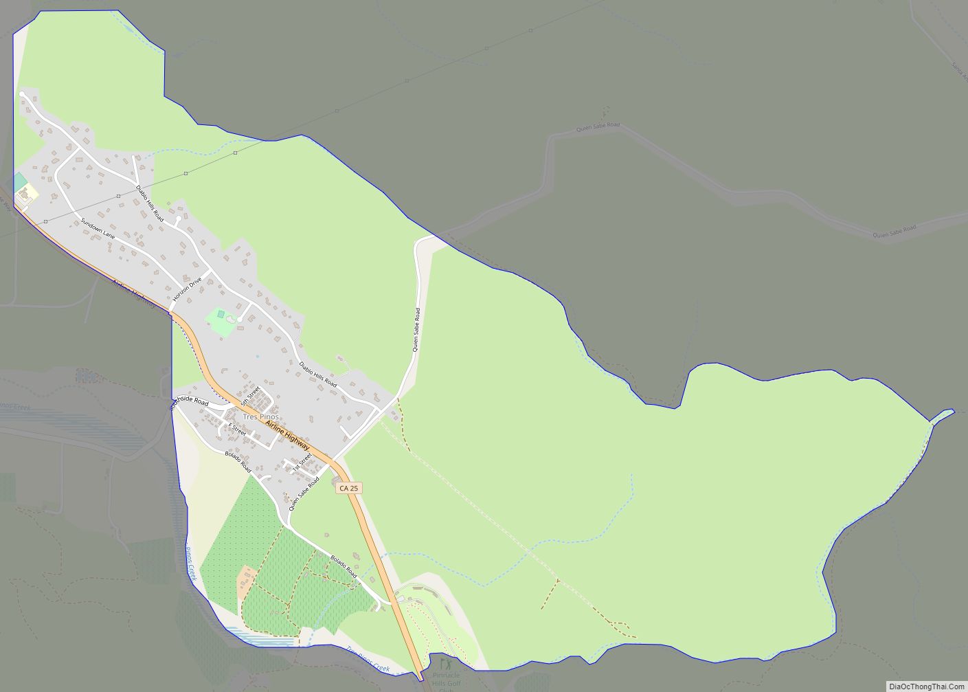
The town of Hollister was next founded on November 19, 1868, by William Welles Hollister on the grounds of the former Mexican land-grant Rancho San Justo. In 1874 the California legislature formed San Benito county from a section of Monterey County while naming Hollister as the new county seat. Sections of Merced and Fresno Counties were also later reassigned to San Benito county in 1887 as a result of the growth of the New Idria community. Other towns in the county which were founded early in the county’s history include Tres Pinos and Paicines.
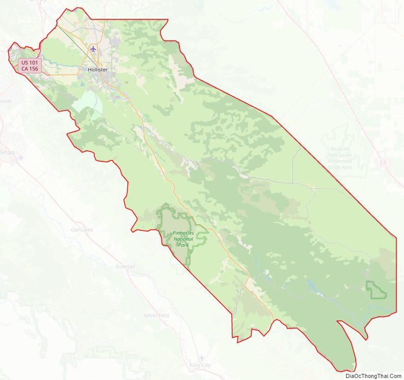
San Benito County Road Map

Geography
According to the U.S. Census Bureau, the county has a total area of 1,390 square miles (3,600 km), of which 1,389 square miles (3,600 km) is land and 1.8 square miles (4.7 km) is water (0.1%).
Sharing a border with Santa Clara County, San Benito County lies adjacent to the San Francisco Bay Area and is sometimes considered a part of that region. Frequently, the county is associated with the Monterey Bay Area through governmental organizations such as the Association of Monterey Bay Area Governments as well as the Pajaro River, which flows from northern San Benito County into the Monterey Bay. The United States Census Bureau includes the county in the San Jose-Sunnyvale-Santa Clara MSA and the San Jose-San Francisco-Oakland CSA, which the Census uses as a statistical definition of the San Francisco Bay Area.
The county also borders Merced County and Fresno County on the east, which extend into California’s San Joaquin Valley. It borders Santa Cruz County on the west and Monterey County on the southwest border.
The county is also the location of the Mount Harlan and San Benito American Viticultural Areas. The latter contains the Cienega Valley, Lime Kiln Valley, and Paicines AVAs.
Flora
Due to the high degree of topography, diverse geology, and varied climate from near-coastal to inland, San Benito County contains a high diversity of vegetation types. Common vegetation types include annual grasslands, coastal scrub, chaparral, and oak woodland.
In the extreme southeastern portion of San Benito County at Panoche Valley, Panoche Hills, Tumey Hills, and Vallecitos, the climate is arid and part of the recently recognized San Joaquin Desert biome. The flora there includes saltbush scrub, San Joaquin Desert scrub, and California juniper woodland. Panoche Hills navarretia (Navarretia panochensis) is nearly endemic to this small portion of the San Joaquin Desert in San Benito County.
At the highest elevations of San Benito County at Fremont Peak and San Benito Mountain, the average annual precipitation is high enough and the average annual temperature is cool enough to support mixed conifer forest. At San Benito Mountain, the high elevation climate and extreme geology of the New Idria serpentine, supports a unique mixed-conifer forest that includes foothill pine, Coulter pine, Jeffrey pine, and incense cedar. The extreme conditions of the serpentine soils of the New Idria serpentine mass support many rare local endemic plant species including San Benito evening primrose (Camissonia benitensis), rayless layia (Layia discoidea), Guirado’s goldenrod (Solidago guiradonis), and San Benito fritillary (Fritillaria viridea).
The plant species Benitoa occidentalis was named for San Benito County. Camissonia benitensis, Monardella antonina subsp. benitensis, and Arctostaphylos benitoensis were named in recognition of their being endemic or near-endemic to San Benito County. The species Hollisteria lanata was named after William Welles Hollister, namesake of the city of Hollister.
Fauna
Illacme plenipes, a millipede having more legs than any other millipede species, discovered in the county in 1926.
National protected area
- Pinnacles National Park
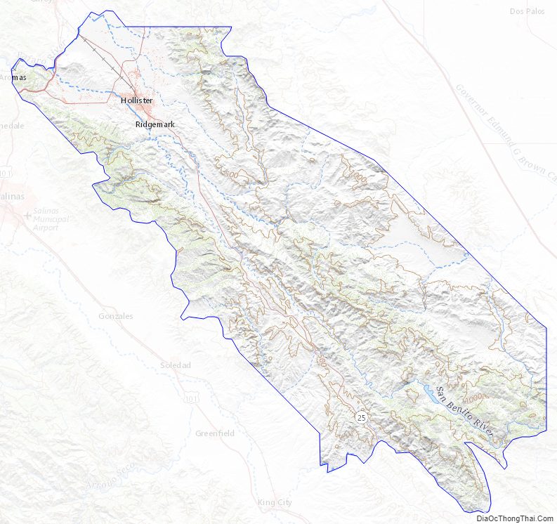
San Benito County Topographic Map
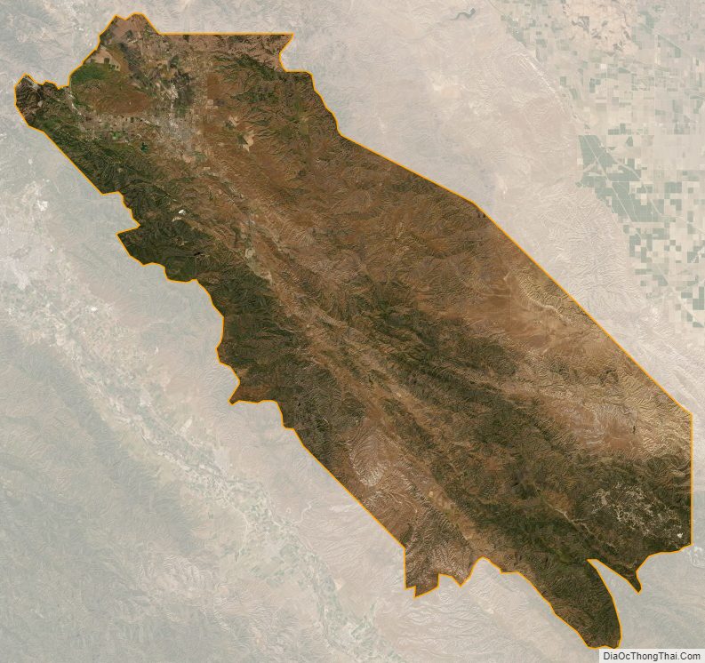
San Benito County Satellite Map
San Benito County Outline Map