Hot Spring County is located in the U.S. state of Arkansas. As of the 2020 census, the population was 33,040. The county seat is Malvern. Hot Spring County was formed on November 2, 1829, from a portion of Clark County. It was named for the hot springs at Hot Springs, Arkansas, which were within its boundaries until Garland County was formed in 1873. Up until November 2022, it was an alcohol prohibition or dry county. However, there was no record of this law.
Hot Spring County comprises the Malvern, AR Micropolitan Statistical Area, which is included in the Hot Springs-Malvern, AR Combined Statistical Area.
| Name: | Hot Spring County |
|---|---|
| FIPS code: | 05-059 |
| State: | Arkansas |
| Founded: | November 2, 1829 |
| Named for: | hot springs at Hot Springs, Arkansas |
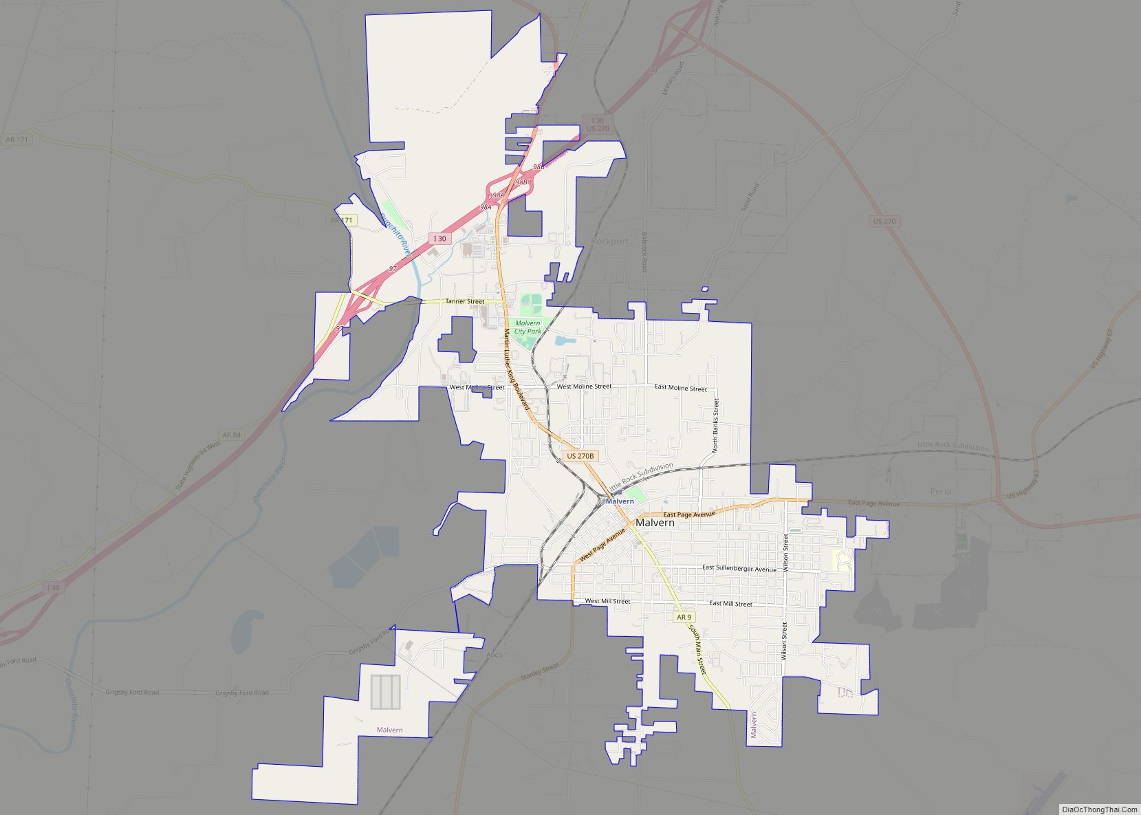
| Seat: | Malvern |
| Largest city: | Malvern |
| Total Area: | 622.16 sq mi (1,611.4 km²) |
| Land Area: | 614.94 sq mi (1,592.7 km²) |
| Total Population: | 33,040 |
| Population Density: | 53/sq mi (21/km²) |
| Time zone: | UTC−6 (Central) |
| Summer Time Zone (DST): | UTC−5 (CDT) |
| Website: | www.hotspringcounty.org |
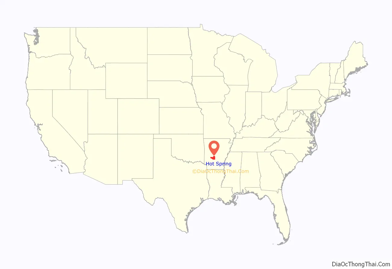
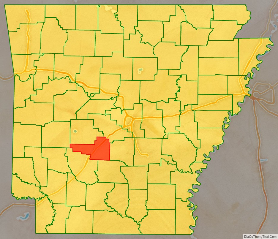
Hot Spring County location map. Where is Hot Spring County?
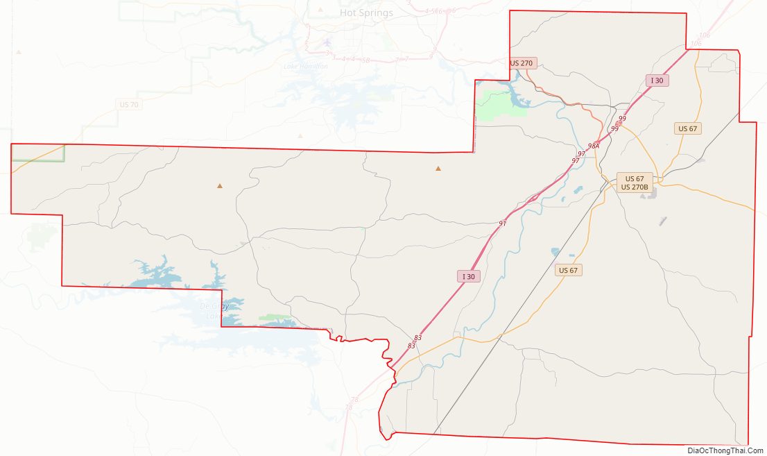
Hot Spring County Road Map
Geography
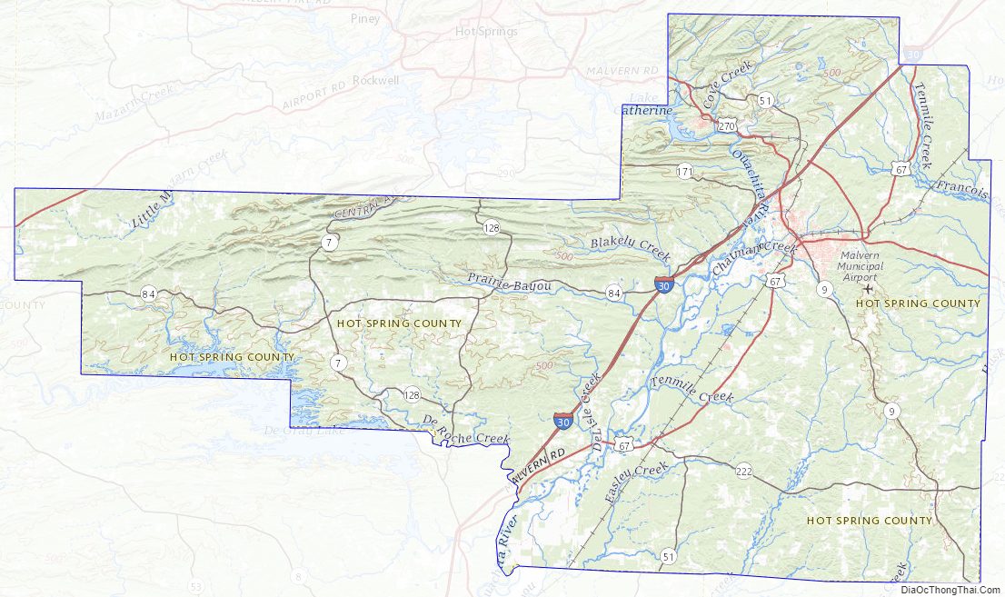
Hot Spring County is located in Southwest Arkansas, a region composed of the Ouachita Mountains, deep valleys, and the Arkansas Timberlands. Hot Spring County is mostly within the mountainous segment of the region, mostly covered in hardwood and pine forests. One of the six primary geographic regions of Arkansas, the Ouachitas are a mountainous subdivision of the U.S. Interior Highlands. The Ouachita River roughly divides the county. According to the U.S. Census Bureau, the county has a total area of 622.16 square miles (1,611.4 km), of which 614.94 square miles (1,592.7 km) is land and 7.22 square miles (18.7 km) (1.16%) is water.
The county is located approximately 47 miles (76 km) southwest of Little Rock, 170 miles (270 km) northeast of Shreveport, Louisiana, and 277 miles (446 km) northeast of Dallas, Texas. Hot Spring County is surrounded by six counties, including the Ouachitas, Central Arkansas, and Lower Arkansas Delta, due to its short and wide shape. The county neighbors Garland County to the north, Saline County in the northeast corner, Grant County to the east, Dallas County to the southeast, Clark County to the south, and a small portion with Montgomery County in the northwest.
Protected areas
Hot Spring County contains two state parks, DeGray Lake Resort State Park and Lake Catherine State Park, and two Wildlife Management Area (WMA), DeGray Lake WMA, and Jack Mountain WMA maintained by the Arkansas Game and Fish Commission. The county also contains 320 acres (130 ha) of Ouachita National Forest managed by the National Forest Service.
DeGray Lake Resort State Park is a 984-acre (398 ha) in southwest Hot Spring County, and Arkansas’s only resort state park. The 94-room DeGray Lodge and Convention Center includes a restaurant and 18-hole championship rated golf course. Traditional state park amenities for camping, hiking, fishing, boating, picnic tables, and horseback riding are also offered. The park is owned and operated by the Arkansas Department of Parks and Tourism (ADPT). DeGray Lake WMA essentially bounds the portions of lake shoreline not bounded by the state park. The land is owned by the United States Army Corps of Engineers (USACE) and extends into Clark County.
Near Malvern, Lake Catherine State Park is a small state park on the west side of Lake Catherine. The park offers 20 cabins, including five Civilian Conservation Corps cabins of natural wood and stone built in the 1930s, and 70 campsites. In summer, the parks offers a marina, boat rental, visitor center, guided tours, nature center and horseback trail rides.
Hot Spring County Topographic Map
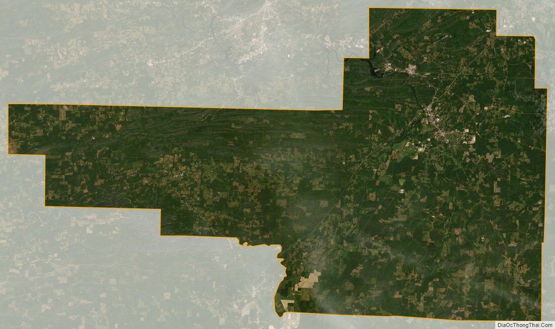
Hot Spring County Satellite Map
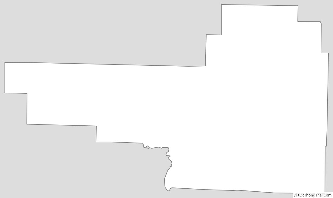
Hot Spring County Outline Map