Sutter County is a county located in the U.S. state of California. As of the 2020 census, the population was 99,633. The county seat is Yuba City. Sutter County is included in the Yuba City, CA Metropolitan Statistical Area as well as the Sacramento–Roseville, CA Combined Statistical Area. The county is located along the Sacramento River in the Sacramento Valley.
| Name: | Sutter County |
|---|---|
| FIPS code: | 06-101 |
| State: | California |
| Founded: | 1850 |
| Named for: | John Augustus Sutter |
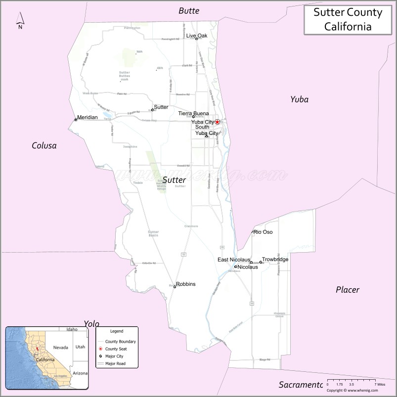
| Seat: | Yuba City |
| Largest city: | Yuba City |
| Total Area: | 608 sq mi (1,570 km²) |
| Land Area: | 602 sq mi (1,560 km²) |
| Total Population: | 99,633 |
| Population Density: | 160/sq mi (63/km²) |
| Time zone: | UTC-8 (Pacific Time Zone) |
| Summer Time Zone (DST): | UTC-7 (Pacific Daylight Time) |
| Website: | www.co.sutter.ca.us |
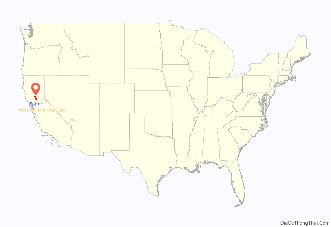
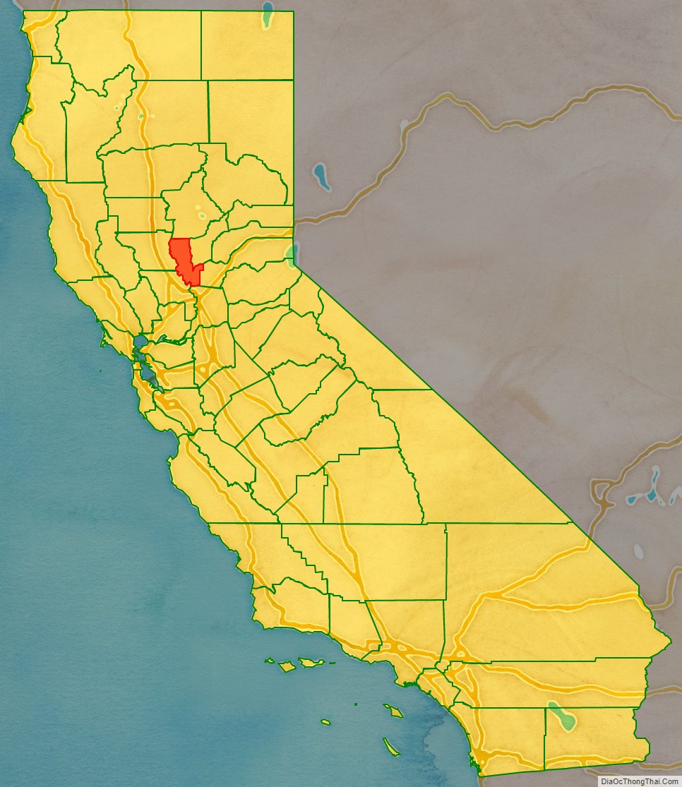
Sutter County location map. Where is Sutter County?
History
The Maidu were the people living in the area of Sutter County when European settlers arrived.
Sutter County was one of the original counties of California, created in 1850 at the time of statehood. Parts of the county were given to Placer County in 1852.
Sutter County is named after John Augustus Sutter, a German native born to Swiss parents. He was one of the first Europeans to recognize the Sacramento Valley for its potential in agriculture. His Hock Farm, established in 1841 on the Feather River just south of present-day Yuba City, was the site of the first major farm in the Central Valley, and used extensive slave labor from Natives in order to function.
Sutter obtained the Rancho New Helvetia Mexican land grant, and called his first settlement New Helvetia (which included the present day city of Sacramento). In 1850, Sutter retired to Hock Farm when the gold rush led to him losing his holdings in Sacramento.
Sutter County is the birthplace (Yuba City, 1858) of John Joseph Montgomery, who was the first American to successfully pilot a heavier-than-air craft, 20 years before the Wright Brothers, and who held the first patent for an “aeroplane.”
In the 1890s, Sutter County was one of the two prohibition counties in California; the other was Riverside County. Both outlawed saloons and sale or consumption of alcohol in public.
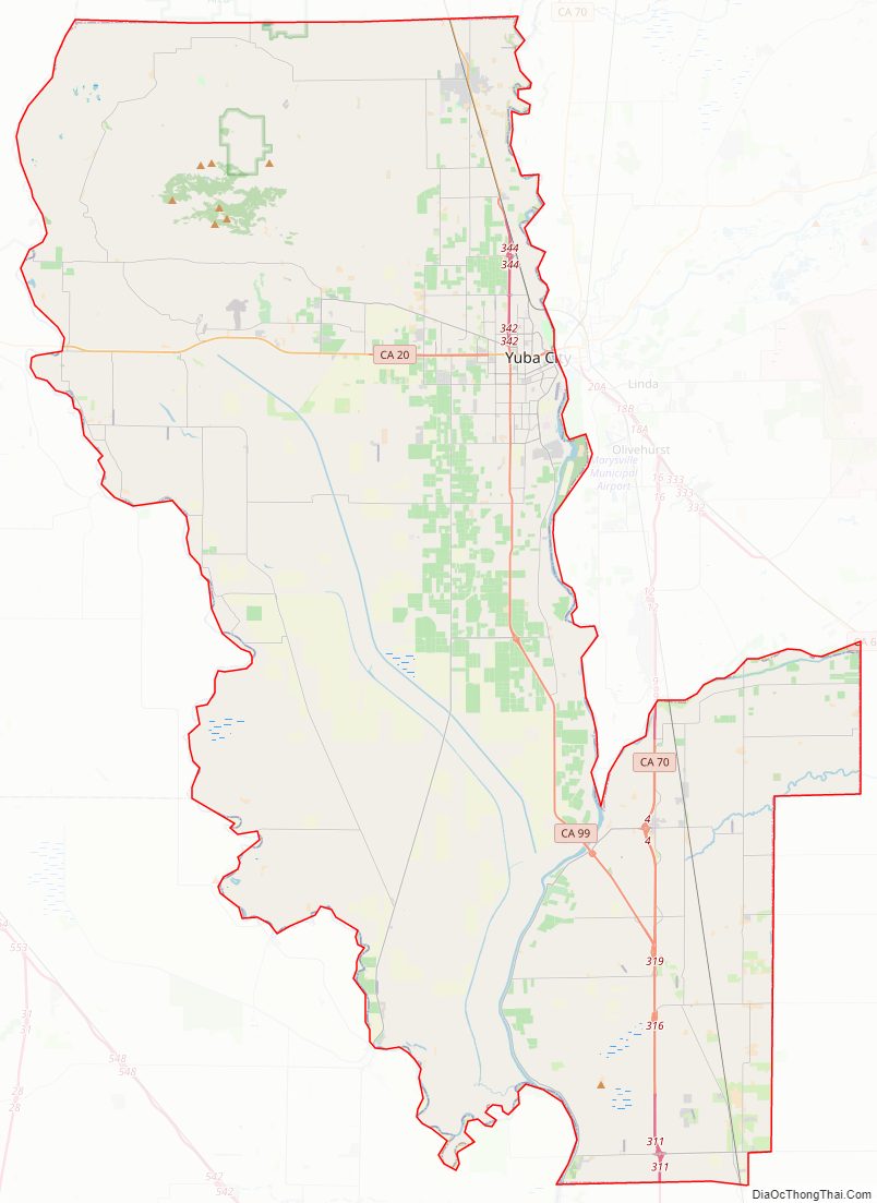
Sutter County Road Map
Geography
According to the U.S. Census Bureau, the county has a total area of 608 square miles (1,570 km), of which 602 square miles (1,560 km) is land and 6.1 square miles (16 km), comprising 1.0%, is water. It is the fourth-smallest county in California by total area. Some 88 percent of the county is prime farmland and grazing land.
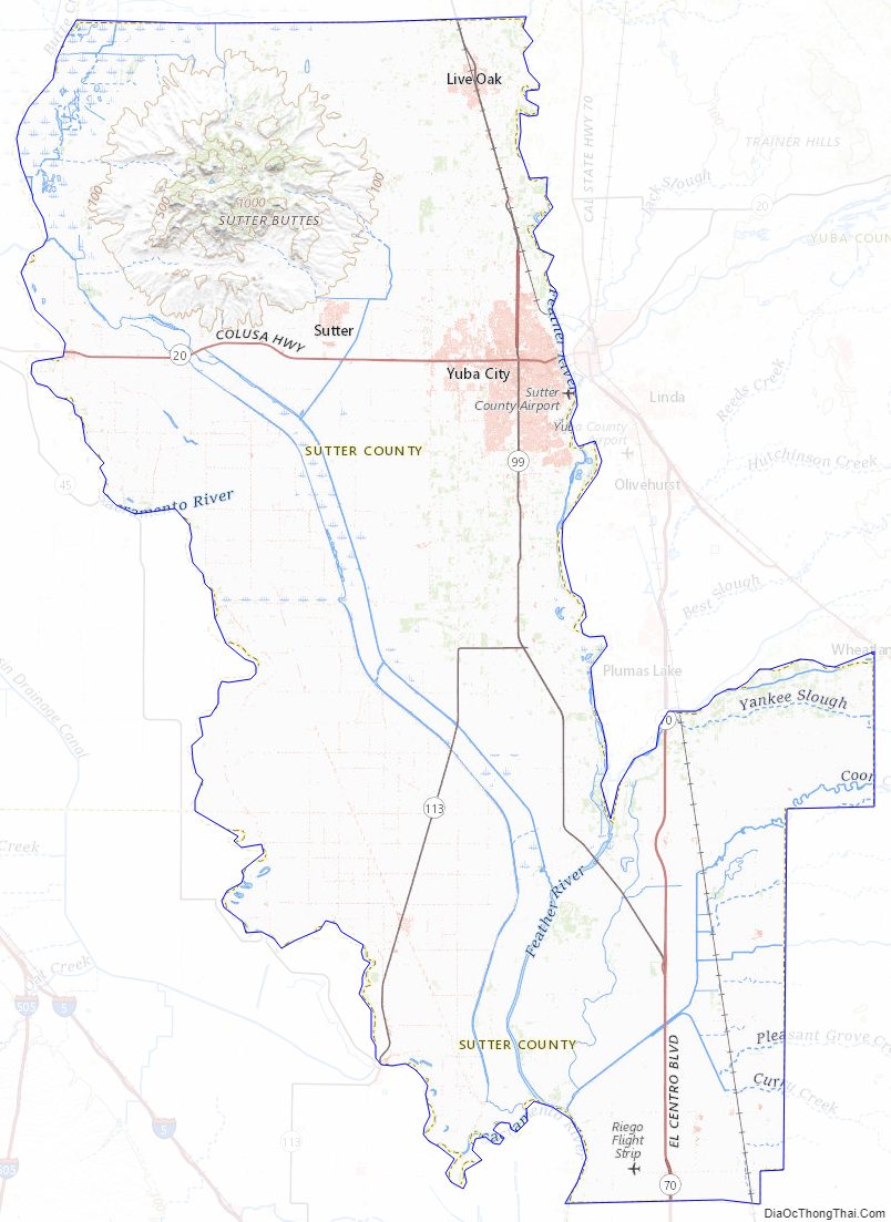
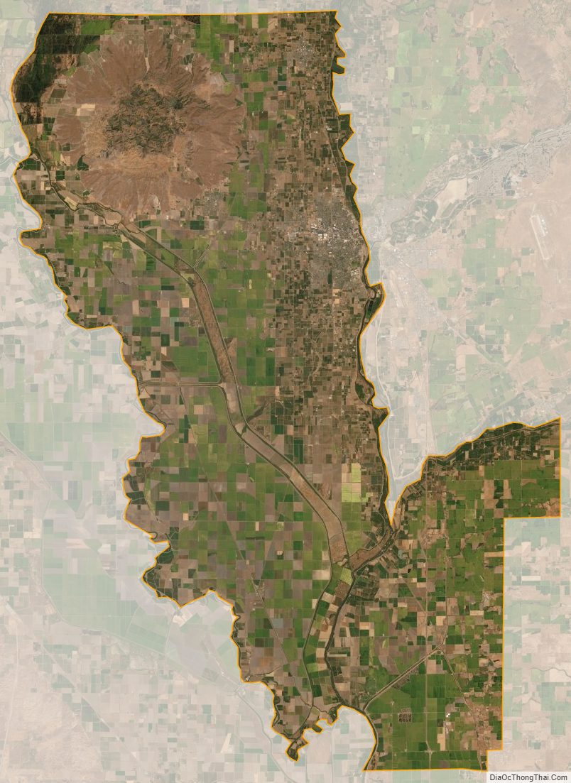
Sutter County is home to the Sutter Buttes, known as the “World’s Smallest Mountain Range.” This volcanic formation provides relief to the otherwise seemingly flat Sacramento Valley.
Bordered by the Sacramento River on the west and the Feather River on the east, Sutter County has 240 miles (390 km) of levees. The Sutter Bypass, which diverts flood waters from the Sacramento River, cuts through the heart of Sutter County.
Adjacent counties
- Butte County – north
- Yuba County – east
- Placer County – southeast
- Sacramento County – south
- Yolo County – southwest
- Colusa County – west
National protected areas
- Butte Sink National Wildlife Refuge (part)
- Sutter National Wildlife Refuge
Sutter County also has the State Feather River Wildlife Area, consisting of the Nelson Slough, O’Connor Lakes, Abbott Lake, Shanghai Bend, and Morse Road Units in Sutter County. Also, a 1,795-acre (7.26 km) State Park in the Sutter Buttes. In addition, there are the state public trust lands of the Feather, Bear and Sacramento rivers as well as smaller streams including Butte Creek and Butte Slough.
Sutter County Topographic Map
Sutter County Satellite Map
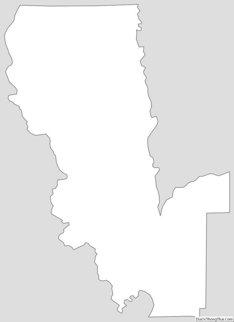
Sutter County Outline Map