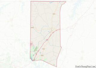
Map of Rawlins County

Map of Rawlins County, Kansas

Rawlins County (standard abbreviation: RA) is a county located in the U.S. state of Kansas. As of the 2020 census, the county population was 2,561. The largest city and county seat is Atwood. It was named after Union Civil War General John Aaron Rawlins. Rawlins County overview: Name: Rawlins County FIPS code: 20-153 State: Kansas … Read more

Map of Stafford County

Map of Stafford County, Kansas

Stafford County (standard abbreviation: SF) is a county located in the U.S. state of Kansas. As of the 2020 census, the county population was 4,072. Its county seat is St. John. The county is named in honor of Lewis Stafford, captain of Company E, First Kansas Infantry, who was killed at the Battle of Young’s … Read more

Map of Ballard County

Map of Ballard County, Kentucky

Ballard County is a county located in the extreme west portion of the U.S. state of Kentucky. As of the 2020 census, the population was 7,728. Its county seat is Wickliffe and its largest city is LaCenter. The county was created by the Kentucky State Legislature in 1842 and is named for Captain Bland Ballard, … Read more

Map of Carlisle County

Map of Carlisle County, Kentucky

Carlisle County is a county located in the U.S. state of Kentucky. As of the 2020 census, the population was 4,826, making it the fourth-least populous county in Kentucky. Its county seat is Bardwell. The county was founded in 1886 and named for John Griffin Carlisle, a Speaker of the United States House of Representatives … Read more

Map of Floyd County

Map of Floyd County, Kentucky

Floyd County is a county located in the U.S. state of Kentucky. As of the 2020 census, the population was 35,942. Its county seat is Prestonsburg. The county, founded in 1800, is named for Colonel John Floyd (1750–1783). Floyd County overview: Name: Floyd County FIPS code: 21-071 State: Kentucky Founded: 1800 Named for: John Floyd … Read more

Map of Henry County

Map of Henry County, Kentucky

Henry County is a county located in the north central portion of the U.S. state of Kentucky bordering the Kentucky River. As of the 2020 census, the population was 15,678. Its county seat is New Castle, but its largest city is Eminence. The county was founded in 1798 from portions of Shelby County. It was … Read more

Map of Lewis County

Map of Lewis County, Kentucky

Lewis County is a county located in the U.S. state of Kentucky. Its county seat is Vanceburg. Lewis County overview: Name: Lewis County FIPS code: 21-135 State: Kentucky Founded: December 2, 1806 Named for: Meriwether Lewis Seat: Vanceburg Largest city: Vanceburg Total Area: 495 sq mi (1,280 km²) Land Area: 483 sq mi (1,250 km²) Total Population: 13,080 Population Density: 26/sq mi … Read more

Map of Mercer County

Map of Mercer County, Kentucky

Mercer County is a county located in the central part of the U.S. Commonwealth of Kentucky. As of the 2020 census, the population was 23,772. Its county seat is Harrodsburg. The county was formed from Lincoln County, Virginia in 1785 and is named for Revolutionary War General Hugh Mercer, who was killed at the Battle … Read more

Map of Pulaski County

Map of Pulaski County, Kentucky

Pulaski County is a county in the U.S. Commonwealth of Kentucky. As of the 2020 census, the population was 65,034. Its county seat is Somerset. The county was founded in December 1798 from land given by Lincoln and Green Counties and named for Polish patriot Count Casimir Pulaski. Pulaski County comprises the Somerset, KY Micropolitan … Read more

Map of Wayne County

Map of Wayne County, Kentucky

Wayne County is a county in the U.S. state of Kentucky along the southern border with Tennessee. As of the 2020 census, the population was 19,555. Its county seat is Monticello. The county, on the south-central border with Tennessee, was named for Gen. Anthony Wayne, a Revolutionary War hero. As of November 3, 2020, Wayne … Read more

Map of Cameron Parish

Map of Cameron Parish, Louisiana

Cameron Parish (French: Paroisse de Cameron) is a parish in the southwest corner of the U.S. state of Louisiana. As of the 2020 census, the population was 5,617. The parish seat is Cameron. Although it is the largest parish by area in Louisiana, it has the second-smallest population in the state, ahead of only Tensas. … Read more

Map of La Salle Parish

Map of LaSalle Parish, Louisiana

LaSalle Parish overview: Name: LaSalle Parish FIPS code: 22-059 State: Louisiana Founded: January 1, 1910 Named for: René-Robert Cavelier, Sieur de La Salle Seat: Jena Total Area: 1,710 km² (662 sq mi) Land Area: 1,620 km² (625 sq mi) Total Population: 14,791 Population Density: 8.6/km² (22/sq mi) Time zone: UTC-6 (CST) Summer Time Zone (DST): UTC-5 (CDT) LaSalle Parish location map. Where … Read more