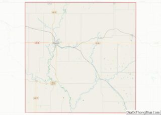
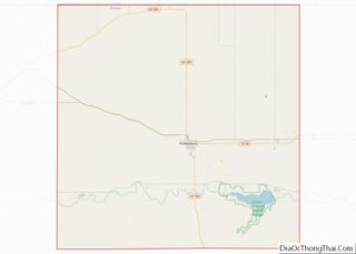
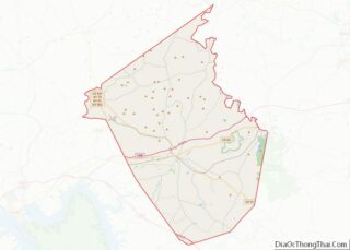
Map of Leslie County, Kentucky
Leslie County is located in the U.S. state of Kentucky. Its county seat is Hyden. Leslie is a prohibition or dry county. Leslie County overview: Name: Leslie County FIPS code: 21-131 State: Kentucky Founded: 1878 Named for: Preston Leslie Seat: Hyden Largest city: Hyden Total Area: 404 sq mi (1,050 km²) Land Area: 401 sq mi (1,040 km²) Total Population: 10,513 ... Read more
Map of Leslie County, Kentucky
Map of Meade County, Kentucky
Meade County is a county located in the U.S. state of Kentucky. As of the 2020 census, the population was 30,003. Its county seat is Brandenburg. The county was founded December 17, 1823, and named for Captain James M. Meade, who was killed in action at the Battle of River Raisin during the War of ... Read more
Map of Meade County, Kentucky
Map of Pike County, Kentucky
Pike County is a county in the U.S. state of Kentucky. As of the 2020 Census, the population was 58,669. Its county seat is Pikeville. The county was founded in 1821. With regard to the sale of alcohol, it is classified as a moist county–– a county in which alcohol sales are prohibited (a dry ... Read more
Map of Pike County, Kentucky
Map of Warren County, Kentucky
Warren County is a county located in the south central portion of the U.S. state of Kentucky. As of the 2020 census, the population was 134,554, making it the fifth-most populous county in Kentucky. The county seat is Bowling Green. Warren County is now classified as a wet county after voters approved the measure in ... Read more
Map of Warren County, Kentucky
Map of Calcasieu Parish, Louisiana
Calcasieu Parish (/ˈkælkəˌʃuː/; French: Paroisse de Calcasieu) is a parish located on the southwestern border of the U.S. state of Louisiana. As of the 2020 census, the population was 216,785. The parish seat is Lake Charles. Calcasieu Parish is part of the Lake Charles metropolitan statistical area; it is also located near the Beaumont–Port Arthur ... Read more
Map of Calcasieu Parish, Louisiana
Map of Jefferson Parish, Louisiana
Jefferson Parish (French: Paroisse de Jefferson; Spanish: Parroquia de Jefferson) is a parish in the U.S. state of Louisiana. As of the 2020 census, the population was 440,781. Its parish seat is Gretna, its largest community is Metairie, and its largest incorporated city is Kenner. Jefferson Parish is included in the Greater New Orleans area. ... Read more
Map of Jefferson Parish, Louisiana
Map of Richland Parish, Louisiana
Richland Parish is a parish located in the North Louisiana Delta Country in the U.S. state of Louisiana, known for its fertile, flat farmland, cane brakes, and open spaces. The parish had a population of 20,043 at the 2020 United States Census. The name Richland was chosen due to the rich production from farming. The ... Read more
Map of Richland Parish, Louisiana
Map of Vernon Parish, Louisiana
Vernon Parish (French: Paroisse de Vernon) is a parish located in the U.S. state of Louisiana. As of the 2020 census, the population was 48,750. The parish seat is Leesville. Bordered on the west by the Sabine River, the parish was founded in 1871 during the Reconstruction era. It was long a center of the ... Read more
Map of Vernon Parish, Louisiana
Map of Penobscot County, Maine
Penobscot County is a county in the U.S. state of Maine, named for the Penobscot people in Wabanakik. As of the 2020 census, the population was 152,199. Its county seat is Bangor. The county was established on February 15, 1816, from part of Hancock County when the area was still part of Massachusetts. Penobscot County ... Read more
Map of Penobscot County, Maine
Map of Frederick County, Maryland
Frederick County is a county in Maryland, United States. As of the 2020 U.S. census, the population was 271,717. The county seat is Frederick. Frederick County is part of the Washington-Arlington-Alexandria, DC-VA-MD-WV Metropolitan Statistical Area. Like other outlying sections of the Washington metropolitan area, Frederick County has experienced a rapid population increase in recent years. ... Read more
Map of Frederick County, Maryland
Map of Bristol County, Massachusetts
Bristol County is a county in the Commonwealth of Massachusetts. As of the 2020 census, the population was 579,200. The shire town is Taunton. Some governmental functions are performed by the Commonwealth of Massachusetts, others by the county, and others by local towns and cities. Bristol County is part of the Providence–Warwick, RI-MA Metropolitan Statistical ... Read more
Map of Bristol County, Massachusetts
Map of Antrim County, Michigan
Antrim County (/ˈæntrəm/ AN-trəm) is a county located in the U.S. state of Michigan. As of the 2020 Census, the population was 23,431. The county seat is Bellaire. The name is taken from County Antrim in Northern Ireland. Antrim County is home to Torch Lake, Michigan’s deepest and second-largest inland lake. Torch Lake, famous for ... Read more
Map of Antrim County, Michigan