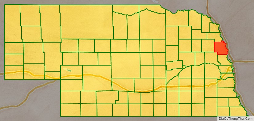
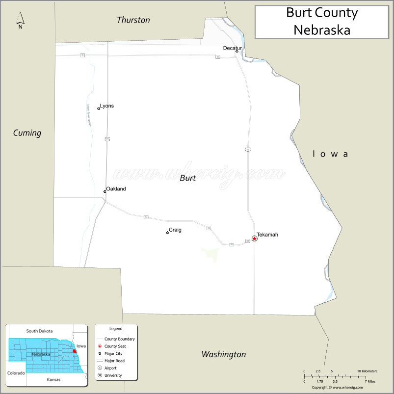
Burt County is a county in the U.S. state of Nebraska, bordering the west bank of the upper Missouri River. As of the 2010 United States Census, the population was 6,858. Its county seat is Tekamah. The county was formed in 1854 and named after Francis Burt, the first governor of Nebraska Territory.
In the Nebraska license plate system, Burt County is represented by the prefix 31 (it had the 31st-largest number of vehicles registered in the county when the license plate system was established in 1922).
| Name: | Burt County |
|---|---|
| FIPS code: | 31-021 |
| State: | Nebraska |
| Founded: | 1854 |
| Named for: | Francis Burt |
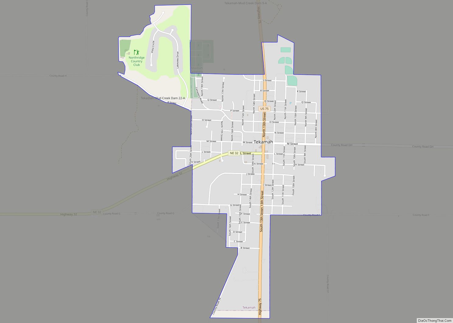
| Seat: | Tekamah |
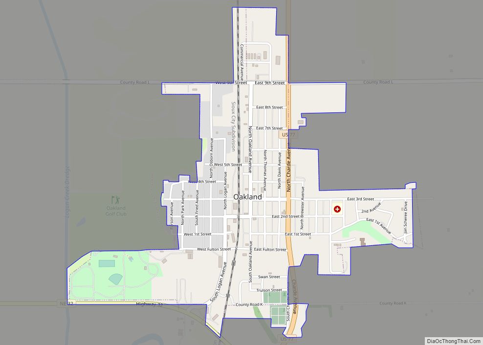
| Largest city: | Tekamah |
| Total Area: | 497 sq mi (1,290 km²) |
| Land Area: | 492 sq mi (1,270 km²) |
| Total Population: | 6,709 |
| Population Density: | 13.3/sq mi (5.1/km²) |
| Time zone: | UTC−6 (Central) |
| Summer Time Zone (DST): | UTC−5 (CDT) |
| Website: | www.burtcounty.ne.gov |
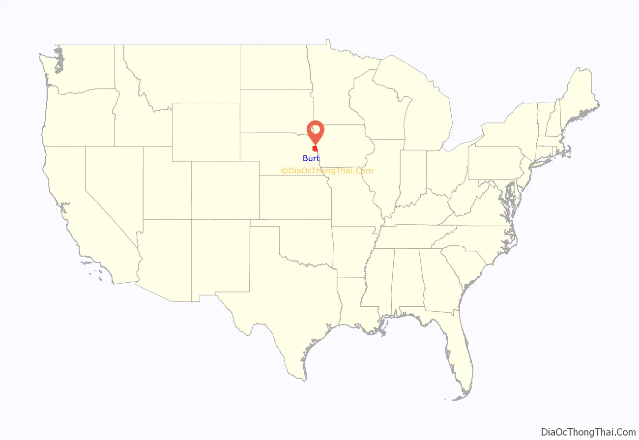
Burt County location map. Where is Burt County?
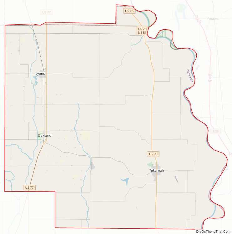
Burt County Road Map
Geography
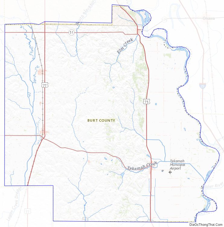
According to the US Census Bureau, the county has an area of 497 square miles (1,290 km), of which 492 square miles (1,270 km) is land and 5.5 square miles (14 km) (1.1%) is water. Its east boundary line is formed by the western border of the state of Iowa, a boundary mostly aligning with the Missouri River. Because of shifts in the river over time, small portions of the county are now located on the eastern bank of the river.
Major highways
- U.S. Highway 75
- U.S. Highway 77
- Nebraska Highway 32
- Nebraska Highway 51
Adjacent counties
- Thurston County – north
- Monona County, Iowa – northeast
- Harrison County, Iowa – southeast
- Washington County – south
- Dodge County – southwest
- Cuming County – west
Burt County Topographic Map
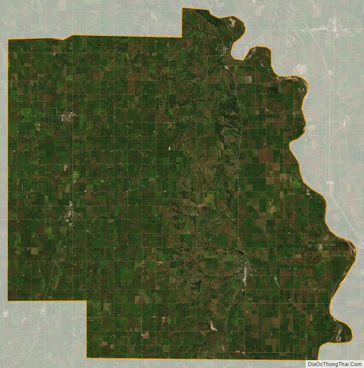
Burt County Satellite Map
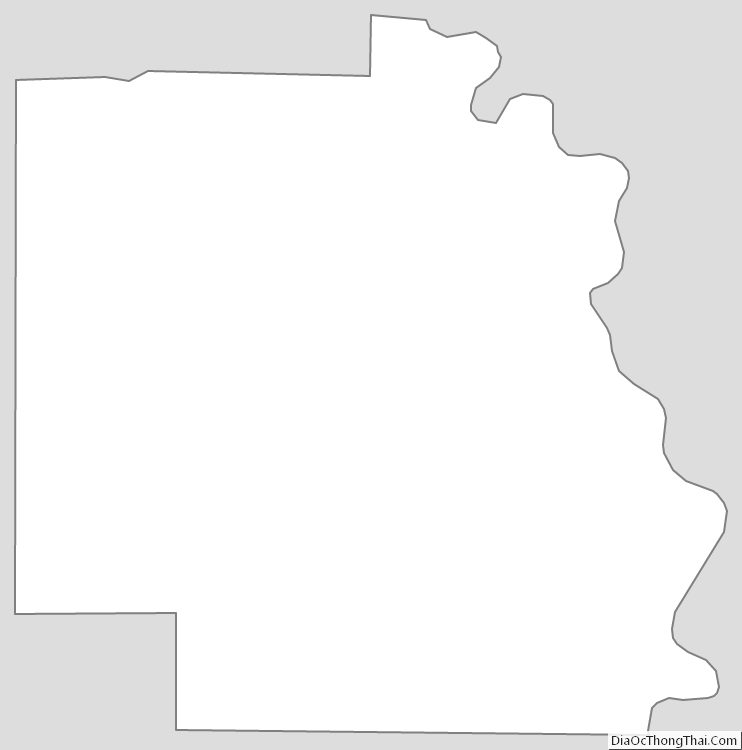
Burt County Outline Map