Williamson County is a county in Southern Illinois. At the 2020 census, it had a population of 67,153. The largest city and county seat is Marion. Williamson County is included in the Carbondale-Marion, IL Metropolitan Statistical Area. This area of Southern Illinois is known locally as “Little Egypt”. Williamson is in the Metro Lakeland area, ... Read more
Daviess County /ˈdeɪviːz/ is a county in the U.S. state of Indiana. As of the 2010 United States Census, the population was 31,648. The county seat is Washington. About 15% of the county’s population is Amish of Swiss origin, as of 2017. Daviess County overview: Name: Daviess County FIPS code: 18-027 State: Indiana Founded: February ... Read more
Hancock County is a county in the U.S. state of Indiana. The 2020 United States Census recorded a population of 79,840. The county seat is Greenfield. Hancock County is included in the Indianapolis-Carmel–Anderson, IN Metropolitan Statistical Area Hancock County overview: Name: Hancock County FIPS code: 18-059 State: Indiana Founded: 1 March 1828 Named for: John ... Read more
Lake Michigan Water body overview: Name: Lake Michigan Water body State: Indiana Lake Michigan Water body location map. Where is Lake Michigan Water body? Lake Michigan Water body Road Map Lake Michigan Water body Topographic Map Lake Michigan Water body Satellite Map Lake Michigan Water body Outline Map
Parke County lies in the western part of the U.S. state of Indiana along the Wabash River. The county was formed in 1821 out of a portion of Vigo County. According to the 2010 census, the population was 17,339, an increase of 0.6% from 17,241 in 2000. The county seat is Rockville. It has a ... Read more
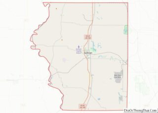
Sullivan County is a county in the U.S. state of Indiana, and determined by the US Census Bureau to include the mean center of U.S. population in 1940. As of 2020, the population was 20,758. The county seat (and the county’s only incorporated city) is Sullivan. Sullivan County is included in the Terre Haute, Indiana, ... Read more
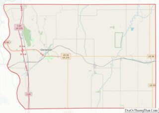
Adair County is a county in the U.S. state of Iowa. As of the 2020 census, the population was 7,496. Its county seat is Greenfield. Adair County overview: Name: Adair County FIPS code: 19-001 State: Iowa Founded: 1851 Named for: John Adair Seat: Greenfield Largest city: Greenfield Total Area: 570 sq mi (1,500 km²) Land Area: 569 sq mi (1,470 km²) ... Read more
Cerro Gordo County (/ˈsɛroʊ ˈɡɔːrdoʊ/; Spanish: [ˈsero ˈɣoɾðo]) is a county located in the U.S. state of Iowa. As of the 2020 census, the population was 43,127. Its county seat is Mason City. The county is named for the Battle of Cerro Gordo, which took place during the Mexican–American War. Cerro Gordo County is part of ... Read more
Fayette County is a county located in the U.S. state of Iowa. As of the 2020 census, the population was 19,509. The county seat is West Union. Fayette County overview: Name: Fayette County FIPS code: 19-065 State: Iowa Founded: 1837 Named for: Marquis de Lafayette Seat: West Union Largest city: Oelwein Total Area: 731 sq mi (1,890 km²) ... Read more
Jackson County is a county located in the U.S. state of Iowa. As of the 2020 census, the population was 19,485. The county seat is Maquoketa. Jackson County overview: Name: Jackson County FIPS code: 19-097 State: Iowa Founded: December 21, 1837 Named for: Andrew Jackson Seat: Maquoketa Largest city: Maquoketa Total Area: 650 sq mi (1,700 km²) Land ... Read more
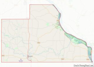
Mills County is a county located in the U.S. state of Iowa. As of the 2020 census, the population was 14,484. The county seat is Glenwood. The county was formed in 1851 and named for Major Frederick Mills of Burlington, Iowa who was killed at the Battle of Churubusco during the Mexican–American War. Mills County ... Read more
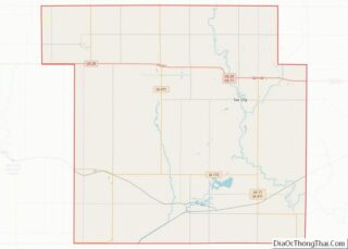
Sac County is a county located in the U.S. state of Iowa. As of the 2020 census, the population was 9,814. The county seat is Sac City. Both were named for the Sauk people, a local American Indian tribe. In February 2007, in its third annual list of the “Best Places to Live in Rural ... Read more