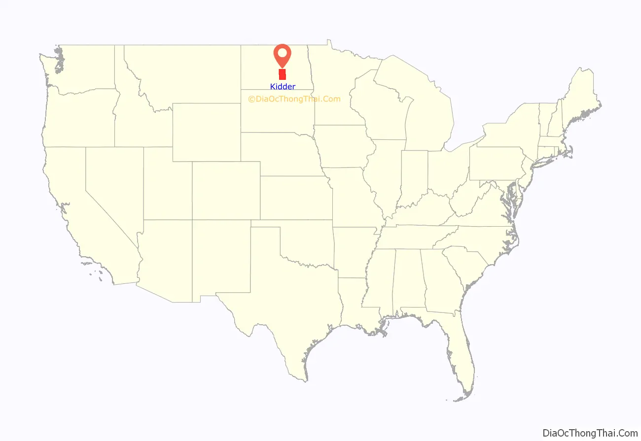
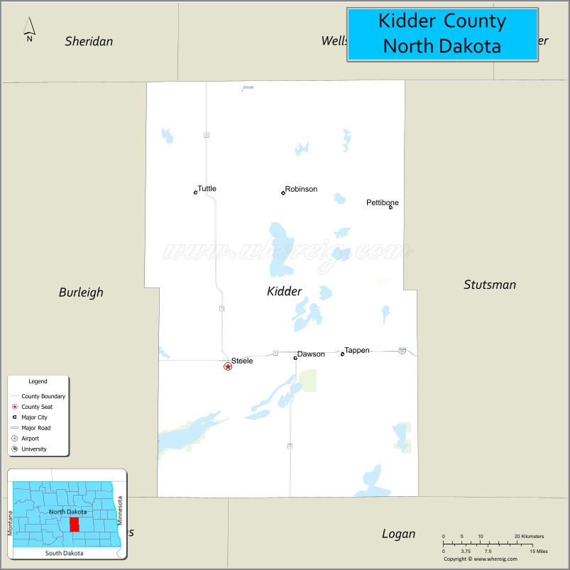
Kidder County is a county located in the U.S. state of North Dakota. As of the 2020 census, the population was 2,394. Its county seat is Steele.
| Name: | Kidder County |
|---|---|
| FIPS code: | 38-043 |
| State: | North Dakota |
| Founded: | 1873 |
| Named for: | Jefferson Kidder |
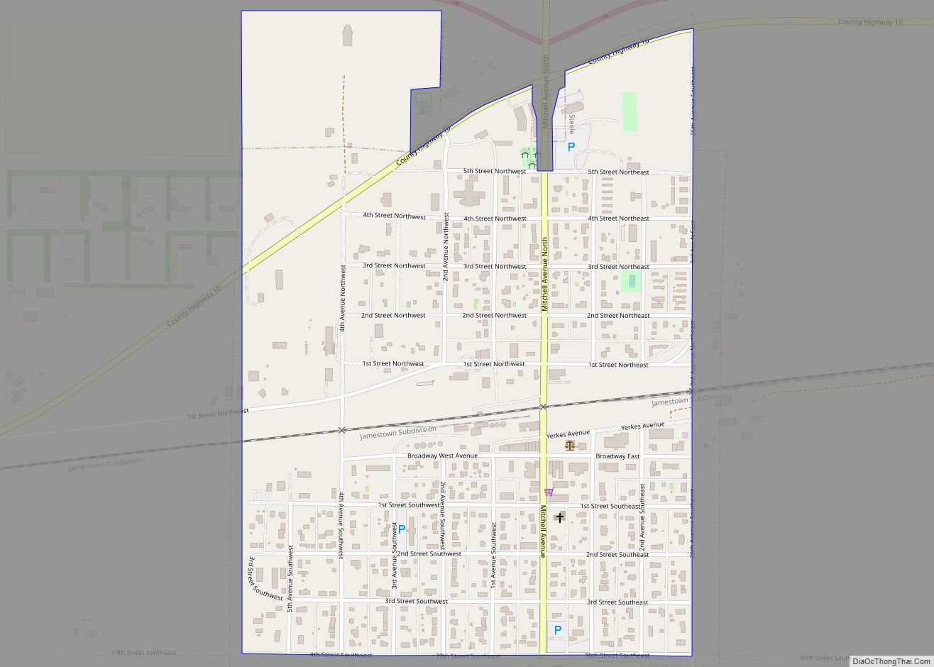
| Seat: | Steele |
| Largest city: | Steele |
| Total Area: | 1,433 sq mi (3,710 km²) |
| Land Area: | 1,351 sq mi (3,500 km²) |
| Total Population: | 2,394 |
| Population Density: | 1.7/sq mi (0.65/km²) |
| Time zone: | UTC−6 (Central) |
| Summer Time Zone (DST): | UTC−5 (CDT) |
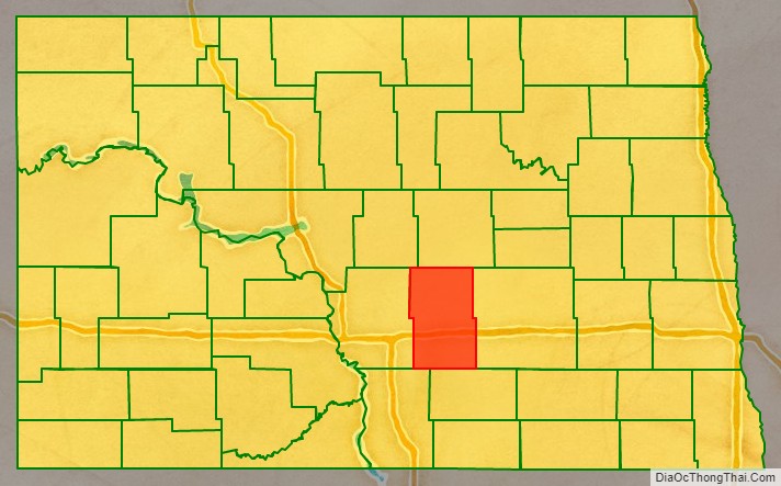
Kidder County location map. Where is Kidder County?
History
The Dakota Territory legislature created the county on January 4, 1873, with areas partitioned from Buffalo County. The county government was not organized at that time, nor was the area attached to another county for administrative or judicial purposes. It was named for Jefferson Parrish Kidder, a delegate to the United States Congress from Dakota Territory (1875–1879) and associate justice of the territorial supreme court (1865-1875, 1879-1883). The county government was effected on March 22, 1881.
The county boundaries were altered on 1879 with territory partitioned to Burleigh, and in 1885 with territory partitioned from Burleigh County. Its boundaries have remained unchanged since 1885.
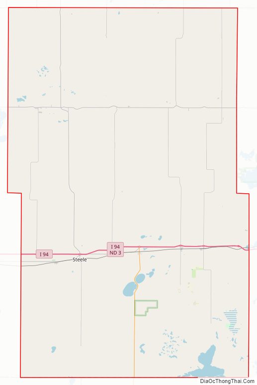
Kidder County Road Map
Geography
The terrain of Kidder County consists of hills dotted with lakes and ponds, largely devoted to agriculture. The terrain slopes to the east and south; its highest point is a hill near its northwestern corner, at 2,064′ (629m) ASL. The county has a total area of 1,433 square miles (3,710 km), of which 1,351 square miles (3,500 km) is land and 82 square miles (210 km) (5.7%) is water.
Major highways
- I-94
- ND 3
- ND 36
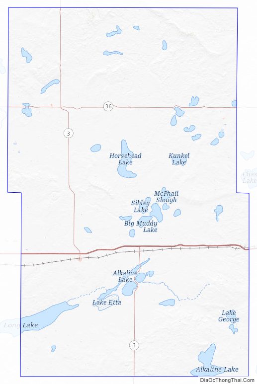
Lakes
- Alkali Lake
- Alkaline Lake
- Ashley Lake
- Big Muddy Lake
- Bird Lake
- Buffalo Lake
- Cherry Lake
- Dead Buffalo Lake
- Deer Lake
- Fresh Lake
- Geneva Lake
- Harker Lake
- Horsehead Lake
- Kunkel Lake
- Lake Etta
- Lake George
- Lake Helen
- Lake Henry
- Lake Isabel
- Long Alkaline Lake
- Long Lake (partial)
- McPhall Slough
- Mud Lake
- Pursian Lake
- Round Lake
- Salt Alkaline Lake
- Sibley Lake
- Swan Lake
- Upper Harker Lake
- Willow Lake
- Woodhouse Lake
Adjacent counties
- Wells County – north
- Stutsman County – east
- Logan County – south
- Emmons County – southwest
- Burleigh County – west
- Sheridan County -northwest
Protected areas
- Alkaline Lake State Wildlife Management Area
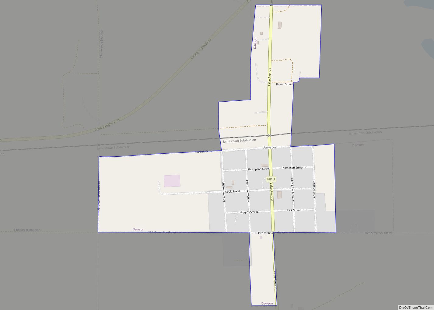
- Dawson State Game Management Area
- Hutchinson Lake National Wildlife Refuge
- Lake George National Wildlife Refuge
- Lake Williams State Game Management Area
- Long Lake National Wildlife Refuge (part)
- Slade National Wildlife Refuge
- Streeter Memorial State Park
Kidder County Topographic Map
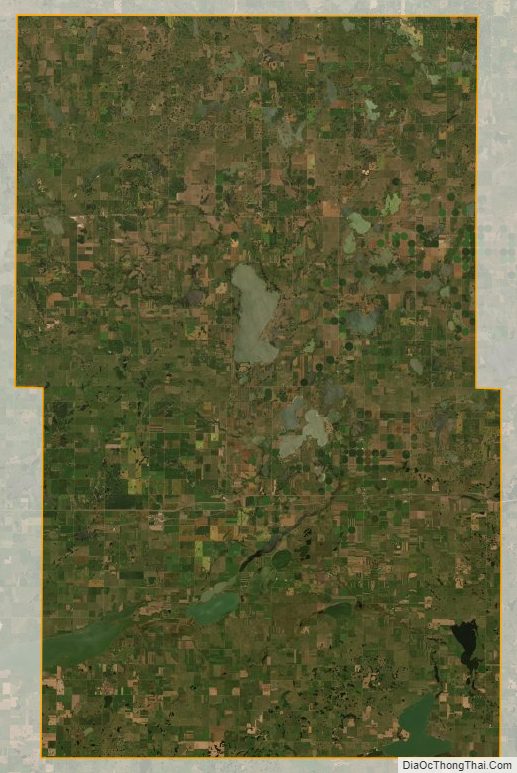
Kidder County Satellite Map
Kidder County Outline Map