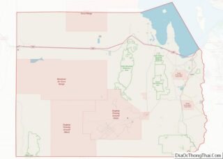
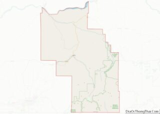
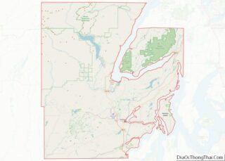
Map of Gallatin County, Kentucky
Gallatin County, is a county located in the northern part of the U.S. state of Kentucky. Its county seat is Warsaw. The county was founded in 1798 and named for Albert Gallatin, the Secretary of the Treasury under President Thomas Jefferson. Gallatin County is included in the Cincinnati-Middletown, OH-KY-IN Metropolitan Statistical Area. It is located ... Read more
Map of Gallatin County, Kentucky
Map of Jackson County, Kentucky
Jackson County is located in the Commonwealth of Kentucky. As of the 2021 census estimation, the population was 12,984. Its county seat is McKee. The county was formed in 1858 from land given by Madison, Estill, Owsley, Clay, Laurel, and Rockcastle counties. It was named for Andrew Jackson, seventh President of the United States. Jackson ... Read more
Map of Jackson County, Kentucky
Map of Logan County, Kentucky
Logan County is a county in the southwest Pennyroyal Plateau area of the U.S. Commonwealth of Kentucky. As of the 2020 census, the population was 27,432. Its county seat is Russellville. Logan County overview: Name: Logan County FIPS code: 21-141 State: Kentucky Founded: 1792 Named for: Benjamin Logan Seat: Russellville Largest city: Russellville Total Area: ... Read more
Map of Logan County, Kentucky
Map of Montgomery County, Kentucky
Montgomery County is a county located in the U.S. state of Kentucky. As of the 2020 census, the population was 28,114. Its county seat is Mount Sterling. With regard to the sale of alcohol, it is classified as a moist county—a county in which alcohol sales are prohibited (a dry county), but containing a “wet” ... Read more
Map of Montgomery County, Kentucky
Map of Rowan County, Kentucky
Rowan County (/ˈroʊ.ɪn/, /raʊn/) is a county located in the northeastern part of the U.S. state of Kentucky, in the Eastern Kentucky Coalfield region. As of the 2020 census, the population was 24,662. Its county seat is Morehead. The county was created in 1856 from parts of Fleming and Morgan counties, and named after John ... Read more
Map of Rowan County, Kentucky
Map of Wolfe County, Kentucky
Wolfe County is a county located in the U.S. state of Kentucky. As of the 2020 census, the population was 6,562. Its county seat is Campton. The county is named for Nathaniel Wolfe. Wolfe County overview: Name: Wolfe County FIPS code: 21-237 State: Kentucky Founded: 1860 Named for: The Wolfe family out of Western North ... Read more
Map of Wolfe County, Kentucky
Map of Concordia Parish, Louisiana
Concordia Parish (Spanish: Parroquia de la Concordia; French: Paroisse de Concordia) borders the Mississippi River in eastern central Louisiana. As of the 2020 census, the population was 18,687. The parish seat is Vidalia. The parish was formed in 1807. Concordia Parish is part of the Natchez, MS–LA Micropolitan Statistical Area. It is historically considered part ... Read more
Map of Concordia Parish, Louisiana
Map of Lincoln Parish, Louisiana
Lincoln Parish overview: Name: Lincoln Parish FIPS code: 22-061 State: Louisiana Founded: 1873 Named for: Abraham Lincoln Seat: Ruston Total Area: 1,220 km² (472 sq mi) Land Area: 1,220 km² (472 sq mi) Total Population: 48,396 Population Density: 40/km² (100/sq mi) Time zone: UTC-6 (CST) Summer Time Zone (DST): UTC-5 (CDT) Website: Parish of Lincoln Lincoln Parish location map. Where is Lincoln ... Read more
Map of Lincoln Parish, Louisiana
Map of St. James Parish, Louisiana
St. James Parish (French: Paroisse de Saint-Jacques) is a parish located in the U.S. state of Louisiana. The parish seat is Convent. The parish was created in 1807. St. James Parish is a part of the New Orleans–Metairie, Louisiana metropolitan statistical area, sitting between New Orleans and Baton Rouge on the Mississippi River. According to ... Read more
Map of St. James Parish, Louisiana
Map of West Feliciana Parish, Louisiana
West Feliciana Parish overview: Name: West Feliciana Parish FIPS code: 22-125 State: Louisiana Founded: 1824 Named for: Marie Félicité de Gálvez Seat: St. Francisville Largest town: St. Francisville Total Area: 426 sq mi (1,100 km²) Land Area: 403 sq mi (1,040 km²) Total Population: 15,310 Population Density: 36/sq mi (14/km²) Time zone: UTC−6 (Central) Summer Time Zone (DST): UTC−5 (CDT) Website: wfparish.org ... Read more
Map of West Feliciana Parish, Louisiana
Map of Washington County, Maine
Washington County is a county located in the U.S. state of Maine. As of the 2010 census, its population was 31,095, making it the third-least populous county in Maine. Its county seat is Machias. The county was established on June 25, 1789. It borders the Canadian province of New Brunswick. It is sometimes referred to ... Read more
Map of Washington County, Maine
Map of Montgomery County, Maryland
Montgomery County is the most populous county in the state of Maryland. As of the 2020 census, the county’s population was 1,062,061, increasing by 9.3% from 2010. The county seat and largest municipality is Rockville, although the census-designated place of Germantown is the most populous place within the county. Montgomery County, which adjoins Washington, D.C., ... Read more
Map of Montgomery County, Maryland