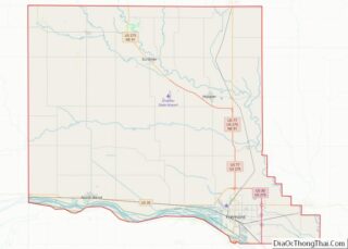
Fulton County is a county located in the U.S. state of Arkansas. As of the 2020 census, the population was 12,075. The county seat is Salem. Fulton County was formed on December 21, 1842, and named for William Fulton, the last governor of the Arkansas Territory. It is an alcohol prohibition or dry county. Fulton ... Read more
Map of US Counties
Little River County overview: Name: Little River County FIPS code: 05-081 State: Arkansas Founded: March 5, 1867 Named for: Little River Seat: Ashdown Largest city: Ashdown Total Area: 565 sq mi (1,460 km²) Land Area: 532 sq mi (1,380 km²) Total Population: 12,026 Population Density: 21/sq mi (8.2/km²) Time zone: UTC−6 (Central) Summer Time Zone (DST): UTC−5 (CDT) Little River County location ... Read more
Polk County is a county located in the U.S. state of Arkansas. As of the 2020 census, the population was 19,221. The county seat is Mena. Polk County is Arkansas’s 48th county, formed on November 30, 1844; it was named for James K. Polk, 11th President of the United States. Polk County overview: Name: Polk ... Read more
White County is a county located in the U.S. state of Arkansas. As of the 2020 census, the population was 76,822. The county seat is Searcy. White County is Arkansas’s 31st county, formed on October 23, 1835, from portions of Independence, Jackson, and Pulaski counties and named for Hugh Lawson White, a Whig candidate for ... Read more
Inyo County (/ˈɪnjoʊ/ (listen)) is a county in the eastern central part of the U.S. state of California, located between the Sierra Nevada and the state of Nevada. In the 2020 census, the population was 19,016. The county seat is Independence. Inyo County is on the east side of the Sierra Nevada and southeast of ... Read more
Orange County, often known by its initials O.C., is located in the Los Angeles metropolitan area in Southern California. As of the 2020 census, the population was 3,186,989, making it the third-most-populous county in California, the sixth-most-populous in the United States, and more populous than 19 American states and Washington, D.C. Although largely suburban, it ... Read more
Sierra County (/siˈɛrə/ (listen)) is a county located in the U.S. state of California. As of the 2020 census, the population was 3,236, making it California’s second-least populous county. The county seat is Downieville; the sole incorporated city is Loyalton. The county is in the Sierra Nevada, northeast of Sacramento on the border with Nevada. ... Read more
Archuleta County overview: Name: Archuleta County FIPS code: 08-007 State: Colorado Founded: April 14, 1885 Named for: Antonio D. Archuleta Seat: Pagosa Springs Largest town: Pagosa Springs Total Area: 1,356 sq mi (3,510 km²) Land Area: 1,350 sq mi (3,500 km²) Total Population: 13,359 Population Density: 9.9/sq mi (3.8/km²) Time zone: UTC−7 (Mountain) Summer Time Zone (DST): UTC−6 (MDT) Website: www.archuletacounty.org Archuleta ... Read more
Eagle County is a county located in the U.S. state of Colorado. As of the 2020 census, the population was 55,731. The county seat is the Town of Eagle and the most populous community is Edwards. The county is named for the Eagle River. Eagle County comprises the Edwards, CO Micropolitan Statistical Area. Eagle County ... Read more
Larimer County is a county located in the U.S. state of Colorado. As of the 2020 census, the population was 359,066. The county seat and most populous city is Fort Collins. The county was named for William Larimer, Jr., the founder of Denver. Larimer County comprises the Fort Collins, CO Metropolitan Statistical Area. The county ... Read more
Pueblo County (/ˈpwɛbloʊ/ or /ˈpjɛbloʊ/) is a county located in the U.S. state of Colorado. As of the 2020 census, the population was 168,162. The county seat is Pueblo. The county was named for the historic city of Pueblo which took its name from the Spanish language word meaning “town” or “village”. Pueblo County comprises ... Read more
Middlesex County overview: Name: Middlesex County FIPS code: 09-007 State: Connecticut Founded: May, 1785 Named for: Middlesex, England Seat: none (since 1960)Middletown (before 1960) Largest city: Middletown Total Area: 439 sq mi (1,140 km²) Land Area: 369 sq mi (960 km²) Total Population: 164,245 Population Density: 370/sq mi (140/km²) Time zone: UTC−5 (Eastern) Summer Time Zone (DST): UTC−4 (EDT) Middlesex County location ... Read more